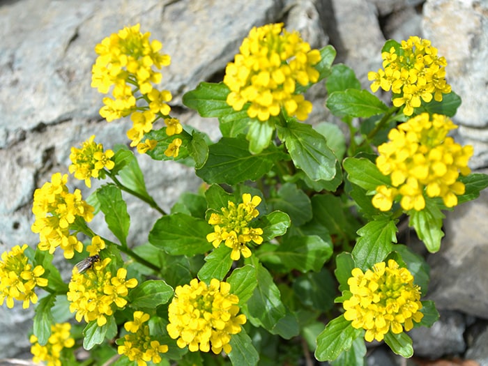
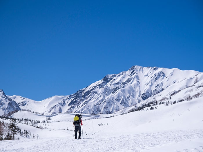
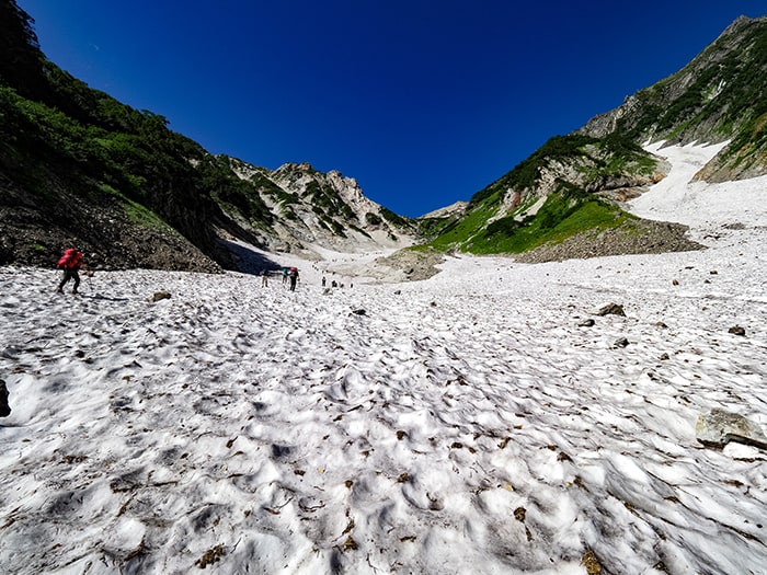
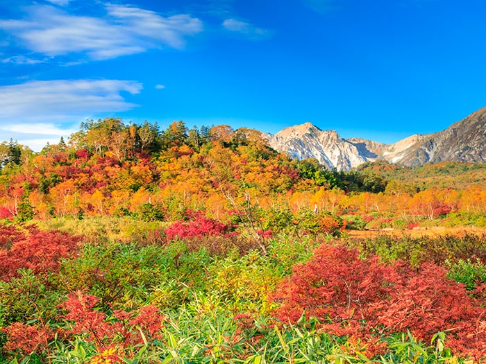
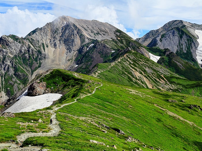
| Mt. Shirouma-dake is well known for its large snowy valley and alpine plants.
In winter, a seasonal wind from the Japan sea blows over the ridgeline and drops snow on the east side of the mountain, creating a heavy snow belt. This once had formed a glacier, with complicated geographical features, and had left a wide variety of alpine plants in the mountains. Today, as snow at the bottom of mountains and their slopes slowly melts, a myriad of flowers bloom one after another. This is the unique feature of Mt. Shirouma-dake, called the jewel box of alpine plants. The name, Mt. Shirouma-dake originated from lingering snow in the shape of a horse on a mountain side at a time of the melting snow. A lot of facilities in the area include the name Mt. Shirouma-dake “白馬” in their names, however, these are all read “Hakuba”. Only when Mt. Shirouma-dake is referred to is “白馬” read “Shirouma.” |
Mt. Shirouma-dake
The elevation of Mt. Shirouma-dake:2,932m
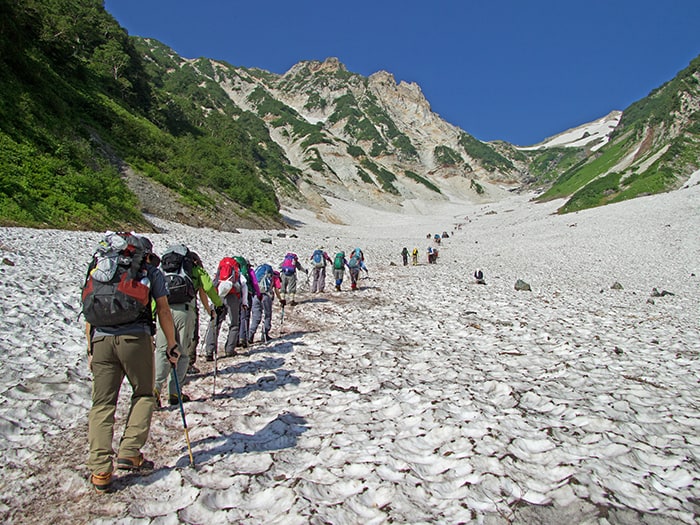
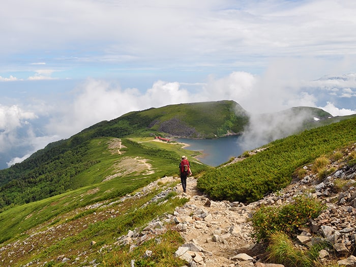
There are three trail heads to Mt. Shirouma-dake. They are Sarukura, Tsugaike Pond, and Renge Onsen hot spring. The shortest trail to a large snowy valley is the one from Sarukura with a 1,230m elevation. This trail is recommended for hikers who climb Mt. Shirouma-dake for the first time because it will include hiking up the snowy valley.
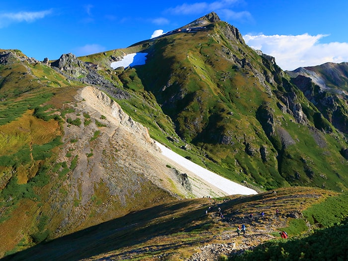
For hikers who would like to enjoy the great view all the way up to the summit of the mountain, Tsuga ike Pond trail head, at a 1,900m elevation is recommended.
This course will include hiking down the snowy valley.
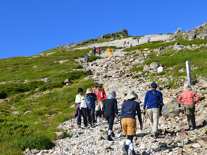
The elevation of the trail head at Renge Onsen hot spring is 1,475m. This trail merges into a trail from Tsugaike Pond at Hakuba-Oike. Up to the junction, beautiful wood corridors form the trail. This course is recommended for hikers who revisit Mt. Shirouma-dake.
Trailhead vicinity weather
Weekly weather forecast zone:Northern Nagano Prefecture
| DAY | WEATHER | LOWEST | HIGHEST |
|---|---|---|---|
| 7/12 | 22℃ | 31℃ | |
| 7/13 | 22℃ | 33℃ | |
| 7/14 | 23℃ | 32℃ | |
| 7/15 | 23℃ | 32℃ | |
| 7/16 | 24℃ | 32℃ | |
| 7/17 | 24℃ | 32℃ |
This is a publication of the calculated figures for weather predictions and is not the weather forecast. There are instances where there will be big differences in the values stated for the mountains, in accord with the topography as well as sunlight, etc. so please take care.
72 hours weather information:Sarukura Villa, Oaza-Kitajo, Hakuba Village, Kita-Azumi-gun, Nagano Prefecture
| Date and time |
7/11 17:00 |
7/11 18:00 |
7/11 19:00 |
7/11 20:00 |
7/11 21:00 |
7/11 22:00 |
7/11 23:00 |
7/12 0:00 |
7/12 1:00 |
7/12 2:00 |
7/12 3:00 |
7/12 4:00 |
7/12 5:00 |
7/12 6:00 |
7/12 7:00 |
7/12 8:00 |
7/12 9:00 |
7/12 10:00 |
7/12 11:00 |
7/12 12:00 |
7/12 13:00 |
7/12 14:00 |
7/12 15:00 |
7/12 16:00 |
7/12 17:00 |
7/12 18:00 |
7/12 19:00 |
7/12 20:00 |
7/12 21:00 |
7/12 22:00 |
7/12 23:00 |
7/13 0:00 |
7/13 1:00 |
7/13 2:00 |
7/13 3:00 |
7/13 4:00 |
7/13 5:00 |
7/13 6:00 |
7/13 7:00 |
7/13 8:00 |
7/13 9:00 |
7/13 10:00 |
7/13 11:00 |
7/13 12:00 |
7/13 13:00 |
7/13 14:00 |
7/13 15:00 |
7/13 16:00 |
7/13 17:00 |
7/13 18:00 |
7/13 19:00 |
7/13 20:00 |
7/13 21:00 |
7/13 22:00 |
7/13 23:00 |
7/14 0:00 |
|---|---|---|---|---|---|---|---|---|---|---|---|---|---|---|---|---|---|---|---|---|---|---|---|---|---|---|---|---|---|---|---|---|---|---|---|---|---|---|---|---|---|---|---|---|---|---|---|---|---|---|---|---|---|---|---|---|
| Weather | ||||||||||||||||||||||||||||||||||||||||||||||||||||||||
| Temperature | 20℃ | 19℃ | 18℃ | 17℃ | 16℃ | 16℃ | 16℃ | 16℃ | 15℃ | 15℃ | 14℃ | 14℃ | 14℃ | 14℃ | 15℃ | 17℃ | 18℃ | 19℃ | 21℃ | 22℃ | 23℃ | 23℃ | 23℃ | 22℃ | 21℃ | 21℃ | 20℃ | 19℃ | 18℃ | 17℃ | 17℃ | 17℃ | 16℃ | 16℃ | 15℃ | 15℃ | 16℃ | 16℃ | 16℃ | 17℃ | 19℃ | 20℃ | 22℃ | 23℃ | 23℃ | 24℃ | 24℃ | 24℃ | 23℃ | 22℃ | 21℃ | 20℃ | 19℃ | 18℃ | 19℃ | 18℃ |
| Precipitation | 0mm/h | 0mm/h | 0mm/h | 0mm/h | 0mm/h | 0mm/h | 0mm/h | 0mm/h | 0mm/h | 0mm/h | 0mm/h | 0mm/h | 0mm/h | 0mm/h | 0mm/h | ※ 16時間以降は表示されません | ||||||||||||||||||||||||||||||||||||||||
| Wind direction |
none 2m/s |
none 2m/s |
none 2m/s |
none 2m/s |
none 1m/s |
none 1m/s |
none 1m/s |
none 1m/s |
none 1m/s |
none 2m/s |
none 2m/s |
none 2m/s |
none 2m/s |
none 2m/s |
none 1m/s |
none 1m/s |
0m/s |
0m/s |
0m/s |
0m/s |
0m/s |
0m/s |
none 1m/s |
none 1m/s |
none 1m/s |
0m/s |
none 1m/s |
none 2m/s |
none 1m/s |
none 1m/s |
none 1m/s |
none 1m/s |
none 1m/s |
none 2m/s |
none 1m/s |
none 1m/s |
none 2m/s |
none 1m/s |
none 1m/s |
none 1m/s |
none 1m/s |
none 1m/s |
none 1m/s |
none 1m/s |
none 1m/s |
none 1m/s |
none 2m/s |
none 2m/s |
none 1m/s |
none 2m/s |
none 1m/s |
none 1m/s |
none 1m/s |
none 1m/s |
none 1m/s |
0m/s |
※The weather information will be information on 5km square including the relevant point.
※天気予報マークは一次細分区域から表示しています
View of Mt. Shirouma-dake


Route Information
A-Basic course sorted by trailheads
From Sarukura
From Tsugaike Nature Park
From Renge Onsen
B‐Variation courses from Mt. Shirouma-dake sorted by experience and physical strength
From Shiroumadake
-
Hakuba Three mountains Roundabout Route
④ Mt. Shirouma-dake〜Mt. Shakushi-dake〜Mt. Hakuba-yari-gatake〜Hakuba-yari-onsen-goya Mountain hut~ Sarukura (Difficulty level: ⛰️⛰️⛰️) -
Kaerazuno-ken Route
⑤ Mt. Shirouma-dake~Mt. Shakushi-dake~Mt. Hakuba-yari-gatake ~ Kerazuno-ken~Mt. Karamatsu-dake~ Happo-ike-sansou Mountain Hut (Difficulty level: ⛰️⛰️⛰️⛰️) -
Ushiro-tateyama Traverse Route
⑥ Mt. Shirouma-dake ~ Mt. Shakushi-dake ~Mt. Hakuba-yari-gatake~Mt. Karamatsu-dake~Mt. Goryu-dake ~ G4 ~ G5 ~ Mt. Kashima-yari-gatake ~ Ougisawa (expert) -
Babadani Route from Shirouma-dake
⑦ Mt. Shirouma-dake ~ Shimizu o’ne ~ Babadani Onsen hot spring (Difficulty level: ⛰️⛰️⛰️⛰️) -
Yukikura-dake – Asahi-dake Route
⑧ Mt. Shirouma-dake ~ Mt. Yukimi-dake ~ Mt. Asahi-dake ~ Ogawa Onsen hot spring (Difficulty level: ⛰️⛰️⛰️⛰️) -
Tsugami Shindo New Trail Route
⑨Mt. Shirouma-dake ~ Mt. Asahi-dake ~Mt. Kuroiwa~Mt. Inuga-take~Oyashirazu (Difficulty level: ⛰️⛰️⛰️⛰️⛰️)
