Tsugami Shindo New Trail Route
Mt. Shirouma-dake ~ Mt. Yukukira-dake ~ Mt. Asahi-dake ~ Mt. Kuroiwa-yama ~ Tsugami-sanso Mountain Hut ~ Shiratori-koya Mountain Hut ~ Oyashirazu station (Advanced)
Technical level:C
Physical strength:10
Difficulty ★★★★★
From Mt. Shioruma-dake. Hike to the shore of the Japan Sea.
On this route, hike down on Tsugami-shindo, where only few hikers walk, heading to Oyashirazu along the shore of the Japan Sea. At one time, many college students in mountaineering clubs passing by this route as part of their summer training. It is a route for advanced hikers; therefore, you must be fully prepared.
※The places that could not be passed on the Tsugami Shindo can now be passed with the help of the local Tsugami Gakuyukai.
Access to Sarukura
Access to Oyashirazu
●Hiking Data
Schedule: Four nights and five days (From Sarukura)
Walking hours: 31 hours 25 minutes
Walking distance: 43.83 km
Variance in elevation: 3,961 m
Mt. Shirouma-dake

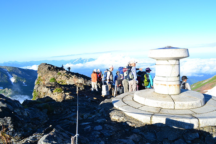
Elevation 2,932m
↓ 2 hours 50 minutes
Mt. Yukikura-dake
Elevation 2,610m
↓ 3 hours 30 minutes
Mt. Asahi-dake
Elevation 2,417m
↓ 4 hours 20 minutes
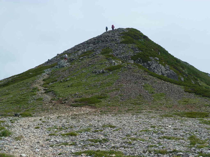
Mt. Kuroiwa-yama
Elevation 1,623m
↓ 3 hours 40 minutes
Mt. Inuga-take
Elevation 1,592m
↓ 4 hours
Mt. Shiratori-yama
Elevation 1,286m
↓ 6時間10分
Oyashirazu Station
Elevation 10m


Route Guide
For the route to Mt. Shirouma-dake, refer to 1. Mt. Shirouma-dake.
This route is scheduled as three nights and four days from Mt. Shirouma-dake. It is recommended that you stay at Asahi-koya Mountain Hut for the first night, Tsugami-sanso Mountain hut for the second night, and Shiratori-koya Mountain hut for the third night. Both Tsugami-sanso and Shiratori-sanso are emergency shelters. One is scheduled to hike for 6 hours 20 minutes the first day, 8 hours the second day, 4 hours the third day and 6 hours 10 minutes the fourth day.
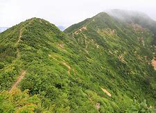
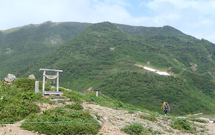
From Mt. Asahi-dake, descend shortly to Fukiage-no-koru. Gorin O’ne will separate to the right at the junction. Follow the sign marked on the big rock to the left. After passing a forest of Abies Veitchii, the trail turns into a promenade. Teruha-no-ike comes into sight. A flower field of Avens or Hakusan-kozakura spreads out. The promenade continues in front of Mt. Nagatsuga-yama. The summit of Mt. Nagatsuga-yama is wide and flat. From here, the trail becomes a downhill. It is a steep slope so you may use branches to hike down. Just be careful not to bend them or damage trees. When ponds appear in sight, Ayame-daira will be reached. Beautiful canopies can be seen. After passing this spot, the trail enters into a forest zone and you may encounter flower fields here and there. However, some parts of the trails are fragile, so you have to keep focused. Kuroiwa-daira, where there is a place to replenish the water supply, is a place which can be said to be a “flower paradise”. After passing that point, Mt. Kuroiwa-yama at an elevation of 1,623 m is close.
From Mt. Kuroiwa-yama, follow the ridgeline. The trail is covered by bamboo leaves. For some parts, the trail is not marked clearly. In those cases, you have to follow footsteps. After passing ups and down, you will pass Mojino-ike and reach the summit of Mt. Sawagani-yama. This is the summit with a great view along Tsugami-shindo.
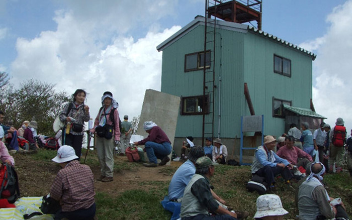
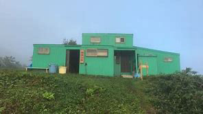
From the summit, hike through some ups and downs, then the saddle, where the sign for a water place will be reached. It takes about 10 minutes for a round trip to the place to replenish water supply. When the trail returns to the narrow ridgeline, after a short steep hill, the summit of Mt. Inuga-take will be reached. The view is phenomenal, and you can see the Japan Sea. It is recommended that you stay at Tsugai-sanso mountain hut, which can be reached in 10 minutes if you descend from here. It is an emergency shelter; therefore, you should check with Benizu-ai Mountain club TEL.025-545-2885 in the event of need to use the shelter. It is a rule to give 2,000 Yen in the volunteer money box set within the hut.
On the next day, you are going to hike north. It takes about 4 hours to Shiratori-koya Mountain hut, where you will stay that night, so you can take your time to hike. The trail is covered by bushes, so make sure that you follow footsteps. After descending about 1 hour 20 minutes, Ouren-nokkoshi will be reached. There is a place to replenish your water supply on the right, however, it gets dried up in summer. From here to Mt. Kikuishi-yama, the trail descends through a forest of Beeches. From the trail, Mt. Shiratori-yama can be seen. From Mt. Kikuishi-yama to Mt. Shiratori-yama, the trail repeats ups and down. It is recommended that you go at a steady pace to avoid over exhaustion. In about 2 hours 30 minutes from Mt. Kiku-ishi-yama, Mt. Shiratori-yama will be reached.
The view at the summit is fantastic. The Japan Sea can be seen clearly. It is recommended that you stay at Shiratori-koya mountain hut, standing by the summit, for the night. This is another emergency shelter.
From Mt. Shiratori-yama, descend on the steep slope. It becomes a muddy and stream-like trail. It is recommended that you wear spats. Descend further after passing Shikiwari, a place to replenish the water supply. The trail meets a road. That is Sakata pass, where Jizo are worshipped. From here, the slope becomes a gradual uphill. When you reach Mt. Shiritaka-yama, the Japan Sea spreads out in front of your eyes. When you descend about 30 minutes from the summit, you will cross a road. Pass Nihonmatsu pass and enter national route 8. This is the end of Tsugami-shindo. The statue of Weston stands here. Oyashirazu station will be reached after one hour walk on the national route.