Hakuba Three mountains Roundabout Route
Mt. Shirouma-dake~Mt. Shakushi-dake~Hakuba-Yari-onsen hot spring junction~Hakuba-yari onsen-koya Mountain hut~Kobinata saddle~Sarukura
Technical level: C
Physical strength level: 6
Difficulty level: ⛰️⛰️⛰️
This is a route that Hakuba Dai-sekkei Snowy Gorge and a source of hot springs can be enjoyed.
From Hakuba Dai-sekkei Snowy Gorge to the summit of Mt. Shirouma-dake. It is recommended to stay the night at the summit. On the next day, hike from this mountain to another through ‘Hakuba three mountains’ all the way to Hakuba-yari onsen-koya Mountain hut.
●Hiking Data
Schedule: One day or one night two days (From Mt. Shirouma-dake), 1 or 2 nights from Sarukura
Walking hours: 15 hours 50 minutes
(Sarukura~Mt. Shirouma-dake : 6 hours 55 minutes Mt. Shirouma~Hakuba-yari hot spring: 5 hours 15 minutes Hakuba-yari onsen hot spring ~ Sarukura: 3 hours 40 minutes)
Walking distance: 18.9 km
(Sarukura ~ Mt. Shirouma-dake ~ Hakuba-yari onsen koya hut ~ Sarukura)
Difference in elevation: 2,330 m
Mt. Shirouma-dake


Elevation 2,982m
↓ 1 hour 25 minutes
Mt. Shakushi-dake

Elevation 2,812m
↓ 1 hours
Mt. Hakuba-yari-gatake

Elevation 2,903m
↓ 2 hours 50 minutes
Hakuba-yari onsen-koya Mountain hut

Elevation 2,100m
↓ 1 hours 50 minutes
Kobinata saddle
Elevation 1,824m
↓ 1 hours 50 minutes
Sarukura
Elevation 1,230m


Route Guide
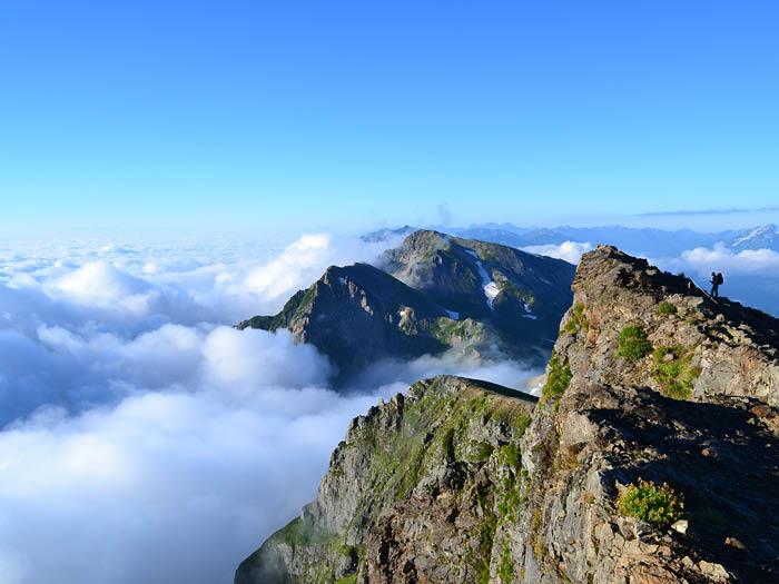
From the summit of Mt. Shirouma-dake, Mt. Shakushi-dake and Mt. Hakuba-yari-gatake, which you are heading to, can be seen. Climb down to a ridgeline where Mt. Shirouma-dake summit hut is located. Mt. Asahi-dake will be in your sight on the west side. Descend on the ridgeline. Take the zigzag path, which is a slightly graveled trail but should be easy to hike down. When looking back at the flat saddle on the trail, the summit of Mt. Shirouma-dake and Hakuba Mountain hut can be seen.
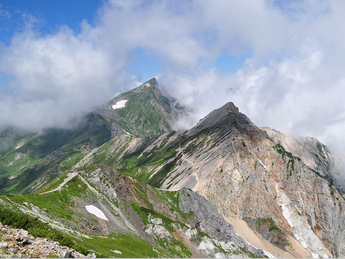
At the saddle of Mt. Shakushi-dake, the trail separates. The path on the left will take you to the ridgeline to walk down. For those who would like to escape the summit, take the path to the right. Where those two paths meet again is the saddle of Mt. Hakuba-yari-gatake. From here, hike up the steep slope, then Koyari will be reached. The path descends for once, where Ptamigan family can be spotted occasionally. Mt. Hakuba-yari-gatake is reached after a short uphill. The summit is a wide open space and Mt. Shirouma-dake and Mt. Shakushi-dake can be seen as asymmetric mountains. There is nothing to block your sight so the view is phenomenal.
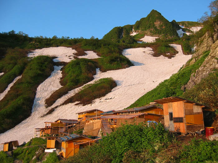
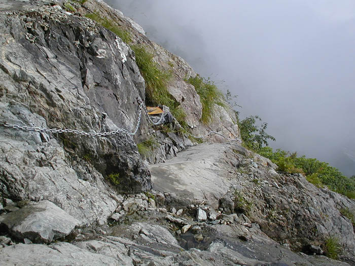
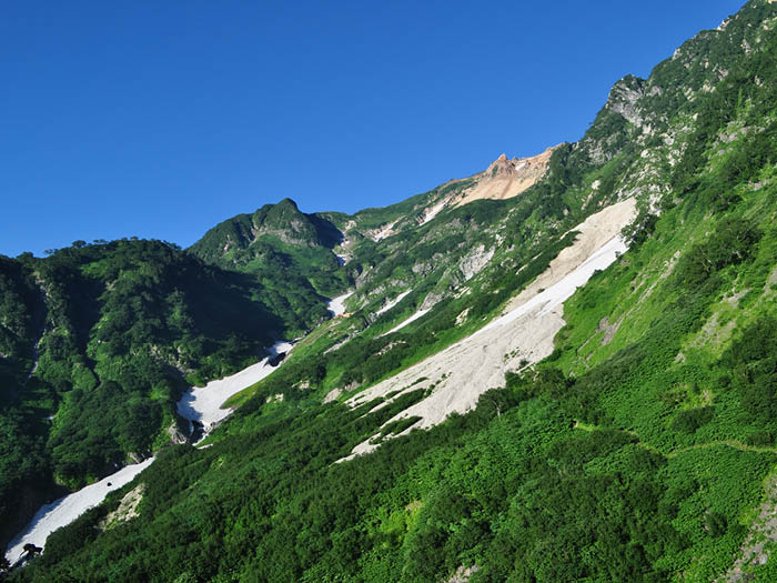
From the summit, descend the graveled ridgeline to the point where Tengu sanso Mountain hut can be seen in your direction. At the bottom of the descending hill, the trail comes to the junction to Hakuba-yari onsen hot spring. Leave the main ridgeline and take a path to Hakuba-yari onsen-koya Mountain hut. O-deppara is reached where Mt. Hakuba-yari-gatake can be seen above your head. This is a spot where Alpine plants can be enjoyed. From here, follow a rocky zone with the use of chains and ladders. A snowy valley can be spotted on your right side. Hakuba-yari onsen-koya Mountain hut will appear in your direction.
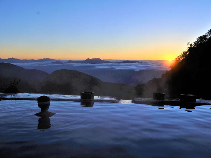
You can stay for the night at the hut or just enjoy the onsen hot spring here. An outdoor hot spring is popular at the hut, but female hikers might find it difficult to take a bath due to the open view. Inside of the hut, there is a indoor bath only for female customers. This building gets dismantled at the end of each hiking season. The camping site is located in front of the outdoor bath.
From Hakuba-yari onsen hot spring, walk through the camping site and cross the river which contains hot water from the spring. You will come to a field of flowers. Cross a wooden bridge then walk past a few small snowy valleys. The trail continues on a long slope. There will be some ups and downs. The trail is narrow so use caution. Kobinata saddle is reached when the trail enters into a flat forest zone, where Mizubasyo and Nikkoukisuge can be admired. You will walk on the trail in the forest for about 2 hours. The trail joins a logging road. Sarukura is reached after a right turn.