Renge Onsen Route
Renge Onsen ~ Hakuba Oike ~ Mt. Shirouma-dake ~ Hakuba Massive Snowy Gorge starting point ~ Sarukura
Technical level: C
Physical strength level: 5
Difficulty level: ⛰️⛰️⛰️
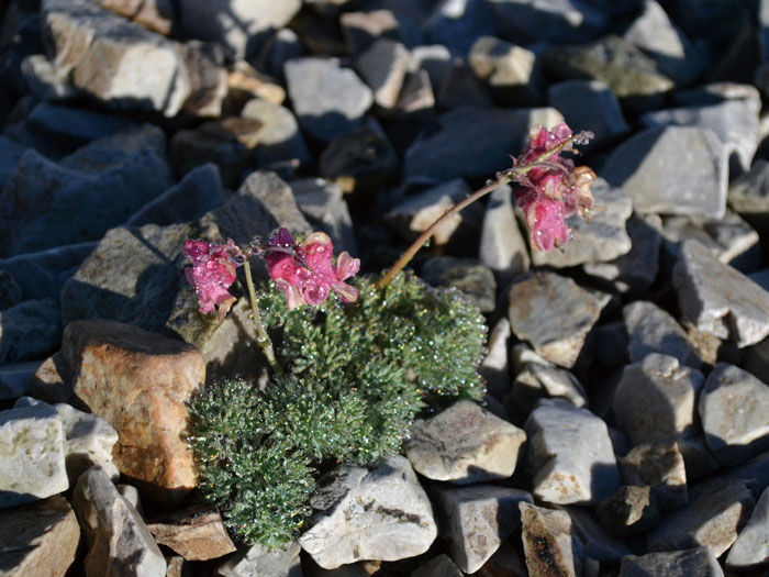
This hiking course along the ridges of Mt. Shirouma-dake starts from a hidden hot spring, Renge Onsen. Full of Alpine plants, it will entertain you from Tengunoniwa to Hakuba Oike
Access to Renge Onsen
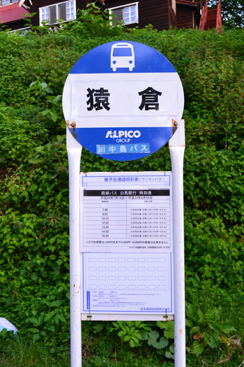
Access to Sarukura
●Hiking Data
Schedule: Two nights three days
(first night: Renge Onsen Second night: Hakuba-sanso Mountain hut or Hakuba-dake Chojyo Mountain hut)
Walking hours: 10 hours 15 minutes
(Up: 6 hours 30 minutes/ Down 3 hours 45 minutes)
Walking distance 15.6 km
Difference in elevation: 1,696 m
※Daisekkei (Hakuba Snowy gorge) Route closed.
Please use the return trip from the trailhead or other routes. However, all of the other routes require more technical and physical skills, and require a longer schedule.
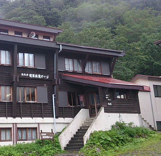
Renge Onsen

Elevation 1,470m
↓ 1 hour 40 minutes
Tenguno-niwa
Elevation 2,093m
↓ 1 hours 20 minutes
Hakuba Oike

Elevation 2,380m
↓ 2 hours
Mt. Korenge-san
Elevation 2,766m
↓ 30 minutes
Mikuni-zakai
Elevation 2,751m
↓ 11 hours
Mt. Shirouma-dake

Elevation 2,932m
↓ 1hours 25 minutes
Nebukabira
Elevation 2,290m
↓ 1hour 30 minutes
Hakubajiri
Elevation 1,250m
↓ 50minutes
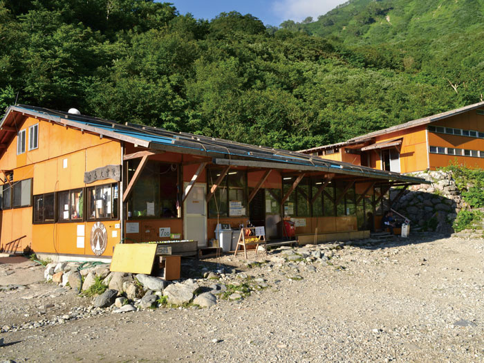
Sarukura
Elevation 1,230m


Route Guide
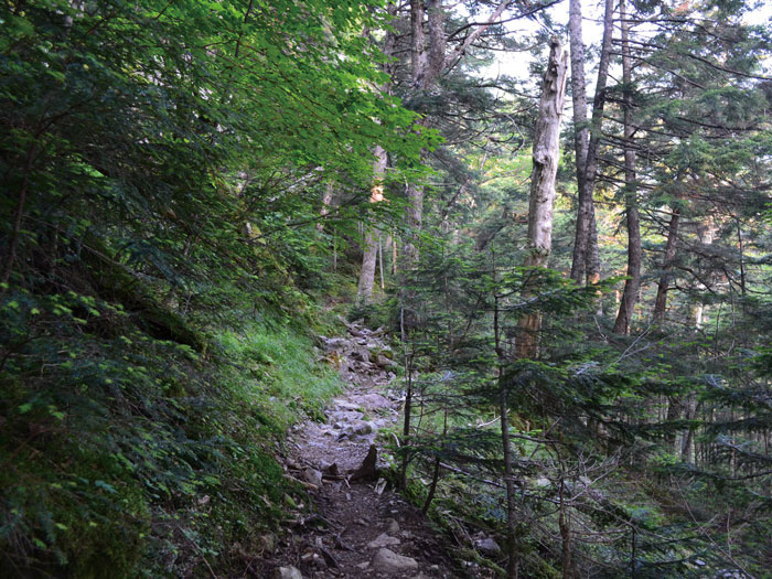
Renge Onsen is known as a hot spring discovered by Kenshin Uesugi. It is popular for its wild outdoor spa. A trailhead starts from Renge Onsen Lodge. The beginning of the trail is almost flat. Tenguno-niwa is reached after a deep forest zone. Pinguicula and Hakusan-shajin can be seen along the trail. Larches spread their branches horizontally. There is a great view of Mt. Yukikura-dake and Mt. Asahi-dake in sight.
From this point, the elevation gradually increases. Take a short break while standing as needed. After a climb on the straight trail not covered by trees anymore, Hakuba 0ike Mountain hut is reached. There is a camping site in front of the hut. The Alpine plants at the site are beautiful.
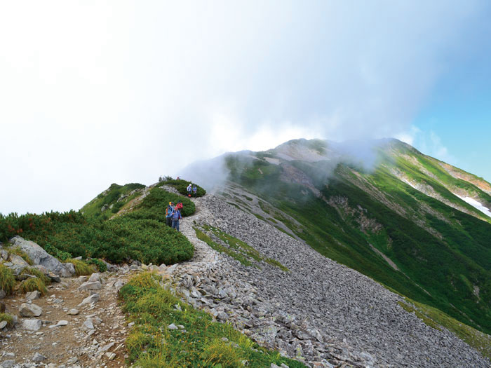
Mountains in front of Hakuba Oike Mountain hut lead to Mt. Shirouma-dake. Start hiking on the ridgeline known as Raicho slope, where ptarmigan can be spotted occasionally. Take a short break while standing at Funakoshi-no-atama. Continue onto the graveled trail to Mt. Korenge-san. Your view becomes wider as the elevation becomes higher.
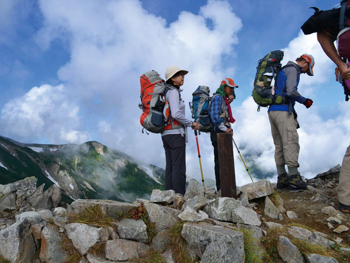
Passing the summit of Mt. Korenge-san where an iron sword is plunged into the ground, Mt. Shirouma-dake appears in your direction. Take a right trail at Mikuni-zakai. This path leads to Mt. Asahi-dake. This trail eventually goes to Oyashirazu in Niigata along the Japan sea. This is a difficult path to follow. It will take one hour from Mikuni-zakai to Mt. Shirouma-dake. It will be a fantastic ridgeline walk with a wide open view. As you come closer to the summit, mountains on the south side of Mt. Shirouma-dake appear in your sight. Then you will reach the summit of Mt. Shirouma-dake, where many hikers are resting. Enjoy an impressive view. Staying for a night at Hakuba-sanso Mountain hut or Hakuba-dake Chojo-sanso Mountain hut is recommended. There is a camping site at Hakuba-dake Chojo-sanso Mountain hut.
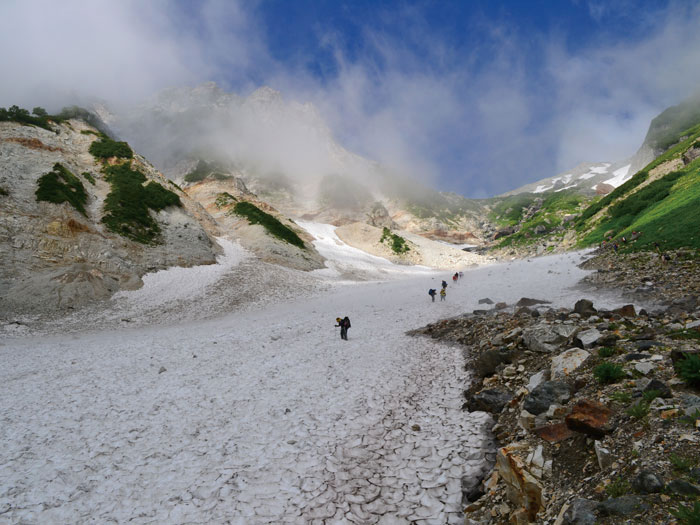
On the final day, please descend the famous Hakuba Massive Snowy Gorge, the large snowy valley. Great caution needs to be employed on the steep slope from the emergency hut to the beginning of the snowy gorge. Descending the snowy valley will take about 1 hour and 30 minutes. Crampons might not be necessary but two trekking poles might be useful when descending. Carefully follow the red line. Also be cautious for falling rocks. From the end of the slope, Hakubajiri will be reached shortly. From there, take a logging road to Sarukura for about 50 minutes.