Kita-Yatsu-gatake Traverse Route
③Ropeway Top Station~Kitayokodake~Kameko Pond~Twin Pond~Twin Mountain~Okawara Pass~Shogundaira-Tateshina Mountain~Tateshina Mountain Trailhead
Technical level: C
Physical strength level: 5
Difficulty level: ⛰️⛰️⛰️
Northern Yatsu-gatake Traverse, a sublime course through lush forests
The course starts at the ropeway summit station. From here, you will traverse the core part of the Northern Yatsu-gatake Mountains. Throughout this jewel of a course, you will find alluring ponds, moss, and tracts of deep forest different from that of the Southern Yatsu-gatake Mountains. The itinerary is scheduled to take three days and two nights, but a fit hiker can reach the Kuroyuri Hutte mountain hut, which stands five minutes from the Nakayama pass, in one day. In that case, the second day you can travel back and forth to Mt. Tengu-dake and then descend through Inakoyu.
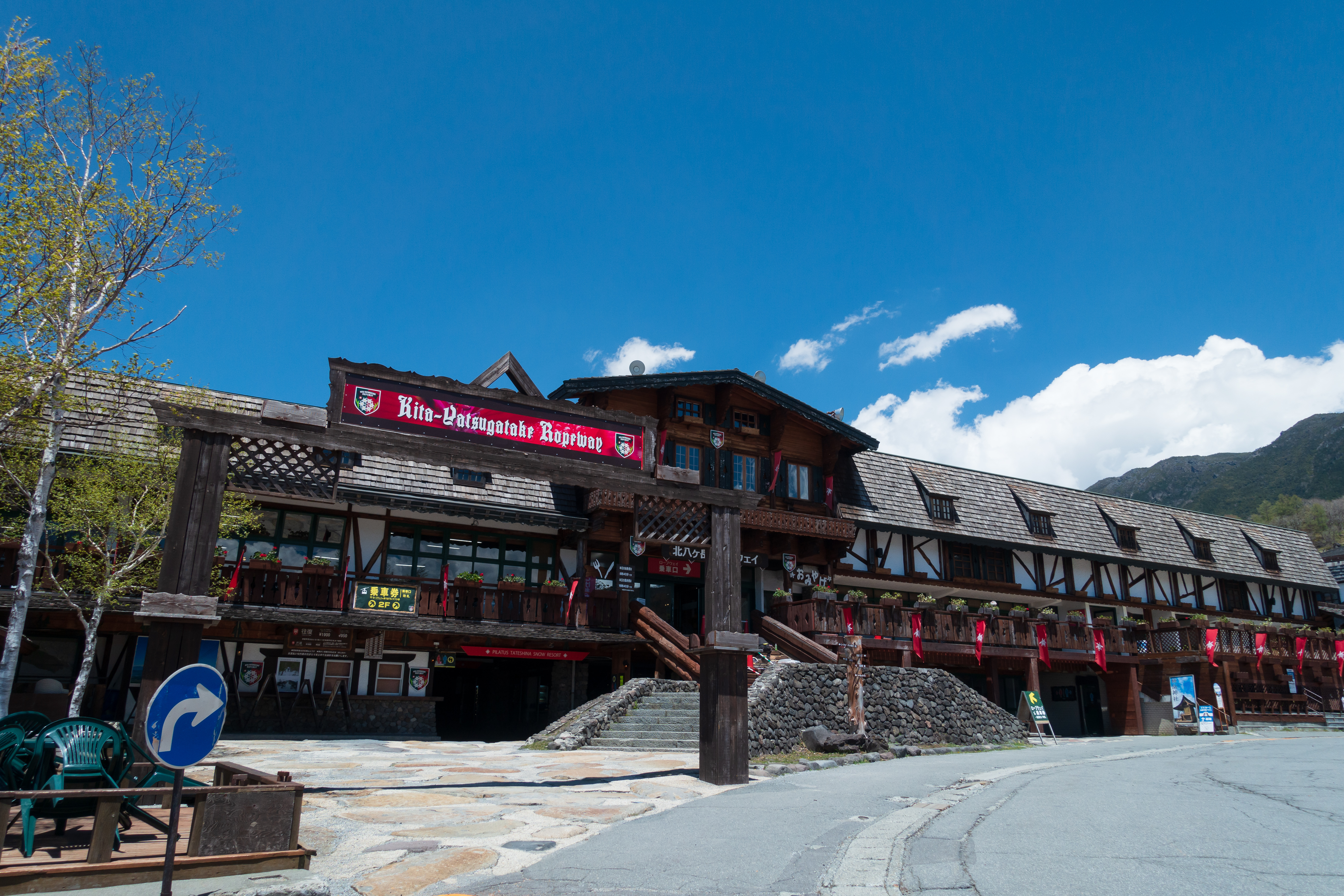
Access to Kitayatsugatake Ropeway
Access to Inakoyu
●Hiking data:
Itinerary: 2 days and 1 night or 3 days and 2 nights
Walking time: 14 hours (Day 1 Summit station – Shirakomaso Inn 6 hours 10 minutes, Day 2 Shirakomaso Inn – Mt. Tengu-dake – Kuroyuri Hutte mountain hut 4 hours 35 minutes, Day 3 Kuroyuri Hutte mountain hut – Inakoyu 3 hours 15 minutes)
Walking distance: 15.5 km
Cumulative elevation gain on ascent: 1,496 m
Kitayatsuga-dake Ropeway Top Station

Elevation 2,230m
↓ 1 hour 10 minutes
Kitayoko-dake
Elevation 2,480m
↓ 2 hours 10 minutes
Amaike Pass
Elevation 2,276m
↓ 1 hour 10 minutes
Mt. Chausu
Elevation 2,384m
↓ 45 minutes
Mugikusa Pass
Elevation 2,120m
↓ 35 minutes
Shirokoma Pond
Elevation 2,115m
↓ 1 hour 35 minutes
Myu
Elevation 2,352m
↓ 1 hour 5 minutes
Nakayama Pass
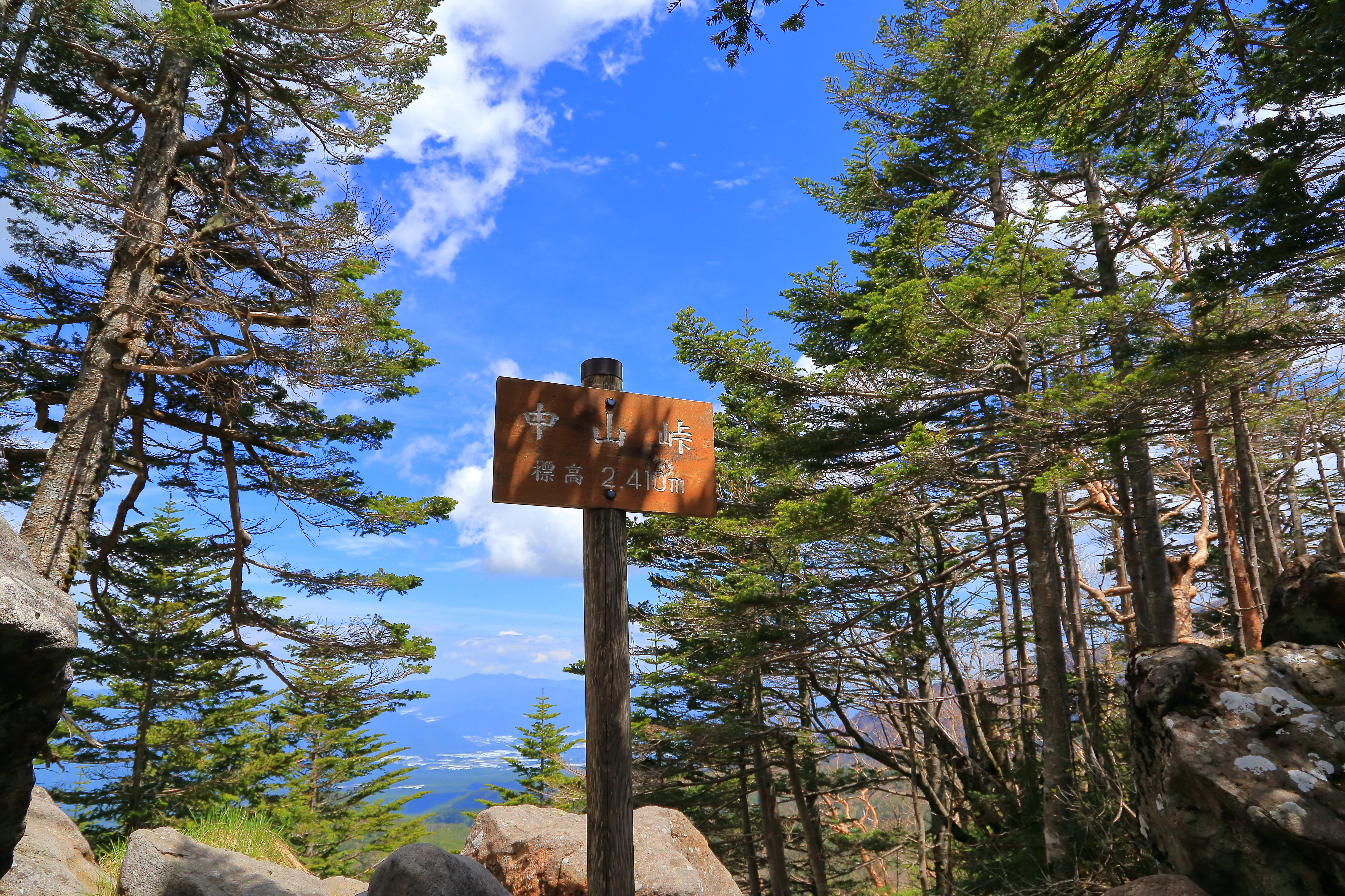
Elevation 2,410m
↓ 2 hours
Nishitengu-dake
Elevation 2,646m
↓ 1 hour 30 minutes
Kuroyuri Hutte
Elevation 2,400m
↓ 1 hour 25 minutes
Shirabiso-goya
Elevation 2,031m
↓ 1 hour 50 minutes
Inakoyu
Elevation 1,497m


Route Guide
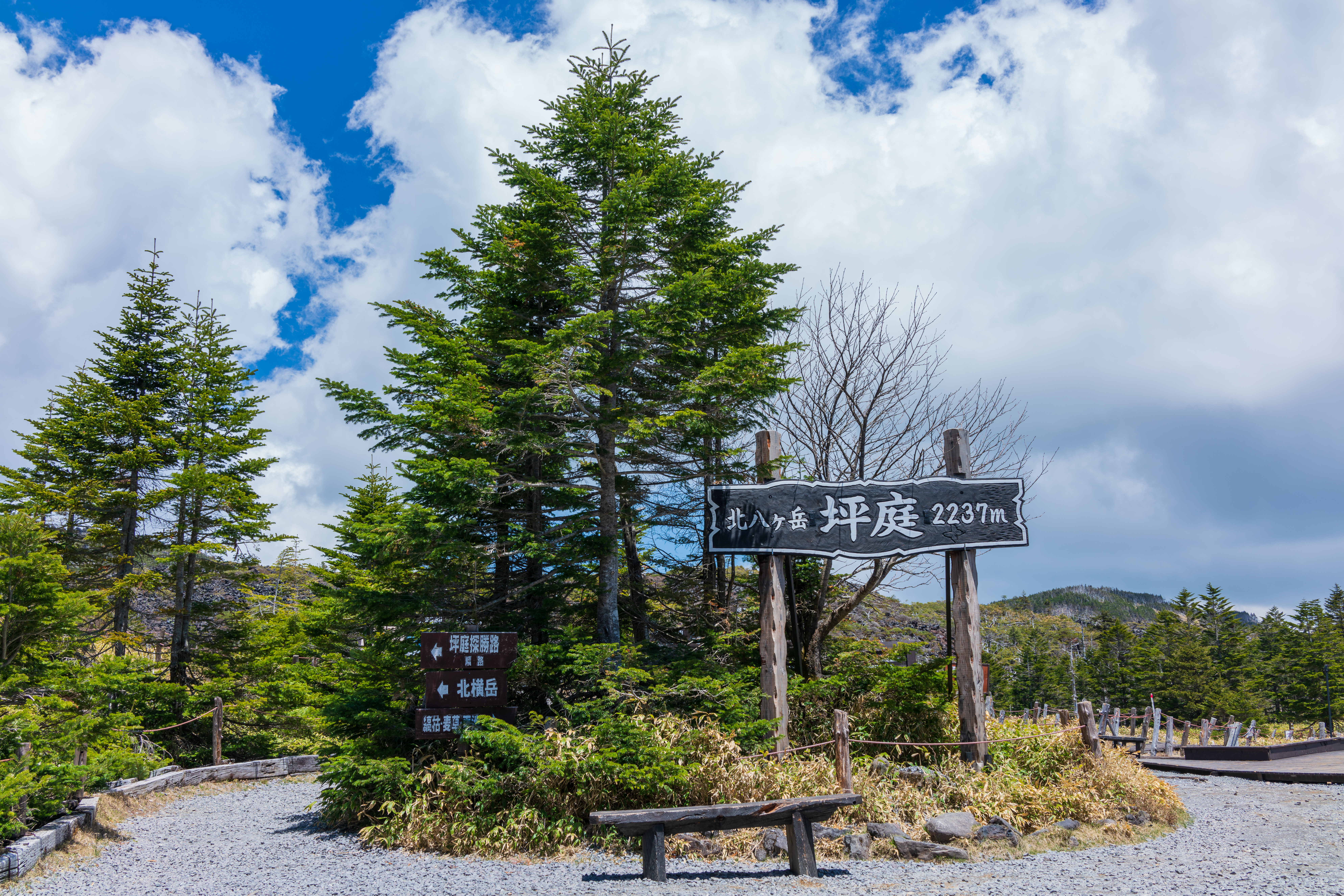
The course starts at the Kita-Yatsu-gatake Ropeway summit station.
Shrubs, such as northern Japanese hemlock and creeping pine, and lava give this place a unique atmosphere. Follow the one-way walking trail. After passing the first and second rest stops, continue in the direction of Mt. Kita-yoko-dake. When you pass the location that overlooks the entire Tsuboniwa, you will pass the midway point on the Tsuboniwa scenic route. A short distance after the 60-minute signpost to Mt. Kita-yoko-dake, you will come upon a wooden path. This path starts out level and ascends. Follow the small left and right turns as you climb. When you start walking on rocks, the path narrows.
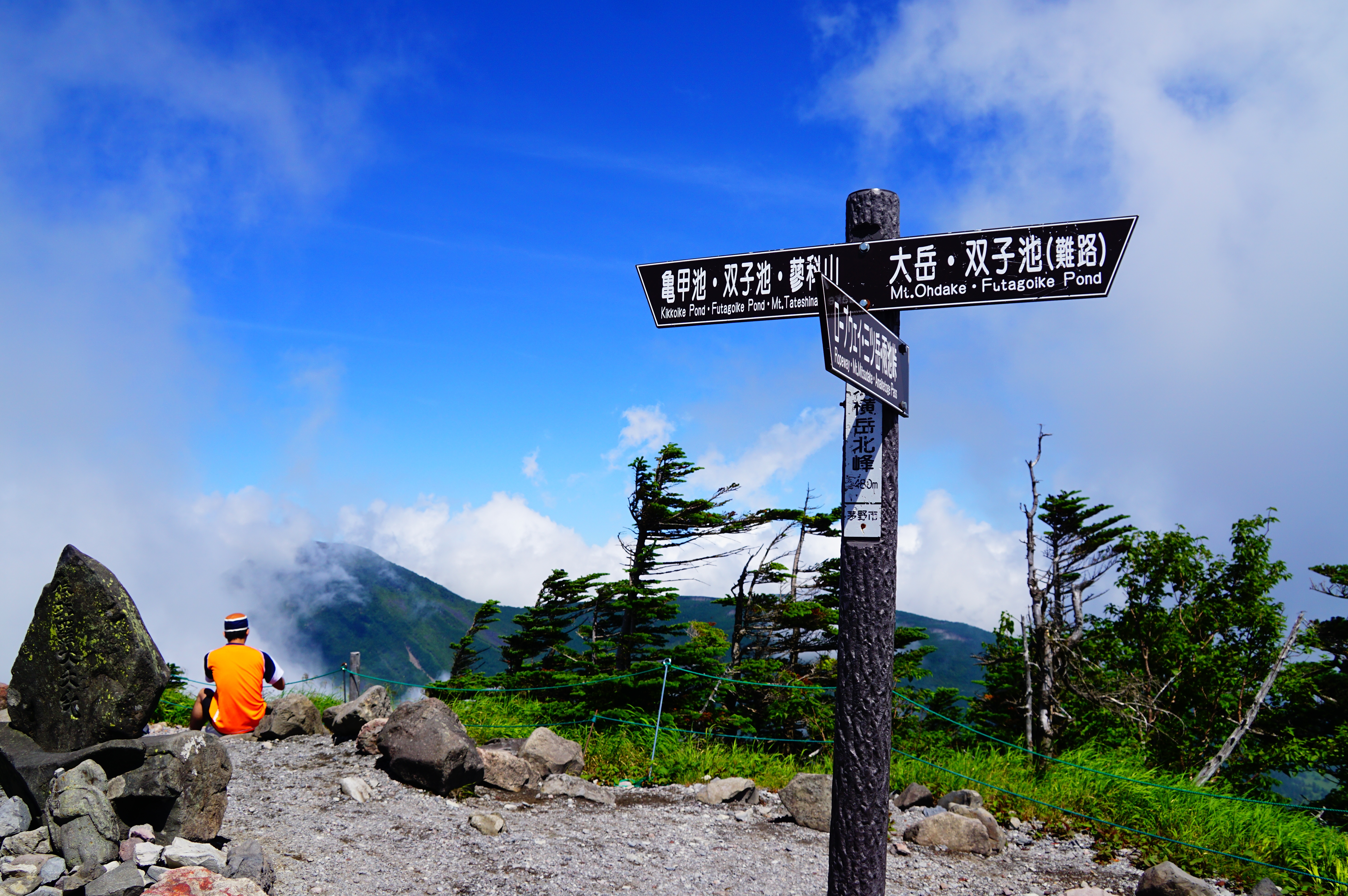
Once you get past this area, the view opens up. You can see the summit station building behind you from here. When you find yourself climbing wooden stairs, you will come upon the junction between Mt. Kita-yoko-dake and Mt. Mitsu-gatake. Here, you’ll go left. Now you will climb a path with low growing shrubs like northern Japanese hemlock. You will arrive at Kita-yoko-dake Hutte in five minutes.
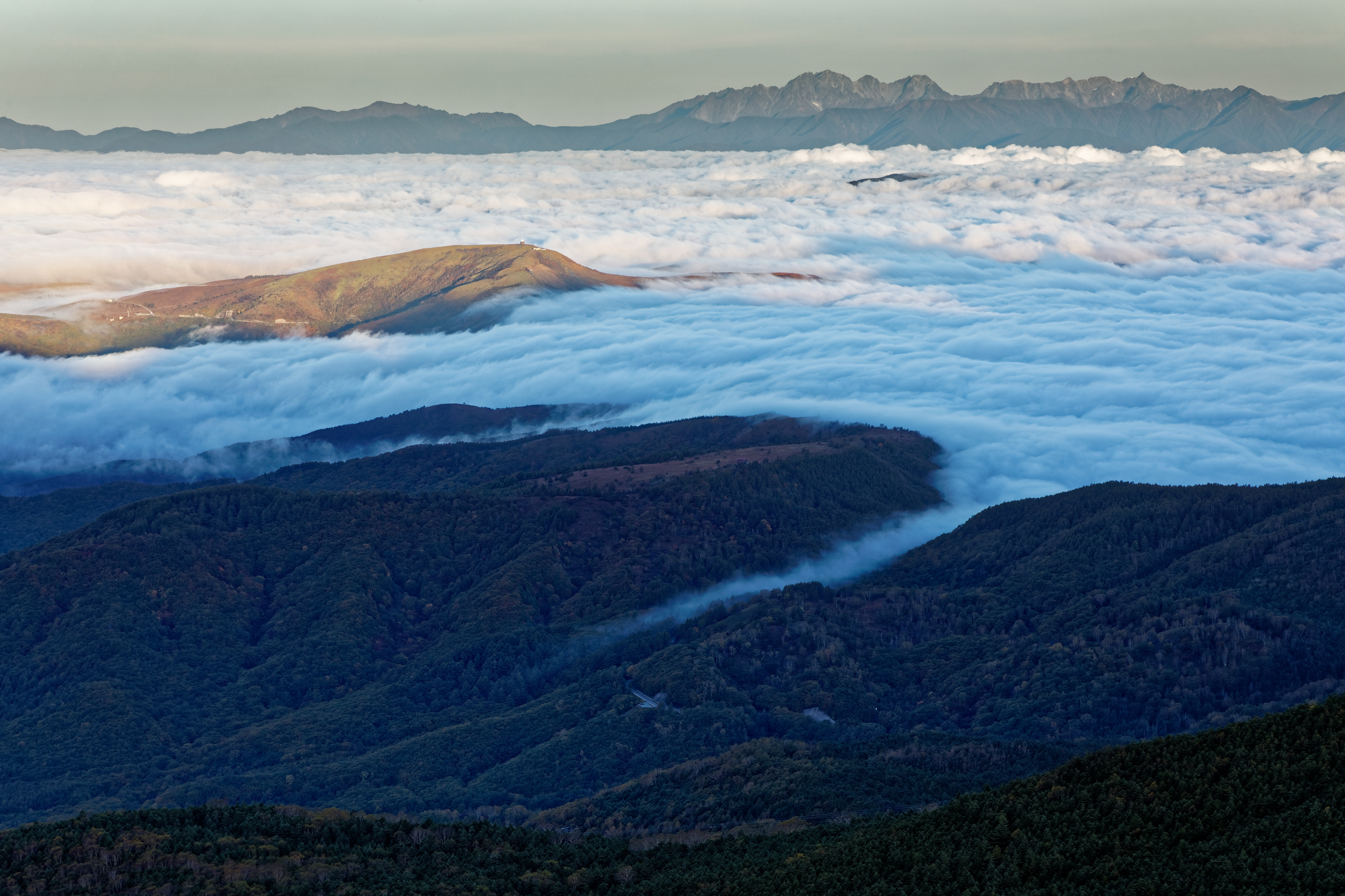
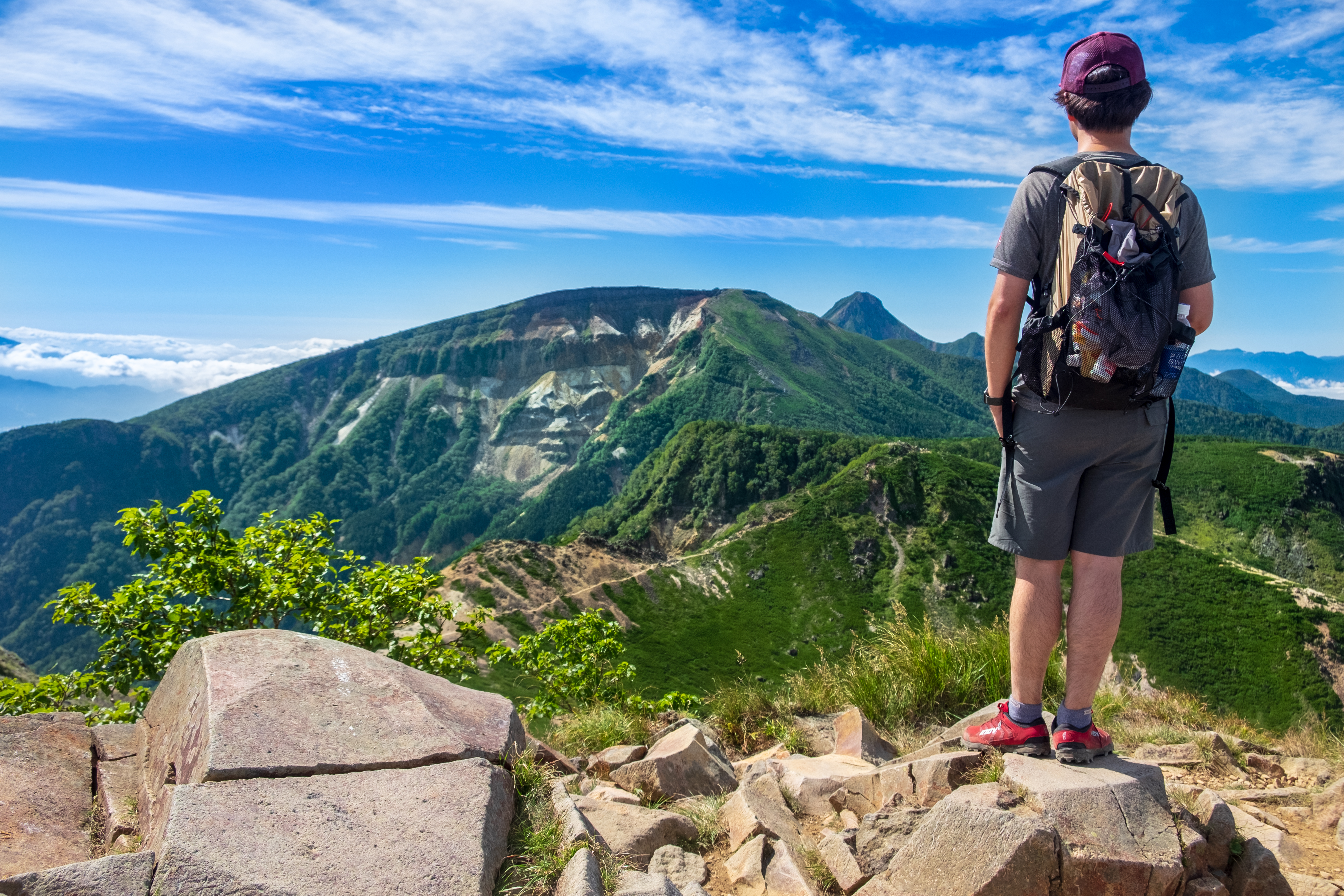
As the path narrows even more, the view expands. You will soon arrive at the summit of Mt. Kita-yoko-dake. There are two peaks here, north and south. Stand on the southern summit followed by the northern summit. Both peaks offer amazing views of the Northern Alps, Southern Alps, and Southern Yatsu-gatake Mountains. Below is a view of Nanatsu-ike Pond. You can also see Mr. Tateshina and its distinctive form.
After enjoying the view, return along the same path you came. When you get to the junction to Mt. Mitsu-gatake, do not take the path to the summit station on the right, but rather continue straight. At the junction heading to Mt. Mitsu-dake, there is a sign that says to refrain from climbing any further with light clothing. Follow the path with creeping pine where large rocks are stacked on top of one another. There are marks on the rocks for guidance. The summit of Mt. Mitsu-gatake is divided into three peaks. Climb the short tract with a guide chain from the third peak to the second, and then on to the first. The trail here is rocky, so please be careful.
From Mt. Mitsu-gatake, we will then head to Mt. Amaike. From the first peak, you have to descend a steep, rocky slope. Some portions are dirt, so try to walk on the dirt as much as possible. As the reed growth along the path increases, you will notice more decaying trees. This area features the sprawling typical landscape of the Northern Yatsu-gatake Mountains, and you will once again climb a rocky slope. Just below the peak ahead is Amaike pass. The area with large rocks is the perfect rest stop.
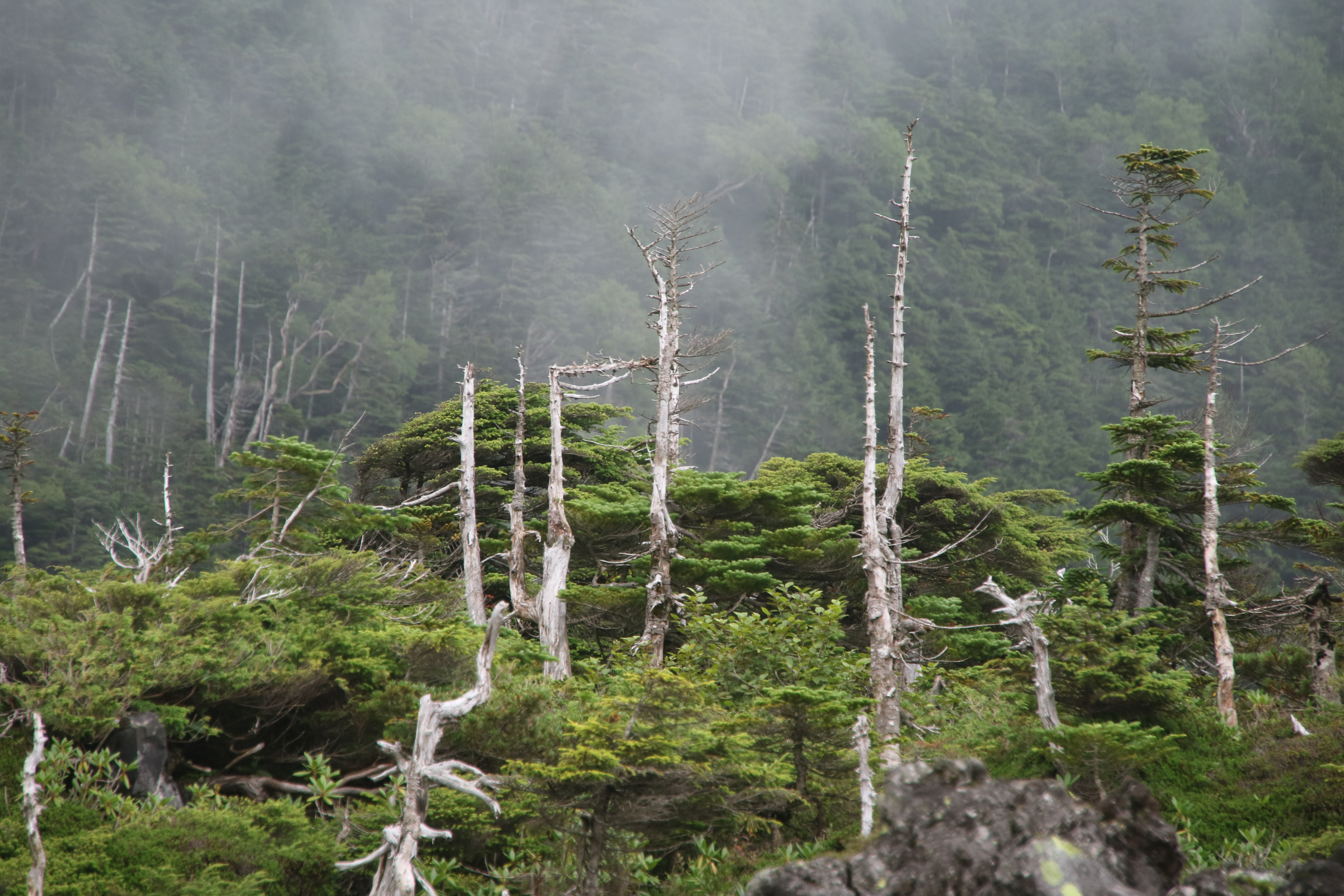
Climbing the rocky trail ascending from Amaike pass, you will arrive at the summit of Mt. Shimagare in approximately 40 minutes. Decayed trees and fallen decomposing trees stand out here. From afar they create a striped pattern on the mountain. This is called the “shimagare” (striped decomposition) phenomenon. This is only seen in forests where Veitch’s silver fir and Maries’ fir prefer to grow, but the mechanism behind the phenomenon is still unclear.
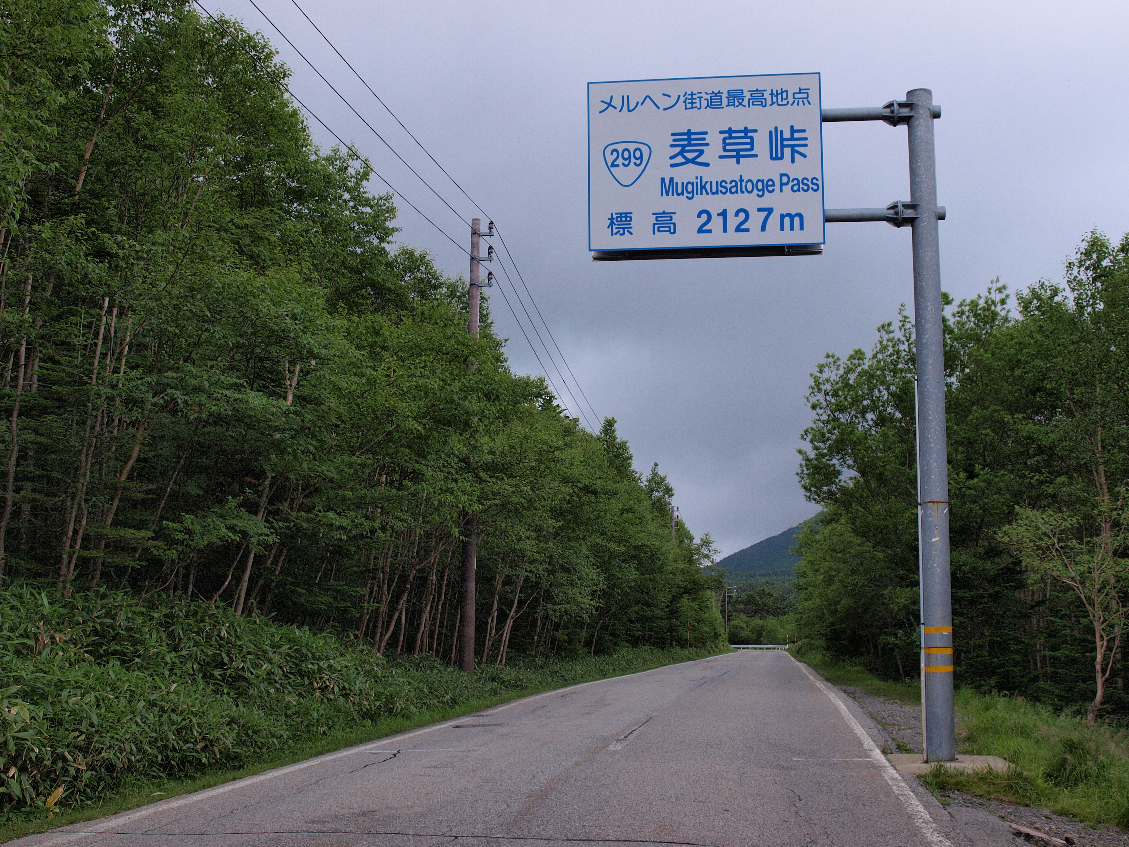
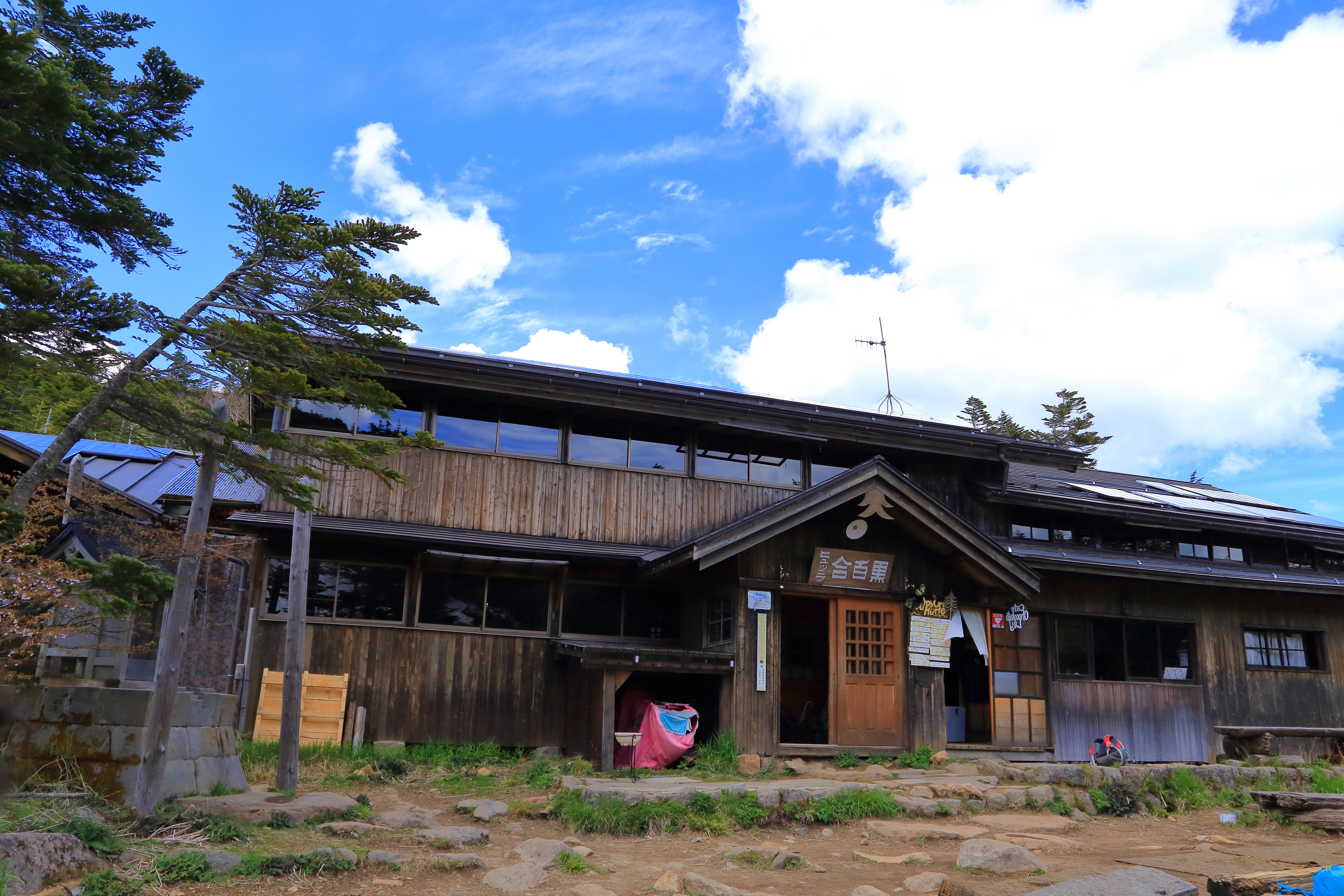
At five minutes along the descent from Mt. Shimagare, there is a lookout point. From an elevation of 2,386 meters, the view spreads in the direction of Mt. Tengu-dake and Mugiso pass. From here, we’ll head to Mt. Chausu-dake. This summit has an excellent view of the Northern and Southern Alps and the Southern Yatsu-gatake Mountains. From Mt. Chausu we return along the ridge and descend along a straight, slippery path. Passing through small-to-medium sized areas with great views, you will descend to the reed covered Oishi pass. From Oishi pass you’ll walk along a wooden path that stretches into a forested area. Descend straight and you will arrive at Mugiso pass. National highway route 299 passes through Mugiso pass at an elevation of 2,127 meters. It is the second highest pass in the country with a national highway running through it. The highest pass is Shibu pass which stands on the border of Gunma and Nagano prefectures at an elevation of 2,172 meters with national highway route 292 running through it. Mugiso Hutte, which has an Alpen feel to it, stands here.
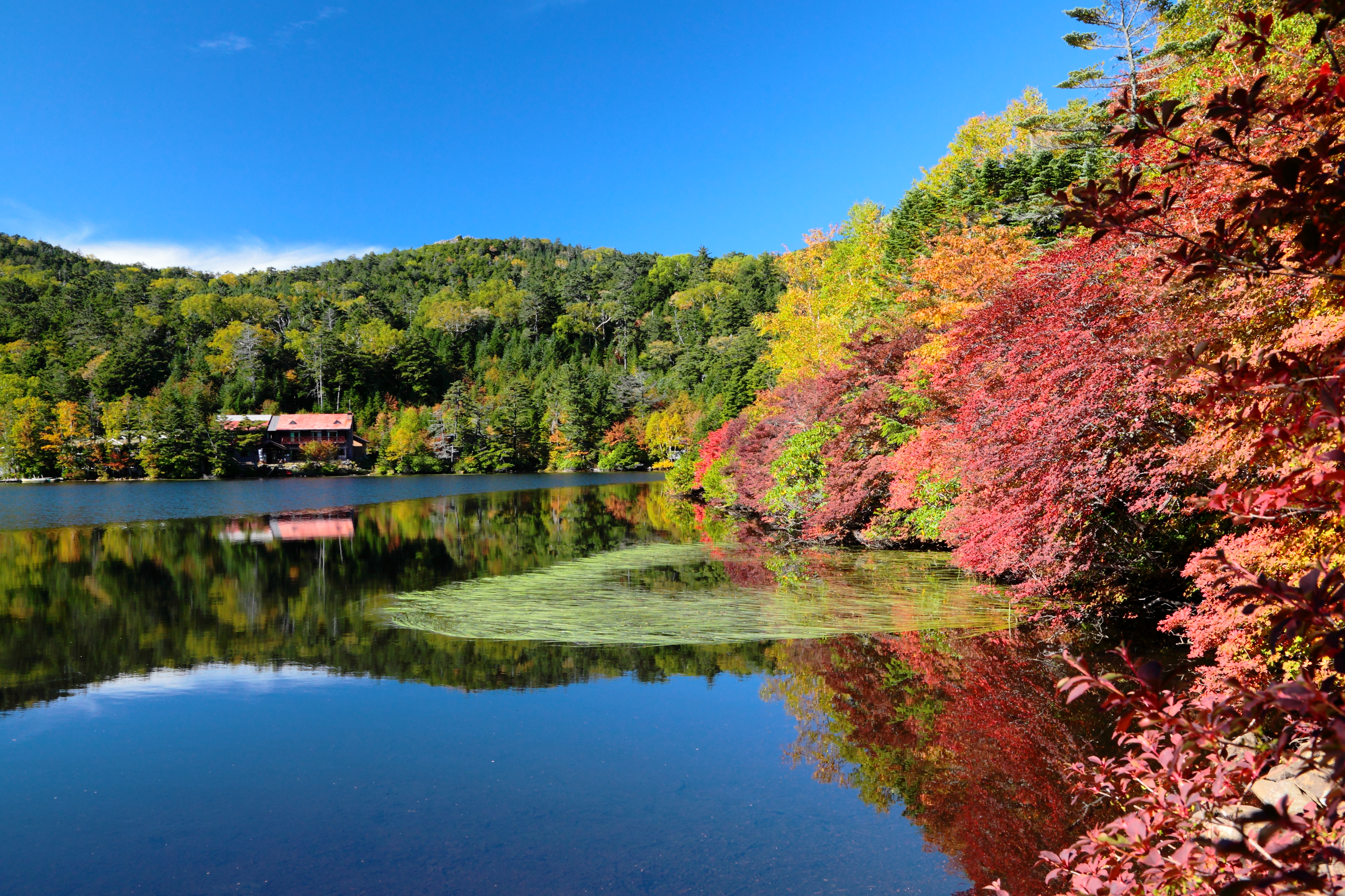
From Mugiso pass, you will follow the path that leads to a grassy field. In about 35 minutes, you will see Shirakomaso Inn and Shirakoma-ike Lake that stands before it. The lake is a symbol of the Northern Yatsu-gatake Mountains. Tonight, you will spend the night here at Shirakomaso Inn with its Scandinavian atmosphere.
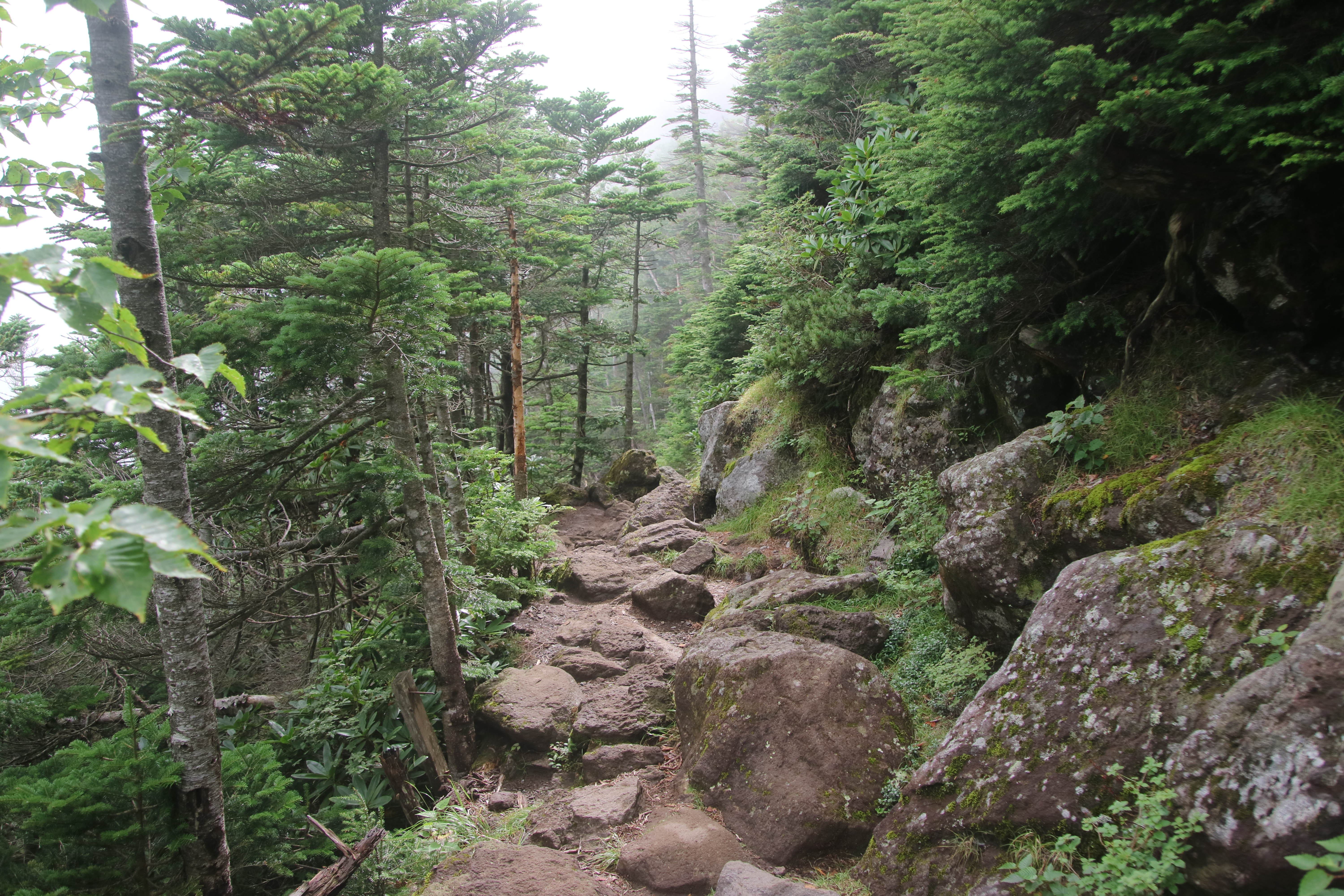
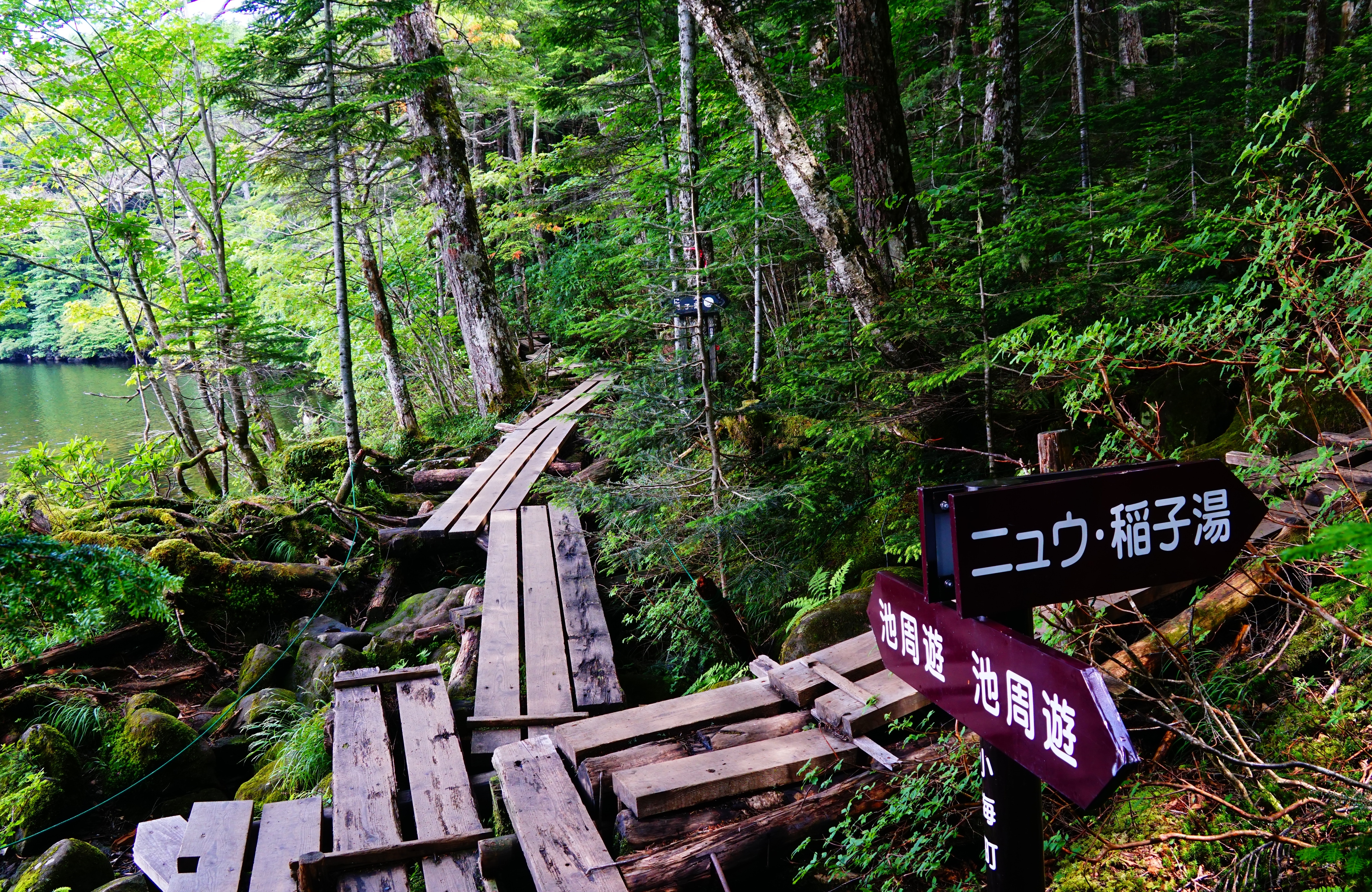
The next day, from Shirakomaso Inn walk the wooden path built around the lake. If you climb through the forested area past the Shirakoma marsh, you will arrive at Mt. Nyu. Mt. Nyu is a mountain made up of giant rocks. From here, you’ll walk through a forested area. The mossy climbing trail here is a truly representative image of the Northern Yatsu-gatake Mountains. Be careful not slip on the moss as you continue, and eventually you will arrive at Nakayama pass. There is a crossroads here and continuing straight will take you to Mt. Tengu-dake. Going to the right will take you to Kuroyuri Hutte, and going to the left will take you on the trail that extends from Shirabiso-koya hut to Inakoyu. First, let’s go straight and climb the eastern Mt. Tengu-dake peak.
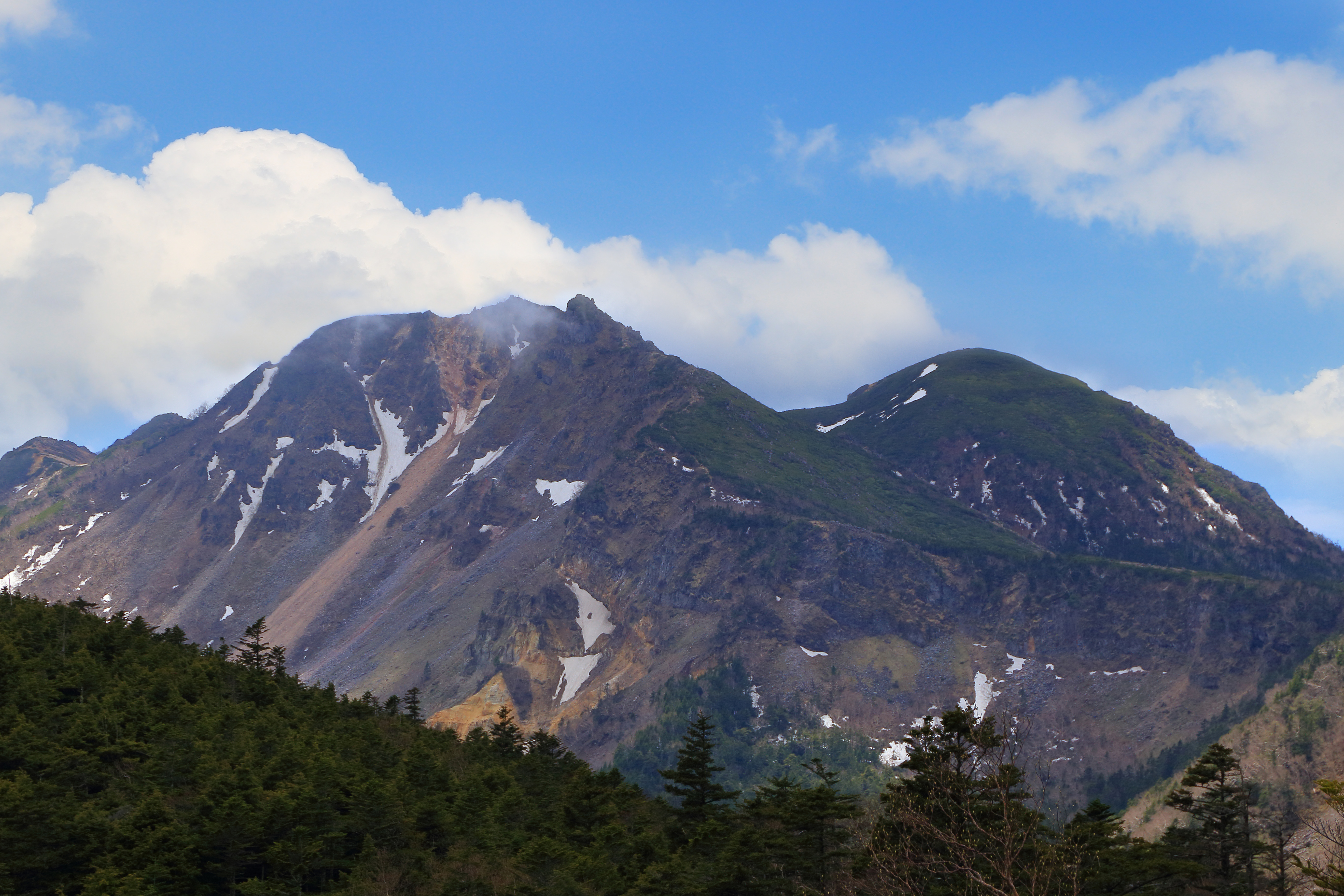
From Nakayama pass continue through the forest and you will come upon a rocky area. The atmosphere of the Southern Yatsu-gatake Mountains can still be felt here. The Northern and Southern Yatsu-gatake Mountains are delineated by the north and south faces of Mt. Tengu-dake and that can be easily seen standing here. Landslides have been known to happen here, so please take care as you climb. Once you cross the steep, rocky terrain, the summit stands before you. Looking back, you can see the sprawling green carpet of the Northern Yatsu-gatake Mountains. The eastern peak of Mt. Tengu-dake is a small plateau. Before you, is the ridgeline leading from Mt. Neishi-dake to Mt. Aka-dake and Mt. Amida-dake. From here let’s travel to the western peak of Mt. Tengu-dake, twin to the eastern peak. Descend the rocky ridge and climb up again to the western Mt. Tengu-dake peak. This summit is much larger than the eastern peak though the view from here is the same as that of its eastern twin. After enjoying the view, we will return to the eastern peak.
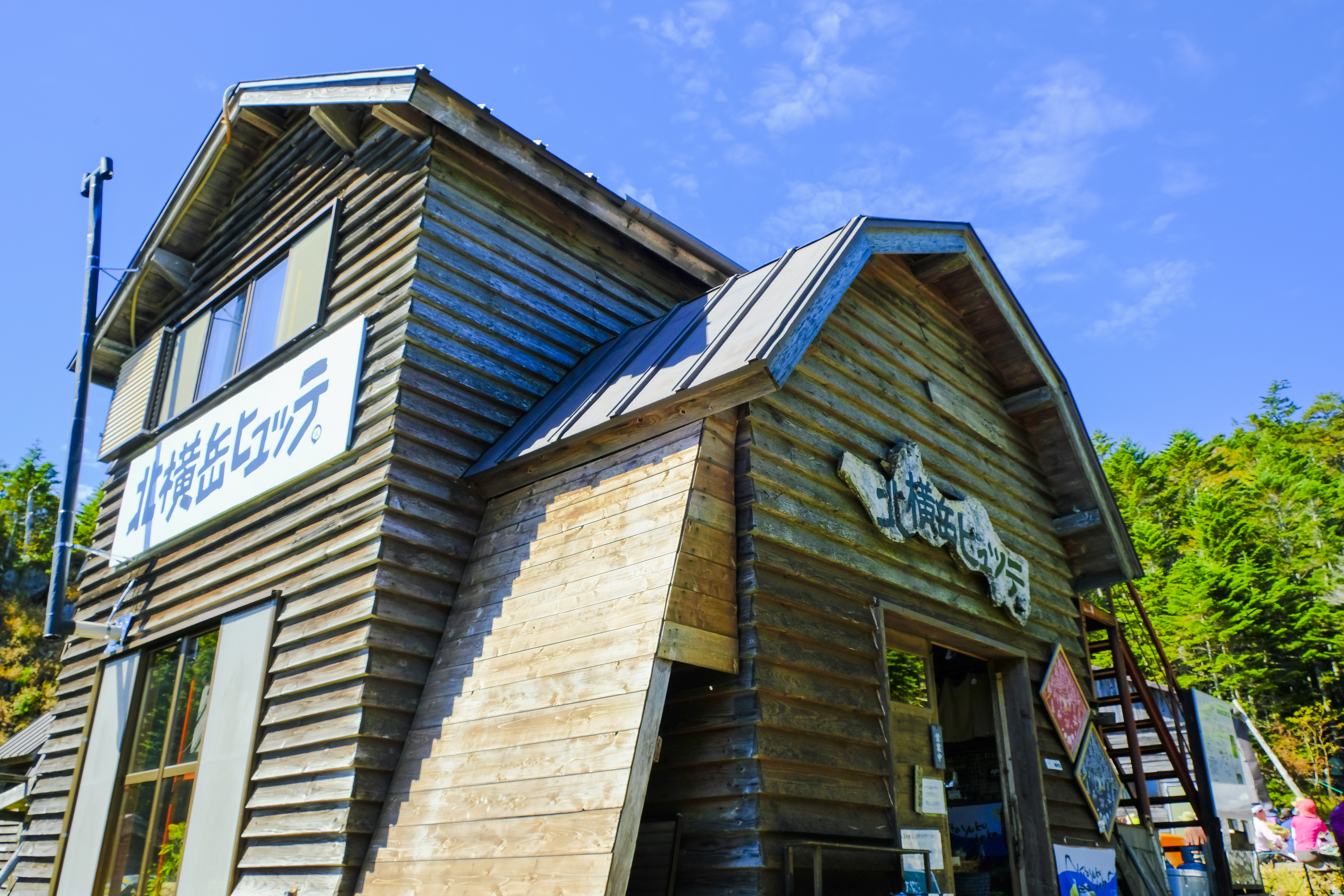
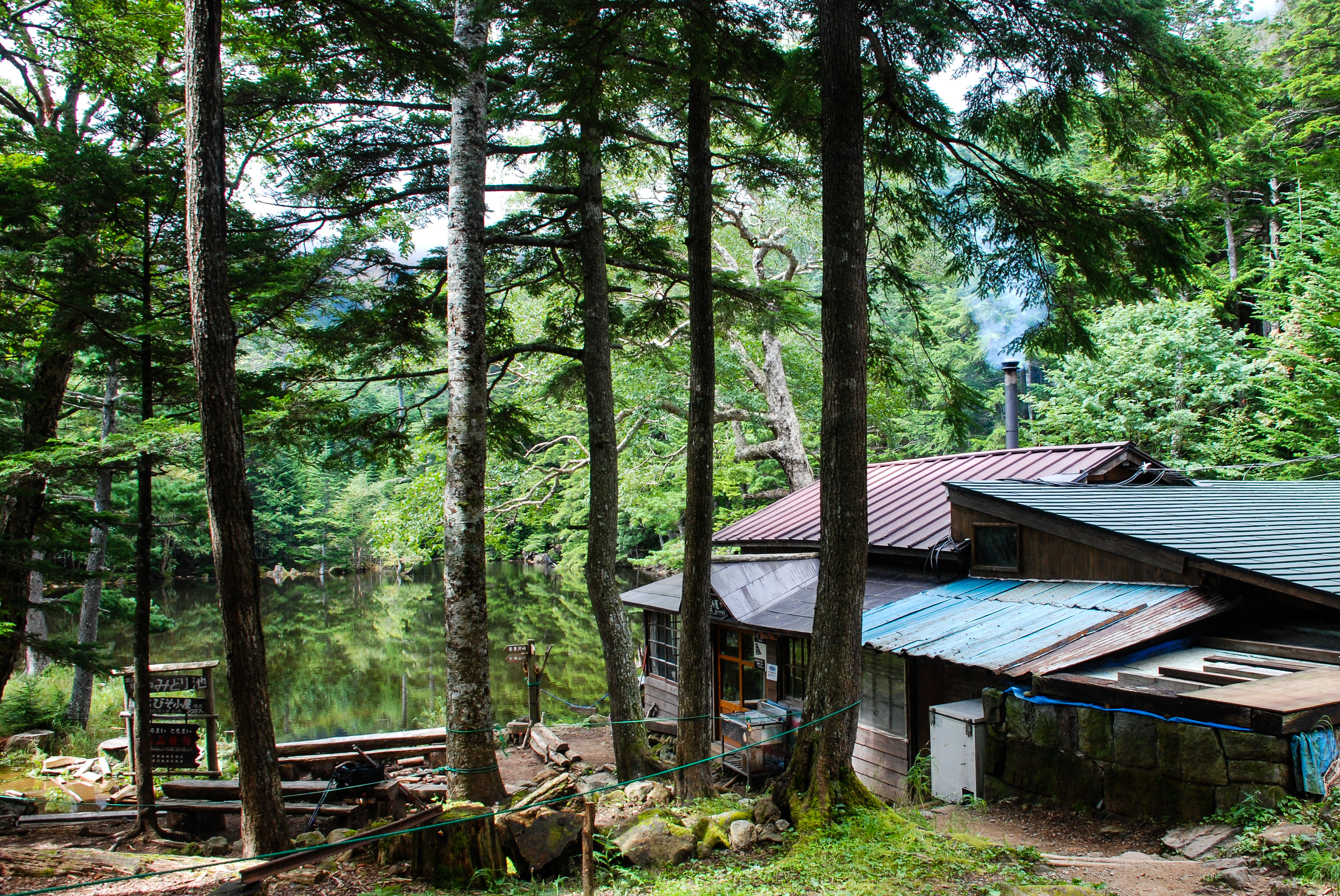
From the eastern peak of Mt. Tengu-dake descend slightly along the path you came toward Nakayama pass. Be careful not to get tangled in the rocks underfoot as you walk. At the junction, take the trail on the left to descend. This descent is also rocky, but once you reach the Kuroyuri Hutte, you will have arrived at your accommodation for the second night. The Kuroyuri Hutte is open year-round welcoming many visitors even during the harsh winter season. The hut was named for the black lilies (kuroyuri in Japanese) that bloom around it in summer.
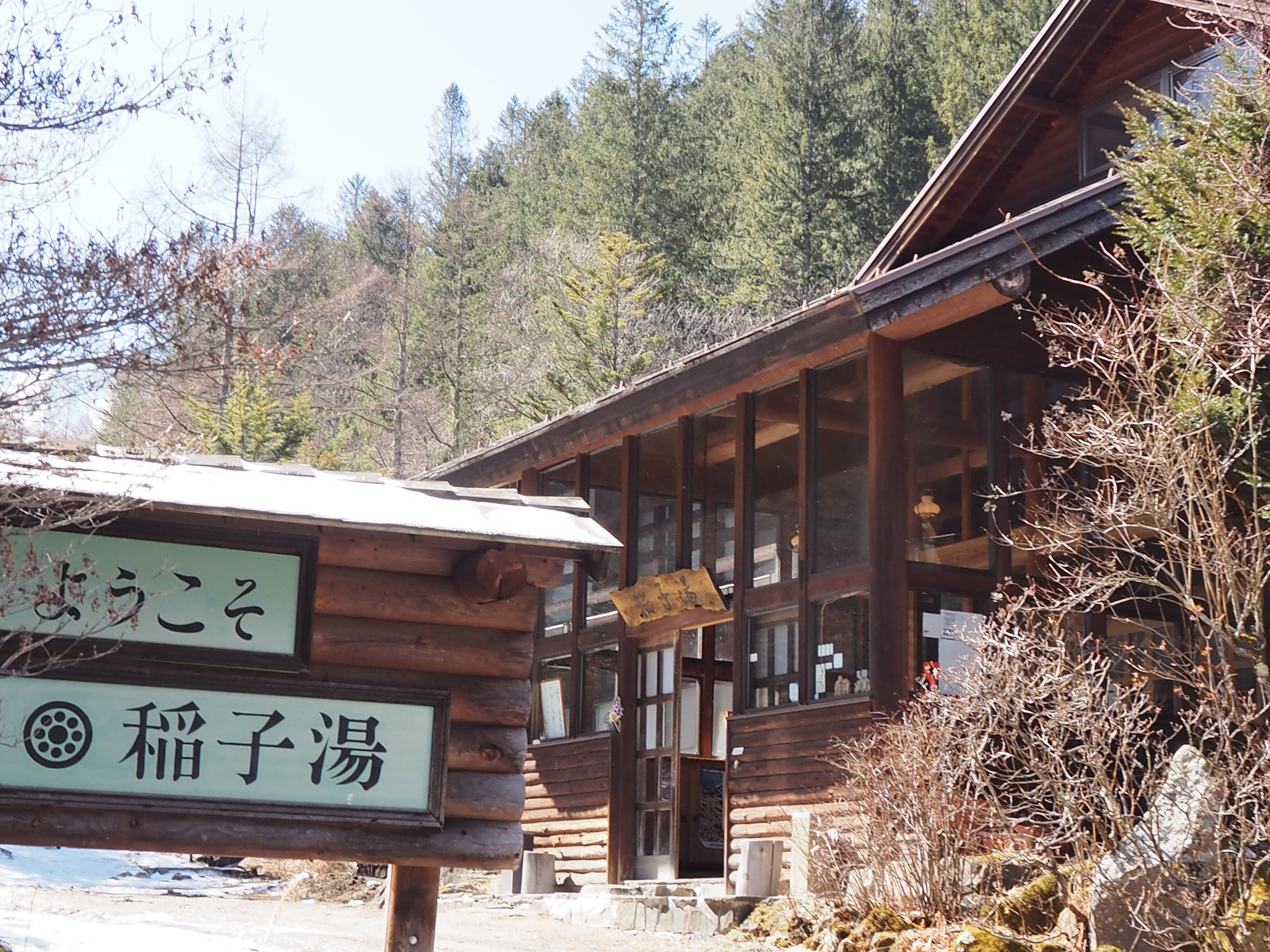
On day three, walk five minutes to the south east of the Kuroyuri Hutte, and you will arrive at Nakayama pass, which we passed through the day before. From here, walk through the forested area toward the Shirabiso-koya hut. This trail unfortunately does not offer the best views. If you look to the right at the junction on the way to Honzawa Onsen, you will see Shirabiso-koya hut. After taking a break here, we will head toward Inakoyu. You can see the remnants of old trolley car rails along this trail, and the clear flowing water of the Komadori mountain stream will feel refreshing. From Shirabiso-koya hut it takes about one hour to Inakoyu.