Mt. Hotaka-dake Difficult Location Detailed Route Guide -The Karasawa Route-
Detailed route from Karasawa
Assuming you start at Kamikochi, you should not experience any difficulties in reaching Karasawa. As long as you take it slow and go at your own pace, you will be fine.
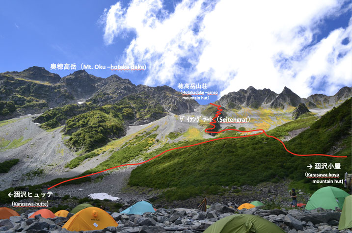
From Karasawa to the Saitengrat starting point, you will be climbing up the broad mountain base. It is an expansive space and should feel amazing to hike, but that is provided the weather is good. When the sky is looking suspiciously dark or the wind is strong, you have to be careful. The skies may look slightly concerning, but if you start out telling yourself “it will be okay” without any evidence for that, it can easily lead to the worst possible outcome. When it is difficult to judge for yourself, we recommend asking someone who works at one of the mountain huts or someone stationed in the Mountain Rescue Team office (open seasonally) at Karasawa.
If for some reason you do start out under such circumstances, please have the courage to turn back. Do not think that if you can just make it to Hotaka-dake-sanso mountain hut, you will be okay. It could be a fatal mistake to forget that accidents frequently happen on the Saitengrat (which means “branch ridge” in contrast to the main ridge).
It is a series of difficult locations from Hotaka-dake-sanso hut all the way to Mt. Oku-hotaka-dake. If it is raining or the wind is strong, please wait it out at the hut. It is only possible to climb mountains because your life is intact. There is a certain feeling of elation that envelops you on a high mountain that tends to push you to just “go for it,” but it is important to exercise self-control.
Detailed route writer
Shinji Nakata, Mountain writer, Mountain walker
Born in Matsumoto city, Nagano prefecture. After working for a publishing company, he became a mountain walker and as of December 2021, he has left his mark on more than 3,300 Japanese and mountains abroad. He has written many books on mountain guiding.
Director of The Japan Alps Guide Center
Detailed route from Karasawa to Hotaka-dake-danso
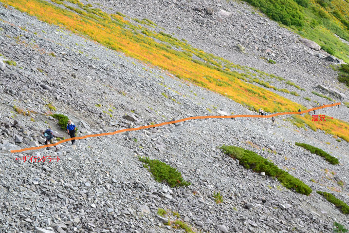
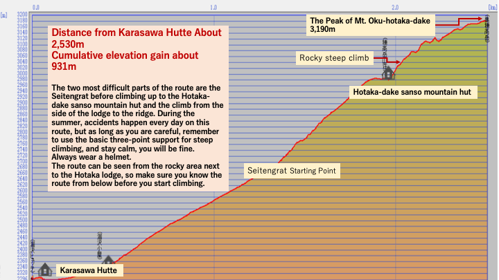
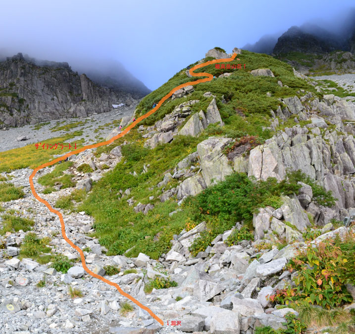
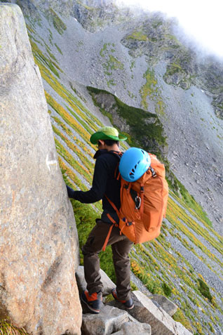
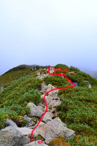
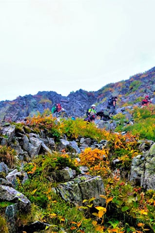
There is an incline from Karasawa to the Saitengrat, but you can climb it if you go slow. For the most part, the climbing gradient on the Saitengrat is steep and you will be walking on a narrow path that runs between the rocks. When it gets hard to breathe, make sure to take standing breaks along the way. There are locations with chains or iron ladders with a few rungs, but they are not a problem. The hardest part is that the air is a bit thin at this altitude of 2,600 meters. If you get a headache while climbing here, it may be altitude sickness, If that is the case, make sure to hydrate and take a break. If it still doesn’t get any better, or it seems to get worse, descend the mountain right away. If it’s a mild case of altitude sickness, lowering your elevation should alleviate the symptoms.
Oku-hotaka-dake sanso〜Mt. Oku-hotaka-dake Detailede route guide
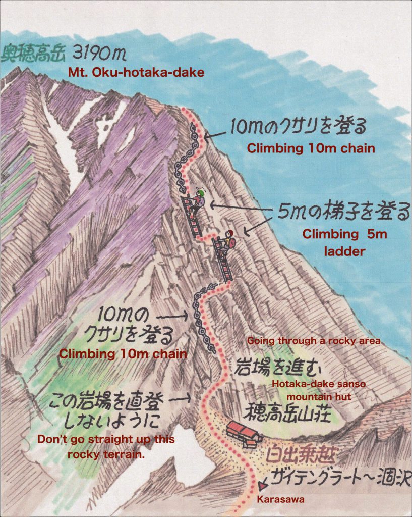
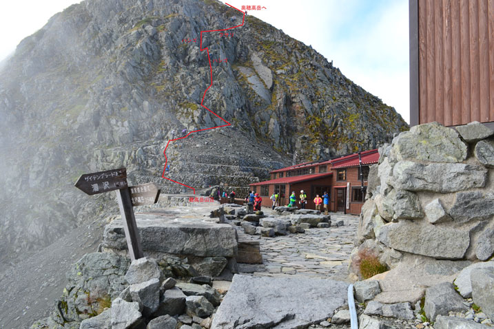
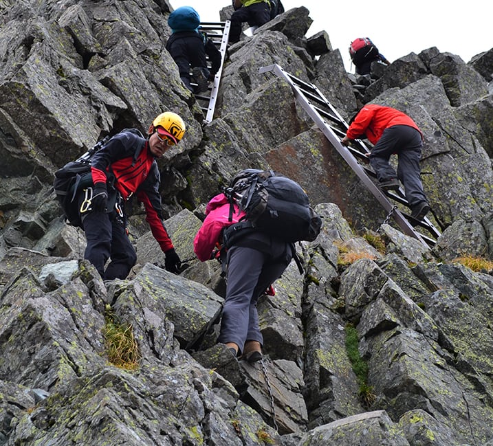
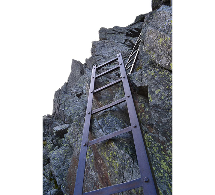
From the Hotaka-dake-sanso hut, you will ascend through some rocky terrain and then climb a series of two iron ladders followed about more rocky terrain with chains. The iron ladders and chains are all firmly affixed, so they are not a worry, but the sense of altitude you will feel can be scary. Even experienced hikers feel nervous here, so it is only natural that beginners will feel scared. The rule of thumb is that those ascending have the right of way, but it is a good idea to be flexible and pay attention to what those who are descending are doing because if you are hiking up and back the same route, you will eventually be descending too. If, for example, you are the cause of a traffic jam, do not panic. One of the rules of mountain climbing is not to place blame for these things because a safe climb means one that you walk at your own pace.
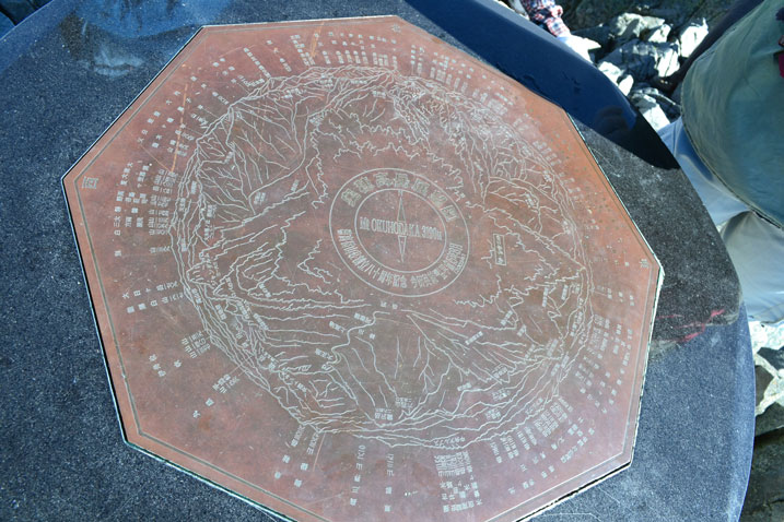
If the weather is nice, you will want to spend hours up here enjoying the view, but lightning is a concern when you are atop a high mountain. You never know when or where lightning will strike. After you finish your lunch, it is time to slowly head down the mountain.
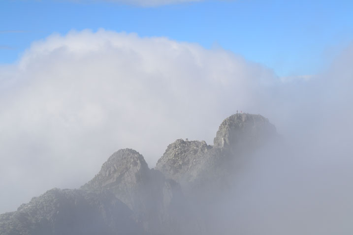
You can see people standing on the summit. Everyone imagines themselves standing there someday, but it is best not to attempt it until you have acquired sufficient experience in the Yari and Hotaka mountain ranges, but do not climb solo. If possible, it is best to have a mountain guide leading you.
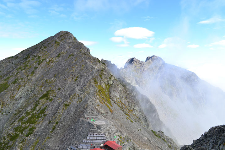
Kita-hotaka-dake northern peak
Kita-hotaka-dake southern peak
and the sharp, rocky peak on the left is Karasawa-dake
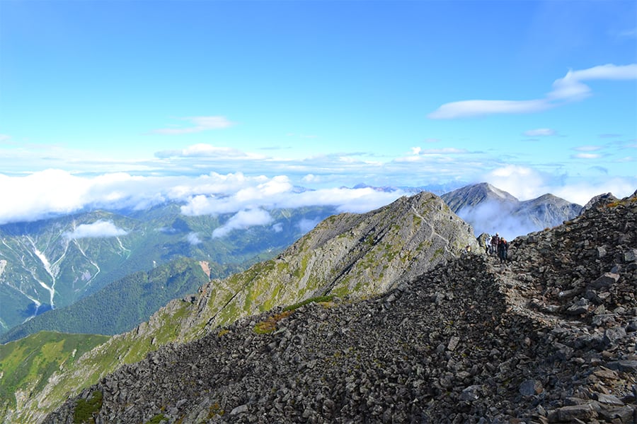
This location is on the way down to Hotaka-dake-sanso hut. You may be able to really get a sense that you are standing in the heart of the Alps. You have to be even more careful on the descent than the ascent, so focus and concentrate on the task of descending without allowing your gaze to wander.
Elevation map: From Karasawa to Mt. Oku-hotaka-dake
