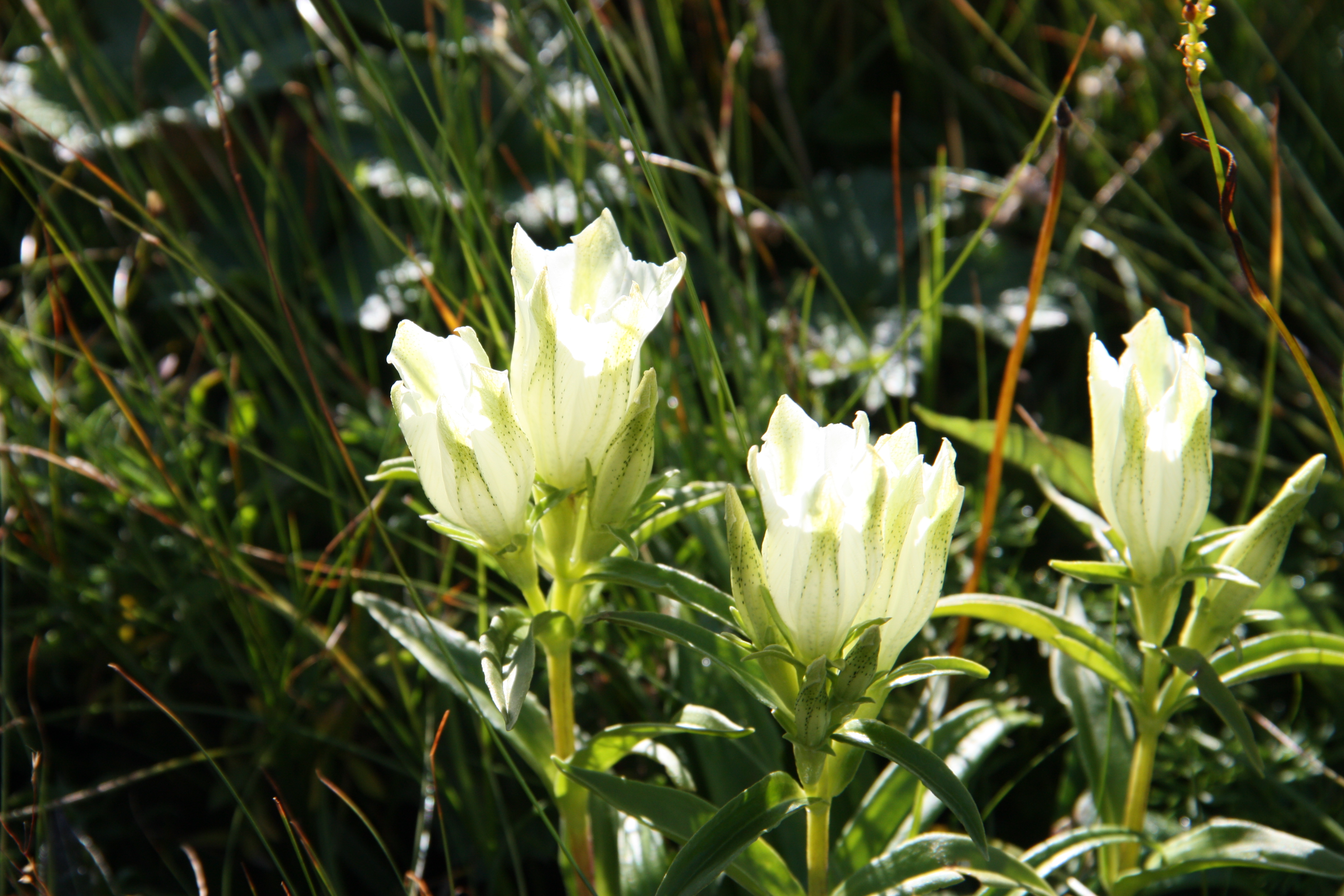
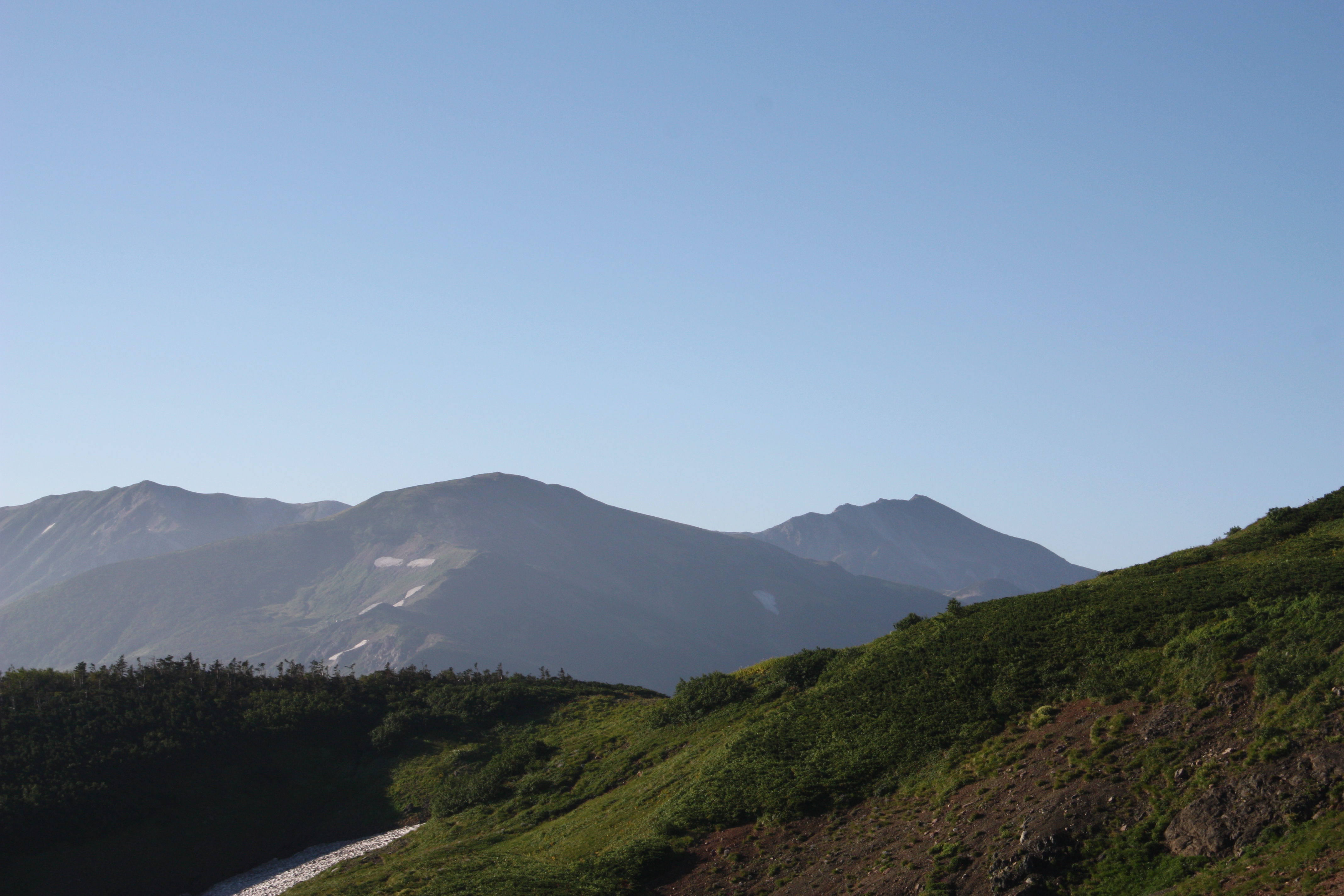
Mt. Asahi-dake is the northernmost peak of the Northern Alps with an elevation in the 2,000m range. Though the mountain is quite large, it somehow appears feminine and forgiving. The bountiful variety of flowers blooming around the mountain’s ponds are as numerous as those of Mt. Shirouma-dake. However, it is somewhat disappointing that few people make the trip out here. The trail from Mt. Asahi-dake down to Ogawa Onsen is often used as a trail to the Tsugami Shindo trail, but if you use the Renge Onsen trailhead to descend down to Ogawa Onsen, you can enjoy the many alpine plants and hot springs along the way.
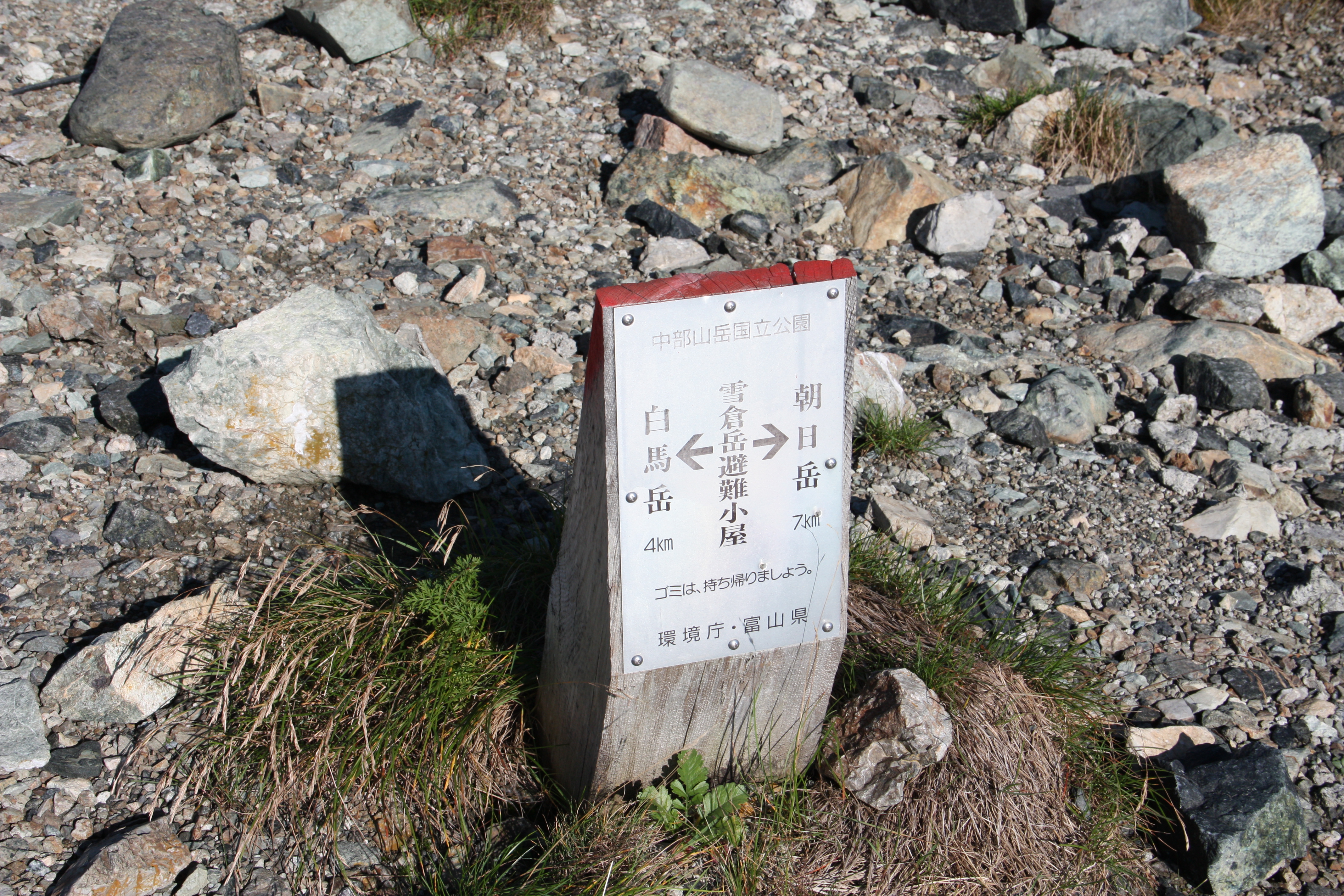
Mt. Yukikura-dake, has a higher elevation than Mt. Asahi-dake and offers more spectacular views. However, despite being included on the list of Japan’s 200 Famous Mountains, it is unfortunately only considered a mountain for passing through.
Asahi-dake:Elevation 2,417m Climbing
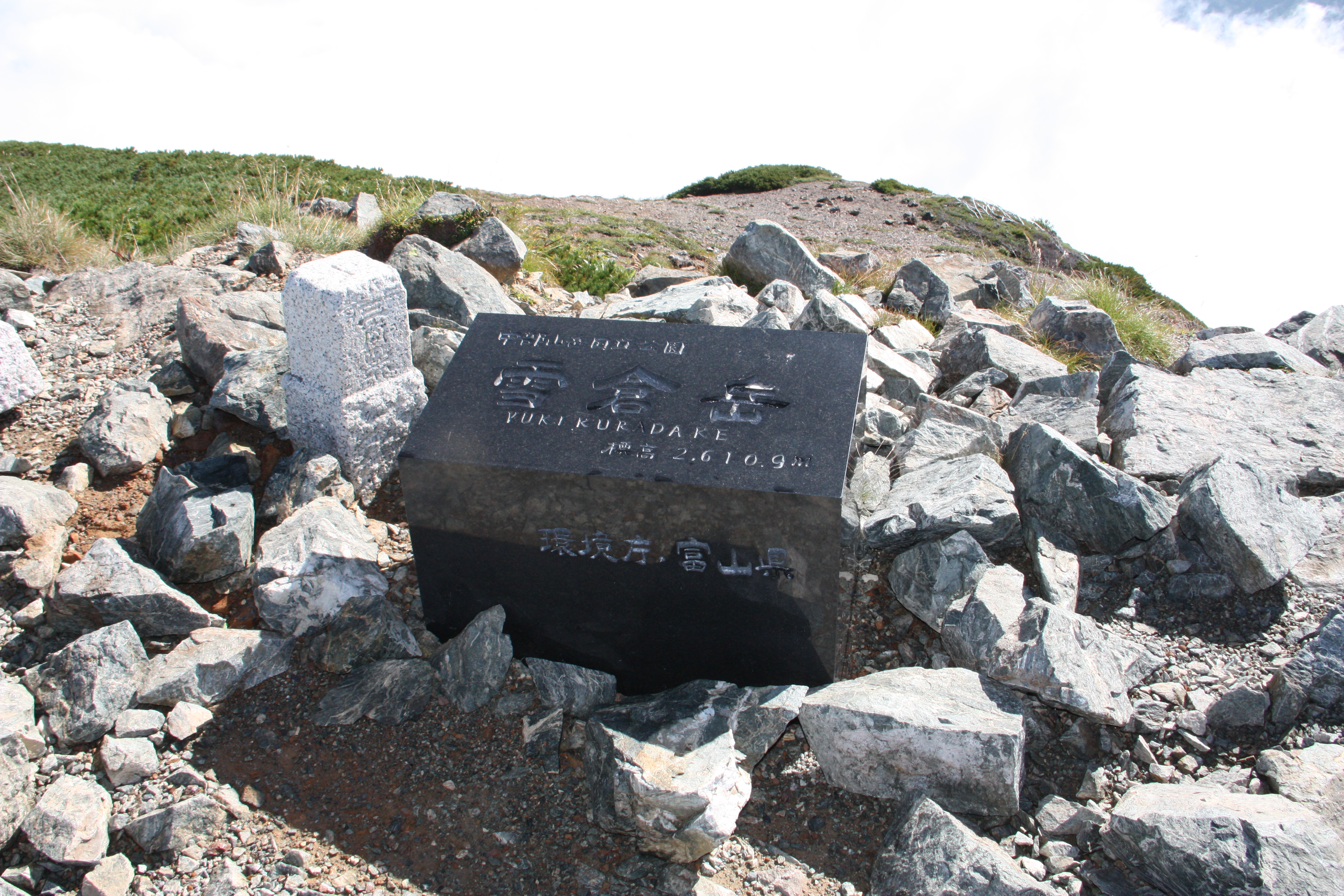
Yukikura-dake:Elevation 2,610m Climbing
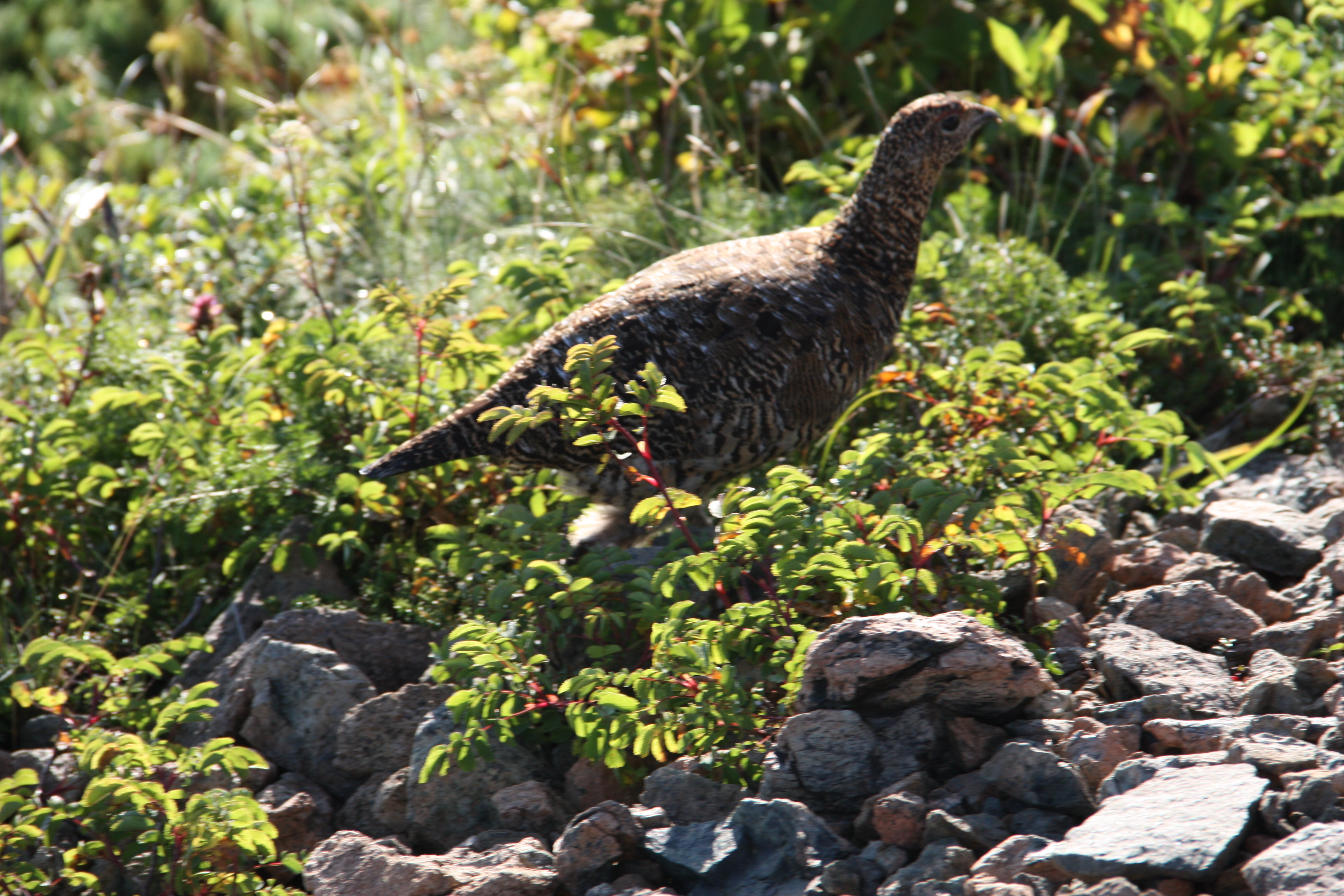
Mt. Asahi-dake is the starting point of the Tsugami Shindo trail that stretches all the way to the Japan Sea. However, this trail is long and challenging, so according to a volunteer who maintains one of the mountain shelters along the trail, currently only about 50 people hike it annually. The general Mt. Asahi-dake hiking course travels back and forth between Renge Onsen. If you want to hike it as a set with Mt. Yukikura-dake, one option would be to ascend Mt. Yukikura-dake from Mt. Shirouma-dake and continue on to Mt. Asahi-dake, and from there descend to Renge Onsen. Currently, few people climb both Mt. Asahi-dake and Mt. Yukikura-dake, which may be why there is a good chance you will encounter a rock ptarmigan. If you have experience descending from Mt. Shirouma-dake to Hakuba Oike, I recommend taking the course from Mt. Shirouma-dake to Mt. Yukikura-dake to Mt. Asahi-dake descending to Renge Onsen. This course is guaranteed to double, or even triple, your memories of Shirouma.
Trailhead vicinity weather
Weekly weather forecast zone:Toyama Prefecture Eastern Region
| DAY | WEATHER | LOWEST | HIGHEST |
|---|---|---|---|
| 7/20 | 25℃ | 34℃ | |
| 7/21 | 25℃ | 34℃ | |
| 7/22 | 25℃ | 34℃ | |
| 7/23 | 25℃ | 34℃ | |
| 7/24 | 25℃ | 33℃ | |
| 7/25 | 24℃ | 33℃ |
This is a publication of the calculated figures for weather predictions and is not the weather forecast. There are instances where there will be big differences in the values stated for the mountains, in accord with the topography as well as sunlight, etc. so please take care.
72 hours weather information:1, Yunose, Asahi-cho, Shimo-Niikawa-gun, Toyama
| Date and time |
7/19 9:00 |
7/19 10:00 |
7/19 11:00 |
7/19 12:00 |
7/19 13:00 |
7/19 14:00 |
7/19 15:00 |
7/19 16:00 |
7/19 17:00 |
7/19 18:00 |
7/19 19:00 |
7/19 20:00 |
7/19 21:00 |
7/19 22:00 |
7/19 23:00 |
7/20 0:00 |
7/20 1:00 |
7/20 2:00 |
7/20 3:00 |
7/20 4:00 |
7/20 5:00 |
7/20 6:00 |
7/20 7:00 |
7/20 8:00 |
7/20 9:00 |
7/20 10:00 |
7/20 11:00 |
7/20 12:00 |
7/20 13:00 |
7/20 14:00 |
7/20 15:00 |
7/20 16:00 |
7/20 17:00 |
7/20 18:00 |
7/20 19:00 |
7/20 20:00 |
7/20 21:00 |
7/20 22:00 |
7/20 23:00 |
7/21 0:00 |
7/21 1:00 |
7/21 2:00 |
7/21 3:00 |
7/21 4:00 |
7/21 5:00 |
7/21 6:00 |
7/21 7:00 |
7/21 8:00 |
7/21 9:00 |
7/21 10:00 |
7/21 11:00 |
7/21 12:00 |
7/21 13:00 |
7/21 14:00 |
7/21 15:00 |
7/21 16:00 |
7/21 17:00 |
7/21 18:00 |
7/21 19:00 |
7/21 20:00 |
7/21 21:00 |
7/21 22:00 |
7/21 23:00 |
7/22 0:00 |
|---|---|---|---|---|---|---|---|---|---|---|---|---|---|---|---|---|---|---|---|---|---|---|---|---|---|---|---|---|---|---|---|---|---|---|---|---|---|---|---|---|---|---|---|---|---|---|---|---|---|---|---|---|---|---|---|---|---|---|---|---|---|---|---|---|
| Weather | ||||||||||||||||||||||||||||||||||||||||||||||||||||||||||||||||
| Temperature | 25℃ | 26℃ | 27℃ | 27℃ | 28℃ | 28℃ | 28℃ | 28℃ | 27℃ | 26℃ | 25℃ | 24℃ | 24℃ | 24℃ | 24℃ | 24℃ | 23℃ | 23℃ | 23℃ | 23℃ | 23℃ | 23℃ | 23℃ | 25℃ | 26℃ | 26℃ | 27℃ | 27℃ | 28℃ | 28℃ | 28℃ | 28℃ | 27℃ | 27℃ | 26℃ | 25℃ | 24℃ | 24℃ | 24℃ | 24℃ | 24℃ | 24℃ | 24℃ | 24℃ | 24℃ | 24℃ | 24℃ | 26℃ | 27℃ | 27℃ | 28℃ | 28℃ | 28℃ | 28℃ | 28℃ | 27℃ | 27℃ | 26℃ | 26℃ | 25℃ | 24℃ | 24℃ | 24℃ | 24℃ |
| Precipitation | 0mm/h | 0mm/h | 0mm/h | 0mm/h | 0mm/h | 0mm/h | 0mm/h | 0mm/h | 0mm/h | 0mm/h | 0mm/h | 0mm/h | 0mm/h | 0mm/h | 0mm/h | ※ 16時間以降は表示されません | ||||||||||||||||||||||||||||||||||||||||||||||||
| Wind direction |
east-southeast 1m/s |
east-southeast 1m/s |
east-southeast 1m/s |
east-southeast 2m/s |
east-southeast 1m/s |
east-southeast 1m/s |
east-southeast 1m/s |
east-southeast 1m/s |
east-southeast 1m/s |
east-southeast 1m/s |
east-southeast 1m/s |
east-southeast 1m/s |
east-southeast 1m/s |
east-southeast 1m/s |
east-southeast 1m/s |
east-southeast 1m/s |
east-southeast 1m/s |
east-southeast 1m/s |
east-southeast 1m/s |
east-southeast 1m/s |
east-southeast 2m/s |
east-southeast 2m/s |
east-southeast 1m/s |
0m/s |
east-southeast 1m/s |
east-southeast 1m/s |
east-southeast 1m/s |
east-southeast 2m/s |
east-southeast 2m/s |
east-southeast 1m/s |
east-southeast 1m/s |
east-southeast 1m/s |
east-southeast 1m/s |
east-southeast 1m/s |
0m/s |
east-southeast 1m/s |
east-southeast 1m/s |
east-southeast 1m/s |
east-southeast 1m/s |
east-southeast 1m/s |
east-southeast 1m/s |
east-southeast 1m/s |
east-southeast 2m/s |
east-southeast 1m/s |
east-southeast 1m/s |
east-southeast 1m/s |
east-southeast 1m/s |
0m/s |
east-southeast 1m/s |
east-southeast 1m/s |
east-southeast 1m/s |
east-southeast 2m/s |
east-southeast 2m/s |
east-southeast 2m/s |
east-southeast 2m/s |
east-southeast 2m/s |
east-southeast 1m/s |
east-southeast 1m/s |
0m/s |
east-southeast 1m/s |
east-southeast 1m/s |
east-southeast 1m/s |
east-southeast 1m/s |
east-southeast 1m/s |
※The weather information will be information on 5km square including the relevant point.
※天気予報マークは一次細分区域から表示しています
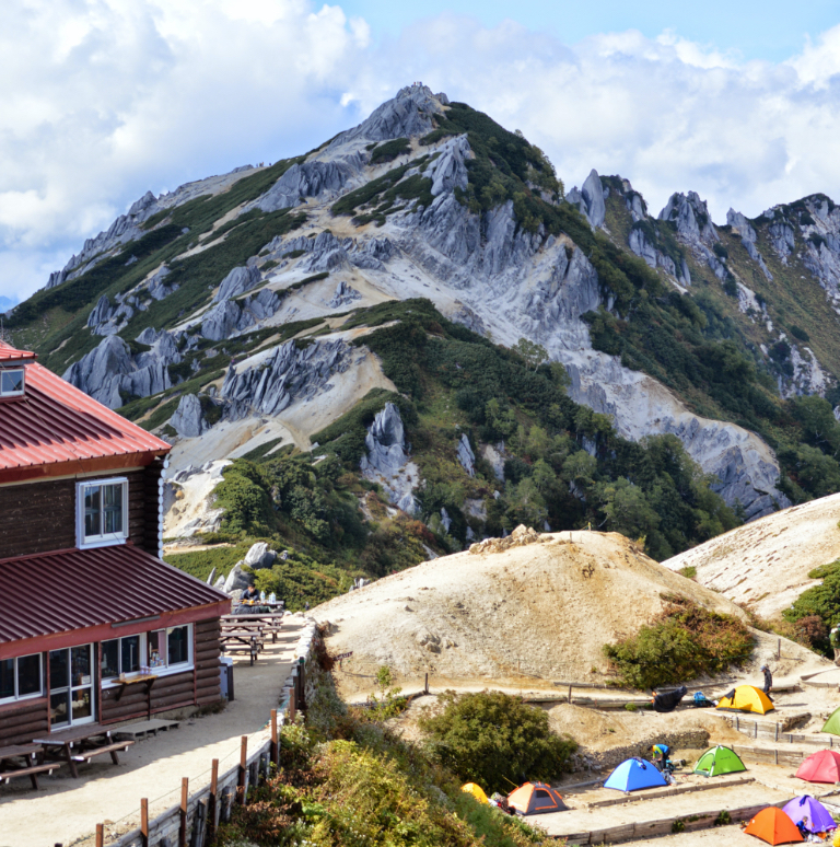
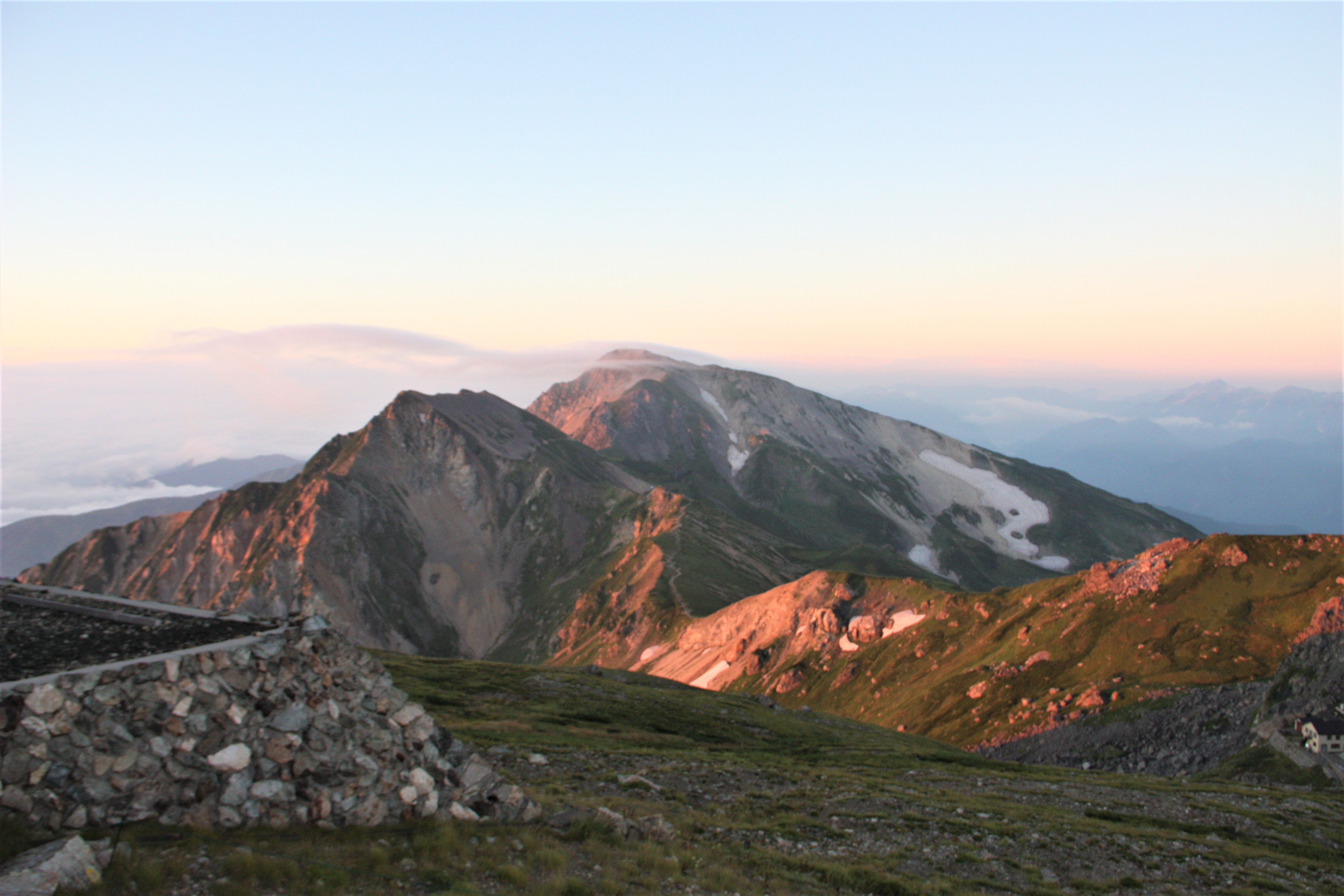
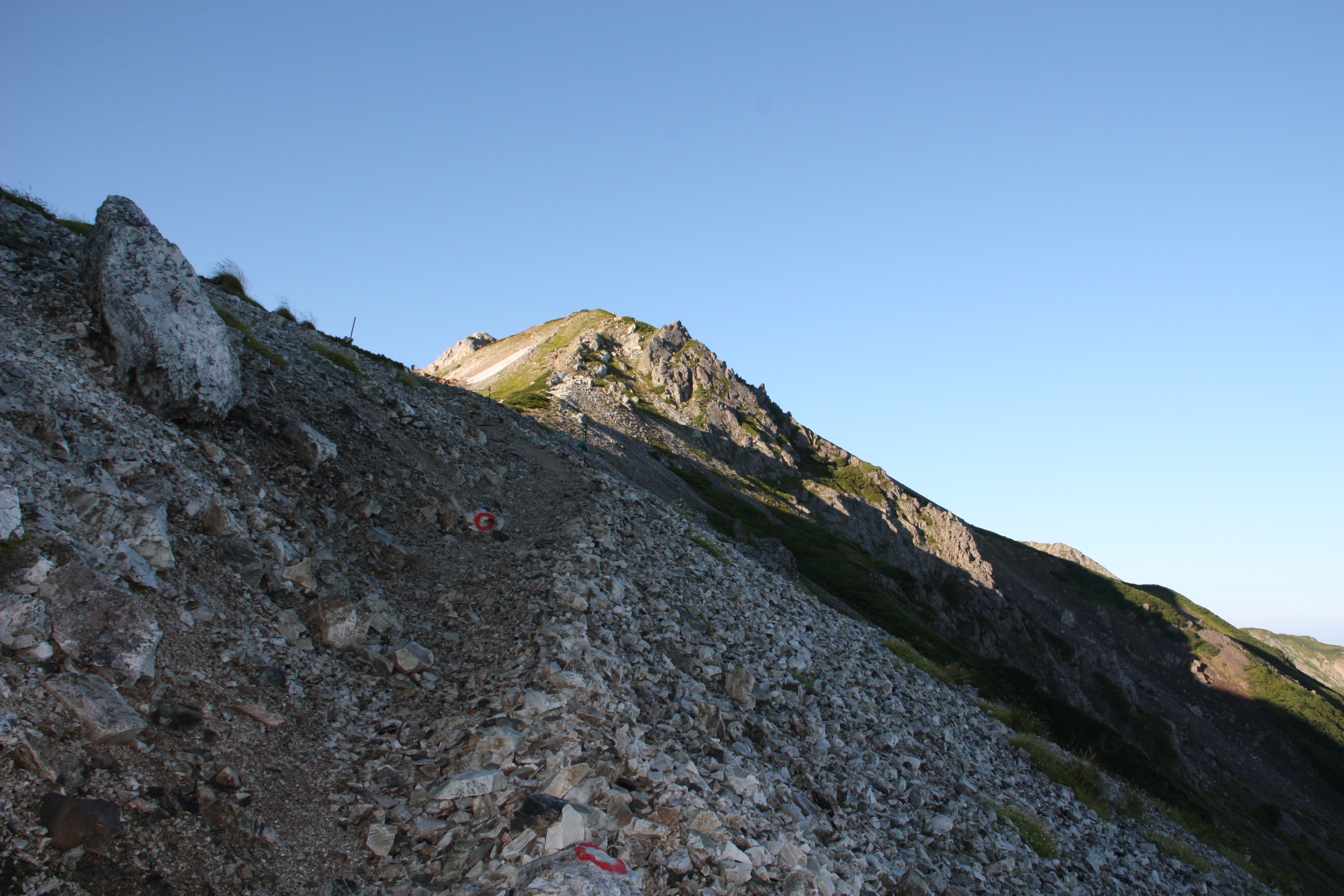
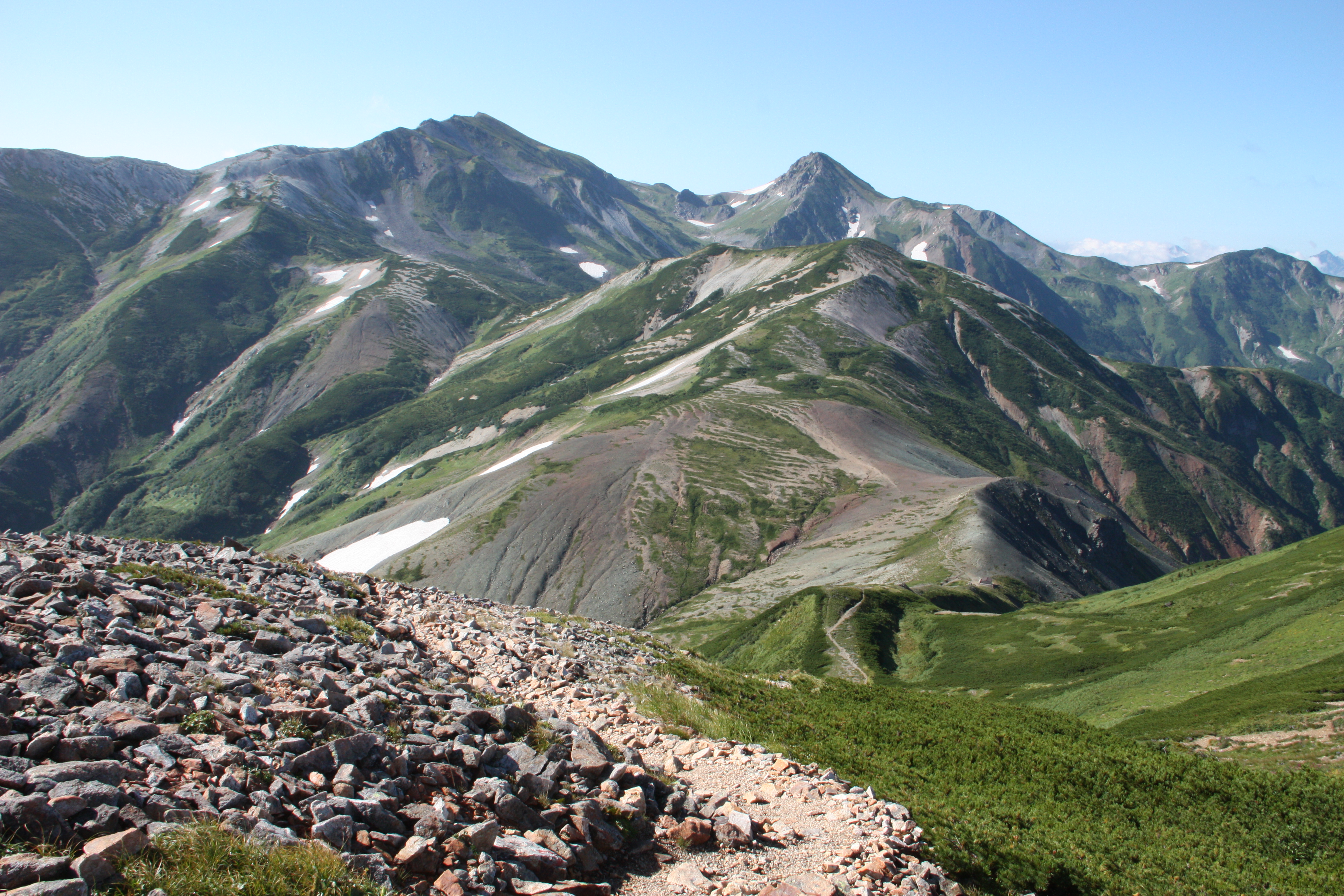
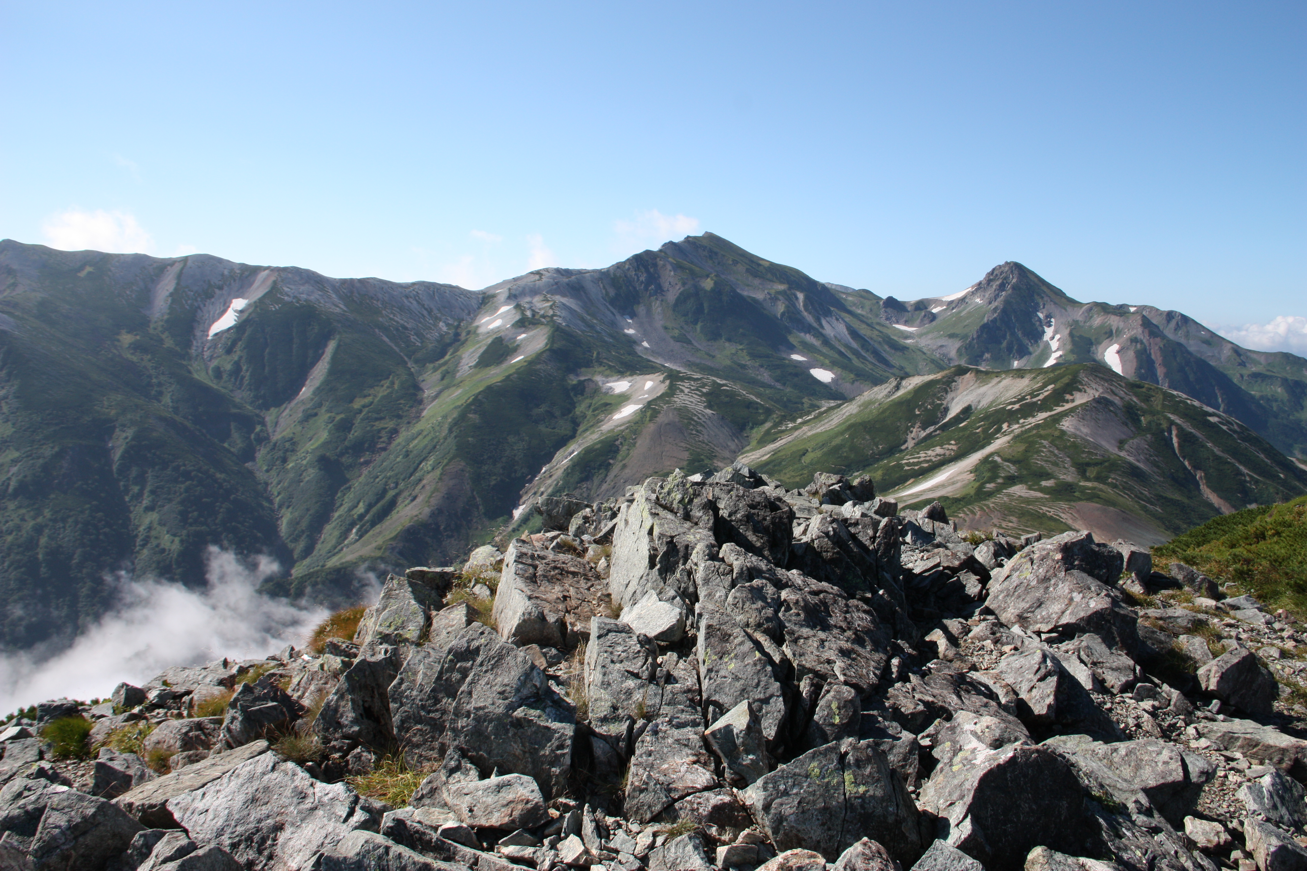
View of Asahi-dake・Yukikura-dake


Route Information
A-Basic course sorted by trailheads
From Shiroumadake
-
Yukikura-dake - Asahi-dake Route
①Mt. Shioruma-dake ~ Mt. Yukikura-dake ~ Kitamata-koya Mountain Hut ~ Ogawa Onsen Motoyu Hot Spring -
Tsugami Shindo New Trail Route
②Mt. Shirouma-dake ~ Mt. Yukukira-dake ~ Mt. Asahi-dake ~ Mt. Kuroiwa-yama ~ Tsugami-sanso Mountain Hut ~ Shiratori-koya Mountain Hut ~ Oyashirazu station (Advanced)