South Alps Ura-ginza Route
②Torikura trailhead ~ Sanpuku Pass ~ Mt. Shiomi-dake ~ Sanpuku-touge-koya Mountain Hut ~ Mt. Akaishi-dake ~ Mt. Hijiri-dake ~ Mt. Chausu-dake ~ Hatanagi-Daiichi Dam
Technical level: D
Physical strength: 10
Difficulty: ★★★★★
A hike on the ridgeline from Mt. Shiomi-dake to Mt. Akaishi-dake and Mt. Hijiri-dake
Mt. Shiomi-dake, Mt. Akaishi-dake and Mt. Hijiri-dake are usually visited on separate occasions, however, on this route, those three mountains will be reached in one trip. You will stay at Shiomi-koya mountain hut, Sho-kouchi-dake emergency shelter, Naka-dake emergency shelter, Akaishi-dake emergency shelter, Usagi-dake emergency shelter and Chausu-koya Mountain hut. It means that it is a satisfying trail of six nights and seven days. It will for sure be a lifetime memory trip, however, you will stay at emergency shelters for many nights, and you will have to carry your own foods with you. Therefore, it is recommended that you hike this route as a group of three or four, not solo hiking.
●Hiking data
Schedule: Six nights and seven days
Walking hours: 45 hours 15 minutes
Walking distance: 56 km
Cumulative elevation difference: 6,545.8 m
Torikura Trailhead


Elevation 1,790m
↓ 3 hours
Sanpuku Pass

Elevation 2,580m
↓ 4 hours 10 miniutes
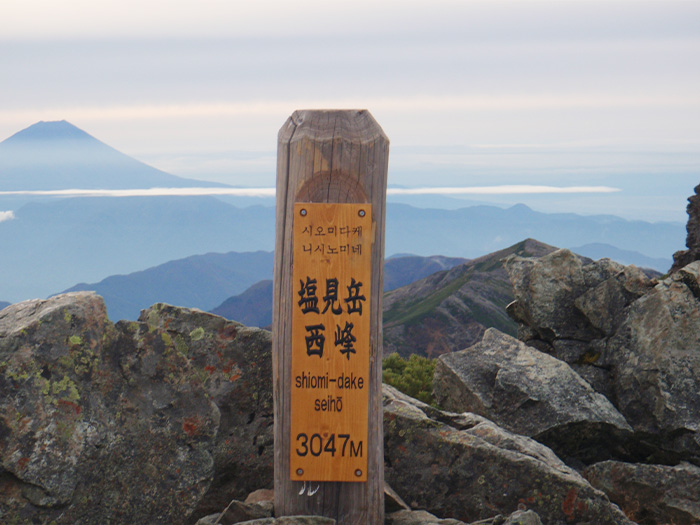
Mt. Shiomi-dake
Elevation 3,052m
↓ 7 hours 5 minutes
Syo-kouchi Emergency Shelter

Elevation 2,780m
↓ 6 hours 50 minutes
Naka-dake Emergency Shelter
Elevation 3,083m
↓ 4 hours 5 minutes
Mt. Akaishi-dake
Elevation 3,120m
↓ 5 hours 35 minutes
Mt. Usagi-dake Emergency Shelter
Elevation 2,740m
↓ 2 hours 10 minutes
Mt. Hijiri-dake
Elevation 3,012m
↓ 6 hours 20 minutes
Mt. Chausu-dake
Elevation 2,604m
↓ 6 hours
Hantanagi Daiichi Dam
Elevation 1,400m
Route Guide
Hiking through 6 nights and 7 days is hard on your body no matter how much you love mountains. Therefore, you should prepare yourself fully before your departure. The starting point is the Torikura trailhead.
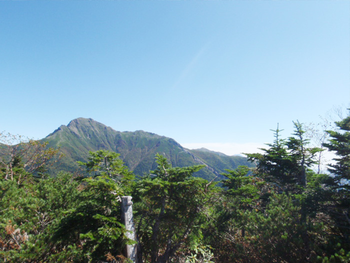
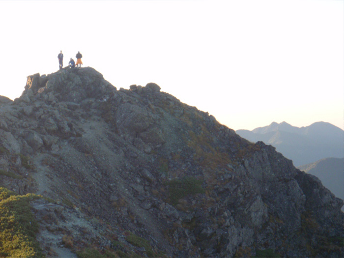
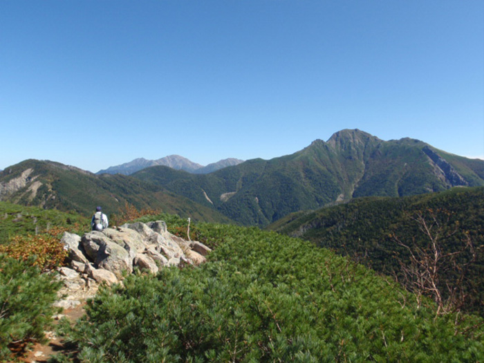
When you get off the bus at Torikura trailhead, you should do warm-up exercises and check your gear such as shoelaces or backpack belts before you depart. There will be road signs with distance indication standing along the trail to Sanpuku pass so you can measure your progress. When you hike on the ridgeline, Toyoguchi-yama saddle will be reached. From here, the trail proceeds as it traverses the north slope. Along the way, there will be narrow areas or plan paths. However, Sanpuku pass should be reached without too much rushing. Take a break then head north. Mt. Sanpuku-yama will be reached shortly. The trail descends through a shrub belt. Mt. Hontani is surrounded by Pinus Pumila. Depart after you take a short break. When you pass the forest where you can spot dried-up trees, the source of Goemon-sawa stream will be reached. After a steep slope from here, Shiomi-koya mountain hut (advanced reservation required) will be reached. It is recommended that you stay at the hut for the night. After you check-in, take a round trip to Mt. Shiomi-dake. From here to Mt. Shiomi-dake, the trail will pass through rocky zones or gravel areas, therefore, you should take only necessary hiking items with you. The east and west peaks of Mt. Shiomi-dake should come into view. After enjoying the view of Mt. Fuji-yama, return to Shiomi-koya mountain hut.
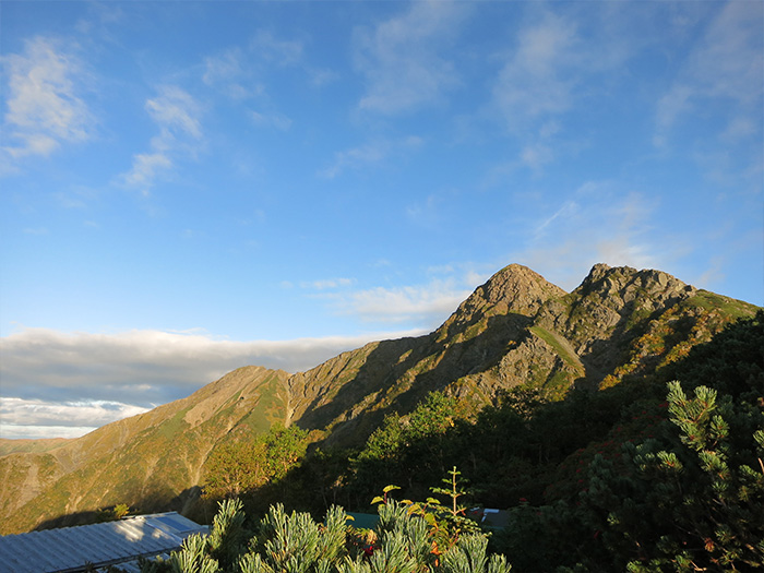
On the next day, from Shiomi-koya mountain hut, return to Sanpuku pass. The ridgeline walk starts from here. Hike on the edge of the rocky trail and pass a flower field. Then the summit of Mt. Eboshi-dake will be reached. Mt. Shiomi-dake spreads out in front of you. From here, head towards Mt. Mae-sho-kouchi-dake. It is a peak where the view of the Arakawa three mountains is phenomenal. From the next peak, Mt. Sho-kouchi-dake, those three mountains can be seen big and up close. The emergency shelter stands right beneath the summit. It is recommended that you stay at the shelter for the second night.
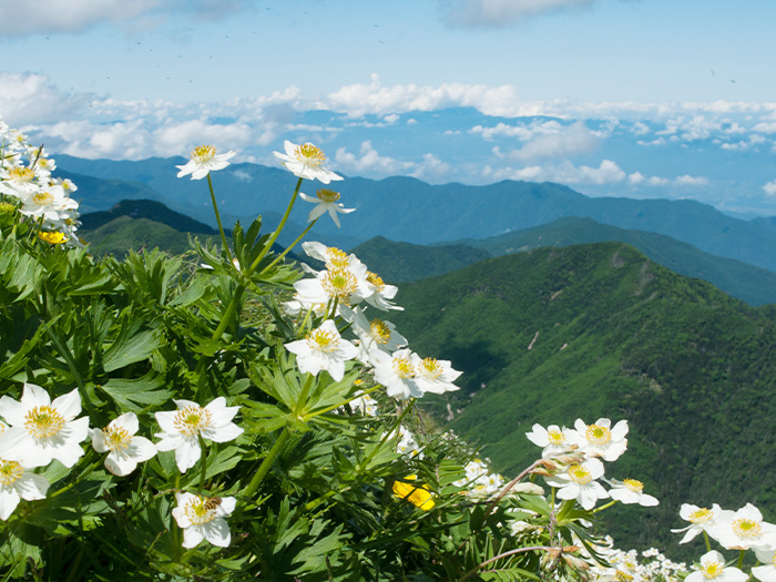
On the third day, descend for 30 minutes from the shelter, then the tree line will be reached. Pass through the area where flower fields spread out and traverse the north side of the ridgeline. Hike from Mt. Itaya-dake to Takayama-ura emergency shelter. It stands on the west side with an open view. Also, there is a place to replenish your water supply in 30 minutes for a round trip from here. When you pass a small open space via a traversing trail covered by Abies mariesii, Mt. Mae-dake at an elevation of 3,068 m will be reached. Mt. Naka-dake stands in 15 minutes north from here. It is recommended that you stay at Naka-dake emergency shelter for the night.
On the fourth day, hike off the ridgeline and walk through flower fields. After you pass Arakawa-koya mountain hut, the trail will be descending while traversing. Pass Daisyouji-daira and enter the trail continuing to the right. Pass Sho-akaishi shoulder and hike for one hour, then the summit of Mt. Akaishi-dake will be reached. Use the direction indication plate as a guide to check your view. For the fourth night, you will stay at Akaishi-dake emergency shelter, which stands right beneath the summit.
On the fifth day, you will traverse a big slope of Mt. Akaishi-dake. Hike on the comfortable ridgeline. The trail is blessed with a great view of Mt. Hijiri-dake and Mt. Arakawa-dake. There will be plenty of photoshoot spots. If time allows, stop to enjoy the view. Pass Hyakken-daira and proceed for a while. Then the trail comes off the ridgeline and passes in front of Hyakkan-boarayama-no-ie. Proceed from Mt. Nakamori-yama to Mt. Usagi-dake. It is recommended that you stay at Usagi-dake emergency shelter for the fifth night.
The walking hours on day 6 are long so you should depart as early as possible. The summit of Mt. Hijiri-dake will be reached after passing some rocky zones and steep slopes. The mountain is the southern most peak over 3,000 m in altitude in the Japan Alps. Enjoy the view. The variance in elevation from Mt. Hijiri-dake to the junction beneath Hijiri-daira-koya mountain hut is about 860 m. It takes about 2 hours to descend the difference. The ridgeline is a narrow cliff, so great caution must be practiced. You must be tired because it will be the sixth day in the mountains at this point. Listen to your body carefully while walking. You are scheduled to stay at Chausu-koya mountain hut, however, you can stay at Hijiri-daira-koya mountain hut and make it into a seven-nights trip if necessary. It is a 20-minute round trip from the shoulder to Mt. Kami-kouchi-dake, where a 360-degree view can be enjoyed. It takes about 1 hour and 15 minutes from the shoulder to Chausu-koya mountain hut. The view of Mt. Fuji over the Betula birch is impressive. It is recommended that you stay at Chausu-koya mountain hut. If you have time, let’s take a round trip to Mt. Chausu-dake.
On the last day, descend from Chausu-koya mountain hut to Hata-nagi Daiichi Dam. From a flower field, pass by the front of Yokokubo-sawa-koya mountain hut. From the lookout bench in front of Yokokubo-sawa-koya mountain hut, the view of Daimugen can be enjoyed. Steep slopes continue, so you have to stay focused on each step. There are a few places to go down steps so caution must be exercised. When you pass Usokko-sawa-koya mountain hut, Hata-nagi-o-tsuri bridge will be reached shortly. After crossing the bridge, Hata-nagi Daiichi Dam will be reached soon.