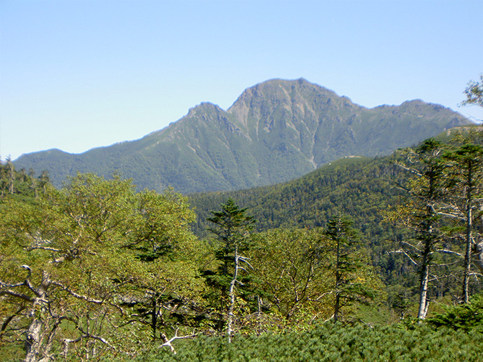
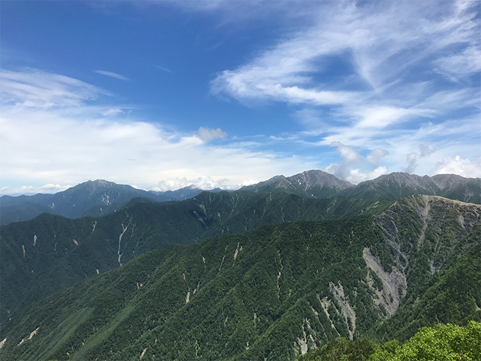
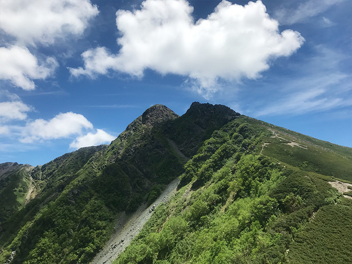
The north of Shizuoka prefecture and the southeast of Nagano prefecture. This mountain is located at the center of the South Japan Alps. The east peak is at an elevation of 3,052 m and the west peak where second triangulation is set is at an elevation of 3,047 m. Looking from Sanpuku pass, Tengu-iwa can be seen on the left and Mt. Kitamata-dake on the right. That view is dignified and beautiful. Also the view from the summit is phenomenal. The main ridgeline descends sharply at Tengu-iwa and it runs from Mt. Gonemon-yama to Mt. Hontani-yama and Sanpuku pass. The dynamic view of the high-altitude mountain makes one’s willingness to climb. This is the mainstay of the Akaishi mountains.
Mt. Shiomi-dake: Elevation 3,052 m
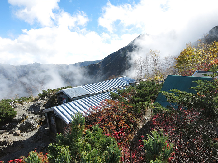
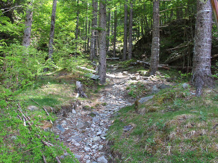
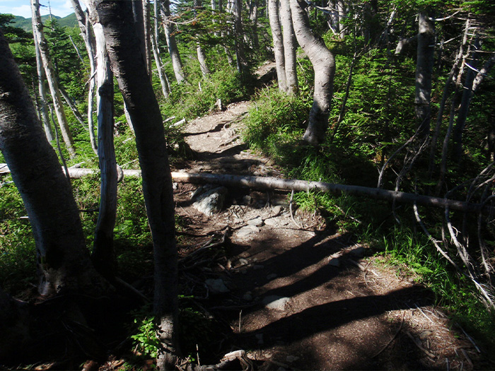
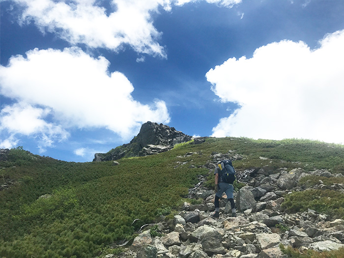
It can be hiked from the Arakawa Three Mountains or from the direction of Mt. Kita-dake. Some like the long trail, however, it requires many days to complete. There are actually routes to climb only Mt. Shiomi-dake. Those are the Shiomi-shindo route, Shio-kawa route, and the Torikura route. Unfortunately, the Shiomi-shindo and Sho-kawa routes are either lost due to the damage from a Typhoon or requires a 20 km walk on a logging road. The Torikura route still exists and a trailhead is accessible by your car or bus. By using this route, this mountain can be hiked in one night and two days. Shiomi-koya Mountain hut, however, does require a reservation to stay. Make sure that you make a reservation before you enter the mountain.
Trailhead vicinity weather
Weekly weather forecast zone:Southern Nagano Prefecture
| DAY | WEATHER | LOWEST | HIGHEST |
|---|---|---|---|
| 7/20 | 23℃ | 35℃ | |
| 7/21 | 23℃ | 34℃ | |
| 7/22 | 23℃ | 34℃ | |
| 7/23 | 23℃ | 33℃ | |
| 7/24 | 22℃ | 33℃ | |
| 7/25 | 22℃ | 33℃ |
This is a publication of the calculated figures for weather predictions and is not the weather forecast. There are instances where there will be big differences in the values stated for the mountains, in accord with the topography as well as sunlight, etc. so please take care.
72 hours weather information:Torikura Parking Lot, Oshika Village, Shimoina-gun, Nagano Prefecture
| Date and time |
7/19 9:00 |
7/19 10:00 |
7/19 11:00 |
7/19 12:00 |
7/19 13:00 |
7/19 14:00 |
7/19 15:00 |
7/19 16:00 |
7/19 17:00 |
7/19 18:00 |
7/19 19:00 |
7/19 20:00 |
7/19 21:00 |
7/19 22:00 |
7/19 23:00 |
7/20 0:00 |
7/20 1:00 |
7/20 2:00 |
7/20 3:00 |
7/20 4:00 |
7/20 5:00 |
7/20 6:00 |
7/20 7:00 |
7/20 8:00 |
7/20 9:00 |
7/20 10:00 |
7/20 11:00 |
7/20 12:00 |
7/20 13:00 |
7/20 14:00 |
7/20 15:00 |
7/20 16:00 |
7/20 17:00 |
7/20 18:00 |
7/20 19:00 |
7/20 20:00 |
7/20 21:00 |
7/20 22:00 |
7/20 23:00 |
7/21 0:00 |
7/21 1:00 |
7/21 2:00 |
7/21 3:00 |
7/21 4:00 |
7/21 5:00 |
7/21 6:00 |
7/21 7:00 |
7/21 8:00 |
7/21 9:00 |
7/21 10:00 |
7/21 11:00 |
7/21 12:00 |
7/21 13:00 |
7/21 14:00 |
7/21 15:00 |
7/21 16:00 |
7/21 17:00 |
7/21 18:00 |
7/21 19:00 |
7/21 20:00 |
7/21 21:00 |
7/21 22:00 |
7/21 23:00 |
7/22 0:00 |
|---|---|---|---|---|---|---|---|---|---|---|---|---|---|---|---|---|---|---|---|---|---|---|---|---|---|---|---|---|---|---|---|---|---|---|---|---|---|---|---|---|---|---|---|---|---|---|---|---|---|---|---|---|---|---|---|---|---|---|---|---|---|---|---|---|
| Weather | ||||||||||||||||||||||||||||||||||||||||||||||||||||||||||||||||
| Temperature | 17℃ | 18℃ | 19℃ | 19℃ | 18℃ | 19℃ | 19℃ | 19℃ | 19℃ | 18℃ | 17℃ | 16℃ | 16℃ | 15℃ | 15℃ | 15℃ | 14℃ | 14℃ | 14℃ | 14℃ | 14℃ | 14℃ | 14℃ | 17℃ | 18℃ | 19℃ | 19℃ | 20℃ | 20℃ | 20℃ | 20℃ | 20℃ | 20℃ | 19℃ | 18℃ | 17℃ | 17℃ | 16℃ | 16℃ | 16℃ | 16℃ | 16℃ | 15℃ | 15℃ | 15℃ | 15℃ | 16℃ | 18℃ | 19℃ | 20℃ | 21℃ | 21℃ | 20℃ | 20℃ | 20℃ | 20℃ | 19℃ | 18℃ | 18℃ | 18℃ | 17℃ | 17℃ | 17℃ | 17℃ |
| Precipitation | 0mm/h | 0mm/h | 0mm/h | 0mm/h | 0mm/h | 0mm/h | 0mm/h | 0mm/h | 0mm/h | 0mm/h | 0mm/h | 0mm/h | 0mm/h | 0mm/h | 0mm/h | ※ 16時間以降は表示されません | ||||||||||||||||||||||||||||||||||||||||||||||||
| Wind direction |
east-southeast 1m/s |
east-southeast 1m/s |
east-southeast 2m/s |
east-southeast 2m/s |
east-southeast 2m/s |
east-southeast 2m/s |
east-southeast 2m/s |
east-southeast 2m/s |
east-southeast 2m/s |
east-southeast 1m/s |
east-southeast 1m/s |
0m/s |
east-southeast 1m/s |
0m/s |
east-southeast 1m/s |
east-southeast 1m/s |
east-southeast 1m/s |
east-southeast 1m/s |
east-southeast 1m/s |
east-southeast 1m/s |
east-southeast 1m/s |
east-southeast 1m/s |
east-southeast 1m/s |
0m/s |
east-southeast 1m/s |
east-southeast 1m/s |
east-southeast 2m/s |
east-southeast 2m/s |
east-southeast 2m/s |
east-southeast 2m/s |
east-southeast 2m/s |
east-southeast 2m/s |
east-southeast 1m/s |
east-southeast 1m/s |
0m/s |
0m/s |
east-southeast 1m/s |
east-southeast 1m/s |
east-southeast 1m/s |
east-southeast 1m/s |
east-southeast 1m/s |
east-southeast 1m/s |
east-southeast 1m/s |
east-southeast 1m/s |
east-southeast 1m/s |
east-southeast 1m/s |
east-southeast 1m/s |
0m/s |
east-southeast 1m/s |
east-southeast 1m/s |
east-southeast 1m/s |
east-southeast 1m/s |
east-southeast 1m/s |
east-southeast 1m/s |
east-southeast 1m/s |
east-southeast 1m/s |
east-southeast 1m/s |
0m/s |
0m/s |
0m/s |
east-southeast 1m/s |
east-southeast 1m/s |
east-southeast 1m/s |
east-southeast 1m/s |
※The weather information will be information on 5km square including the relevant point.
※天気予報マークは一次細分区域から表示しています
View of Mt. Shiomi-dake