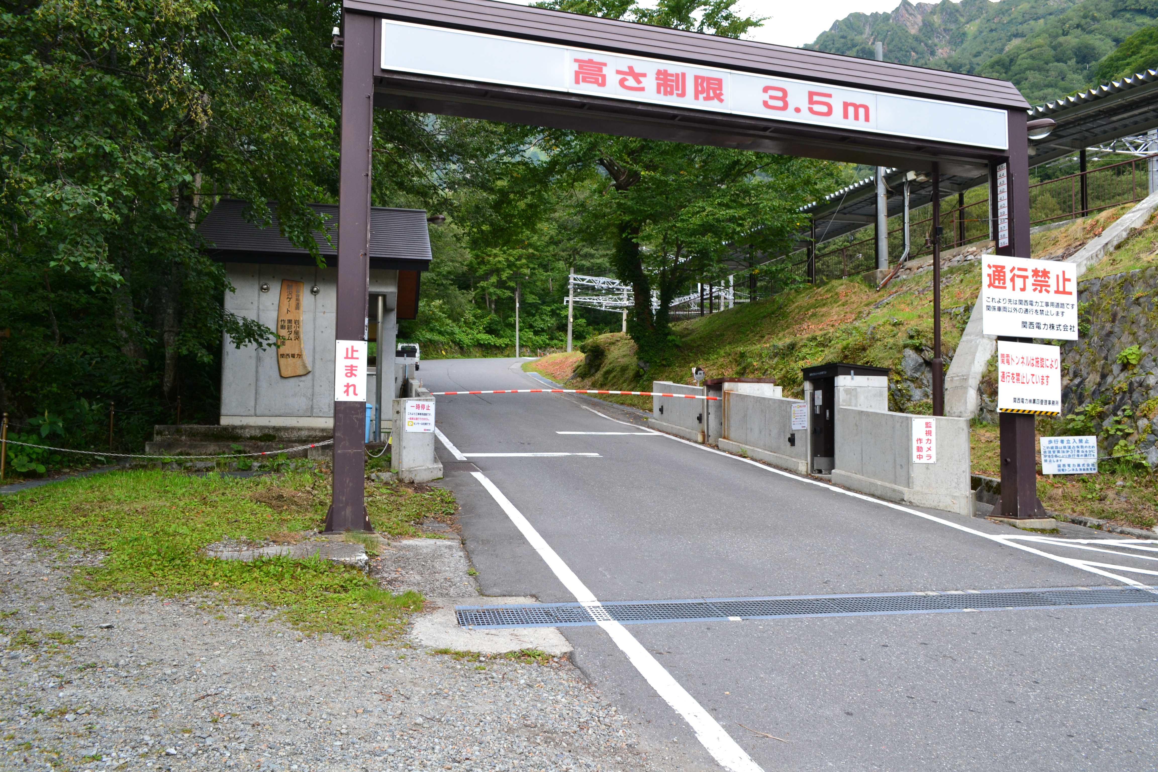
Ougisawa Roundabout Route
Ougi-sawa ~ Harinoki Snowy Valley ~ Mt. Harinoki-dake ~ Mt. Akasawa-dake ~ Shinkoshi-sanso Mountain Hut ~ Taneike-sanso Mountain Hut ~ Ougi-sawa
Technical level: C
Physical strength: 6
Difficulty ★★★
Enjoy hiking along the prefectural border while enjoying the view of the Mt. Tateyama mountains
This route climbs Harinoki Snowy Valley, one of the big three snowy valleys in the North Japan Alps, from Ougi-sawa. From Mt. Harinoki-dake, walk along the ridgeline to Taneike-sanso Mountain Hut. It is an enjoyable hike with a nice view of the Mt. Tateyama mountains and Kurobe lake.
●Hiking Data
Schedule: One night and two days or two nights and three days
Walking hours: 15 hours and 45 minutes
Walking distance: 21.21 km
Difference in cumulative elevation: 2,541 m
Ougi-sawa

Elevation 1,433m
↓ 1 hour 30 minutes
Osawa-koya Mountain Hut

Elevation 1,675m
↓ 3 hours 30 minutes
Harinoki Pass
Elevation 2,540m
↓ 1 hour
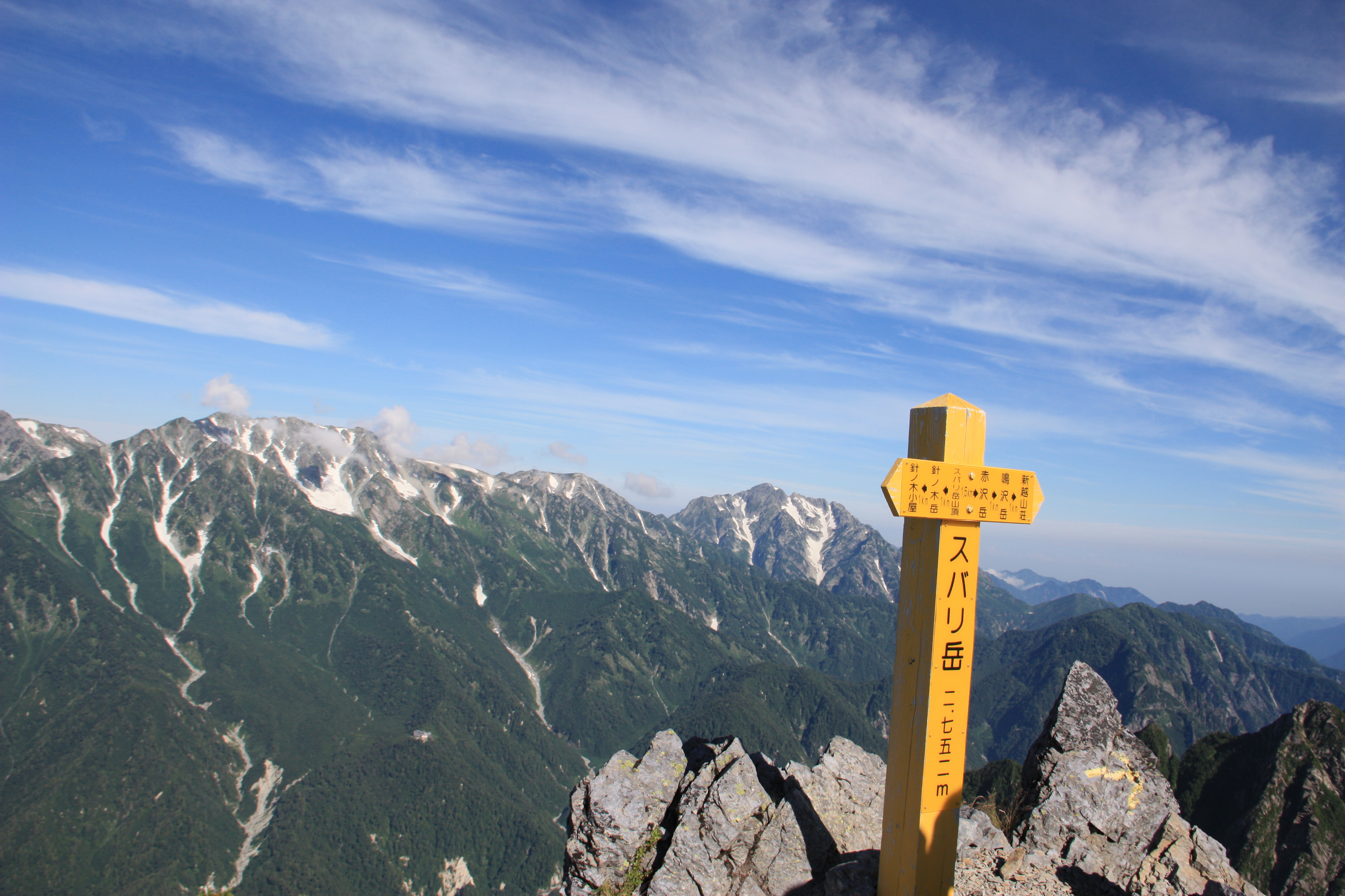
Mt. Harinoki-dake
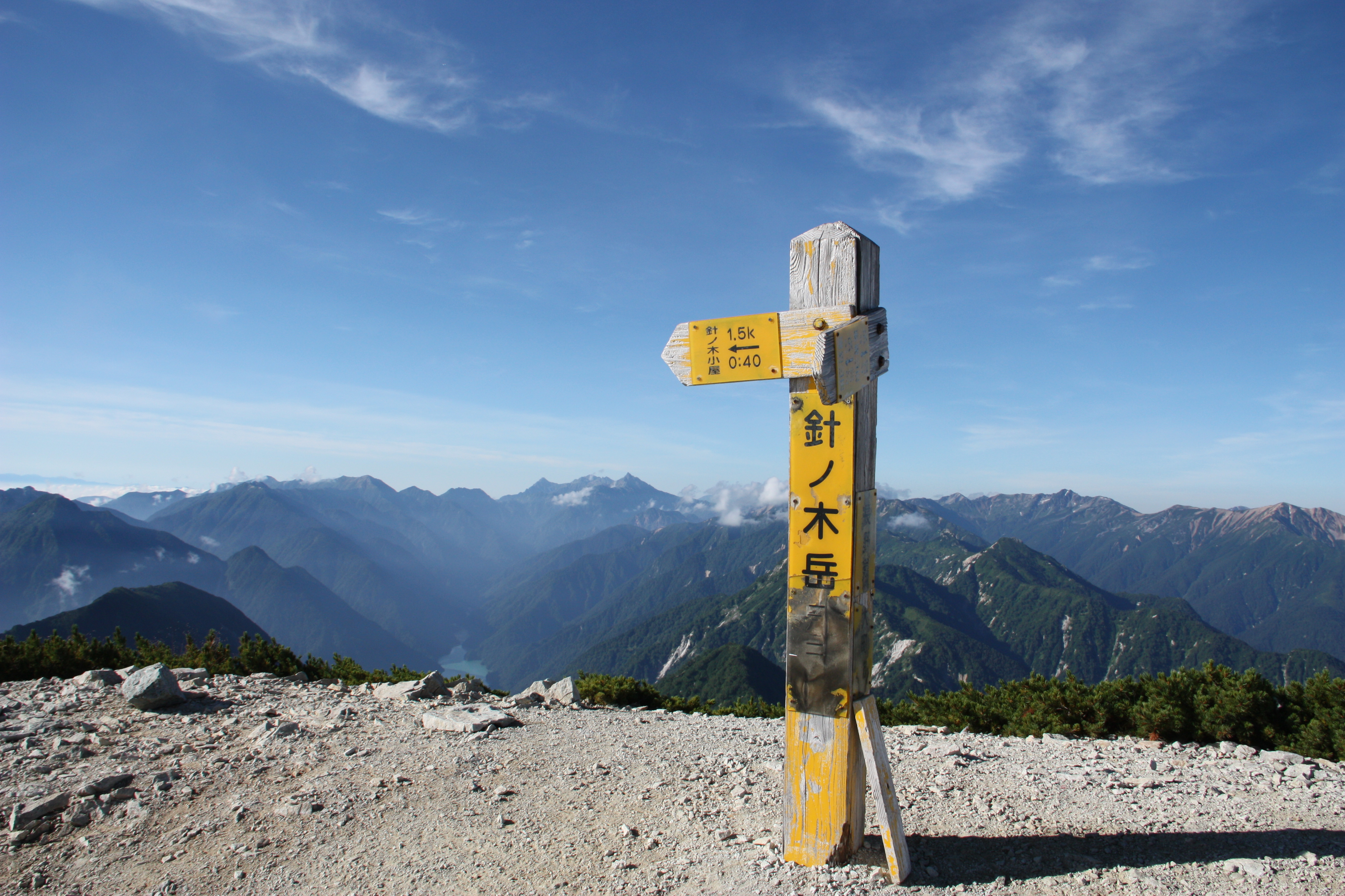
Elevation 2,820m
↓ 2 hours 45 minutes
Mt. Akasawa-dake
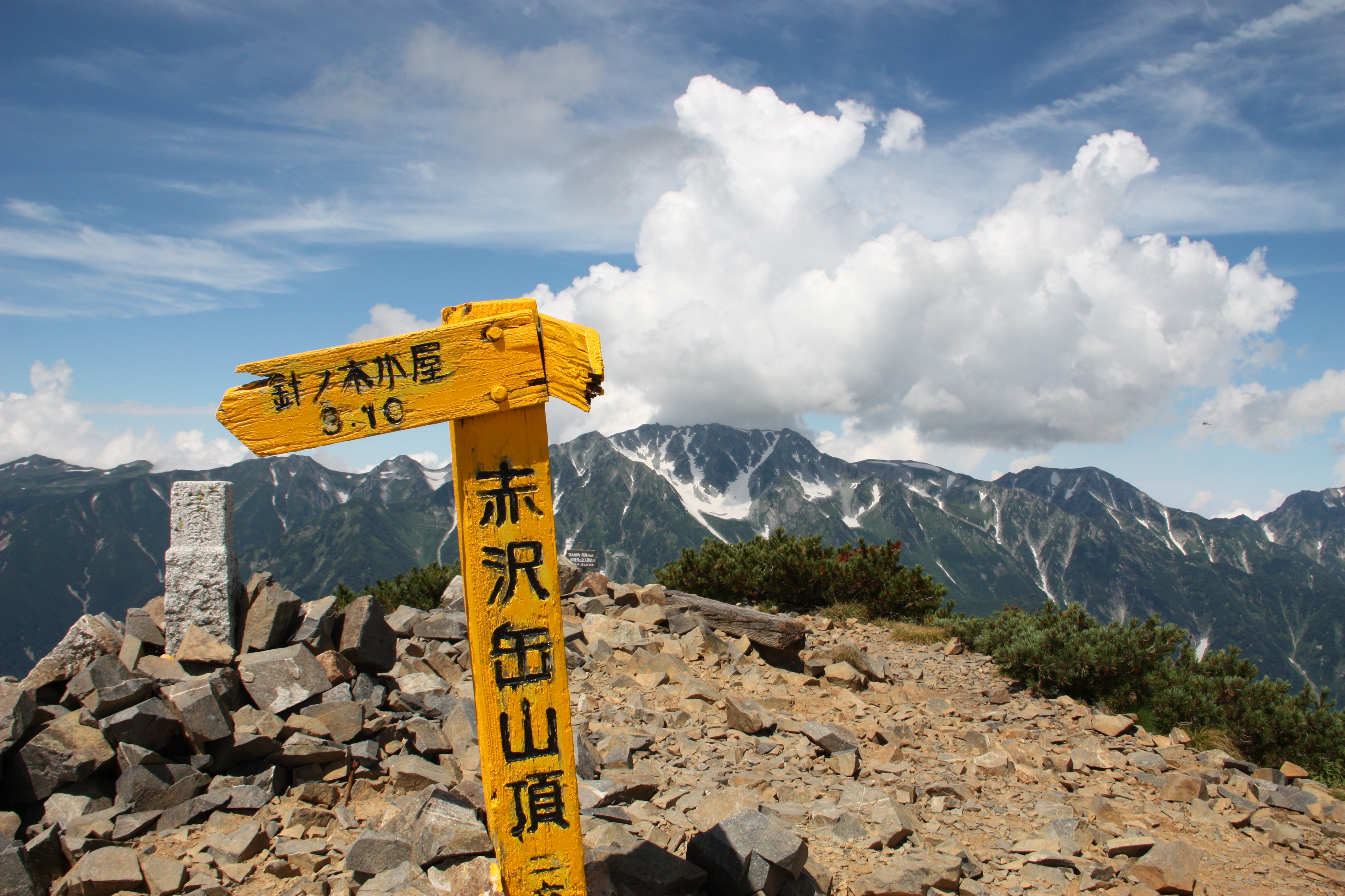
Elevation 2,678m
↓ 1 hour 30 minutes
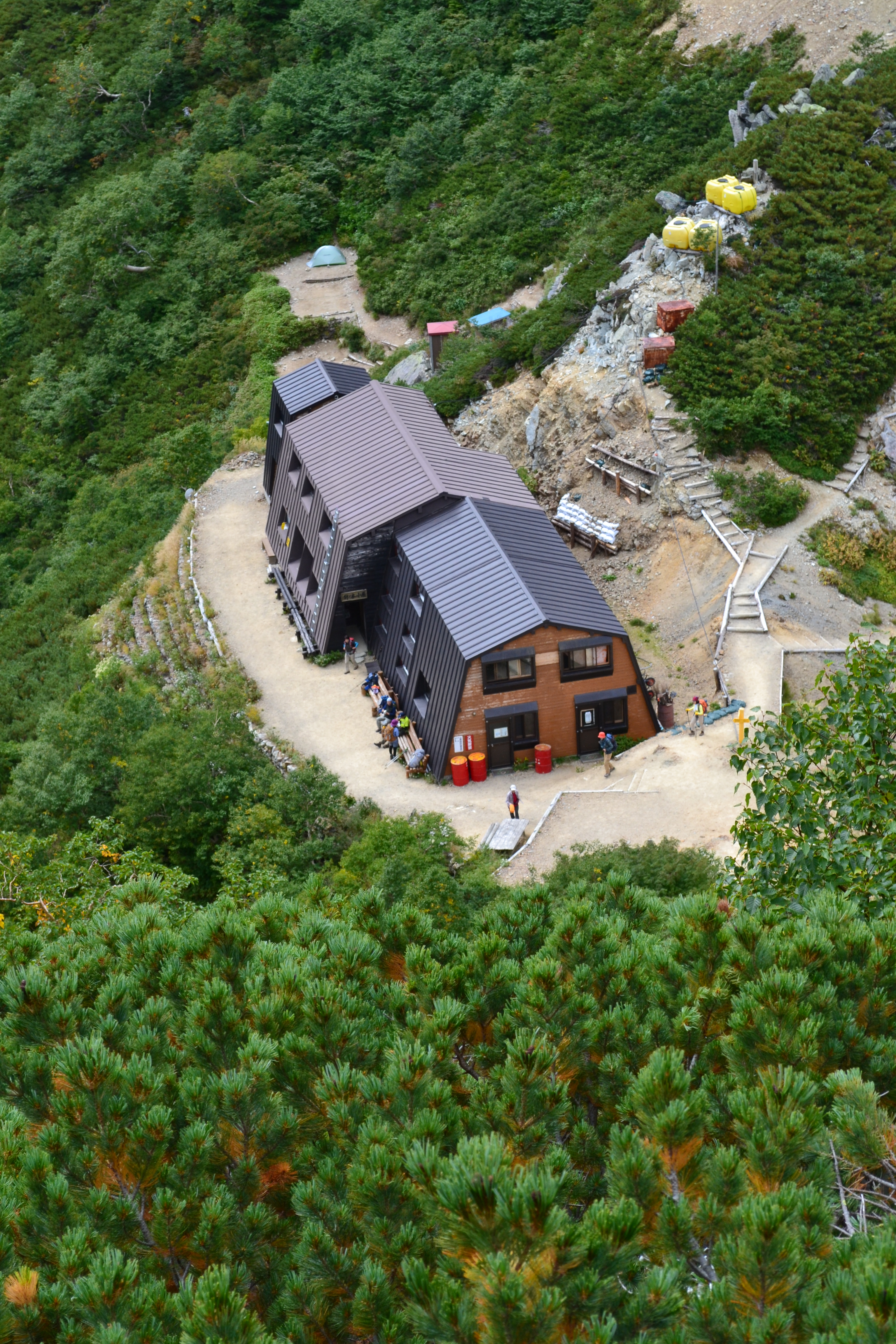
Shinkoshi-sanso Mountain Hut
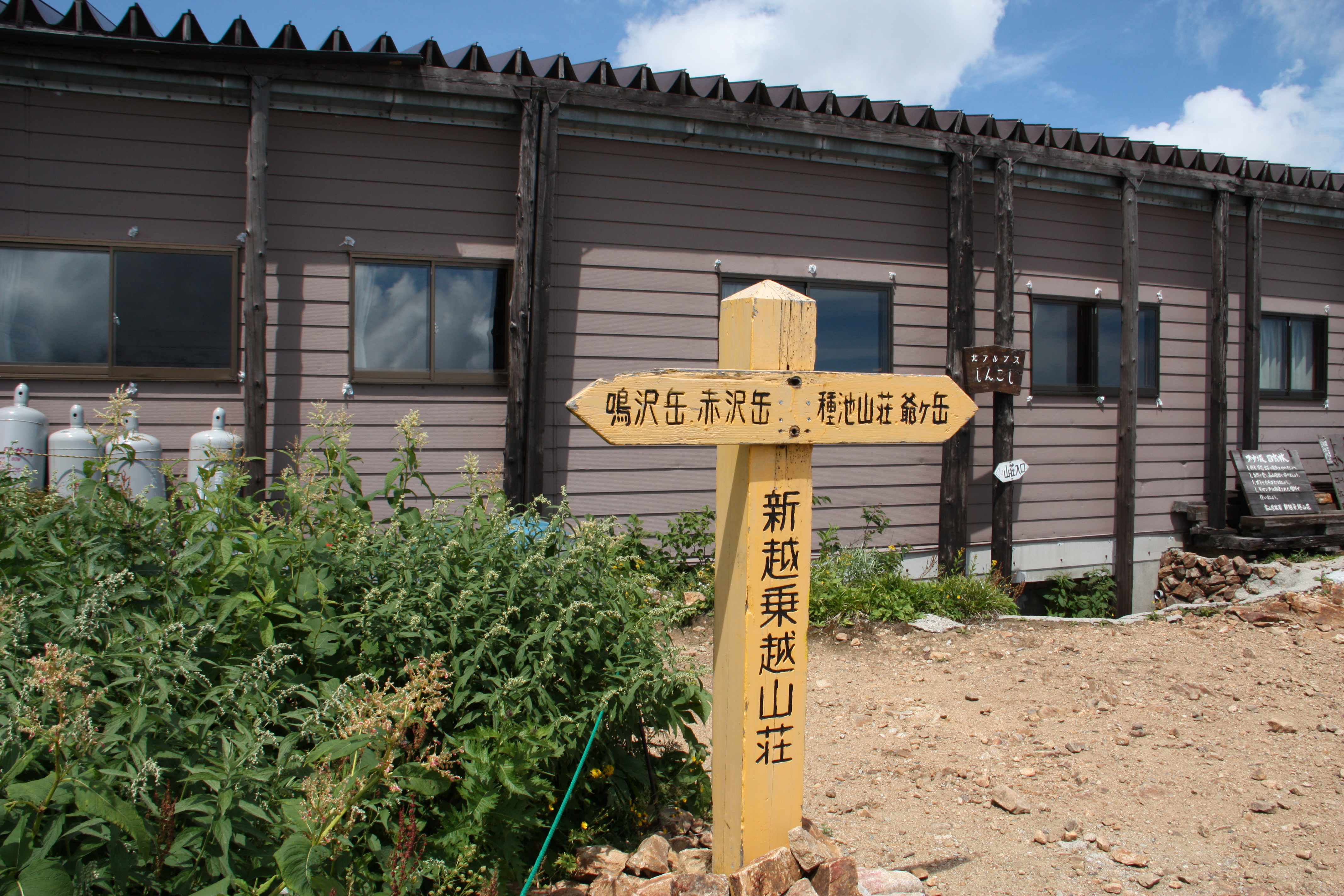
Elevation 2,462m
↓ 2 hours 30 minutes
Taneike-sanso Mountain Hut
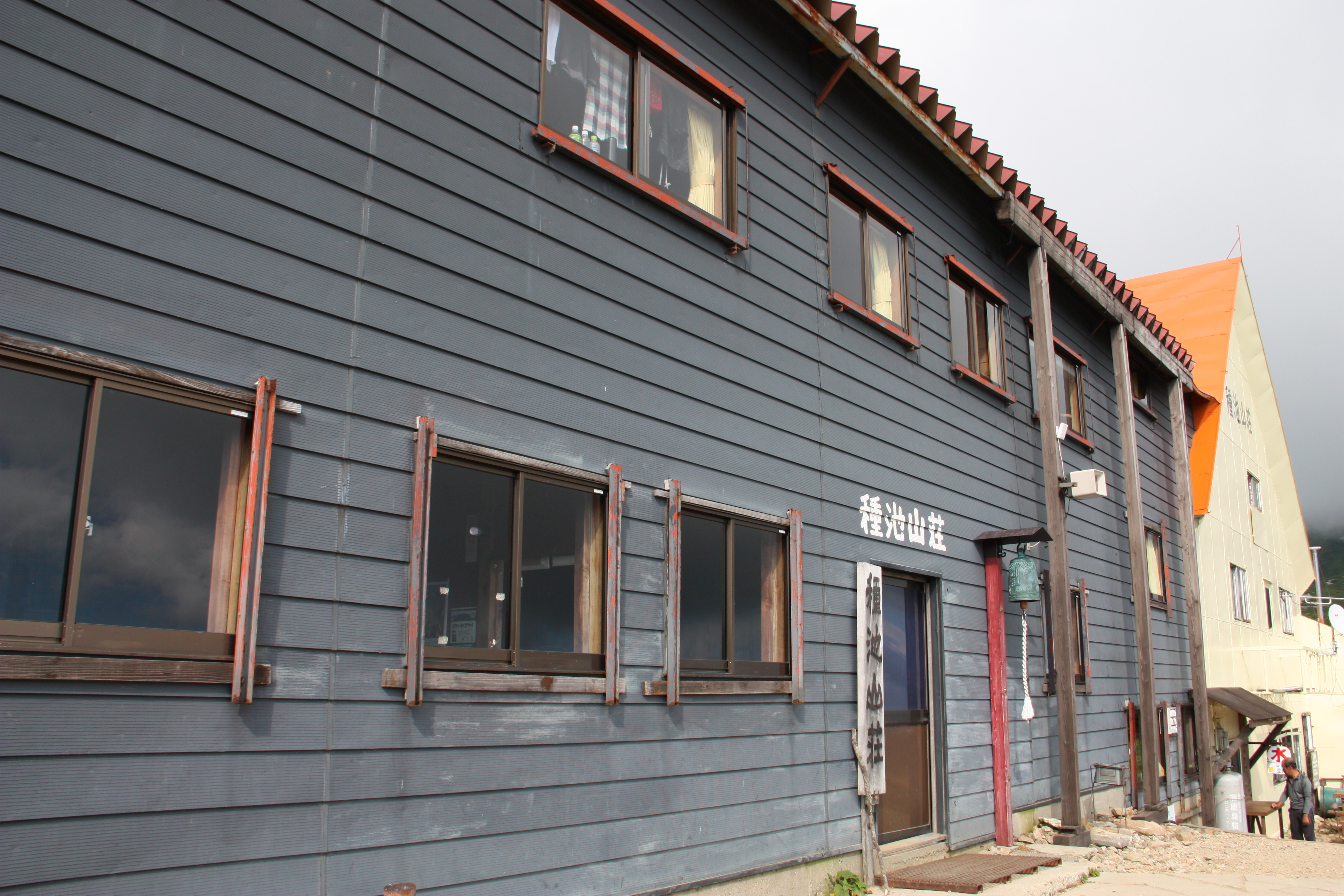
Elevation 2,460m
↓ 3 hours
Ougi-sawa
Elevation 1,433m


Route Guide
This route starts from Ougi-sawa, the trailhead on the side of Nagano prefecture. This is where Tateyama Kurobe Alpine route to Murodo starts. When you face the station in front of you, the trailhead is located on the left side. Enter there. The trail starts as a logging road. After crossing two small streams, the ridgeline of Mt. Harinoki-dake appears in your direction. Ascend higher, then you will reach Osawa-koya Mountain Hut. On the side, you will find a relief of Shintaro Momose, who organized the Omachi Mountain Guides Association. From this point, climb through the forest zones for a while. When the sky opens up, the starting point of the Harinoki snowy valley will be reached.
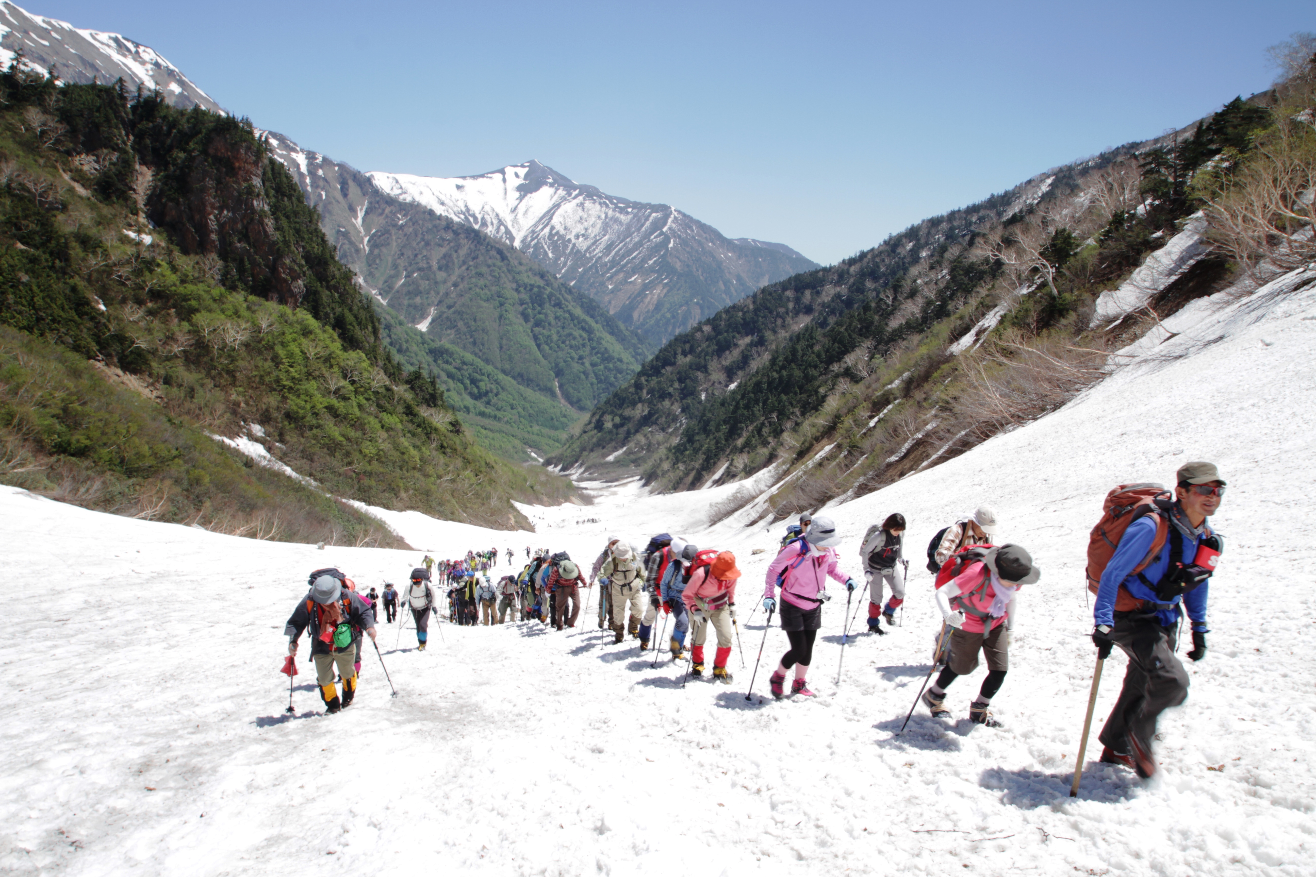
Wear crampons and start climbing on the snowy slope. If your crampons grasp the snowy slope securely, you can gain altitude in short time. Adjust the length of your trekking poles as you climb. On the way, there is an area where the width of the snowy valley becomes narrow. This spot is called the “throat”. After passing this point, climb while paying attention to the left hand side to avoid the risk of entering Maekubo-sawa by accident. When the snowy valley ends, climb the trail on the right hand in a zigzag pattern. Harinoki pass is reached when the yellow sign for Harinoki Pass appears above your head. Harinoki-koya Mountain Hut stands at the pass. It is recommended that you stay at the hut. From the camping site, the view around Mt. Yariga-take can be seen.
Start early on the following day. Head to Mt. Harinoki-dake. The trail starts from the back of Harinoki-koya Mountain Hut. Gradually gain altitude. After passing the rocky uphill, climb on the gravel slope in a zigzag pattern. When the trail enters into a Pinus Pumila zone, the summit of Mt. Harinoki-dake is close. There is nothing to block your view at the summit. The Mt. Tate-yama mountains, the Hotaka mountains, and Kurobe lake can all be viewed.
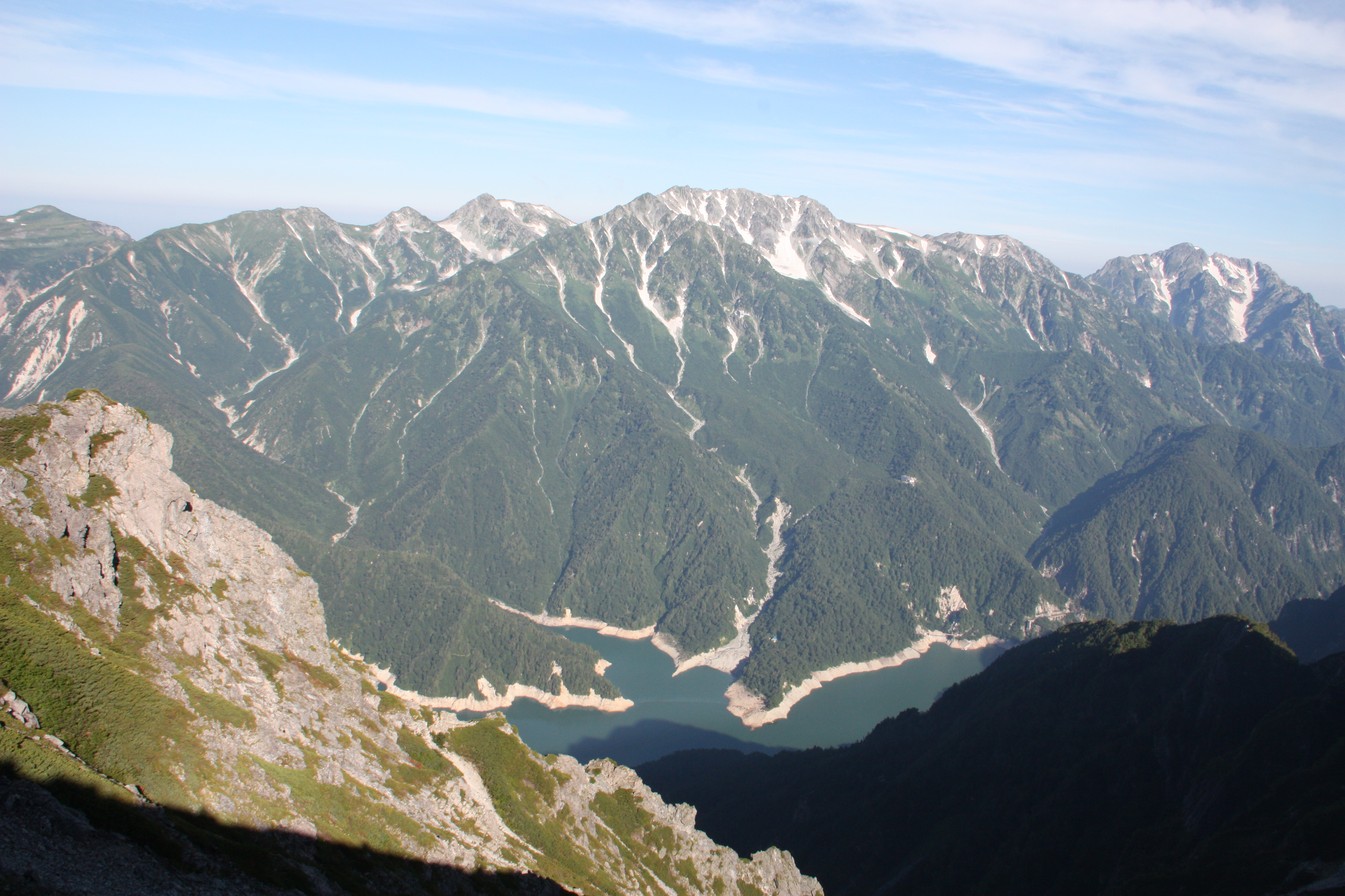
From here, hike on the ridgeline. Descend on the rocky area from Mt. Harinoki-dake. Descend with caution. The gravel road and rocky descending trail continues. After climbing one uphill, the summit of Mt. Subari-dake will be reached. From the summit, the bright green Kurobe lake and Kurobe Dam can be spotted below your feet. The Mt. Tateyama mountains can be seen just above them. The summit of Mt. Osuyama, which is probably packed with many hikers, can be seen as well. From Mt. Subari-dake, descend on the gravel trail. The Shinano side of the trail is a cliff, which might make you nervous, however, the trail itself is very stable so remain focused on it. Mt. Akasawa-dake is reached after a gradual uphill from the saddle.
Mt. Akasawa-dake is the closet summit to The Tateyama mountains. The view of Kurobe lake below your feet is the most beautiful view. A hike from the trail from Mt. Akasawa-dake to Mt. Narusawa-dake is like walking on Tsuri O’ne (a hanging ridgeline). The tunnel, from which buses to Kurobe Dam operate, runs just below this ridgeline on the side of Mt. Narusawa-dake. You might feel like enjoying the view while walking, however, you have to stay focused on the trail. Take a break while standing here and there to enjoy the view. The trail descends from Mt. Narusawa-dake. The slope becomes gradual after Shinkoshi-nokkoshi and Shinkoshi-sando Mountain hut will be reached. On the Shinano side, flower fields spread out. It takes about 2 hours 30 minutes to Taneike-sanso Mountain Hut. If you can, it is recommended that you stay at Shinkoshi-sanso Mountain Hut.
On the third day, please head to Taneike-sanso Mountain Hut first. Ascend the trail from Shinkoshi-sanso Mountain Hut. Proceed after passing peaks then Mt. Kashima-yari-gatake appears into your direction. Mt. Tsurugi-dake can be seen closely as well. Pass Mt. Iwagoya-sawa-dake and walk on the gradual slope. From Mt. Jiiga-take, Mt. Kashima-yariga-take can be seen closely. If you proceed on the Kurobe side, Bouno-koya-nokkoashi will be reached. Enter the forest zone and Taneike-sanso will be reached shortly. If you hike from Mt. Harinoki-dake in one day, it is recommended to stay at the hut.
From Taneike-sanso Mountain hut, descend on Kashihara-shindo. It takes about three hours to Ougi-sawa. There are no dangerous areas, however, the slope is steep and the trail is narrow so be careful when you pass other hikers.