Dai-kiretto Route
Mt. Yari-gatake ~ Mt. O-bami-dake ~ Mt. Minami-dake ~Dai-kiretto ~ Mt. Kita-hodaka-dake
Technical level: E
Physical strength: 9
Difficulty: ★★★★★
Walk from Mt. Yari-gatake to Mt. Hodaka-dake
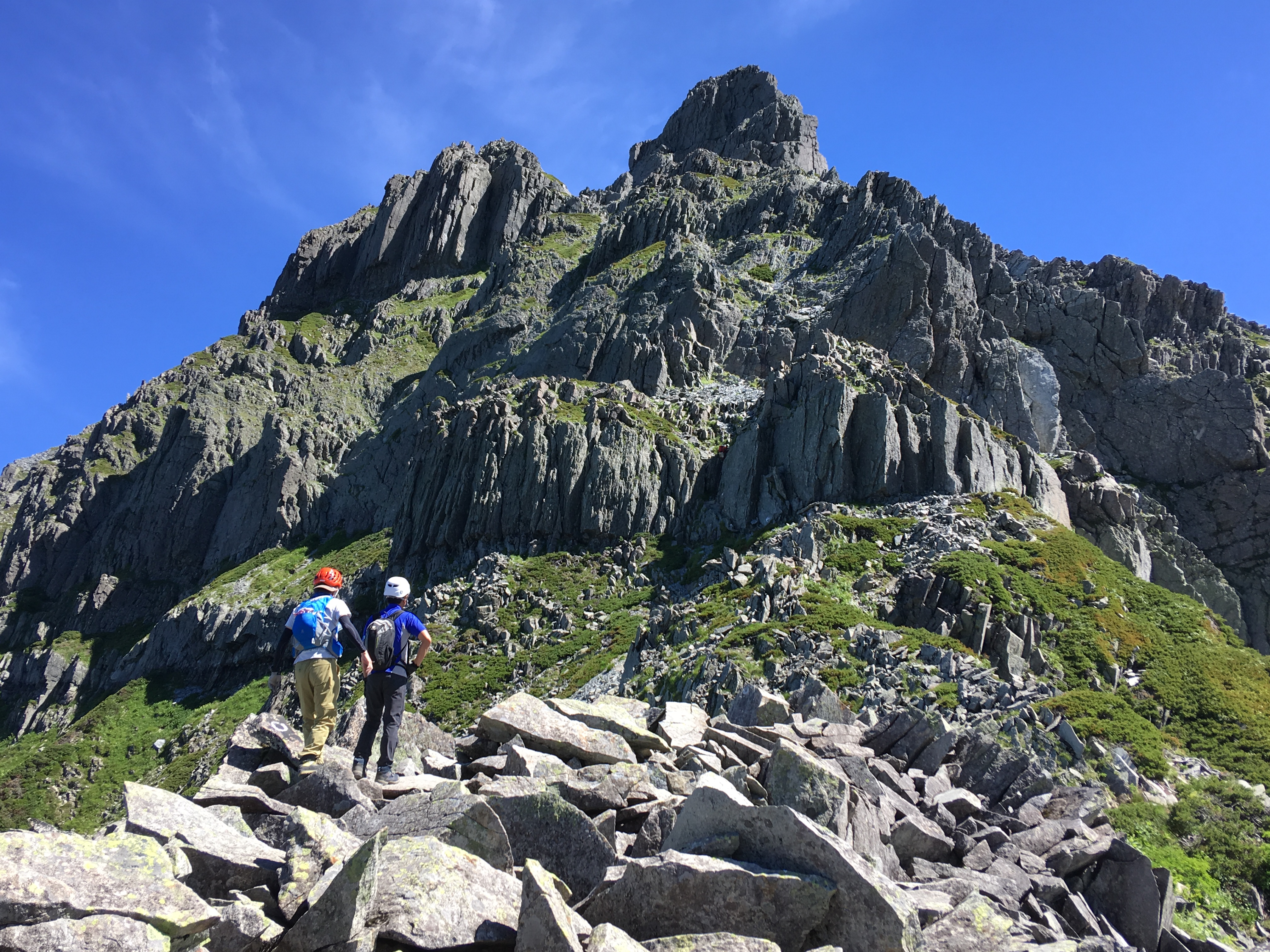
You will hike through the main part of the Hotaka mountains. The difficulty of this route is as high as the route from Mt. Nishi-hodaka-dake to Mt. Oku-hodaka-dake. Great caution must be exercised. There tends to be busy traffic at Dai-kiretto, however, you should maintain your own pace for your safety.
Access to Kamikochi
Access to Shinhotaka Ropeway
●Hiking Data
Schedule: One night and two days
(From Mt. Yari-gatake)/Kami-kochi round trip: Three nights and four days
Walking hours: 6 hours 30 minutes
(From Mt. Yari-gatake)/Kami-kochi round trip 24 hours 25 minutes
Walking distance: 6 km
(From Mt. Yari-gatake)/ Kami-kochi round trip 40.985 km
Cumulative elevation difference 757 m
(From Mt. Yari-gatake) /Kami-kochi round trip 2,997 m
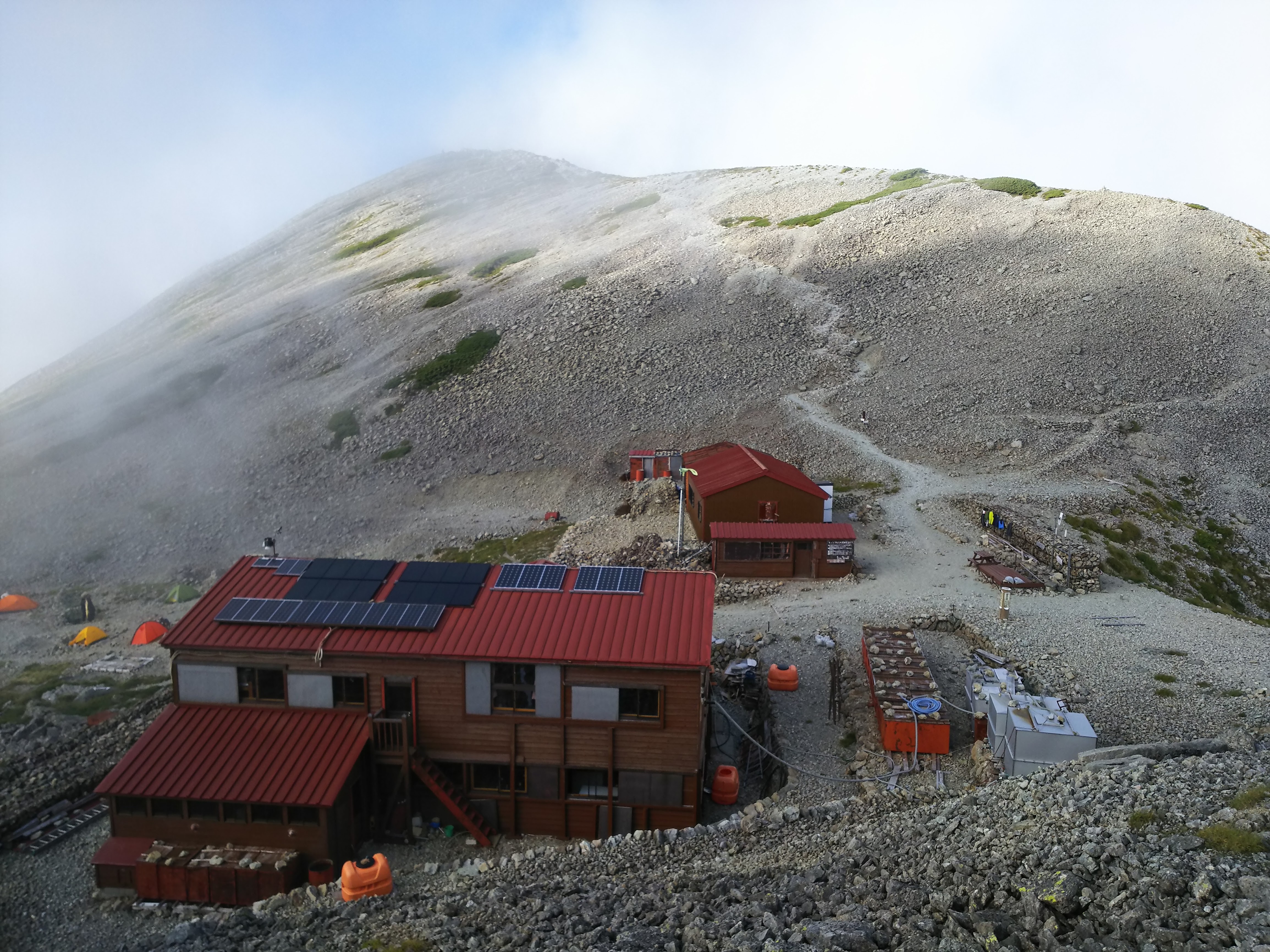
Yari-gatake sanso Mountain hut
Elevation 3,080m
↓ 2 hours 40 minutes
Tengu-hara junction
Elevation 2,975m
↓ 20 minutes
Mt. Minami-dake

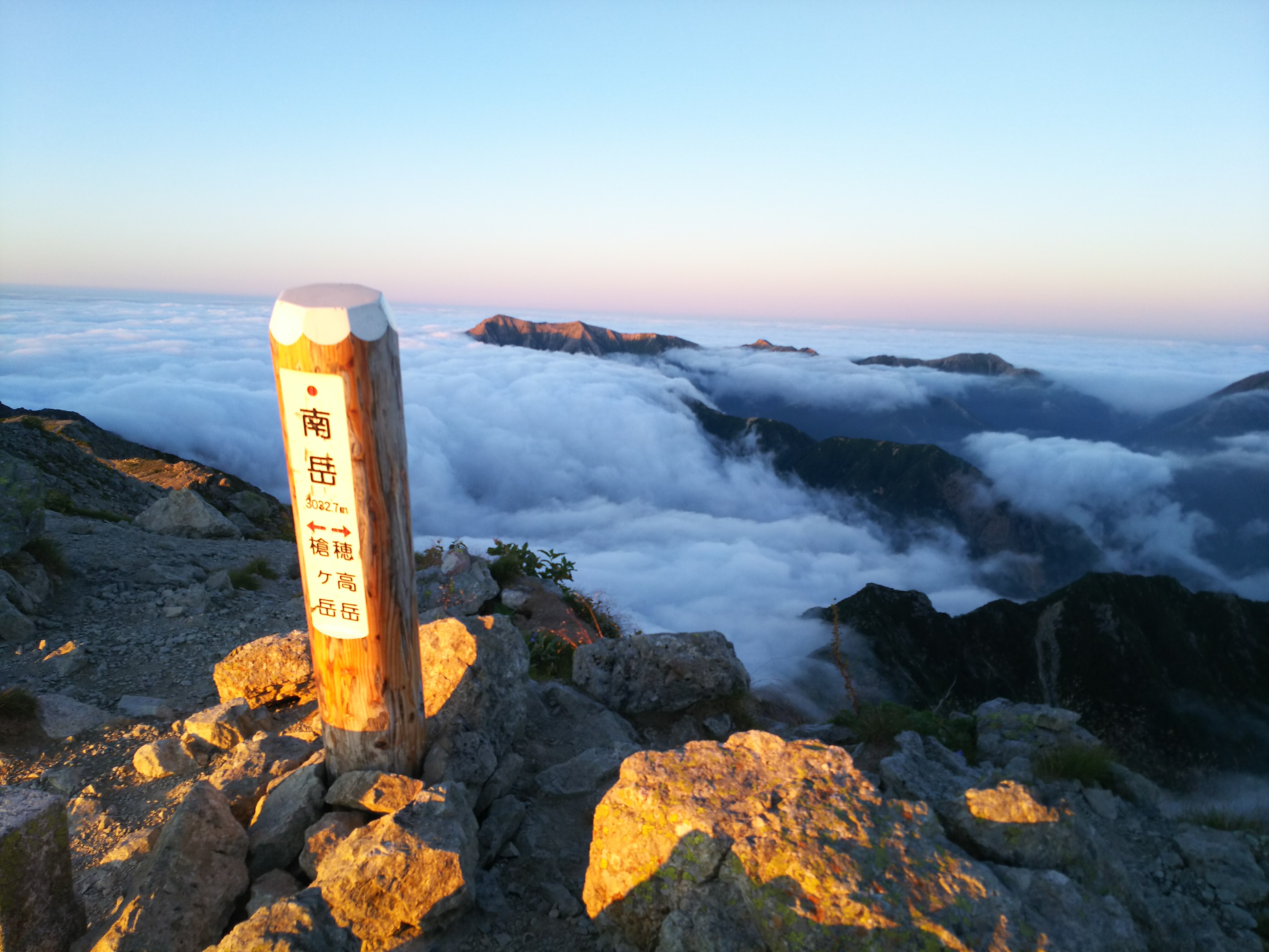
Elevation 3,032m
↓ 40 minutes
Saitei-coru Lowest point
Elevation 2,748m
↓ 40 minutes
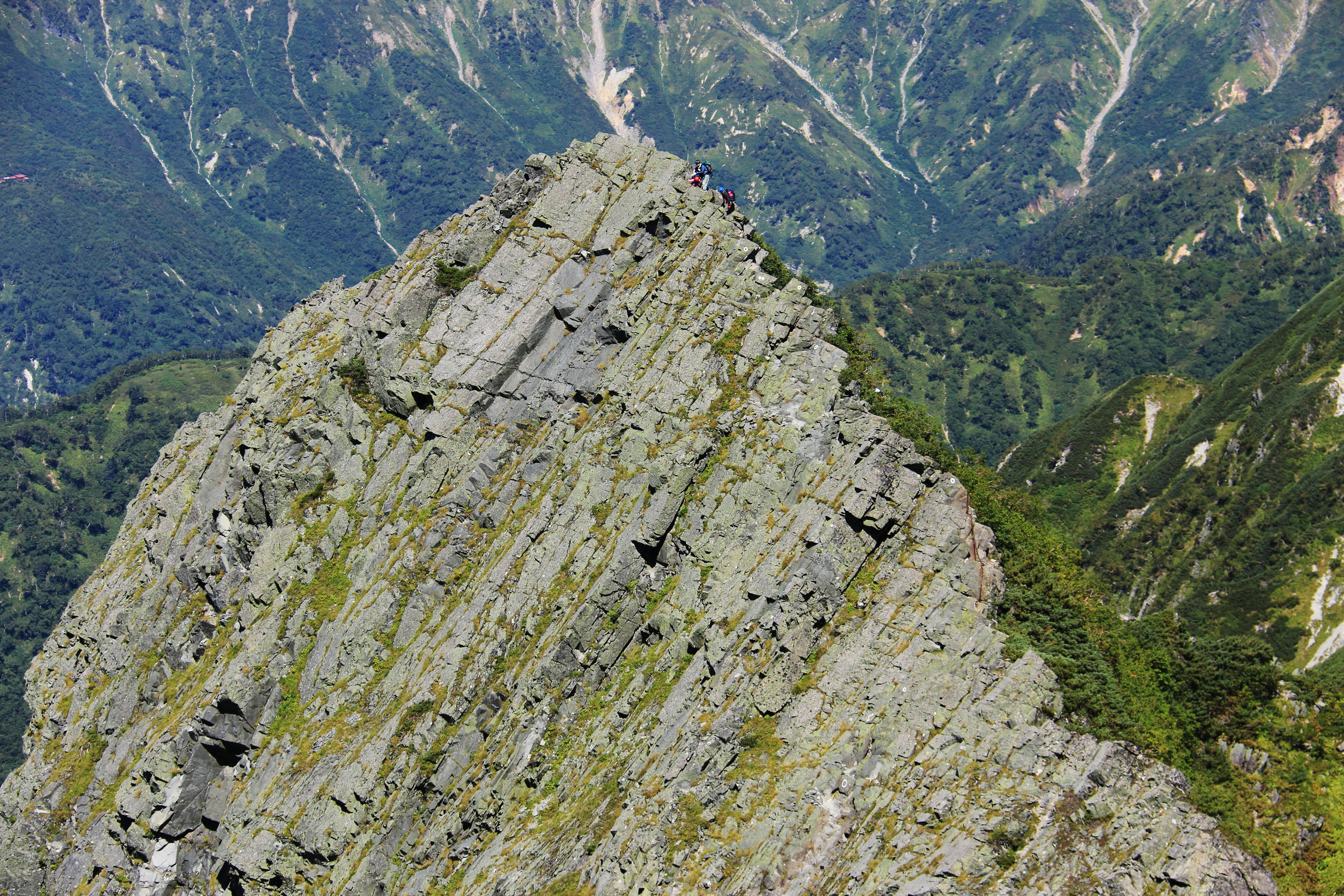
Hasegawa Peak
Elevation 2,841m
↓ 45 minutes
A-sawa point
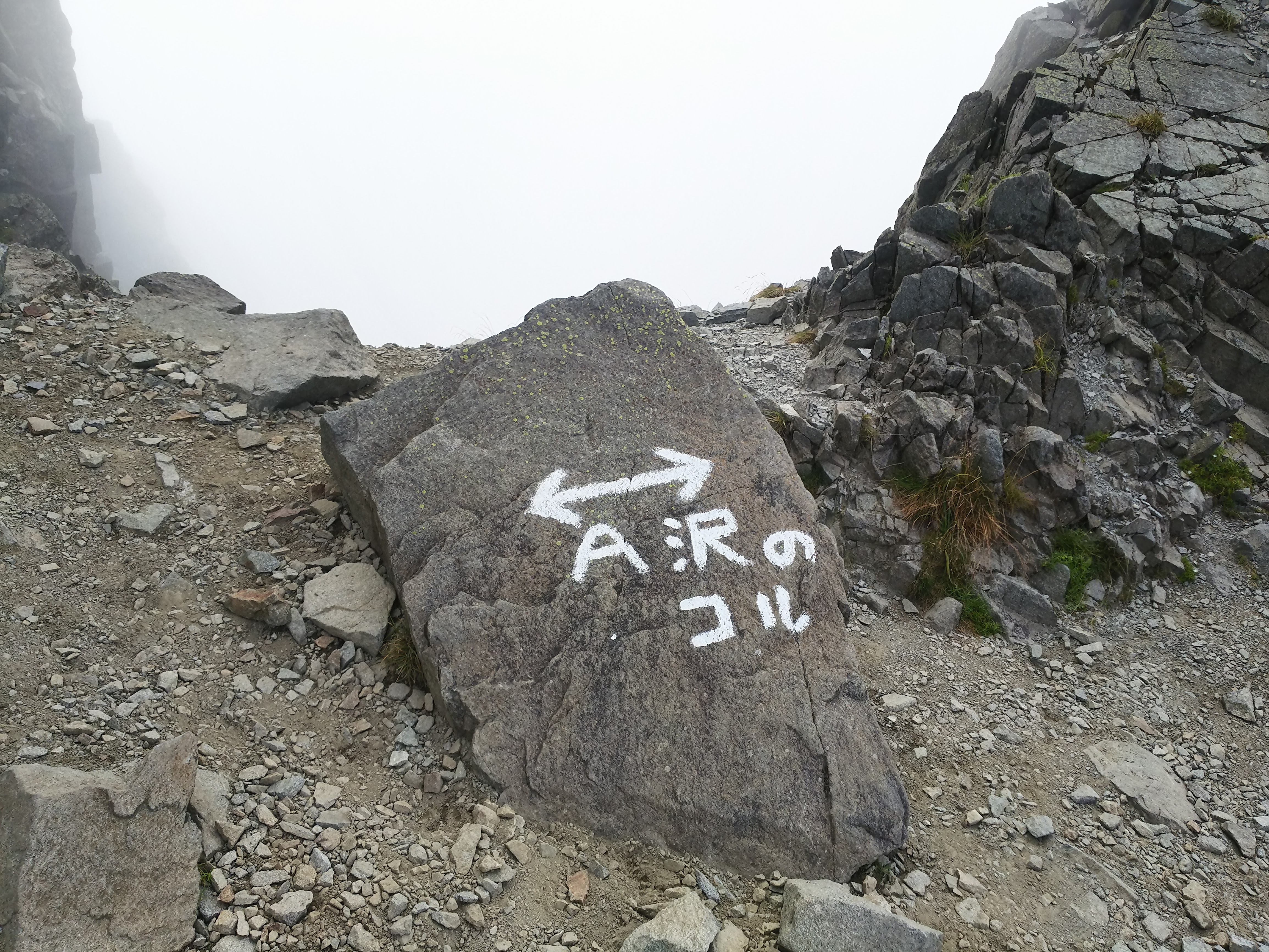
Elevation 2,795m
↓ 30 minutes
Hida-naki point
Elevation 2,924m
↓ 1hour 5 minutes
Mt. Kita-hotaka-dake North Peak
Elevation 3,103m
Route Guide
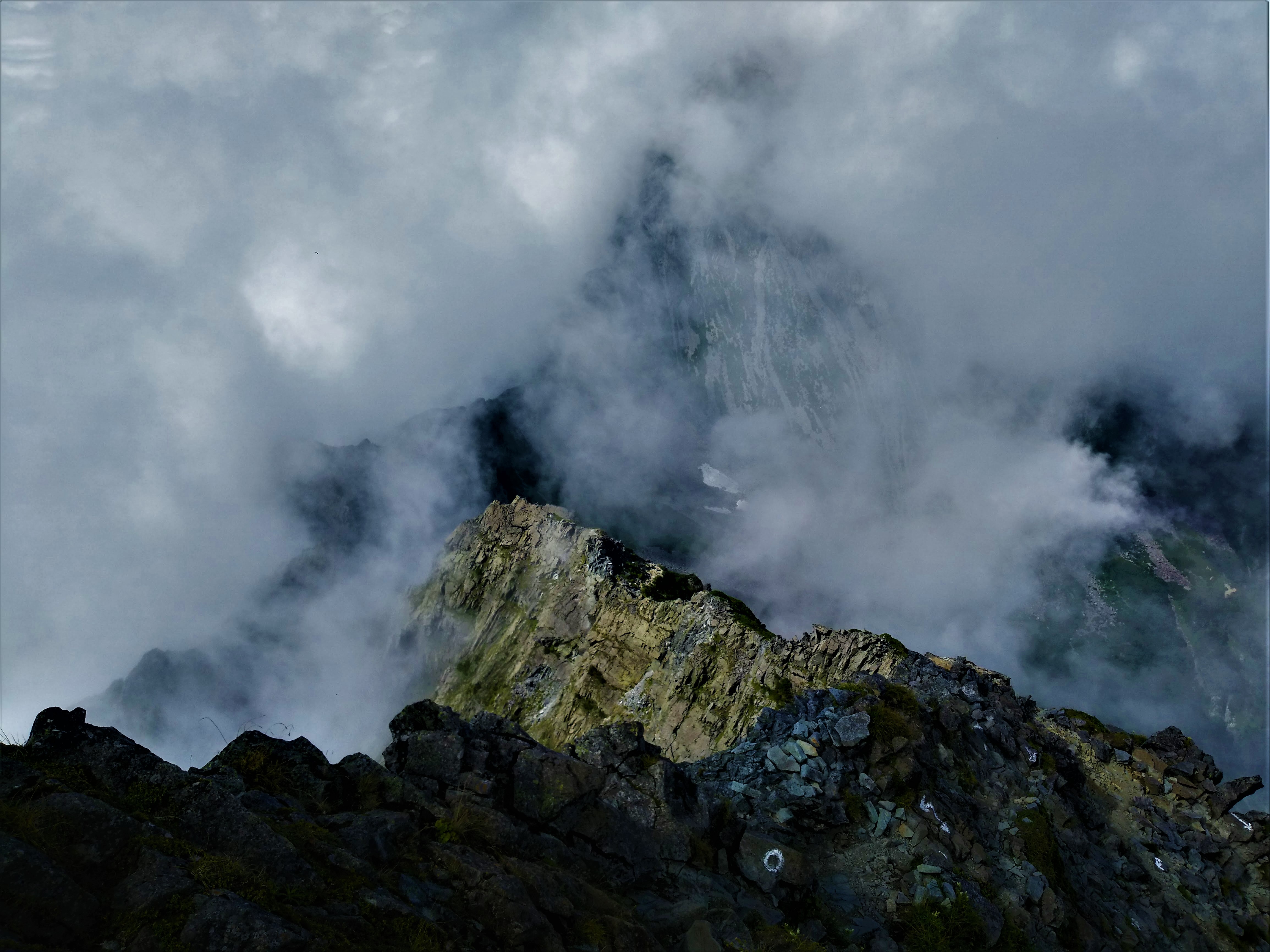
It is recommended that you start early from the summit of Mt. Yari-gatake. Hida-nokkoshi is located at the bottom of the steep hill on the rocky ridgeline from the front of the hut. The trail to Shin-hodaka via Yari-daira branches off to the right. From here, the trail ascends up to Mt. O-bami-dake. The summit of Mt. O-bami-dake spreads out in a plateau shape and the peak of Mt. Yari-gatake stands in front of you. The saddle will be reached when you descend from here to Mt. Naka-dake. The trail ascends on the side of Hida. The summit of Mt. Naka-dake is slightly to the south of the trail. The trail goes around east and descends while crossing rocky zones. There are places where snow fields remain till late summer.
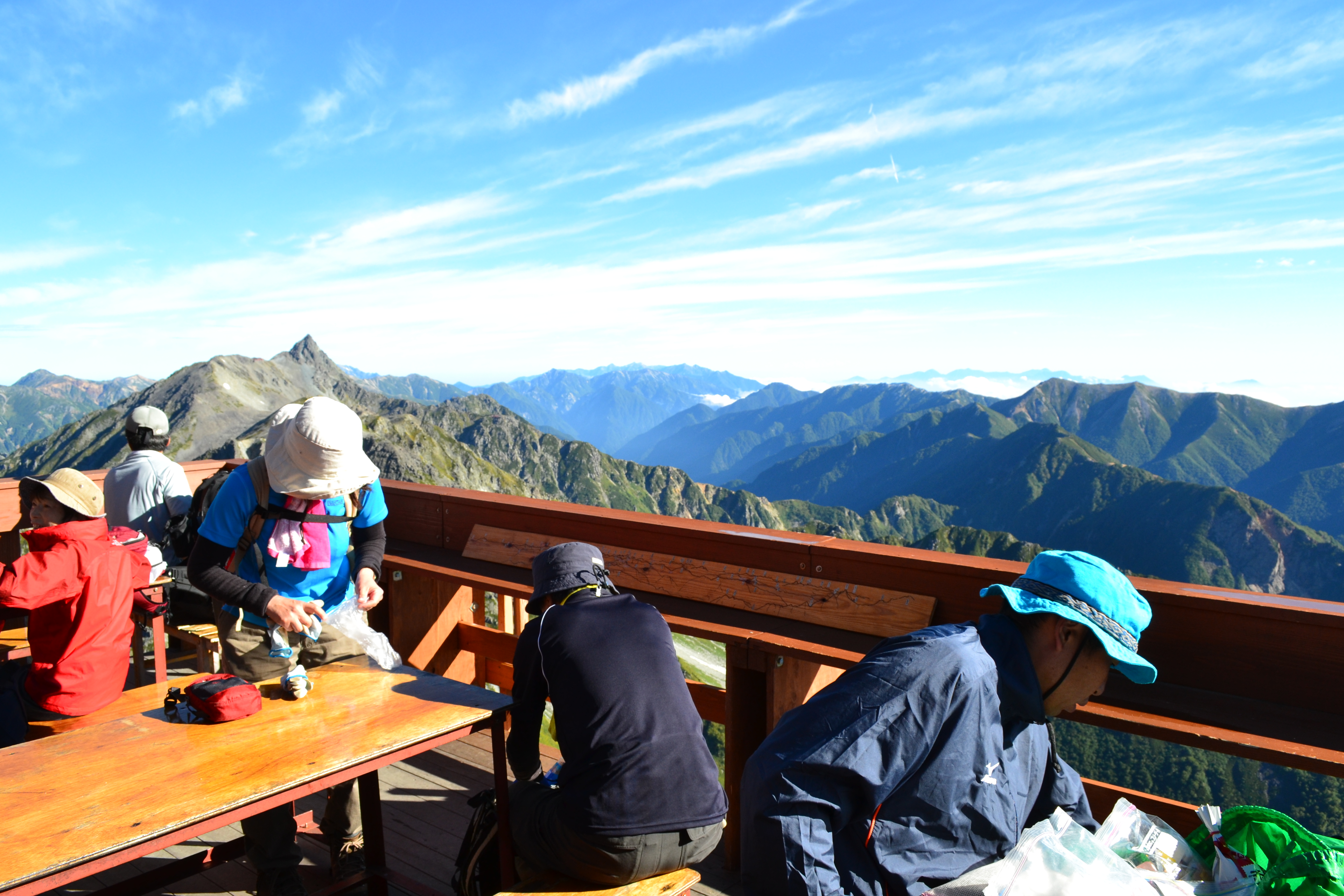
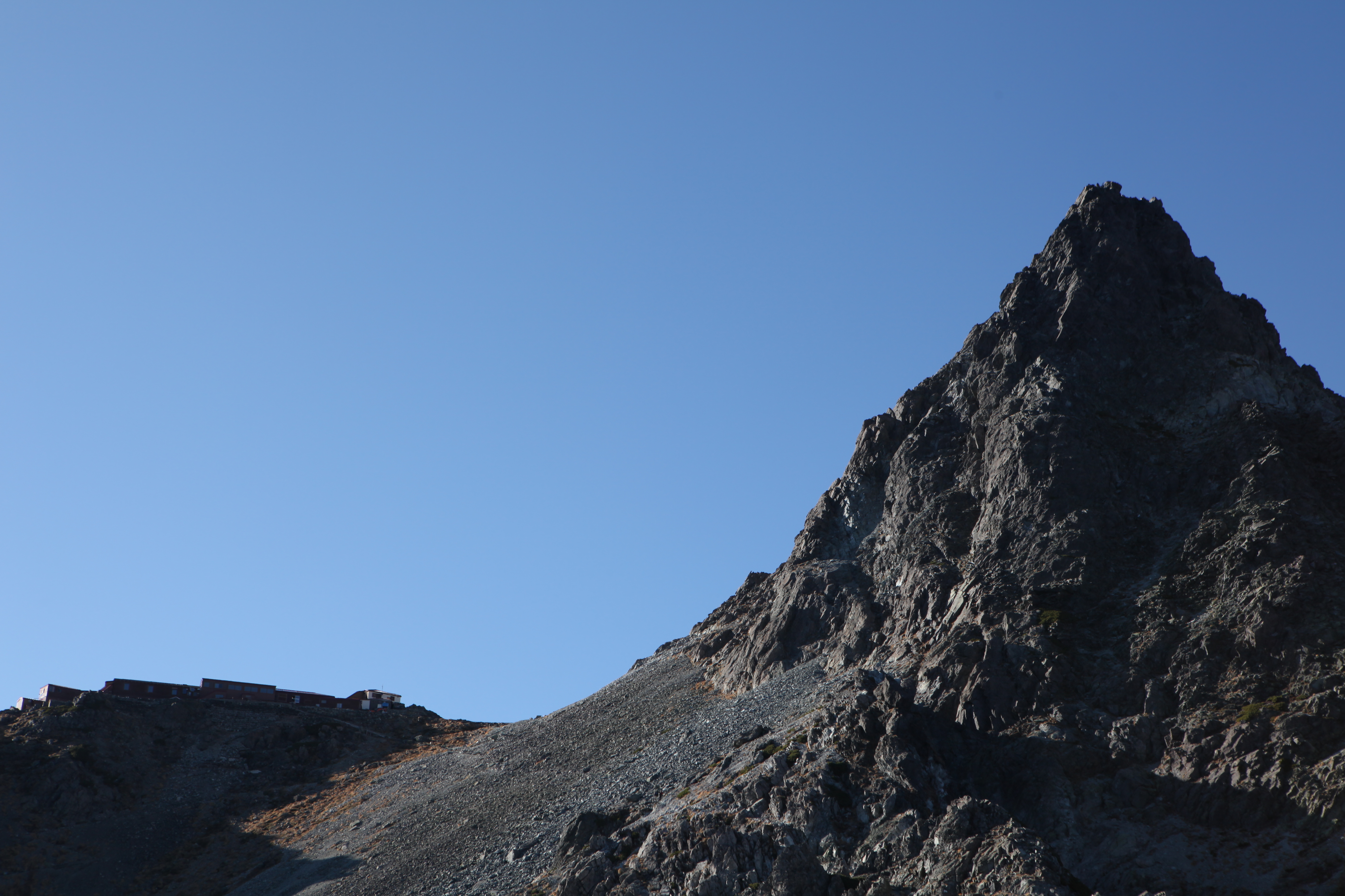
After passing the snow fields, the gradual ridgeline continues to Mt. Minami-dake. The trail to the left descends to Tengu-hara. From the right side, climb the rock wall beneath the summit, then Mt. Minami-dake will be reached. You can view Mt. Yari-gatake in the background and the Hotaka mountains in front. There is also a great view of Mt. Kasa-gatake and Mt. Jyounen-dake. Minami-dake-koya mountain hut is located one step beneath the summit. From the summit, pass a small peak, where you can see Dai-kiretto or Kitaho-no-ike, then start descending. Descend on the unstable ditch-like trail then proceed to the narrow rocky zone where the height might scare you. Descend further another 10 m on the rocky zone, using a ladder, then a small plateau will be reached.
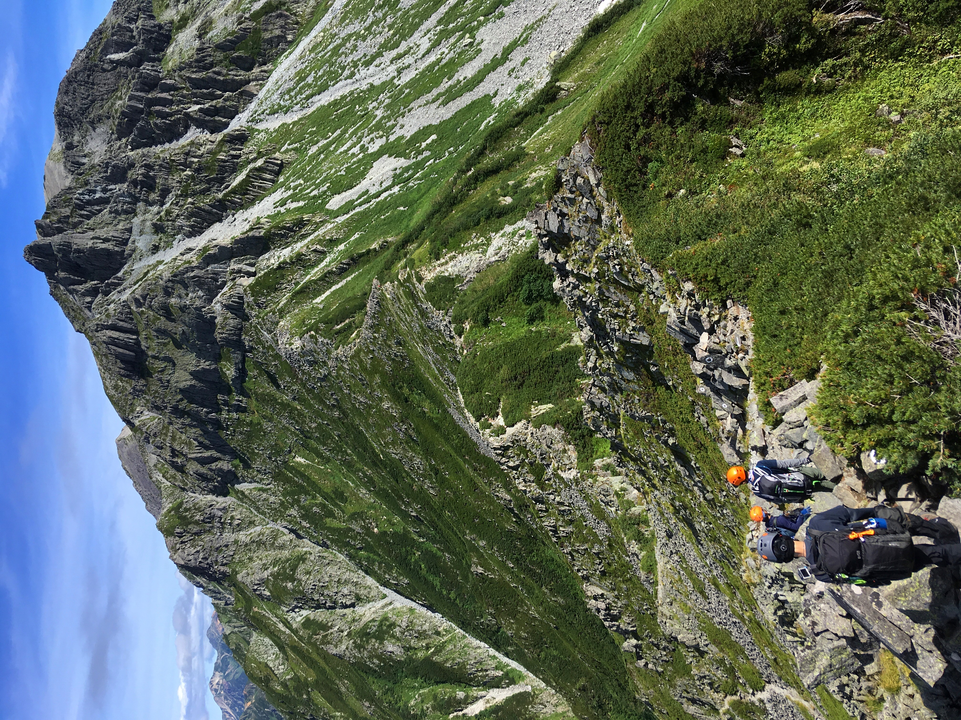
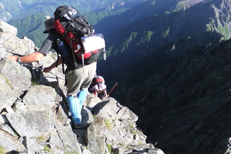
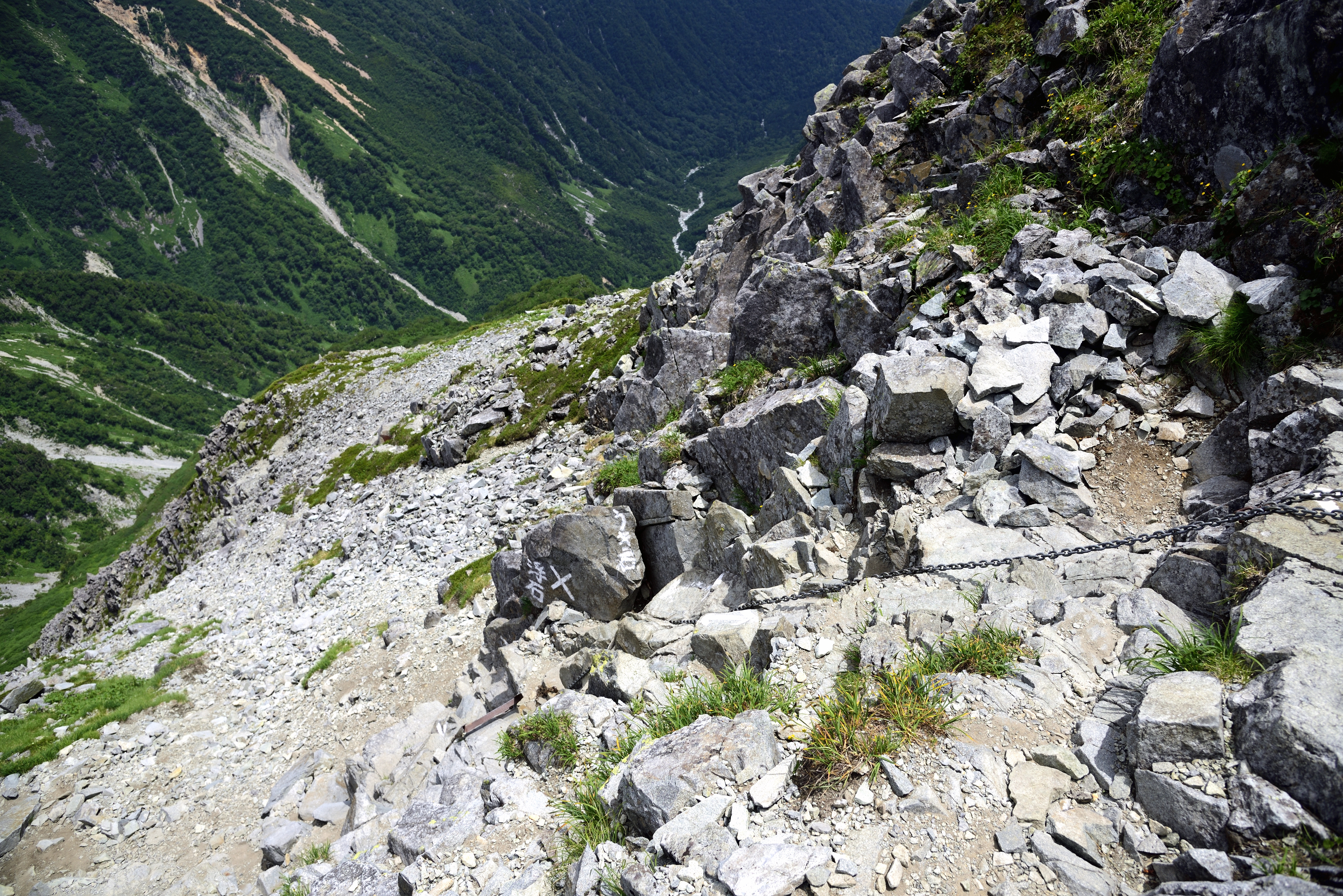
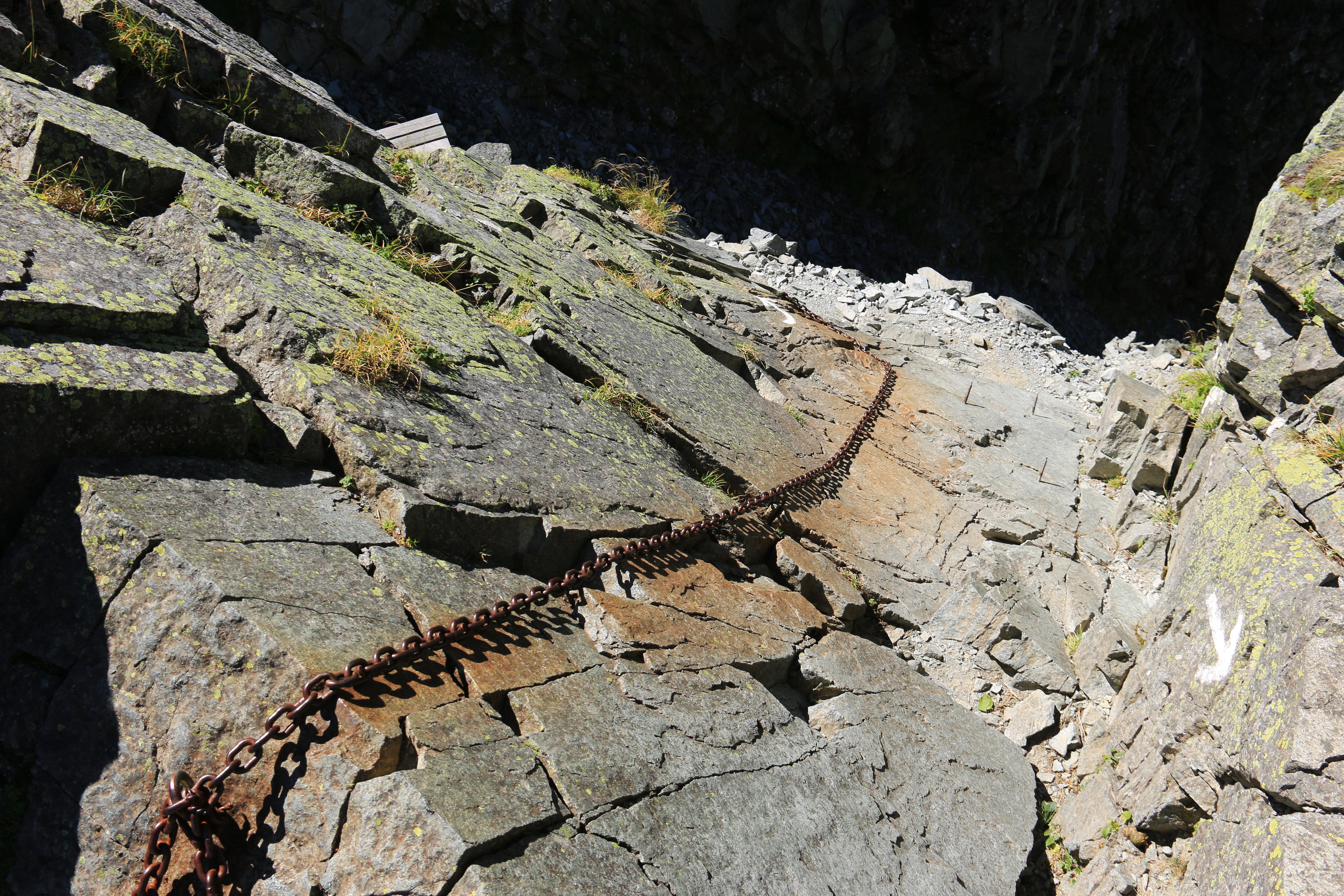
The trail from the plateau to the bottom of the kiretto, v-shaped but in the mountain range, is fairly stable. From the bottom of the kiretto, the trail enters in a most dangerous zone. The trail ascends on the gradual rocky slope from a small peak to another remarkable peak (Hasegawa peak). Umano-se starts just ahead of the peak and the rock ridge, both sides of which are sharp, knife edge cliffs, continues. Descend the rocky zone 10 m. There are places where chains or anchors are attached. After passing Umano-se-, the narrow ridgeline continues. When you cross a plank path on the Taki-dani side, the base of Mt. Kita-hodaka-dake, called A-sawa saddle. From here, start climbing on the red-brown fragile rock. Be careful not to slip on the gravel trail. Pass the rocky zone and move to Taki-dani side as you pass through the rock ridge. Then, a difficult place to pass, Hida-naki, will be reached.
Climb on the rock cliff then traverse as you lean out of the rock. There is a narrow and deep gap ahead. Get up on the rock as you straddle the gap. You climb up diagonally on the band of the wall, where it is only wide enough to place your toes. Place your feet firmly on anchors or footholds mounted for foot placement. The rock ridge like a knife edge will be reached when you pass the rock peak on the Taki-dani side. Climb another rock wall where plenty of footholds are mounted, then the slope becomes gradual and Hida-naki will end. The slope becomes gradual, however, rocks are loose around the trail, so you should be careful about falling rocks.
When the trial meets the slope on the Yoko-tani side, you should be able to enjoy the view of the ridgeline to Mt. Yari-gatake over Dai-kiretto. However, you should still remain focused because the difficult rocky zones will continue. Just ahead of Taki-tani-nozoki, the trail crosses on the Yoko-dani side then ascends the rocky zone just beneath Mt. Kita-hodaka-dake. Use short ladders or chains to pass the area and enter the rocky ridgeline on Taki-tani side. Follow the ridgeline to the rock wall of Kita-hodaka-koya mountain hut. Go upstairs to the hut. Pass the terrace of the hut and climb the rock stairs, then the summit of Mt. Kita-hodaka-dake will be reached.