Yarisawa Route
Kamikochi ~ Yokoo ~ Yarisawa ~ O-magari ~ Mt. Yari-gatake ~ Tenguhara ~ O-magari ~ Yokoo ~ Kamikochi
Technical level: C
Physical strength level: 8
Difficulty level: ⛰️⛰️⛰️⛰️
The most popular hiking route to Mt. Yari-gatake
The classic route from Kamikochi.
The recommended course schedule is two nights/three days, however, beginners can reach the summit via this route, taking three nights/ four days as well.
●Hiking Data
Schedule: Two nights three days
Walking hours 19 hours 20 minutes
(Up: 10 hours 50 minutes/Down: 8 hours 30 minutes)
Walking distance: 37.2 km
Difference in elevation: 2,122m
Kamikochi

Elevation 1,505m
↓ 1hour
Myoujin
Elevation 1530m
↓ 1 hour
Tokusawa
Elevation 1562m
↓ 1 hour
Yokoo
Elevation 1,620m
↓ 1hour 40 minutes
Yarisawa Lodge

Elevation 1,820m
↓ 1 hour 40 minutes
O-magari
Elevation 2094m
↓ 1 hour
Tenguhara Junction
Elevation 2,348m
↓ 2hours 50 minutes
Mt. Yari-gatake sansou Mountain hut
Elevation 3080m
↓ 30 minutes
Mt. Yariga-take

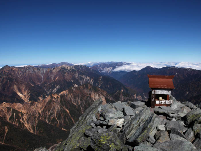
Elevation 3,179m
↓ 30 Minutes
Mt. Yari-gatake sansou Mountain hut
Elevation 3080m
↓ 4hours 50 minutes
Yokoo
Elevation 1620m
↓ 3 hours 10 minutes
Kamikochi
Elevation 1505m

Route Guide
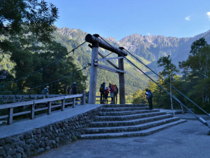
Kamikochi is known as a trailhead to the Hotaka mountains and as a plateau resort place. Many resort hotels are located around Kappa-bashi Bridge where many tourists visit. This is the main entrance for Mt. Yari-gatake.
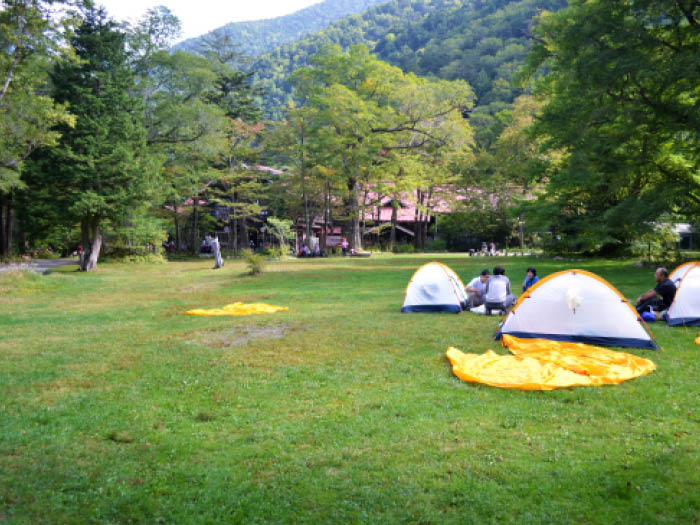
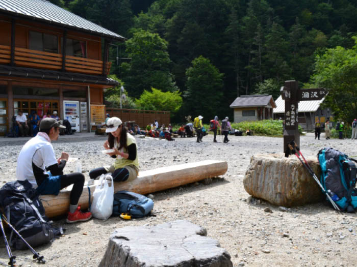
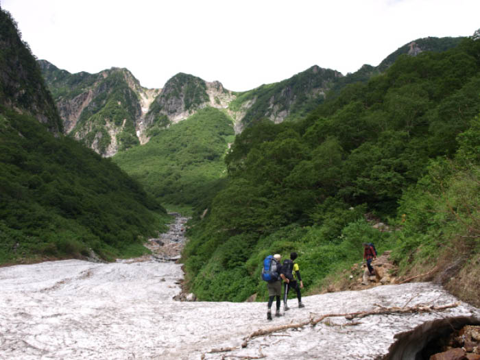
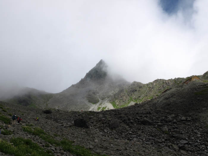
Follow the promenade along the left bank of the Azusa river to Myoujin, then Tokusawa. Take a break at a spacious grass field in Tokusawa then hike to Yokoo. The trail across a big bridge at Yokoo is heading to Karasawa, which is known for its curl-shaped plateau. The trail to Mt. Yari-gatake is the one going straight. When you pass Ichino-mata after Yarimi-gawara, you reach Yarisawa Lodge. It is recommended to stay for the first night here.
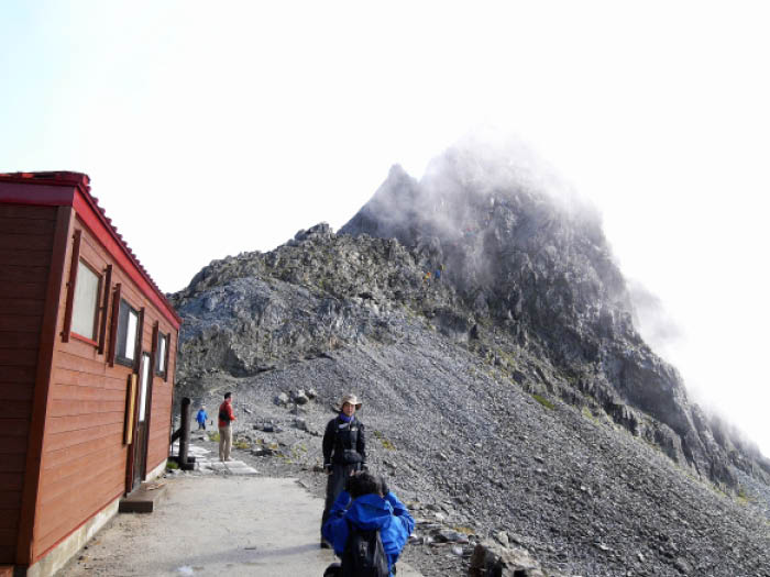
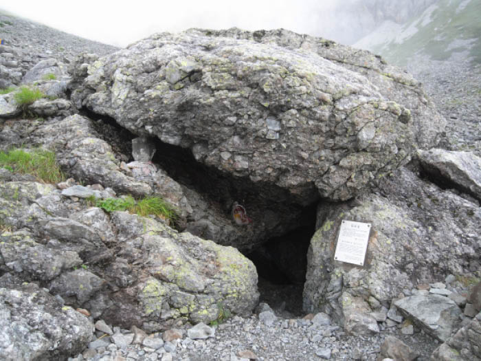
On day 2, the trail becomes very steep. After going through a forest of Betula ermani, a camping site called Baba-daira is reached. From this point forward, your view widens but still the steep trail continues. Take a break occasionally. The trail is graveled so use caution when stepping on loose rocks. After Tenguhara Junction, the trail becomes even steeper. It is recommended to rest while standing and keep climbing to Yari-no-kata, where Mt. Yari-gatake sansou Mountain hut is located.
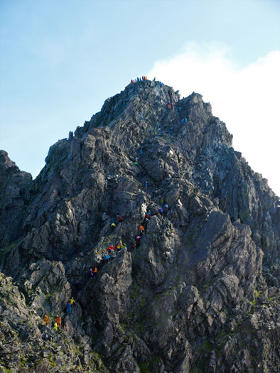
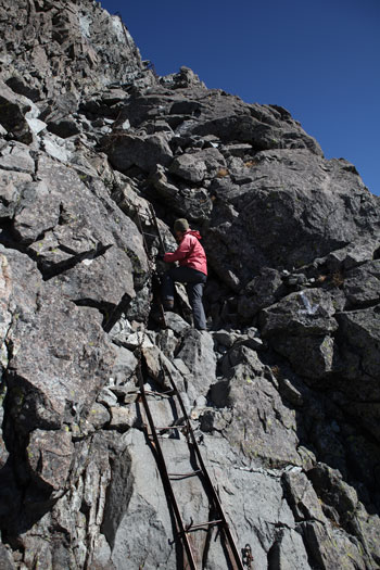
From Yari-no-kata to the summit, the trail becomes very rocky and the use of chains and ladders is required. The trail is well maintained. An ascending trail and a descending trail are separated in some parts, however, they can be congested with climbers. It is recommended to observe these trails from Yari-no-kata before you begin your approach.
The view from the summit is beyond the words. A fantastic 360 degree view can be enjoyed. The Northern and Southern Japanese Alps, Mt. Fuji-yama and Mt. Haku-san can be seen as well.
From the summit, follow the trail down to Kamikochi. The trail is all downhill up to Yokoo. Great caution needs to be employed to avoid slipping and falling. A helmet can be rented at the Mt. Yari-gatake sansou Mountain hut.