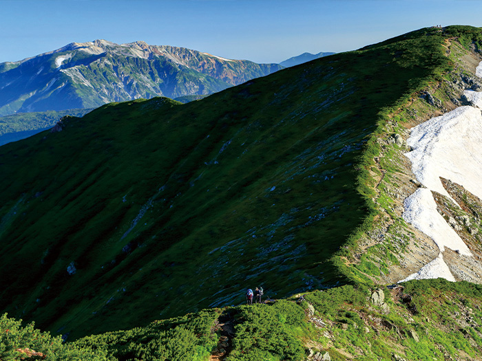
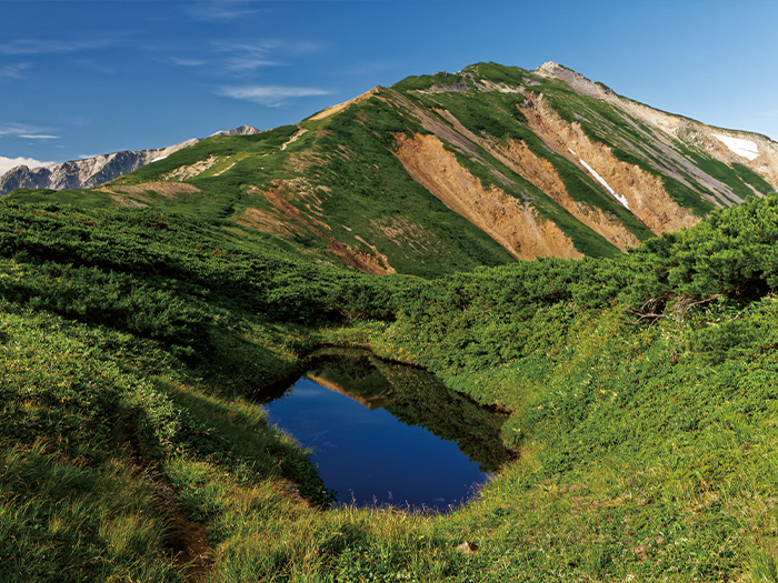
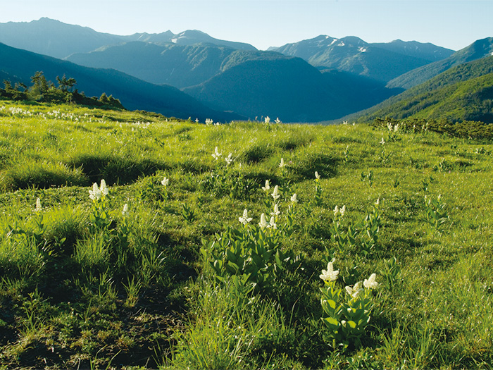
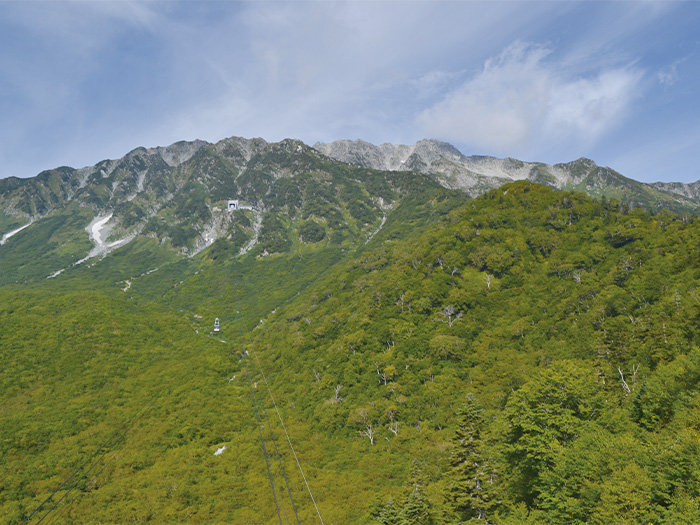
Mt. Yakushi-dake belongs to the Tate-yama Mountains and is known as the most beautiful mountain among the Northern Japan Alps. The shape of the mountain is thick with its width and length. A feature of the mountain, which looks like it’s wearing white make-up, makes it popular. The reflection of lights on the surface of the mountain covered by granite changes its color. The mountain holds four basins on the east slope, which merge into Kamino-rouka of the Kurobe river. The west side of the mountain spreads gradually towards the Jouganji river. It is originally a worshiped mountain and Yakushi-nyorai is enshrined at the summit. This mountain challenges one’s photo shooting skill due to the large scale of the mountain. You might get a feel for how big the mountain is when you walk it for the first time. The hike is recommended for both mountain climbing and hiking.
Mt. Yakushi-dake: Elevation 2,926 m
If you hike only Mt. Yakushi-dake, it is recommended that you start from Oritate.
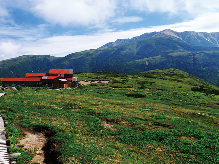
However, it is required to hike up to Yakushi-dake sanso Mountain hut for the first
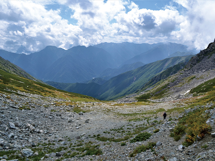
night. The hike on the following day will be harder if you hike only to Taro daira-koya Mountain hut for the first night. If you worry about your physical strength, it is recommended that you hike for two nights and three days. The group of cirques at Mt.Yakushi-dake is designated as a special national nature treasure. It is worth viewing.
There are many routes available to hike from one mountain to another. In that case, it is better to decide the main mountains to hike first, then review available routes. It is recommended to hike once only for an Oritate to Mt. Yakushi-dake round trip. Once you get a glimpse of the mountain atmosphere, then you can hike from one mountain to another from the Tateyama area, or you can include Mt. Yakushi-dake along the way to Kumono-daira.
Trailhead vicinity weather
Weekly weather forecast zone:Eastern Toyama Prefecture
| DAY | WEATHER | LOWEST | HIGHEST |
|---|---|---|---|
| 7/14 | 24℃ | 34℃ | |
| 7/15 | 25℃ | 33℃ | |
| 7/16 | 26℃ | 35℃ | |
| 7/17 | 26℃ | 35℃ | |
| 7/18 | 25℃ | 36℃ | |
| 7/19 | 25℃ | 35℃ |
This is a publication of the calculated figures for weather predictions and is not the weather forecast. There are instances where there will be big differences in the values stated for the mountains, in accord with the topography as well as sunlight, etc. so please take care.
72 hours weather information:Arimine, Toyama City, Toyama Prefecture, Japan
| Date and time |
7/13 17:00 |
7/13 18:00 |
7/13 19:00 |
7/13 20:00 |
7/13 21:00 |
7/13 22:00 |
7/13 23:00 |
7/14 0:00 |
7/14 1:00 |
7/14 2:00 |
7/14 3:00 |
7/14 4:00 |
7/14 5:00 |
7/14 6:00 |
7/14 7:00 |
7/14 8:00 |
7/14 9:00 |
7/14 10:00 |
7/14 11:00 |
7/14 12:00 |
7/14 13:00 |
7/14 14:00 |
7/14 15:00 |
7/14 16:00 |
7/14 17:00 |
7/14 18:00 |
7/14 19:00 |
7/14 20:00 |
7/14 21:00 |
7/14 22:00 |
7/14 23:00 |
7/15 0:00 |
7/15 1:00 |
7/15 2:00 |
7/15 3:00 |
7/15 4:00 |
7/15 5:00 |
7/15 6:00 |
7/15 7:00 |
7/15 8:00 |
7/15 9:00 |
7/15 10:00 |
7/15 11:00 |
7/15 12:00 |
7/15 13:00 |
7/15 14:00 |
7/15 15:00 |
7/15 16:00 |
7/15 17:00 |
7/15 18:00 |
7/15 19:00 |
7/15 20:00 |
7/15 21:00 |
7/15 22:00 |
7/15 23:00 |
7/16 0:00 |
|---|---|---|---|---|---|---|---|---|---|---|---|---|---|---|---|---|---|---|---|---|---|---|---|---|---|---|---|---|---|---|---|---|---|---|---|---|---|---|---|---|---|---|---|---|---|---|---|---|---|---|---|---|---|---|---|---|
| Weather | ||||||||||||||||||||||||||||||||||||||||||||||||||||||||
| Temperature | 21℃ | 21℃ | 20℃ | 19℃ | 18℃ | 18℃ | 17℃ | 17℃ | 17℃ | 17℃ | 17℃ | 17℃ | 17℃ | 17℃ | 18℃ | 20℃ | 21℃ | 23℃ | 24℃ | 25℃ | 24℃ | 24℃ | 24℃ | 23℃ | 20℃ | 20℃ | 19℃ | 19℃ | 19℃ | 19℃ | 18℃ | 19℃ | 19℃ | 19℃ | 19℃ | 18℃ | 17℃ | 18℃ | 17℃ | 17℃ | 19℃ | 20℃ | 21℃ | 21℃ | 22℃ | 22℃ | 22℃ | 23℃ | 22℃ | 21℃ | 20℃ | 18℃ | 18℃ | 18℃ | 17℃ | 17℃ |
| Precipitation | 0mm/h | 0mm/h | 0mm/h | 0mm/h | 0mm/h | 0mm/h | 0mm/h | 0mm/h | 0mm/h | 0mm/h | 0mm/h | 0mm/h | 0mm/h | 0mm/h | 0mm/h | ※ 16時間以降は表示されません | ||||||||||||||||||||||||||||||||||||||||
| Wind direction |
south-southeast 1m/s |
south-southeast 1m/s |
south-southeast 1m/s |
south-southeast 1m/s |
south-southeast 1m/s |
south-southeast 1m/s |
south-southeast 2m/s |
south-southeast 1m/s |
south-southeast 2m/s |
south-southeast 2m/s |
south-southeast 3m/s |
south-southeast 2m/s |
south-southeast 3m/s |
south-southeast 2m/s |
south-southeast 3m/s |
south-southeast 3m/s |
south-southeast 2m/s |
south-southeast 1m/s |
0m/s |
south-southeast 1m/s |
south-southeast 1m/s |
south-southeast 1m/s |
south-southeast 2m/s |
south-southeast 2m/s |
south-southeast 2m/s |
south-southeast 2m/s |
south-southeast 3m/s |
south-southeast 3m/s |
south-southeast 4m/s |
south-southeast 4m/s |
south-southeast 4m/s |
south-southeast 4m/s |
south-southeast 3m/s |
south-southeast 3m/s |
south-southeast 3m/s |
south-southeast 1m/s |
south-southeast 2m/s |
south-southeast 3m/s |
south-southeast 3m/s |
south-southeast 3m/s |
south-southeast 3m/s |
south-southeast 3m/s |
south-southeast 3m/s |
south-southeast 3m/s |
south-southeast 2m/s |
south-southeast 2m/s |
south-southeast 2m/s |
south-southeast 2m/s |
south-southeast 2m/s |
south-southeast 2m/s |
south-southeast 2m/s |
south-southeast 2m/s |
south-southeast 3m/s |
south-southeast 3m/s |
south-southeast 4m/s |
south-southeast 4m/s |
※The weather information will be information on 5km square including the relevant point.
※天気予報マークは一次細分区域から表示しています
View of Mt. Yakushi-dake