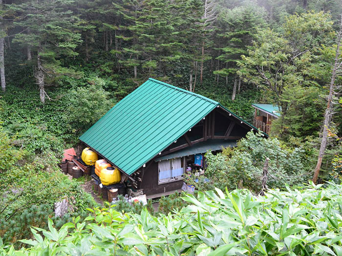
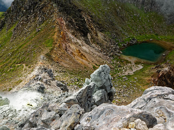
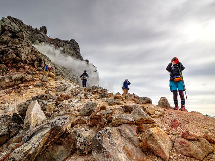
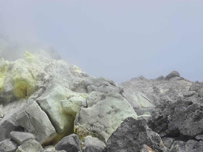
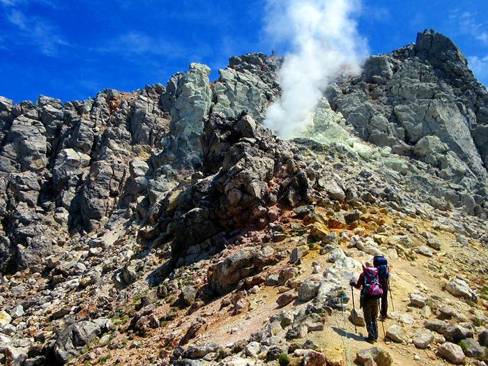
Mt. Yake-dake, locating south of Kamikochi, is the only active volcano among the Northern Japan Alps, dividing Nagano and Gifu prefectures. Recorded histories of volcanic eruption occurred in the year 1585, and in the year 1858. When a volcanic eruption occurred in the year of 1915, (Taisho era year 4), the mud flow stopped the flow of the Azusa river and created Taisho Pond in half a day. A recent eruption occurred in the year 1962 (Showa era year 30) and completely blew off the Nakao pass-koya Mountain hut. Mt. Yake-dake holds two peaks, the north and the south. An actual triangulation point was set at the south peak, however, it is prohibited to climb on the south peak due to the weakness of the trail. The north peak can be reached, however, sulfur steam that you can smell in the air rises from fumaroles sometimes.
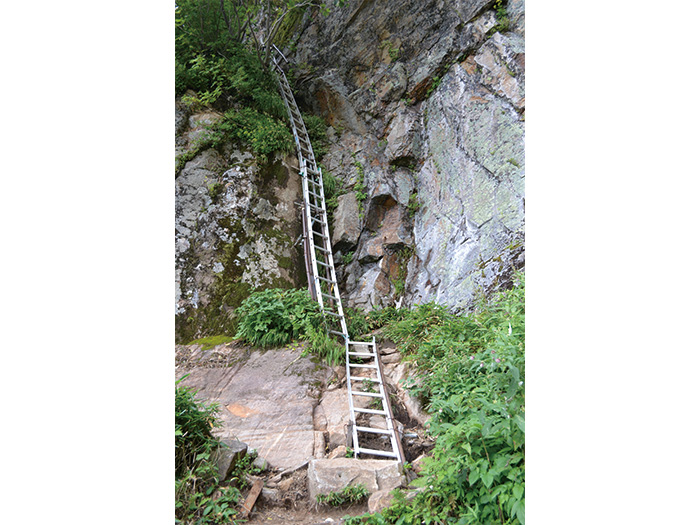
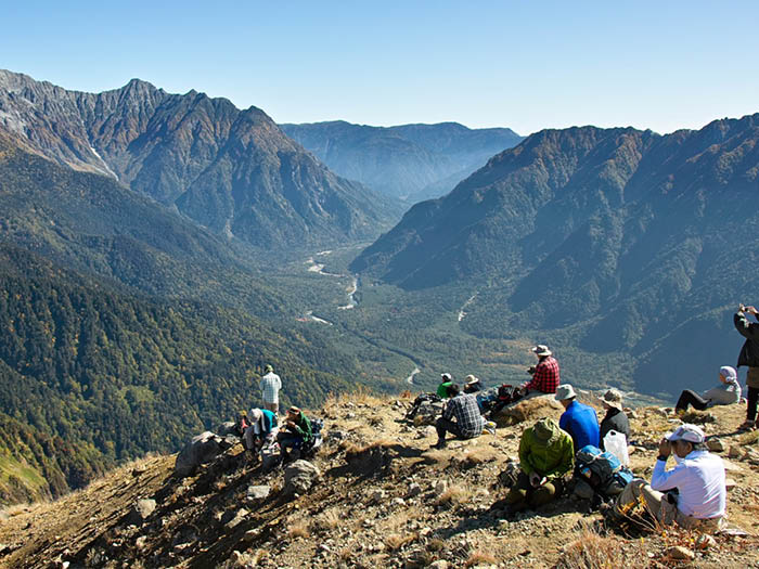
The official elevation is 2,455m for the south peak, however, the elevation of the north peak is 2,444m. From the north peak, you can tell that the south peak stands higher than the north peak. The muscular shape of the mountain might attract many hikers to climb the summit. It is necessary to gain the most updated information about the volcanic activity when planning to climb it. There are two routes to the summit; one from Kamikochi, the other, the Shin-naka-no-yu route from the Naka-no-yu area.
Mt. Yake-dake is an active volcano. Please check the information from the Japan Meteorological Agency in advance and carry a helmet when climbing. Japan Meteorological Agency.
Mt. Yake-dake: Elevation 2,455m(the south peak)
Most hikers take a round trip to Mt. Yake-dake from Kamikochi. It is because you need to wait for a bus from Naka-no-yu hot spring if you descend on the Shin-naka-no-yu route instead of returning to Kamikochi from the summit.
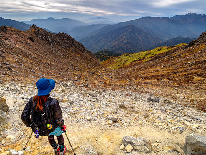
On the other hand, if hikers enter the mountain by Shin-naka-no-yu route, most of them prefer returning to the Naka-no-yu area because most of them drive to the trailhead. Two routes will be introduced here. One is a round trip from Kamikochi and another starts from Naka-no-yu hot spring via Shin-naka-no-yu route to the summit of Mt. Yake-dake, then descends to Kamikochi.,
Trailhead vicinity weather
Weekly weather forecast zone:Central Nagano Prefecture
| DAY | WEATHER | LOWEST | HIGHEST |
|---|---|---|---|
| 7/20 | 23℃ | 35℃ | |
| 7/21 | 23℃ | 34℃ | |
| 7/22 | 23℃ | 34℃ | |
| 7/23 | 23℃ | 33℃ | |
| 7/24 | 22℃ | 33℃ | |
| 7/25 | 22℃ | 33℃ |
This is a publication of the calculated figures for weather predictions and is not the weather forecast. There are instances where there will be big differences in the values stated for the mountains, in accord with the topography as well as sunlight, etc. so please take care.
72 hours weather information:Azumi-Yakidake Trailhead Parking Lot, Matsumoto City, Nagano Prefecture
| Date and time |
7/19 9:00 |
7/19 10:00 |
7/19 11:00 |
7/19 12:00 |
7/19 13:00 |
7/19 14:00 |
7/19 15:00 |
7/19 16:00 |
7/19 17:00 |
7/19 18:00 |
7/19 19:00 |
7/19 20:00 |
7/19 21:00 |
7/19 22:00 |
7/19 23:00 |
7/20 0:00 |
7/20 1:00 |
7/20 2:00 |
7/20 3:00 |
7/20 4:00 |
7/20 5:00 |
7/20 6:00 |
7/20 7:00 |
7/20 8:00 |
7/20 9:00 |
7/20 10:00 |
7/20 11:00 |
7/20 12:00 |
7/20 13:00 |
7/20 14:00 |
7/20 15:00 |
7/20 16:00 |
7/20 17:00 |
7/20 18:00 |
7/20 19:00 |
7/20 20:00 |
7/20 21:00 |
7/20 22:00 |
7/20 23:00 |
7/21 0:00 |
7/21 1:00 |
7/21 2:00 |
7/21 3:00 |
7/21 4:00 |
7/21 5:00 |
7/21 6:00 |
7/21 7:00 |
7/21 8:00 |
7/21 9:00 |
7/21 10:00 |
7/21 11:00 |
7/21 12:00 |
7/21 13:00 |
7/21 14:00 |
7/21 15:00 |
7/21 16:00 |
7/21 17:00 |
7/21 18:00 |
7/21 19:00 |
7/21 20:00 |
7/21 21:00 |
7/21 22:00 |
7/21 23:00 |
7/22 0:00 |
|---|---|---|---|---|---|---|---|---|---|---|---|---|---|---|---|---|---|---|---|---|---|---|---|---|---|---|---|---|---|---|---|---|---|---|---|---|---|---|---|---|---|---|---|---|---|---|---|---|---|---|---|---|---|---|---|---|---|---|---|---|---|---|---|---|
| Weather | ||||||||||||||||||||||||||||||||||||||||||||||||||||||||||||||||
| Temperature | 17℃ | 19℃ | 20℃ | 21℃ | 21℃ | 21℃ | 21℃ | 20℃ | 20℃ | 19℃ | 18℃ | 17℃ | 16℃ | 16℃ | 15℃ | 15℃ | 14℃ | 14℃ | 14℃ | 13℃ | 13℃ | 12℃ | 14℃ | 16℃ | 19℃ | 20℃ | 21℃ | 22℃ | 22℃ | 22℃ | 22℃ | 22℃ | 21℃ | 20℃ | 19℃ | 18℃ | 17℃ | 17℃ | 16℃ | 16℃ | 16℃ | 15℃ | 15℃ | 15℃ | 15℃ | 14℃ | 15℃ | 17℃ | 19℃ | 20℃ | 21℃ | 21℃ | 20℃ | 20℃ | 20℃ | 20℃ | 19℃ | 19℃ | 18℃ | 18℃ | 18℃ | 17℃ | 17℃ | 16℃ |
| Precipitation | 0mm/h | 0mm/h | 0mm/h | 0mm/h | 0mm/h | 0mm/h | 0mm/h | 0mm/h | 0mm/h | 0mm/h | 0mm/h | 0mm/h | 0mm/h | 0mm/h | 0mm/h | ※ 16時間以降は表示されません | ||||||||||||||||||||||||||||||||||||||||||||||||
| Wind direction |
none 1m/s |
none 1m/s |
none 1m/s |
none 1m/s |
none 1m/s |
none 1m/s |
none 2m/s |
none 2m/s |
none 2m/s |
none 1m/s |
none 1m/s |
none 1m/s |
none 1m/s |
none 1m/s |
none 1m/s |
none 1m/s |
none 1m/s |
none 1m/s |
none 1m/s |
none 1m/s |
none 1m/s |
none 1m/s |
none 1m/s |
0m/s |
0m/s |
0m/s |
none 1m/s |
none 1m/s |
none 2m/s |
none 2m/s |
none 2m/s |
none 1m/s |
none 1m/s |
none 1m/s |
none 1m/s |
none 1m/s |
none 1m/s |
none 1m/s |
none 1m/s |
none 1m/s |
none 1m/s |
none 1m/s |
none 1m/s |
none 1m/s |
none 1m/s |
none 1m/s |
none 1m/s |
0m/s |
none 1m/s |
none 1m/s |
none 1m/s |
none 1m/s |
none 1m/s |
none 1m/s |
none 1m/s |
none 1m/s |
none 1m/s |
none 1m/s |
none 1m/s |
0m/s |
none 1m/s |
0m/s |
0m/s |
0m/s |
※The weather information will be information on 5km square including the relevant point.
※天気予報マークは一次細分区域から表示しています
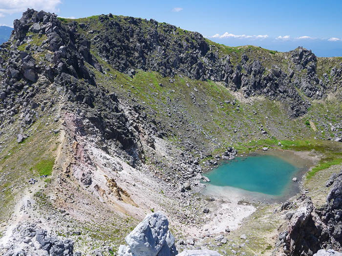
View of Mt. Yake-dake