Niken-koya Route
②Niken-koya Mountain Hut ~ Robotic Rain Gauge Remains ~ Manno-sawa-gashira ~ Mt. Senmai-dake ~ Mt. Warusawa-dake (Mt. Higashi-dake ) ~ Niken-koya Mountain Hut
Technical level: D
Physical strength: 5
Difficulty: ★★★★
Stand on the highest peak of the southern part of the South Japan Alps
This is the route where you can stand on the summit of Mt. Warusawa-dake (Mt. Higashi-dake) in the shortest time. However, there are limited numbers of buses running to Niken-koya mountain hut, which requires more than two nights to hike. It is not a difficult route, so if the weather is stable, you can enjoy hiking on the ridgeline above 3,000 m. A bus schedule to Sawara-jima and a roundtrip route from there to Niken-koya mountain hut must be checked in advance.
Access to Sawara-jima from
Hatanagi Dam
●Hiking data
Schedule: Two nights and three days or three nights and four days
Walking hours: 14 hours 10 minutes
Walking distance: 16.25 km
Cumulative elevation difference: 2,308.6 m
Niken-koya Mountain Hut

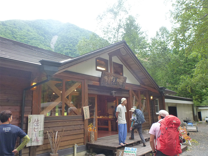
Elevation 1,390m
↓ 2 hours 45 minutes
Robotic Rain Gauge Remains
Elevation 2,271m
↓ 1 hour 10 minutes
Manno-sawa-gashira

Elevation 2,515m
↓ 2 hours
Mt. Senmai-dake
Elevation 2,880m
↓ 25 minutes
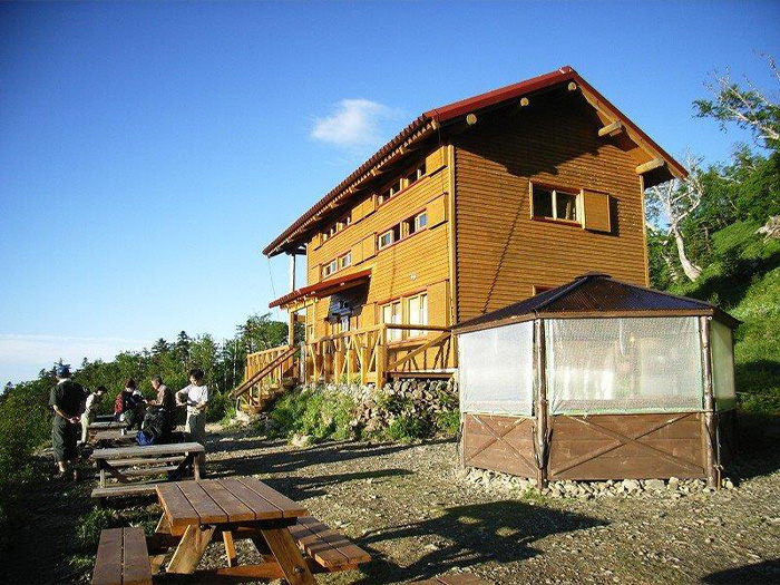
Senmai-koya Mountain Hut
Elevation 2,565m
↓ 35 minutes
Mt. Senmai-dake
Elevation 2,880m
↓ 1 hour
Mt. Maru-yama
Elevation 3,032m
↓ 40 minutes
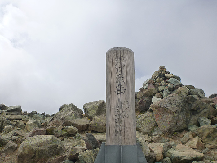
Mt. Warusawa-dake (Mt. Higashi-dake)

Elevation 3,141m
↓ 1 hour 25 minutes
Mt. Senmai-dake
Elevation 2,880m
↓ 4 hours 10 minutes
Niken-koya Mountain Hut
Elevation 1,390m
Route Guide
Because there are a limited number of buses running to Niken-koya mountain hut, it is recommended that you stay at Niken-koya lodge for the first night and schedule this trip as two nights and three days. Since there are no mountain huts on the ridgeline for the second day, you will stay at Senmai-koya mountain hut. Or you can climb to Mt. Naka-dake and stay at Naka-dake emergency shelter. It will add only 20 minutes to the scheduled walking hours in that case. Depending on the descent schedule, you might miss the last bus from Niken-koya mountain hut. You must be prepared for a three nights and four days trip just in case.
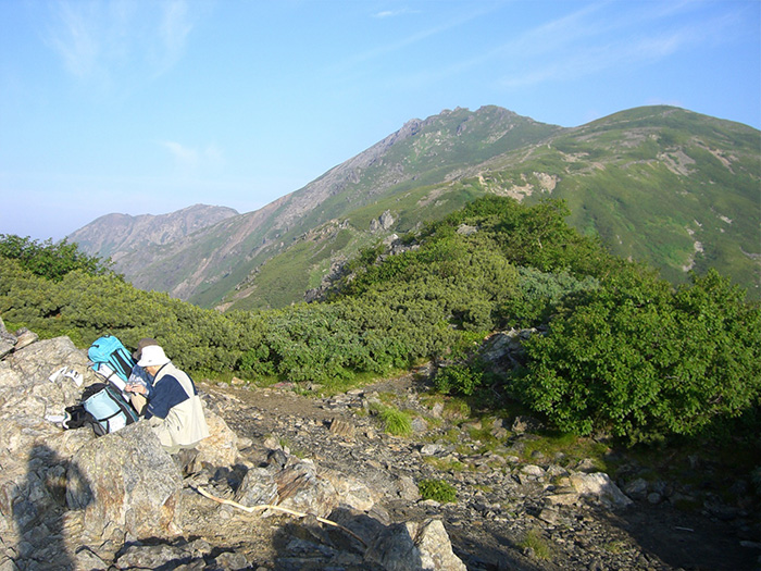
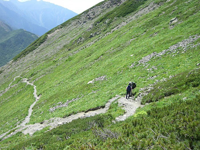
From Niken-koya lodge, cross the river and hike through the forest zone. There are some spots where it is difficult to follow the trail. For those spots, marking tapes are attached on branches so you should follow them in proceeding. Caution must be exercised for areas where rocks are piled up along the trail. The ascending trail is steeper than you might think, therefore you should climb at a steady pace. Pass a small cliff along the trail and proceed. It comes to a big rock marked “Robot”. These are the remains of the robotic rain gauge and Mt. Senmai-dake and Mt. Maru-yama can be seen. Around the spot, a white flower in a group of Asteraceae, Kani-koumori are in bloom. Also, Bellflowers or Aconites might be observed.
When you enter the beautiful forest, the trail becomes easy to hike on. There is no view, however, you can fully enjoy the fresh air of the forest. You will notice signs “Beware of Fire”. After passing spots with signs of Niken-koya Mountain Hut and Manno-sawa-kashira, Manno-sawa-kashira, where the north side was cut open, will be reached. The mountain that you can see to the north direction is Mt. Rousoku-dake, standing at an elevation of 2,865 m. Enjoy the view for a while. Proceed through the forest zone. When you pass the spot called Kusa-tsuki, the view opens up. Mt. Senmai-dake appears in your direction. Pass through a bright Pinus Pumila zone, then the junction of Mt. Senmai-dake and Senmai-koya mountain hut will be reached. At the junction, follow the road sign to Senmai-koya mountain hut and stay at the hut for the night.
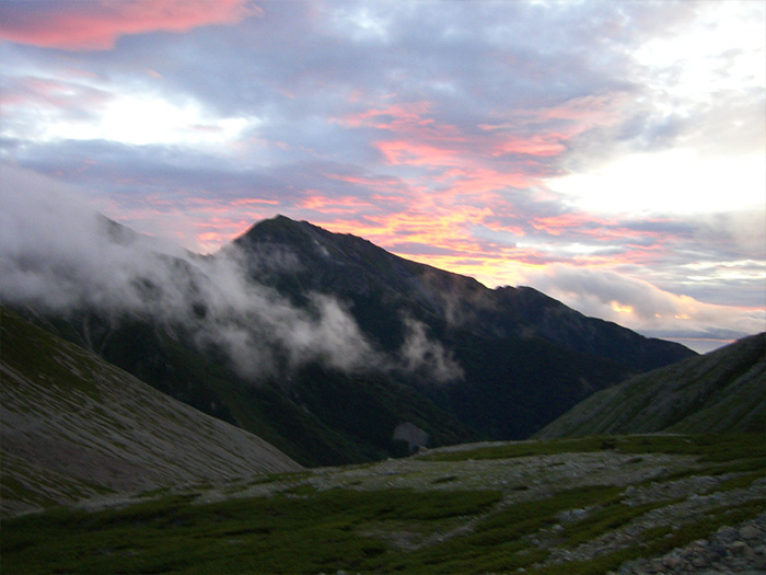
On the next day, you will climb Mt. Warusawa-dake then descend to Niken-koya mountain hut all at once. The walking hours are scheduled at about so you ought to go to bed early. You should depart before sunrise the next day. In about 35 minutes, the junction of Mt. Senmai-dake and Senmai-koya mountain hut, where you visited the day before, will be reached. Turn left at the junction, and you will reach the summit of Mt. Senmai-dake in about 20 minutes. The view of Mt. Akaishi-dake, Mt. Fuji, and Mt. Shiomi-dake are fantastic at the summit. There are sharp rocks at the there so you should be careful. Take a short break and proceed. The trail has a relatively open view, which makes the hiking enjoyable. When the trail starts climbing through a flower field diagonally, Mt. Maru-yama will be reached. The area around the summit is recognized as a protected area of alpine plants. The view on the north side of the summit is wide and phenomenal.
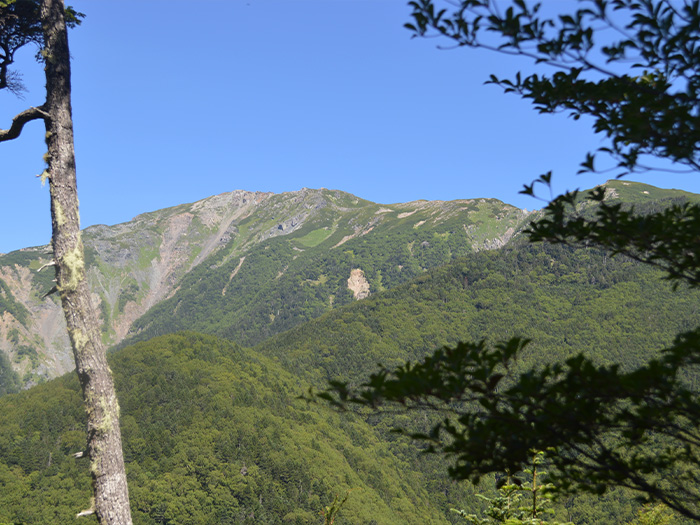
From Mt. Maru-yama, proceed on the ridgeline, where unstable rocks are piled up. In about 40 minutes, Mt. Warusawa-dake (Mt. Higashi-dake) will be reached. It is a rugged mountain, however, the view from the summit is 360-degrees. Fully enjoy the view. Also, this is the highest peak in the southern part of the South Japan Alps, at an elevation of 3,141 m. To descend, return on the ridgeline straight to Niken-koya mountain hut.