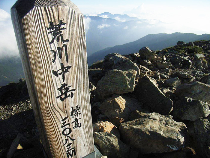
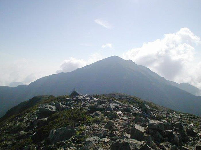
Mt. Higashi-dake is the highest peak among the Arakawa Three mountains, which is a core part of the south of the Southern Japan Alps. The elevation is 3,141 m. It is called Warusawa-dake. It is also called “Higashi-dake” or “Azuma-dake”. It is rare to climb only this mountain. Most hikers climb a part of Arakawa Three mountains (Mt. Higashi-dake, Mt. Naka-dake, and Mt. Mae-dake). There used to be many hikers choosing an approach from Niken-koya Mountain hut, however, these days, more hikers chose the route: Sawara-jima ~ Mt.Higashi-dake (Mt.Warusawa-dake) ~ Mt. Naka-dake ~ Mt. Akaishi-dake ~ Sawarajima, a route hiking from one to another at an elevation above 3,000 m.
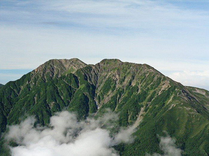
Mt. Akaishi-dake belongs to the Akaishi Mountains, which contains mountains of 3,000 m or higher altitude and begins from Mt. Mitsumine-dake, separating from Mt. Aino-dake. It is also referred to as the leader of the Southern Japan Alps. The elevation is 3,210 m. Even the mountain sitting next to it, Mt. Ko-Akaishi-dake is 3,081 m and is a high peak.
This mountain is climbed often with the Arakawa Three mountains, however, a route starting from Sawara-jima to Mt. Akaishi-dake via Mt. Ko-Akaishi dake then proceeding to Mt. Hijiri-dake, is popular as well. In that case, it is time efficient to descend from Hijiri-daira-koya Mountain hut to Hijiri-sawa trailhead and walk to Sawara-jima. However, it requires more than three nights to complete the route. If time is limited, a round trip from Sawara-jima to Mt. Akaishi-dake is recommended.
Mt. Higashi-dake (Mt.Warusawa-dake) : 3,141 m
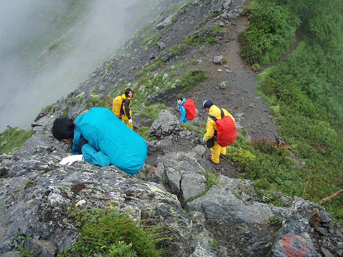
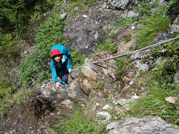
To climb the Arakawa three mountains, a loop route starting from Sawara-jima, a route from Koiji via Mifushi pass, and another route from Niken-koya lodge, can be considered. However, the route from Mifushi pass climbs from Mt. Mae-dake to Mt. Naka-dake and Mt. Higashi-dake (Mt. Warusawa-dake) then descends to Sawara-jima. This route does not go to Mt. Akaishi-dake. If you approach from Niken-koya Mountain hut, you hike from Mt. Senmai-dake to Mt. Higashi-dake (Mt. Warusawa-dake), Mt. Naka-dake, Mt. Maedake, and to Mt. Akaishi-dake, then descend to Sawara-jima. Access to Niken-koya lodge is difficult, however. Therefore, a route from Sawarajima to Mt. Senmai-dake to Mt. Higashi-dake (Mt. Warusawa-dake), Mt. Naka-dake, Mt. Maedake, and to Mt. Akaishi-dake, then a descent to Sawara-jima, is recommended. Also, if you climb Mt. Akaishi-dake, a round trip to the summit from Sawara-jima is recommended. It requires three nights and four days to climb The Arakawa Three mountains and two nights and three days to Mt. Akaishi-dake.
Trailhead vicinity weather
Weekly weather forecast zone:Chubu region, Shizuoka prefecture
| DAY | WEATHER | LOWEST | HIGHEST |
|---|---|---|---|
| 7/16 | 26℃ | 28℃ | |
| 7/17 | 25℃ | 29℃ | |
| 7/18 | 26℃ | 32℃ | |
| 7/19 | 25℃ | 32℃ | |
| 7/20 | 26℃ | 33℃ | |
| 7/21 | 26℃ | 33℃ |
This is a publication of the calculated figures for weather predictions and is not the weather forecast. There are instances where there will be big differences in the values stated for the mountains, in accord with the topography as well as sunlight, etc. so please take care.
72 hours weather information:Sawarajima Lodge, 1301-2 Tashiro, Aoi Ku, Shizuoka City, Shizuoka Prefecture
| Date and time |
7/15 7:00 |
7/15 8:00 |
7/15 9:00 |
7/15 10:00 |
7/15 11:00 |
7/15 12:00 |
7/15 13:00 |
7/15 14:00 |
7/15 15:00 |
7/15 16:00 |
7/15 17:00 |
7/15 18:00 |
7/15 19:00 |
7/15 20:00 |
7/15 21:00 |
7/15 22:00 |
7/15 23:00 |
7/16 0:00 |
7/16 1:00 |
7/16 2:00 |
7/16 3:00 |
7/16 4:00 |
7/16 5:00 |
7/16 6:00 |
7/16 7:00 |
7/16 8:00 |
7/16 9:00 |
7/16 10:00 |
7/16 11:00 |
7/16 12:00 |
7/16 13:00 |
7/16 14:00 |
7/16 15:00 |
7/16 16:00 |
7/16 17:00 |
7/16 18:00 |
7/16 19:00 |
7/16 20:00 |
7/16 21:00 |
7/16 22:00 |
7/16 23:00 |
7/17 0:00 |
7/17 1:00 |
7/17 2:00 |
7/17 3:00 |
7/17 4:00 |
7/17 5:00 |
7/17 6:00 |
7/17 7:00 |
7/17 8:00 |
7/17 9:00 |
7/17 10:00 |
7/17 11:00 |
7/17 12:00 |
7/17 13:00 |
7/17 14:00 |
7/17 15:00 |
7/17 16:00 |
7/17 17:00 |
7/17 18:00 |
7/17 19:00 |
7/17 20:00 |
7/17 21:00 |
7/17 22:00 |
7/17 23:00 |
7/18 0:00 |
|---|---|---|---|---|---|---|---|---|---|---|---|---|---|---|---|---|---|---|---|---|---|---|---|---|---|---|---|---|---|---|---|---|---|---|---|---|---|---|---|---|---|---|---|---|---|---|---|---|---|---|---|---|---|---|---|---|---|---|---|---|---|---|---|---|---|---|
| Weather | ||||||||||||||||||||||||||||||||||||||||||||||||||||||||||||||||||
| Temperature | 16℃ | 16℃ | 16℃ | 17℃ | 17℃ | 17℃ | 17℃ | 17℃ | 16℃ | 16℃ | 15℃ | 15℃ | 14℃ | 14℃ | 13℃ | 14℃ | 14℃ | 13℃ | 13℃ | 13℃ | 13℃ | 14℃ | 14℃ | 14℃ | 14℃ | 15℃ | 15℃ | 15℃ | 16℃ | 16℃ | 16℃ | 16℃ | 15℃ | 15℃ | 15℃ | 15℃ | 15℃ | 15℃ | 15℃ | 15℃ | 15℃ | 15℃ | 15℃ | 15℃ | 15℃ | 15℃ | 15℃ | 15℃ | 14℃ | 14℃ | 15℃ | 15℃ | 15℃ | 15℃ | 15℃ | 15℃ | 15℃ | 14℃ | 14℃ | 14℃ | 13℃ | 13℃ | 13℃ | 13℃ | 13℃ | 13℃ |
| Precipitation | 10mm/h | 12mm/h | 13mm/h | 9mm/h | 18mm/h | 17mm/h | 18mm/h | 9mm/h | 3mm/h | 2mm/h | 0mm/h | 0mm/h | 0mm/h | 0mm/h | 0mm/h | ※ 16時間以降は表示されません | ||||||||||||||||||||||||||||||||||||||||||||||||||
| Wind direction |
south 3m/s |
south 3m/s |
south 3m/s |
south 3m/s |
south 3m/s |
south 3m/s |
south 2m/s |
south 2m/s |
south 2m/s |
south 2m/s |
south 2m/s |
south 2m/s |
south 2m/s |
south 2m/s |
south 2m/s |
south 2m/s |
south 2m/s |
south 2m/s |
south 2m/s |
south 2m/s |
south 2m/s |
south 2m/s |
south 2m/s |
south 2m/s |
south 2m/s |
south 2m/s |
south 2m/s |
south 2m/s |
south 2m/s |
south 2m/s |
south 2m/s |
south 2m/s |
south 2m/s |
south 2m/s |
south 2m/s |
south 2m/s |
south 2m/s |
south 2m/s |
south 2m/s |
south 1m/s |
south 1m/s |
south 1m/s |
south 2m/s |
south 1m/s |
south 2m/s |
south 2m/s |
south 2m/s |
south 2m/s |
south 2m/s |
south 2m/s |
south 2m/s |
south 2m/s |
south 2m/s |
south 2m/s |
south 2m/s |
south 3m/s |
south 2m/s |
south 2m/s |
south 2m/s |
south 2m/s |
south 2m/s |
south 2m/s |
south 2m/s |
south 2m/s |
south 2m/s |
south 2m/s |
※The weather information will be information on 5km square including the relevant point.
※天気予報マークは一次細分区域から表示しています
View of Mt. Higashi-dake (Mt.Warusawa-dake)