Bessan o’ne Route
1.Murodo ~ Raicho-sawa ~ Bessan-nokkoshi ~ Kenzan-so Mountain hut~ Mae-tsurugi ~ Mt. Tsurugi-dake ~ Kenzan-so Mountain hut~ Murodo
Technical Level: E
Physical strength level: 4
Difficulty level: ⛰️⛰️⛰️⛰️
The most accessed route for the Mt. Tsurugi-dake approach
This is a round route from Kenzan-sou Mountain hut, the closest cabin to Mt. Tsurugi-dake.
A stay at Kenzan-so Mountain hut or Tsurugisawa-koya Mountain hut for the previous night is recommended. Some choose to camp out at Tsurugisawa.
●Hiking data
Schedule: One night two days or two nights three days
(1st night: Kenzan-so Mountain hut, Tsurugisawa-koya Mountain hut
2nd night :Kenzan-so Mountain hut, Tsurugisawa-koya Mountain hut)
Walking hours: 12 hours
(Ascent):6hours 15 min. (Decent) 5 hours 45 min.
Walking distance: 15.6 ㎞
Difference in elevation: 1,266 m
Murodo

Elevation 2,420m
↓ 55 min
Raicho-sawa
Elevation 2330m
↓ 1 hour 50 min
Bessan-nokkoshi
Elevation 2,750m
↓ 1 hour 5 minutes
Kenzan-so Mountain hut
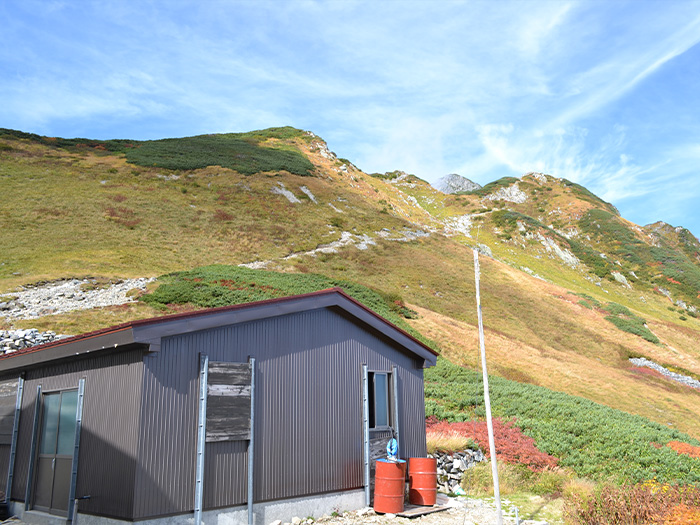
Elevation 2,470m
↓ 30 minutes
Mae-tsurugi
Elevation 2,813m
↓ 40 minutes
Mt. Tsurugi-dake
Elevation 2,999m
↓ 2 hours
Tsurugi-sawa
Elevation 2520m
↓ 1 hour 30 minutes
Bessan-nokkoshi
Elevation 2,750m
↓ 1 hour 20 minutes
Raicho-sawa
Elevation 2330m
↓ 1 hour 10 minutes
Murodo
Elevation 2,420m
Route Guide
Day 1 hiking is to Tsuurugisawa-koya or Kenzan-sou Mountain hut. Hike at a steady pace to conserve strength. Mt. Tsurugi-dake, which will be approached on the following day, can be viewed from Bessan-nokkoshi to Tsurugi-sawa. Tsurugi-sawa camping site is recommended if you prefer to camp out.
An early departure is strongly recommended on day 2. During high season, there might be traffic on the trail so plan your hike accordingly.
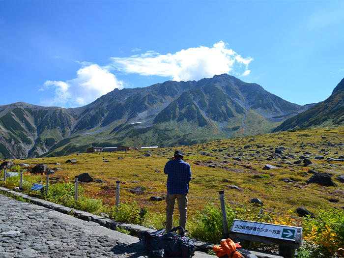
A well-maintained walking trail leads from Murodo towards Mikuri-gaike Pond. Mikuri-gaike Pond Onsen in front of Mikuri-gaike Pond is the highest altitude hot spring in Japan.
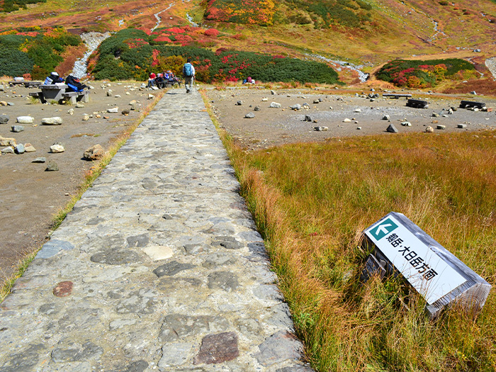
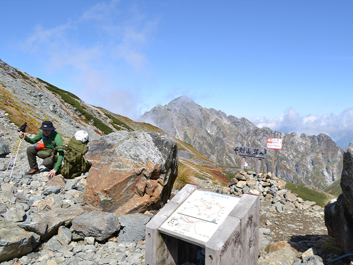
From here, continue to follow the path to Raicho-sawa, passing in front of Raicho-so Mountain hut. There is a large camping site. Cross the small wooden bridge and hike up the steep slope. This is the slope called Raicho-saka (slope), named after the frequent appearance of Raicho, Ptarmigan. The highest point of this trail is Bessan-nokkoshi, where Tsurugi-gozen-goya Mountain hut is located. The overpoweringly brave figure of Mt. Tsurugi-dake is seen in straight in front of you from this point.
From here, the gravel trail leads down to Tsurugi-sawa. The figure of Mt. Tsurugi-dake becomes bigger and bigger as you approach. Passing the campsite, the trail leads to Kenzan-sou Mountain hut, the closest cabin to the summit. A stay on the first night here is recommended.
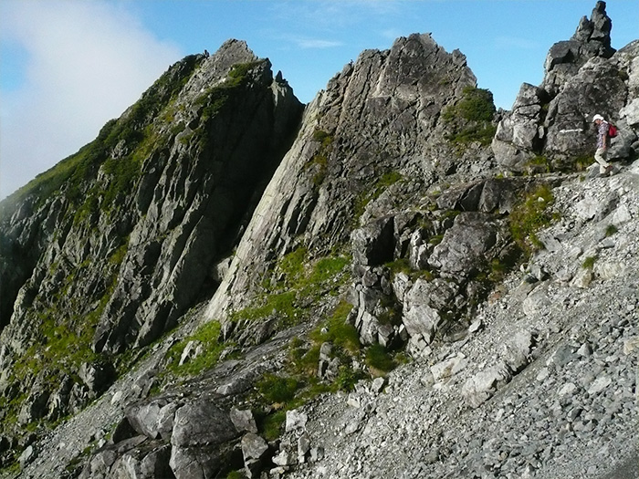
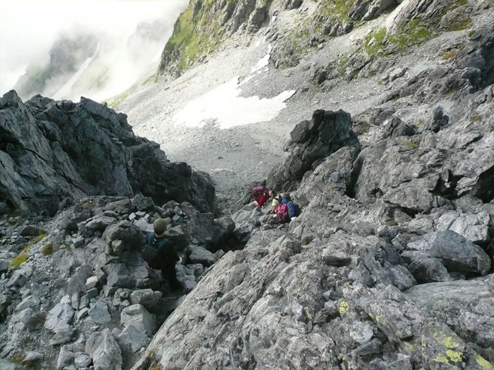
From Kenzan-so Mountain hut, the gravel trail takes small turns to the right and left repeatedly. Right about when you become ready for a short break, you reach Ippuku-tsurugi. From this point the trail becomes rocky. Passing the pinus pumila zone, the trail leads to Musashi saddle. After a short break, start hiking up the rocky zone. Follow the stones marked in ink as a guide. After coming to the end of the long chains, Mae-tsurugi is reached.
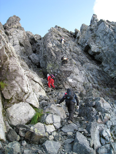
After Mae-tsurugi, the path separates into ascending and descending routes, making the trail slightly easier to traverse, however, the route is still challenging so you need to focus yourself on the trail. Crossing the small bridge, the trail goes up diagonally, requiring the use of the chains.
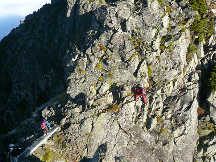
After hiking down from the small peak of rocks, the trail goes up again at which point Kani no Tatebai is reached. The chain is mounted on the rock cliff, which is about 20m in length, With experience and skill, the small ledges of rocks can be used to climb up with ease, however, make sure to hold a chain in one hand.
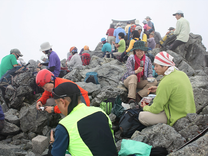
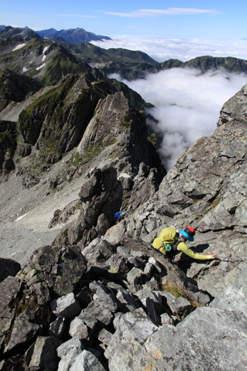
The summit of Mt. Tsurugi-dake is reached after taking a slight right turn at the end of Kani no Tatebai. There is no flat space at the summit with rocks. After paying your respects to the small shrine at the summit, enjoy lunch here while appreciating the fantastic 360-degree view.
To descend, take the trail back a short distance and then Kani no Yokobai appears. The first step of Kani no Yokobai requires great caution. Position a foot securely in a crack in the rocks. Proceed to the left then take the stairs down. The zones with chains continue after the Heizou saddle. Proceed with caution. The Ippuku-tsurugi is reached after traversing Mae-tsurugi. This point marks the end of the two separate trails. Cautiously take the trail used for ascending back to Murodo.