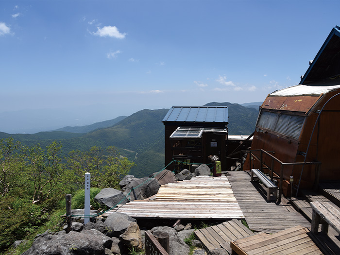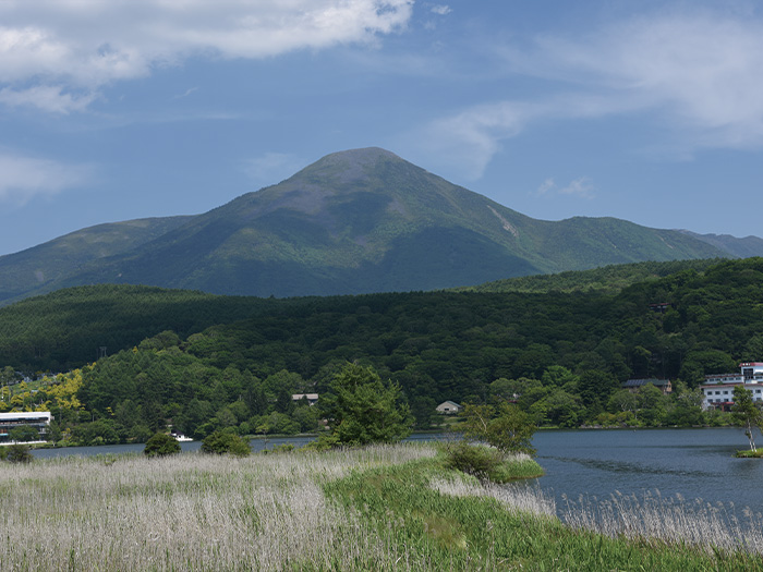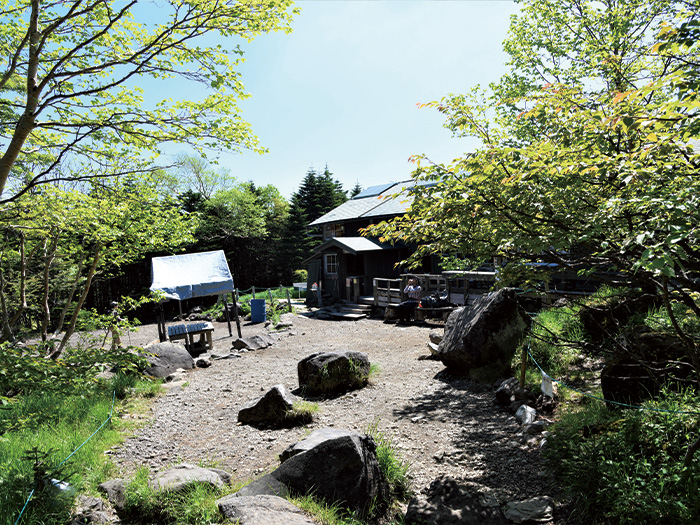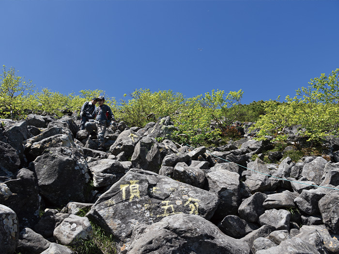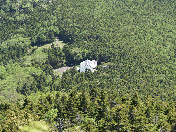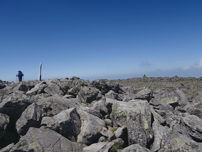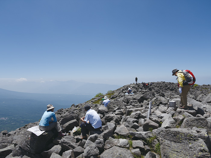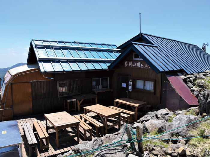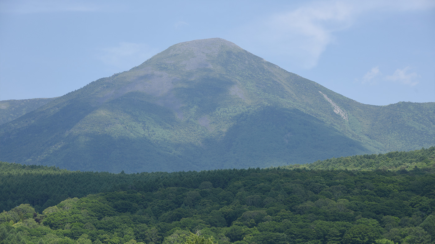
This is a single peak mountain, locating at the north edge of the Yatsu-gatake Mountains. The elevation is 2,531 m. This is a double layered volcano for which the base is a stratovolcano and the second layer is a bell-shaped volcano. The shape resembles that of Mt. Fuji and is called Suwa-fuji. When seen from Mt. Senjyo-ga-take in the South Japan Alps, it may be mistaken as Mt. Fuji even though it is in the wrong direction. There is a crater at the summit and large and small rocks, creating a savage landscape, however, there is nothing to block the sight and the view is phenomenal. Tateshina-sanso Mountain stands at Shougun-daira and Tateshina hut stands at the summit. There are many hikers in the summer season. The stars shown in the night sky can be enjoyed. It is also an impressive view when looked at from Shirakaba-lake, a famous resort.
Kita-yatsu-gatake Mountains (Mt. Tateshina-yama): Elevation: 2,531 m
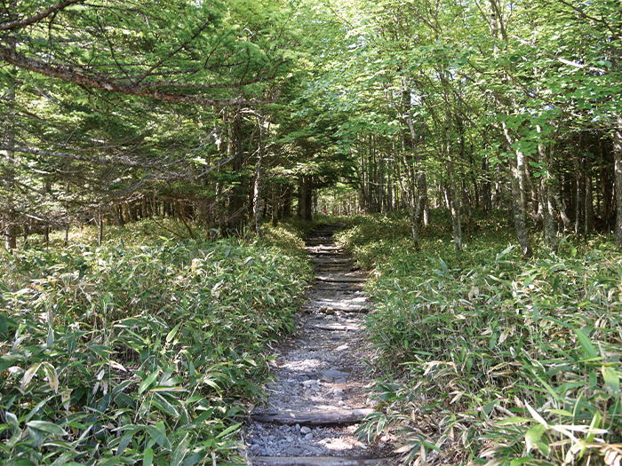
7th station trailhead, O-gawara touge pass, Ryuugen bridge, and Suzuran pass can be used as entrances to Mt. Tateshina-yama. More people choose to start from 7th station trailhead or O-gawara pass by driving their own cars because of the bad access via the use of public transportation. If you use 7th station trailhead, you will ascend and descend the same trail. If you start from O-gawara pass, you can make it a loop trip by descending via Tenshoji-hara on the way back.
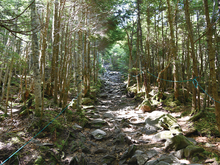
The trail from 7th station-trailhead and another from O-gawara pass meet at Shougun-daira. From there, the trail becomes rocky to the summit. There is a zone requiring use of chains. Caution must be employed especially when descending. From Suzuran pass, the trail becomes rocky near by the summit.
Trailhead vicinity weather
Weekly weather forecast zone:Central Nagano Prefecture
| DAY | WEATHER | LOWEST | HIGHEST |
|---|---|---|---|
| 2/27 | 2℃ | 17℃ | |
| 2/28 | 2℃ | 13℃ | |
| 3/1 | 0℃ | 11℃ | |
| 3/2 | 0℃ | 15℃ | |
| 3/3 | 3℃ | 12℃ | |
| 3/4 | 2℃ | 10℃ |
This is a publication of the calculated figures for weather predictions and is not the weather forecast. There are instances where there will be big differences in the values stated for the mountains, in accord with the topography as well as sunlight, etc. so please take care.
72 hours weather information:Tateshina-machi, Kitasaku-gun, Nagano Prefecture
| Date and time |
2/26 6:00 |
2/26 7:00 |
2/26 8:00 |
2/26 9:00 |
2/26 10:00 |
2/26 11:00 |
2/26 12:00 |
2/26 13:00 |
2/26 14:00 |
2/26 15:00 |
2/26 16:00 |
2/26 17:00 |
2/26 18:00 |
2/26 19:00 |
2/26 20:00 |
2/26 21:00 |
2/26 22:00 |
2/26 23:00 |
2/27 0:00 |
2/27 1:00 |
2/27 2:00 |
2/27 3:00 |
2/27 4:00 |
2/27 5:00 |
2/27 6:00 |
2/27 7:00 |
2/27 8:00 |
2/27 9:00 |
2/27 10:00 |
2/27 11:00 |
2/27 12:00 |
2/27 13:00 |
2/27 14:00 |
2/27 15:00 |
2/27 16:00 |
2/27 17:00 |
2/27 18:00 |
2/27 19:00 |
2/27 20:00 |
2/27 21:00 |
2/27 22:00 |
2/27 23:00 |
2/28 0:00 |
2/28 1:00 |
2/28 2:00 |
2/28 3:00 |
2/28 4:00 |
2/28 5:00 |
2/28 6:00 |
2/28 7:00 |
2/28 8:00 |
2/28 9:00 |
2/28 10:00 |
2/28 11:00 |
2/28 12:00 |
2/28 13:00 |
2/28 14:00 |
2/28 15:00 |
2/28 16:00 |
2/28 17:00 |
2/28 18:00 |
2/28 19:00 |
2/28 20:00 |
2/28 21:00 |
2/28 22:00 |
2/28 23:00 |
3/1 0:00 |
|---|---|---|---|---|---|---|---|---|---|---|---|---|---|---|---|---|---|---|---|---|---|---|---|---|---|---|---|---|---|---|---|---|---|---|---|---|---|---|---|---|---|---|---|---|---|---|---|---|---|---|---|---|---|---|---|---|---|---|---|---|---|---|---|---|---|---|---|
| Weather | |||||||||||||||||||||||||||||||||||||||||||||||||||||||||||||||||||
| Temperature | 1℃ | 1℃ | 1℃ | 3℃ | 5℃ | 6℃ | 7℃ | 8℃ | 8℃ | 8℃ | 8℃ | 7℃ | 6℃ | 4℃ | 4℃ | 3℃ | 2℃ | 2℃ | 2℃ | 2℃ | 2℃ | 1℃ | 1℃ | 1℃ | 0℃ | 0℃ | 1℃ | 2℃ | 5℃ | 7℃ | 8℃ | 8℃ | 9℃ | 8℃ | 8℃ | 7℃ | 6℃ | 5℃ | 4℃ | 4℃ | 3℃ | 3℃ | 3℃ | 2℃ | 2℃ | 1℃ | 1℃ | 1℃ | 1℃ | 1℃ | 1℃ | 1℃ | 1℃ | 1℃ | 1℃ | 2℃ | 2℃ | 1℃ | 0℃ | -1℃ | -1℃ | -2℃ | -3℃ | -3℃ | -4℃ | -4℃ | -4℃ |
| Precipitation | 0mm/h | 0mm/h | 0mm/h | 0mm/h | 0mm/h | 0mm/h | 0mm/h | 0mm/h | 0mm/h | 0mm/h | 0mm/h | 0mm/h | 0mm/h | 0mm/h | 0mm/h | ※ 16時間以降は表示されません | |||||||||||||||||||||||||||||||||||||||||||||||||||
| Wind direction |
north 2m/s |
north 2m/s |
north 2m/s |
north 2m/s |
north 2m/s |
north 2m/s |
north 2m/s |
north 2m/s |
north 2m/s |
north 2m/s |
north 2m/s |
north 2m/s |
north 1m/s |
north 1m/s |
north 1m/s |
north 1m/s |
north 1m/s |
north 1m/s |
north 1m/s |
north 1m/s |
north 1m/s |
north 1m/s |
north 1m/s |
north 1m/s |
north 1m/s |
north 1m/s |
north 1m/s |
north 1m/s |
0m/s |
0m/s |
north 1m/s |
0m/s |
0m/s |
0m/s |
north 1m/s |
north 1m/s |
0m/s |
north 1m/s |
north 1m/s |
north 2m/s |
north 2m/s |
north 1m/s |
north 1m/s |
north 1m/s |
north 1m/s |
north 1m/s |
north 1m/s |
0m/s |
0m/s |
north 1m/s |
north 1m/s |
north 1m/s |
north 2m/s |
north 2m/s |
north 3m/s |
north 3m/s |
north 3m/s |
north 3m/s |
north 3m/s |
north 3m/s |
north 3m/s |
north 3m/s |
north 3m/s |
north 3m/s |
north 2m/s |
north 2m/s |
north 2m/s |
※The weather information will be information on 5km square including the relevant point.
※天気予報マークは一次細分区域から表示しています
Route Information
A-Basic course sorted by trailheads
From 7th Station-trailhead
-
7th Station Route
① 7th station-trailhead ~ Uma-kaeshi ~ Shogun-daira ~ Mt. Tateshina-yama ~ Shogn-daira ~ Uma-kaeshi ~ Nanagoume 7th station-trailhead (Difficulty level: ⛰️) -
O-gawara Touge Route
② O-gawara pass ~ Akatani Junction ~ Shogun-daira ~ Tenshoji-hara ~ Mt. Futago-yama ~ O-gawara pass (Difficulty level: ⛰️)
