Kumono-daira Roundabout Route
②Hietsu tunnel ~ Mt. Tarou-yama ~ Kumono-daira ~ Mt. Washiba-dake ~ Mt. Mitsumata-renge-dake ~ Mt. Kurobe-goro-dake ~ Mt. Kitano-mata-dake ~ Hietsu tunnel
Technical level: C
Physical strength level: 10
Difficulty level: ⛰️⛰️⛰️⛰️⛰️
Start from Hietsu tunnel to Kumono-daira.
Hike to Mt. Kuorbe-goro-dake for a big loop trip.
●Hiking Data
Schedule: three nights four days
Walking hours: 28 hours
(Up:18 hours 10 minutes/Down: 9 hours 50 minutes)
Walking Distance: 47.0 km
Difference in elevation: 4,230 m
Hietsu tunnel parking lot

Elevation 1,450m
↓ 3 hours 50 minutes
Kitano-mata emergency shelter
Elevation 1,996m
↓ 3 hours 15 minutes
Mt. Tarou-yama

Elevation 2,373m
↓ 2 hours 15 minutes
Yakushi-sawa-koya Mountain hut
Elevation 1,920m
↓ 3 hours 20 minutes
Kumono-daira-sanso Mountain hut
Elevation 2,600m
↓ 3 hours 20 minutes
Mitsumata-sanso Mountain hut
Elevation 2,550m
↓ 2 hours 10 minutes
Kurobe-goro-koya Mountain hut
Elevation 2,350m
↓ 2 hours 30 minutes
Mt. Kurobe-goro-dake
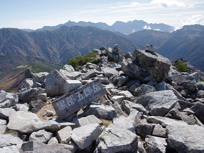
Elevation 2,839m
↓ 3 hours
Mt. Kitano-mata-dake
Elevation 2,662m
↓ 4 hours 20 minutes
Hietsu tunnel
Elevation 1,450m
Route Guide
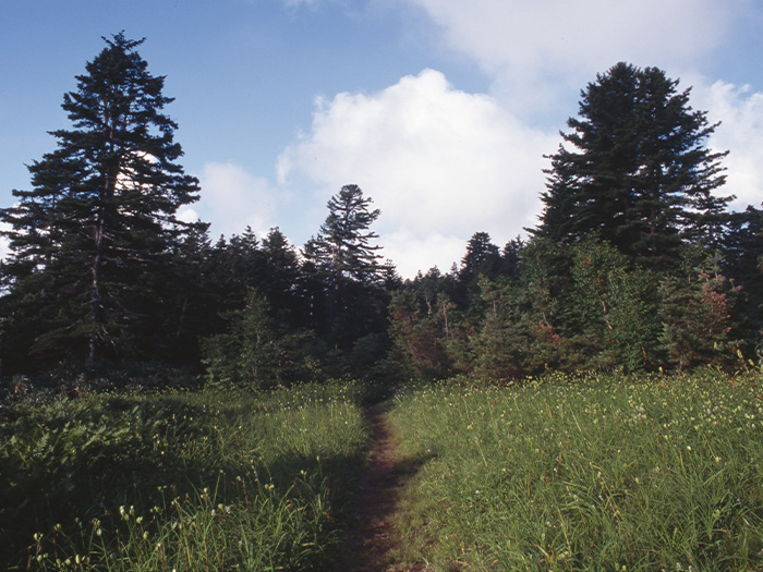
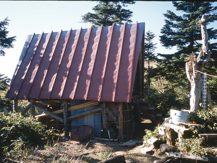
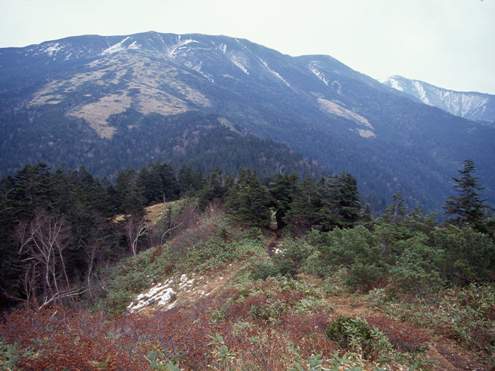
This route starts from Hietsu tunnel parking lot. For the first day, hike about 7 hours to Mt. Taro-yama. The trail starts through a forest zone. This is a very deep forest. It is recommended that you wear long sleeves just in case the trail hasn’t been mowed yet. This trail is a muddy trail. You may need to wear spats. Wooden planks are placed for heavy muddy places. Caution must be employed especially after rain. The muddy trail continues till Mt. Teraji-yama. Take a break as needed. From Mt. Teraji-yama, the trail becomes wider. A triangular building appears in your direction. This had been used as an emergency shelter but its use is now prohibited. From the old shelter, the trail merges with the ridgeline in about 2 hours.
Hike towards the left of the ridgeline. Head to Mt. Taro-yama. The trail is covered by Hakusan-ichige. Enjoy the view of the mountains while tracing the trail. The trail descends gradually. Taro is reached in 1 hour and 15 minutes. It is recommended that you stay at Tarou-daira koya Mountain hut. On the next day, hike to Kumono-daira. From the back of the hut, go around the base of Mt. Tarou-yama to enter the trail to Yakushi-sawa. The first crossing point is reached at the bottom of the hill. Walk over stepping-stones till the second crossing point. From here, the trail becomes very steep. When it reaches an open field covered by bamboo leaves, the boardwalk starts. There are some benches located here and there. The stable bridge is built at the third crossing point. The trail enters Shirabiso forest shortly after crossing the bridge. Kabekke-ga-hara is reached at the end of the forest. The native forest seen in your direction is Kumono-daira. When you hear the sound of the stream, Yakushi-zawa-koya Mountain hut is reached. Take a break and cross the bridge to Kumono-daira. Climb a steep slope through a forest zone from the riverside. The beginning is very steep but it levels out as you proceed.
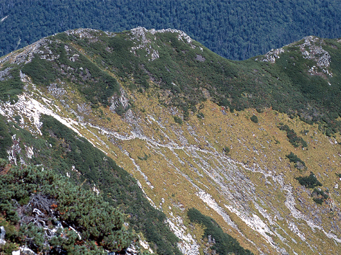
When the boardwalk begins, the forest zone is over and Mt. Suisyou-dake, Mt. Yakushi-dake, and Mt. Kurobe-goro-dake come into sight. This area is called Kumono-daira. Alaska garden appears. Along the boardwalk a Chito, a particular swamp found at high altitude, can be seen. Arens and Iwaicho are seen along the trail as well. Kumono-daira-sanso Mountain hut is located on the hill on your right. It is recommended to stay at the hut for the night. Enjoy the night at a hidden place in the North Japan Alps.
When the boardwalk begins, the forest zone is over and Mt. Suisyou-dake, Mt. Yakushi-dake, and Mt. Kurobe-goro-dake come into sight. This area is called Kumono-daira. Alaska garden appears. Along the boardwalk a Chito, a particular swamp found at high altitude, can be seen. Arens and Iwaicho are seen along the trail as well. Kumono-daira-sanso Mountain hut is located on the hill on your right. It is recommended to stay at the hut for the night. Enjoy the night at a hidden place in the North Japan Alps.
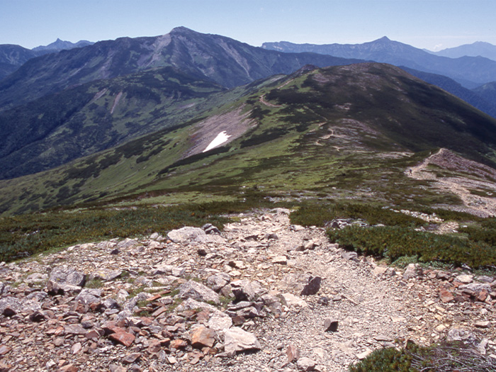
On the third day, hike from Mt. Mitsumata-renge-dake to Mt. Kurobe-goro-dake. Walk from Jiji garden to Japan garden. Mitsumata-sanso Mountain hut is reached at the end of the steep slope. Head to Mt. Mitsumata-renge-dake, standing on the border lines of Toyama, Gifu, and Nagano prefectures. Get a quick overview of the Kumono-daira area, then proceed to Kurobe-goro-koya Mountain hut. The last night will be spent at Kurobe-goro koya Mountain hut. On the next day, hike to Mt. Kurobe-goro-dake while overlooking the Kurobe-goro depression. The view is so fantastic that it might be hard to walk as scheduled. The summit of Mt. Kurobe-goro-dake is reached about 15 minutes from a shoulder of Kurobe-goro. The view of Mt. Yari-gatake and Hodaka Mountains are phenomenal. Return to the shoulder and proceed on the ridgeline towards Mt. Kitano-mata dake. Enjoy the view while walking. Take a break at the summit of Mt. Kitano-mata-dake. Descend the ridgeline about 10 minutes to the junction. Take a left trail at the junction. The trail is the same route used for ascending. Walk back to the Hietsu tunnel parking lot.