Norogawa Route
③Norogawa-deai (bus stop) ~ Ryoumata-koya Mountain Hut ~ Norogawa-koshi ~ Mt. Mitsumine-dake ~ Mt. Aino-dake ~ Mt. Kita-dake ~ Happonbo saddle ~ O-kanba-sawa-futamata ~ Hirogawara ~ Bus Stop
Technical level: D
Physical strength: 7
Difficulty ★★★★
The route for experienced hikers from Norogawa-koshi with fewer hikers
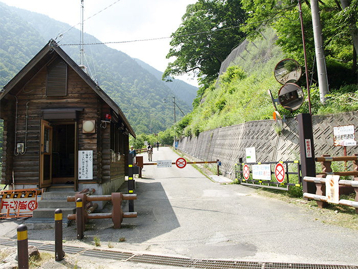
To Norogawa-deai, you can save on cost if you take the South Japan Alps city bus, which runs from Hirogawara to Kitazawa pass. The number of buses are limited per day so you should check the schedule in advance. If you walk to Norogawa-deai via the South Japan Alps logging road, it is downhill for 1 hour 10 minutes from Kitazawa pass and uphill for 2 hours 10 minutes from Hirogawara.
Access to Kitazawa Pass from Hotel Senryu-so
●Hiking data
Schedule: Two nights and three days
Walking hours: 13 hours 55 minutes (15 hours 5 minutes from Kitazawa pass)
Walking distance: 26.4 km
Cumulative elevation difference: 2,291.8 m
Norogawa-deai (but stop)
Elevation 1,790m
↓ 2 hours 20 minutes
Ryomata-koya Mountain Hut
Elevation 2,000m
↓ 1 hour
Norogawa-koshi
Elevation 2,290m
↓ 3 hours
Mt. Mitsuimine-dake
Elevation 2,999m
↓ 1 hour
Mt. Aino-dake
Elevation 3,189m
↓ 2 hours 40 minutes
Mt. Kita-dake

Elevation 3,193m
↓ 45 minutes
Happonbo saddle
Elevation 2,920m
↓ 1 hour 10 minutes
O-kanba-sawa-futamata
Elevation 2,209m
↓ 2 hours
Hirogawara Bus Stop
Elevation 1,520m

Route Guide
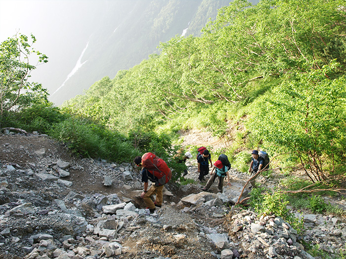
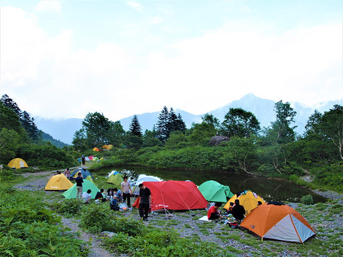
From the bus stop of Norogawa-deai, start walking on the unpaved logging road along Norogawa river. You can hear the sound of Norogawa river running on the left side of the road. The road is surrounded by deep greenery and that will be very refreshing. Unfortunately, it will just be a long and hard uphill on a bad weather day. When you schedule hiking on this route, you must check the weather forecast in advance. When the trail meets the riverside of the source of Norogawa-river, you will enter a camping site. Ryoumata-koya mountain hut will be reached after passing the camping site. It is recommended that you stay at the hut for the night. Your walking hours on the logging road for Day 1 should have been 2 hours and 20 minutes. You will go all the way up to just below Mt. Kita-dake for Day 2 so you should go to bed early.
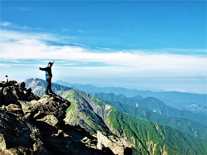
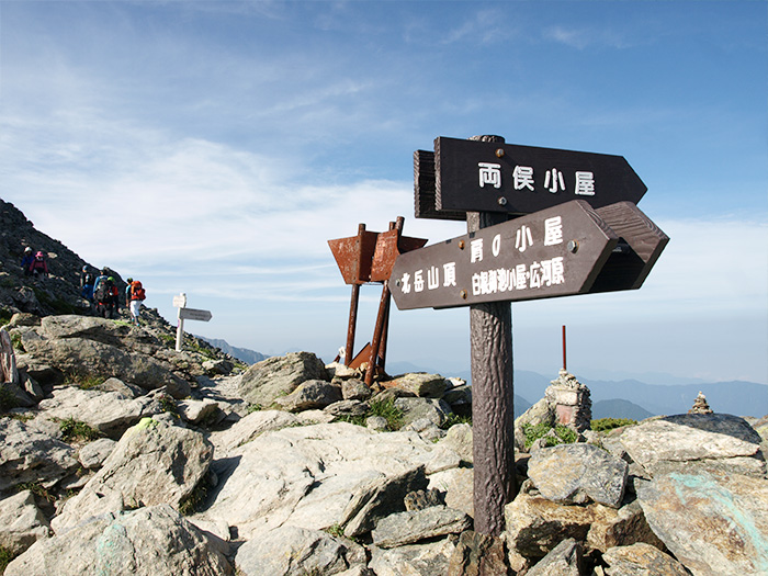
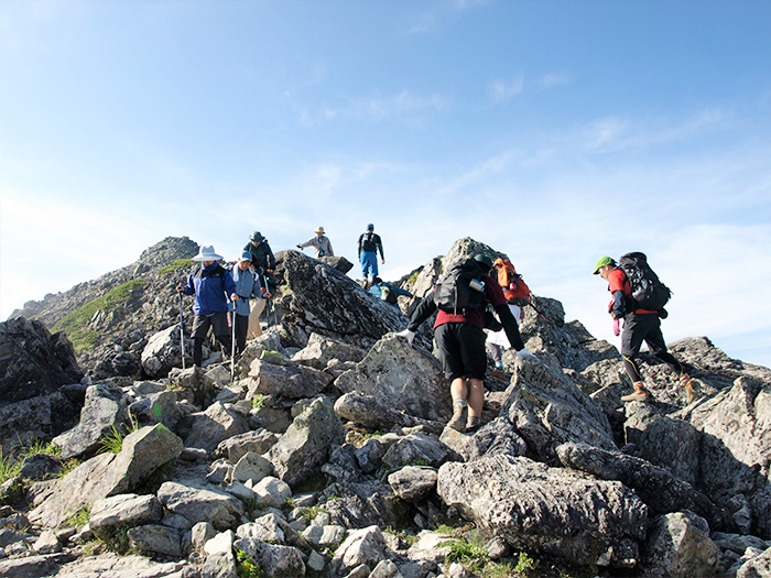
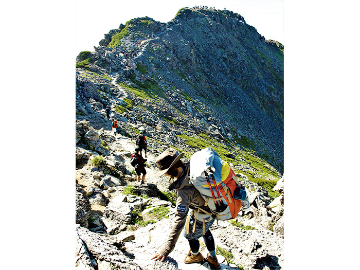
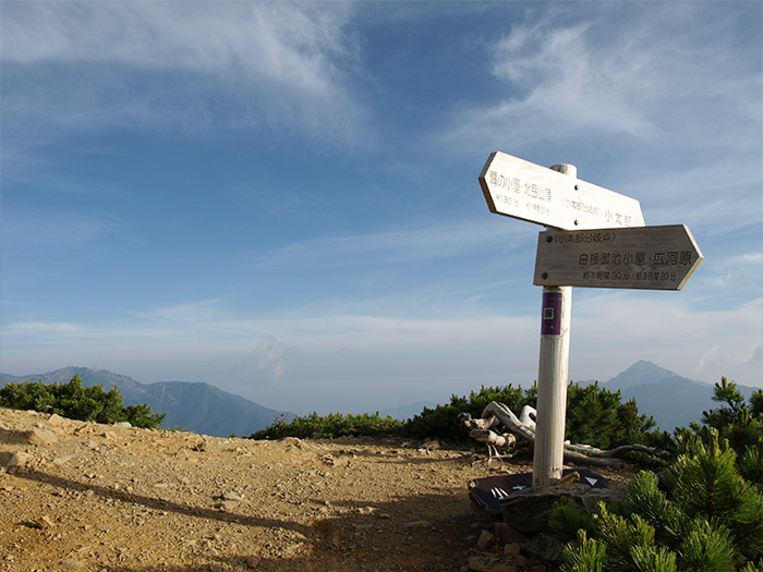
On the second day, start from the back of Ryoumata-koya mountain hut and follow the road signs to Norogawa-koshi. At the same place, there is another road sign, “Mt. Kita-dake→.” This route climbs straight up to Mt. Kita-dake and it is only for experts. You must head to Norogawa-koshi. Walk at a steady pace on the slightly-steep slope. Norogawa-koshi will be reached in about one hour after you walk through the forest filled with many fallen trees. From here, the trail gets on Sen-shio O’ne ridgeline from Mt. Senjyo-gatake. Head to Mt. Mitsumine-dake. Through the trees, Mt. Kita-dake, the second highest mountain in Japan, following Mt. Fuji, can be spotted. That is the mountain you are climbing to. After passing Doppyo, the trail enters into a shrub belt. When the trail becomes narrow shortly, you will come to pass the area requiring the use of a chain of about 5 m in length. After that point, the trail turns into a gravel uphill. It merges into the trail to Mt. Aino-dake just below Mt. Mitsumine-dake. Mt. Mitsumine-dake stands just above, at an elevation of 2,999 m. It is recommended that you visit the summit of Mt. Mitsumine-dake before you enter the ridgeline. It takes about one hour to Mt. Aino-dake. Climb while looking at Mt. Noutori-dake on the right. The summit of Mt. Aino-dake that you will reach, is wide with a great view. In the south, Mt. Akaishi-dake, Mt. Hijiri-dake, and Mt. Tekari-dake, in the west, the Central Japan Alps, the North Japan Alps, Mt. Yatsu-gatake, and the Okuchichibu mountains can be viewed. After enjoying the views, depart to Mt. Kita-dake. Repeat some ups and downs. After passing Mt. Naka-shirane-yama, the hut comes into sight on your right. That is the Kita-dake-sanso mountain hut, which was designed by an internationally famous architect. It is recommended that you stay at the hut for the night.
There are two trails from Kita-dake-sanso mountain hut to the summit of Mt. Kita-dake. One is the route to climb on the ridgeline. The other is a traversing route on the east side of the ridgeline. More hikers tend to choose the ridgeline to climb. The traversing route is filled with alpine plants. You may even observe Kita-sou, an endemic species; the trail reaches Happonbo saddle and the Tsuri O’ne junction and from here, it takes an extra 10 minutes to the summit. It takes about 20 minutes from Tsuri O’ne junction to the summit of Mt. Kita-dake. If you can depart from Kita-dake-sanso mountain hut before sunrise, you can view Mt. Fuji in a sea of clouds from the summit. The summit is so wide that you can relax and enjoy your stay.
For a descending route, return to Tsuri O’ne junction then proceed to Happonba saddle. There will be areas, requiring the use of long ladders on the way. Caution must be exercised. From Happonba saddle, descend to O-kanba-sawa-futamata. This route is called Samata course and is a gravel trail in a zigzag pattern. Great caution must be practiced when passing below the buttress. There might be falling rocks from the buttress. Pay attention to what’s going on above your head and walk by quickly. Snowy valleys remain until August along this route. Avoid hiking down on snowy valleys, instead, hike on the left bank. O-kanba-sawa-futamata is where Migimata course and the route from Shirane-oike-koya mountain hut meet. Because a toilet (with a tipping system) is locatee at the junction, many hikers rest here. From here, descend on the left bank of O-kanba-sawa. The trail comes to the site where it had once collapsed and where a new route on the right bank has been built. Follow the trail till the route from Shirane-oike-koya mountain hut merges. Continue to descend until Hirogawara is reached after crossing a hanging bridge. From Hirogawara, ride a bus to Kofu station.