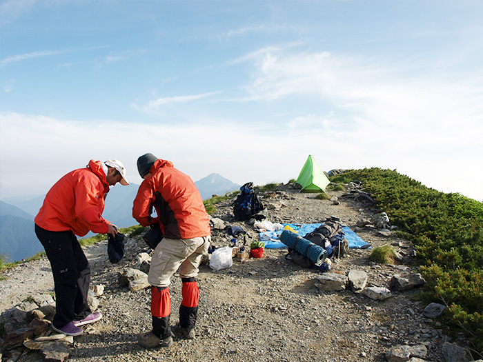
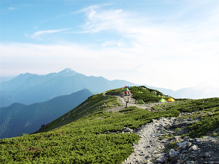
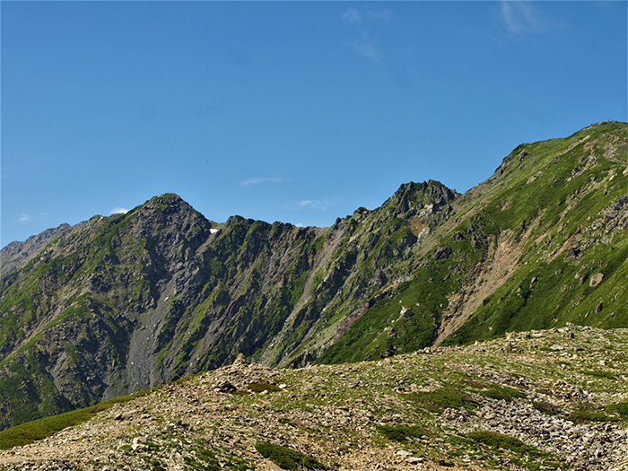
It is located in the north of the Southern Japan Alps and is the main peak of the Shirane Three mountains (Mt. Kita-dake, Mt. Aino-dake, Mt. Notori-dake). It is the second highest peak in Japan, following Mt. Fuji-yama. When looking from north or south, its shape is a beautiful triangular pyramid. This mountain is known as the jewel box of alpine plants such as Kita-dake-sou, an endemic spieces. The view of Mt. Fuji above a sea of clouds can be seen at sunset from the summit, which makes you realize that you are at a high elevation. It is said that the mountain was reached for the first time by a rower, Naoe Natori in 1871 . The numbers of hikers increased dramatically after Norokawa logging road was built in 1963. A rocky cliff on the east slope is called Kita-dake buttress and the 600 M vertical cliff drops from the summit to O-kanba sawa stream. Many rock climbers long for the buttress. It is a place, dear to the climber’s heart in the South Japan Alps, where there are quite a few rocky cliff courses.
Mt. Kita-dake: Elevation 3,193 m
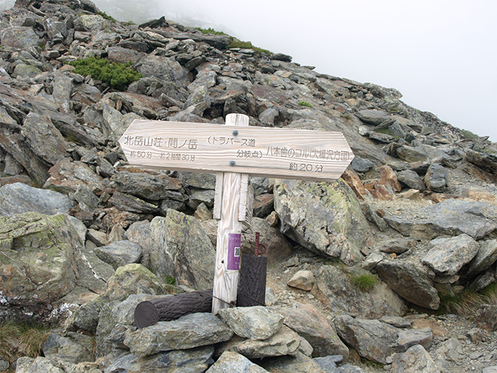
Normally, it is traditional to climb Mt. Kita-dake from Hirogawara. As a variation route, the route on Ikeyama-tsuri o’ne from Yoshimori shindo is available, however, this is only for experts. If you would like to hike from one mountain to another, you can hike from Mt. Kita-dake, Mt. Aino-dake, to Mt. Notori-dake or from Mt. Kita-dake~Mt. Aino-dake~Mt. Shiomidake. There are a variety of courses available because Mt. Kita-dake is located at the north of the South Japan Alps. However, any route requires days to complete. It is important to make appropriate preparations and a hiking schedule. A hike on this route would be slightly different from one in the North Japan Alps. In Route Guide 1, a course to hike only Mt. Kita-dake will be introduced. In Route Guide 2, a course that hikes from Mt. Kita-dake to other representative mountains will be introduced. It is recommended that you hike on these courses first before you set different variation courses.
Trailhead vicinity weather
Weekly weather forecast zone:Western Yamanashi Prefecture
| DAY | WEATHER | LOWEST | HIGHEST |
|---|---|---|---|
| 7/12 | 24℃ | 32℃ | |
| 7/13 | 25℃ | 33℃ | |
| 7/14 | 24℃ | 31℃ | |
| 7/15 | 24℃ | 29℃ | |
| 7/16 | 24℃ | 30℃ | |
| 7/17 | 25℃ | 30℃ |
This is a publication of the calculated figures for weather predictions and is not the weather forecast. There are instances where there will be big differences in the values stated for the mountains, in accord with the topography as well as sunlight, etc. so please take care.
72 hours weather information:YamanashiNan Alps City Ashiyasu Ashikura Hirokawara bus stop
| Date and time |
7/11 17:00 |
7/11 18:00 |
7/11 19:00 |
7/11 20:00 |
7/11 21:00 |
7/11 22:00 |
7/11 23:00 |
7/12 0:00 |
7/12 1:00 |
7/12 2:00 |
7/12 3:00 |
7/12 4:00 |
7/12 5:00 |
7/12 6:00 |
7/12 7:00 |
7/12 8:00 |
7/12 9:00 |
7/12 10:00 |
7/12 11:00 |
7/12 12:00 |
7/12 13:00 |
7/12 14:00 |
7/12 15:00 |
7/12 16:00 |
7/12 17:00 |
7/12 18:00 |
7/12 19:00 |
7/12 20:00 |
7/12 21:00 |
7/12 22:00 |
7/12 23:00 |
7/13 0:00 |
7/13 1:00 |
7/13 2:00 |
7/13 3:00 |
7/13 4:00 |
7/13 5:00 |
7/13 6:00 |
7/13 7:00 |
7/13 8:00 |
7/13 9:00 |
7/13 10:00 |
7/13 11:00 |
7/13 12:00 |
7/13 13:00 |
7/13 14:00 |
7/13 15:00 |
7/13 16:00 |
7/13 17:00 |
7/13 18:00 |
7/13 19:00 |
7/13 20:00 |
7/13 21:00 |
7/13 22:00 |
7/13 23:00 |
7/14 0:00 |
|---|---|---|---|---|---|---|---|---|---|---|---|---|---|---|---|---|---|---|---|---|---|---|---|---|---|---|---|---|---|---|---|---|---|---|---|---|---|---|---|---|---|---|---|---|---|---|---|---|---|---|---|---|---|---|---|---|
| Weather | ||||||||||||||||||||||||||||||||||||||||||||||||||||||||
| Temperature | 16℃ | 15℃ | 15℃ | 15℃ | 15℃ | 15℃ | 15℃ | 15℃ | 15℃ | 15℃ | 15℃ | 14℃ | 14℃ | 14℃ | 14℃ | 15℃ | 16℃ | 18℃ | 19℃ | 19℃ | 20℃ | 20℃ | 20℃ | 19℃ | 18℃ | 17℃ | 16℃ | 15℃ | 15℃ | 14℃ | 14℃ | 14℃ | 13℃ | 13℃ | 13℃ | 13℃ | 14℃ | 13℃ | 14℃ | 16℃ | 18℃ | 19℃ | 19℃ | 18℃ | 19℃ | 19℃ | 19℃ | 19℃ | 18℃ | 17℃ | 16℃ | 16℃ | 16℃ | 15℃ | 15℃ | 15℃ |
| Precipitation | 1mm/h | 0.4mm/h | 0.4mm/h | 1mm/h | 0.4mm/h | 0.4mm/h | 0mm/h | 0mm/h | 0mm/h | 0mm/h | 0mm/h | 0mm/h | 0mm/h | 0mm/h | 0mm/h | ※ 16時間以降は表示されません | ||||||||||||||||||||||||||||||||||||||||
| Wind direction |
west 1m/s |
west 1m/s |
west 1m/s |
west 1m/s |
west 1m/s |
west 1m/s |
west 1m/s |
west 1m/s |
west 1m/s |
west 2m/s |
west 2m/s |
west 2m/s |
west 2m/s |
west 1m/s |
west 1m/s |
west 1m/s |
west 1m/s |
west 1m/s |
west 1m/s |
west 1m/s |
west 1m/s |
west 1m/s |
west 1m/s |
west 1m/s |
west 1m/s |
west 1m/s |
west 1m/s |
0m/s |
west 1m/s |
west 1m/s |
west 1m/s |
west 1m/s |
west 2m/s |
west 2m/s |
west 2m/s |
west 2m/s |
west 2m/s |
west 1m/s |
west 1m/s |
west 1m/s |
west 1m/s |
west 1m/s |
west 1m/s |
west 1m/s |
west 1m/s |
0m/s |
0m/s |
0m/s |
0m/s |
west 1m/s |
west 1m/s |
west 1m/s |
0m/s |
west 1m/s |
0m/s |
west 1m/s |
※The weather information will be information on 5km square including the relevant point.
※天気予報マークは一次細分区域から表示しています
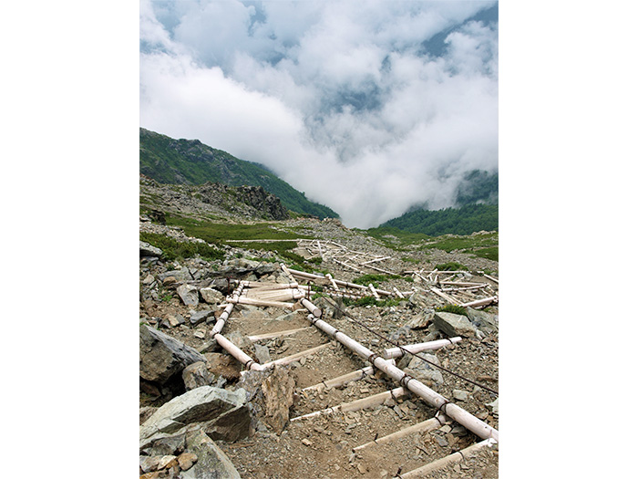
View of Mt. Kita-dake