Shirane-oike-koya Route
1.Hirogawara~Shirane-oike-koya junction ~ Shirane-oike-koya-Mouninta hut ~ Kotaro o’ne junction ~ Kita-dake Katano-koya Mountain hut ~ Mt. Kita-dake ~ Kita-dake Katano-koya Mountain hut ~ Kotaro o’ne junction ~ Shirane-oike-koya-Mouninta hut ~ Hirogawara
Technical level: B
Physical strength level: 5
Difficulty level: ⛰️⛰️⛰️
From Shirane-oike-koya Mountain hut, climb a steep trail through a forest zone and merge onto an enjoyable ridgeline to the summit.
Access to Hirogawara from Ashiyasu
●Hiking Data
Schedule: One night two days
Walking hours: 10 hours 45 minutes
(Up: 6 hours 25 minutes/Down: 4 hours 20 minutes)
Walking Distance: 10.9 km
Difference in elevation: 1,758 m
Hirogawara

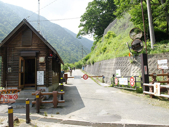
Elevation 1,520m
↓ 25 minutes
Shirane-oike-koya junction
Elevation 1,590m
↓ 2 hours 10 minutes
Shirane-oike-koya-Mountain hut
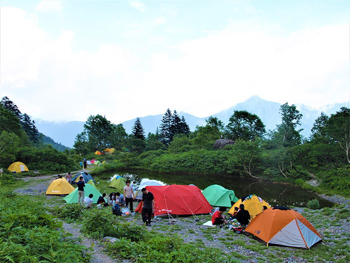
Elevation 2,236m
↓ 2 hours 30 minutes
Kotaro o’ne junction
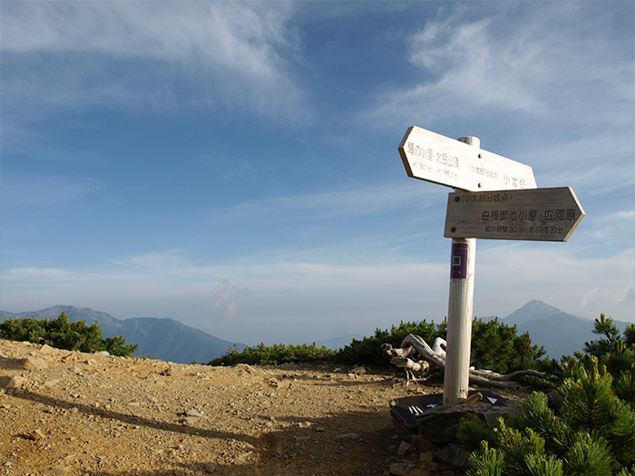
Elevation 2,890m
↓ 30 minutes
Kita-dake Kata-no-koya Mountain hut

Elevation 3,000m
↓ 50 minutes
Mt.Kita-dake
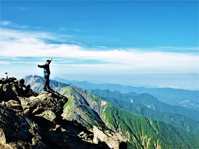
Elevation 3,193m
↓ 40 minutes
Kita-dake Kata-no-koya Mountain hut
Elevation 2,843m
↓ 20 minutes
Kotaro o’ne junction
Elevation 2,890m
↓ 1hour 30 minutes
Shirane-oike-koya-Mountain hut
Elevation 2,236m
↓ 1hour 50 minutes
Hirogawara
Elevation 1,520m
Route Guide
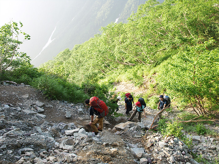
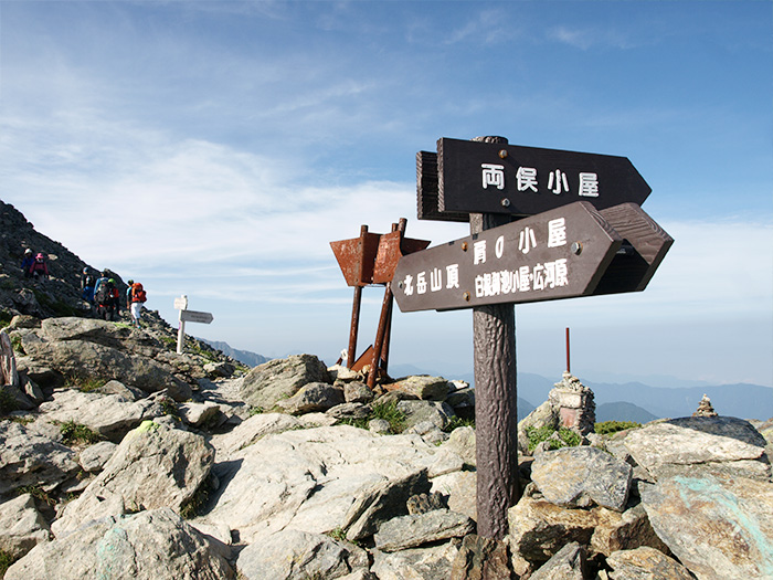
Get off the bus at Hirogawara and walk towards Kitazawa pass after passing the gate. Shortly the trail comes to a bridge on the left to cross Noro river. From the left of Hirogawara-sanso Mountain hut, walk on the left bank of O-kanba sawa stream to a junction of Shirane-oike-koya. The trail on the left goes to Mt. Kita-dake via O-kanbasawa. Take the trail on the right this time. At the beginning, walk along the stream. After a while, the trail merges onto the ridgeline. It is a steep trail. The trail comes to stairs-like slopes or wooden steps. It is entirely an ascending trail, covered by trees with no view. There are no outstanding marks along the trail, however, Daiichi, the first bench, at an elevation of 1,880 m and Daini, the second bench at an elevation of 2,160 m may be resting spots. Time is scheduled as 2 hours 10 minutes for these zones, however, if you can hike at a good tempo, it may take about 1 hour 40 minutes. When the trail comes to a collapsed area, Shirane-oike-koya-Mountain hut is reached. From here, it takes about 2 hours 30 minutes on a steep slope to the ridgeline to the summit. Take a short break in an open space in front of the hut. The buttress and the ridgeline of Happonba can be seen.
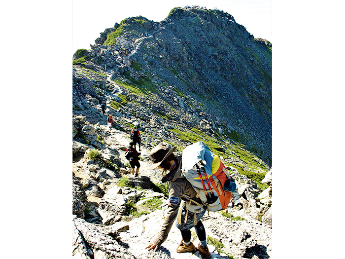
From Shirane-oike-koya-Mountain hut, climb 650 m in altitude. It is called Kusa-suberi, slipping, due to the sequence of steep slopes. However, the trail is well-maintained. Bear in mind that you are ascending, and it does actually help you climb through the slopes without over exhaustion. Rest while standing when you feel tired and keep moving forward. At Kotaro o’ne junction, the trail merges onto Kotaro o’ne. Take the left trail. It is a wide and stable ridgeline with a great view. In your direction, above Katano-koya Mountain hut, the trail to Mt. Kita-dake can be seen. When looking back, Mt. Kai-koma-gatake can be seen. Also, a flower field spreads out and Shinano-kibai or Hakusan-ichige can be enjoyed. While enjoying the views and alpine plants, Kita-dake Katano-koya Mountain hut is reached. It is recommended that you stay for the night.
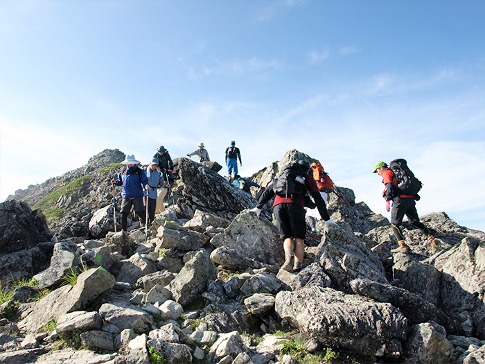
On the next day, start before sunrise to the summit. Leave unnecessary items at the hut. Walk on the rocky ridgeline. When the trail splits widely to the left, the summit of Mt. Kita-dake can be spotted. Hikers on the summit can be seen as well. The summit is rocky but surprisingly wide and suitable for taking a break. The view of Mt. Fuji-yama and the South Japan Alps can be enjoyed. For descending, return to the summit and pick up your belongings and follow the same trail used for ascending.