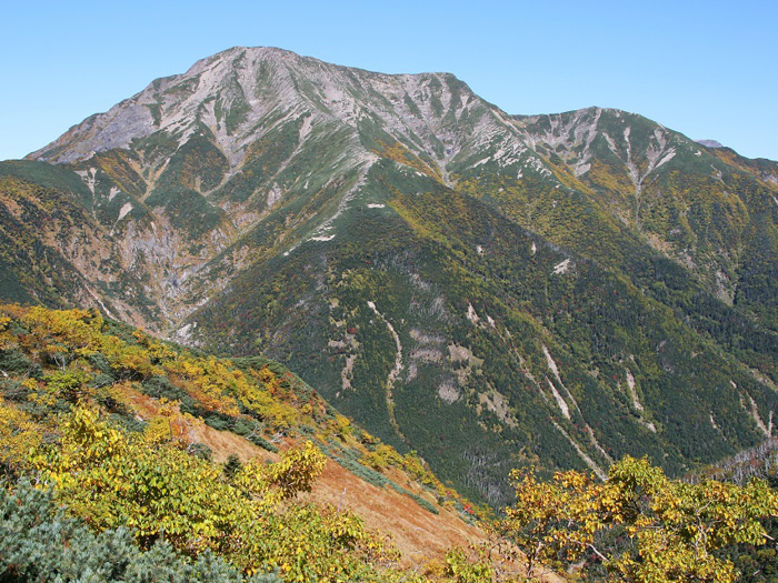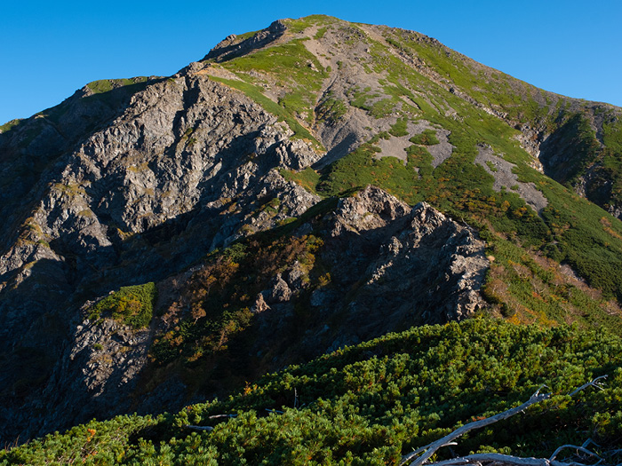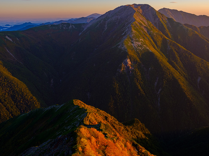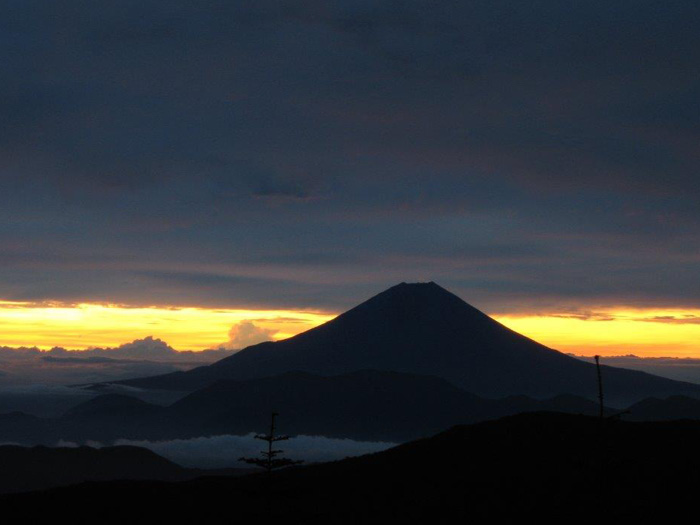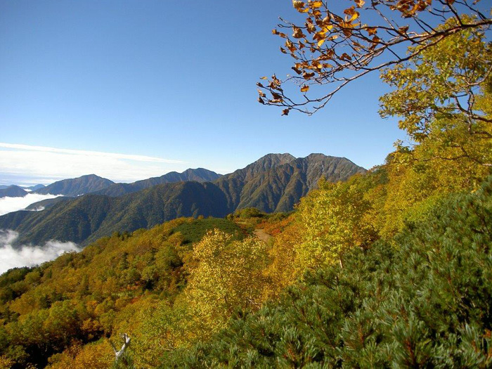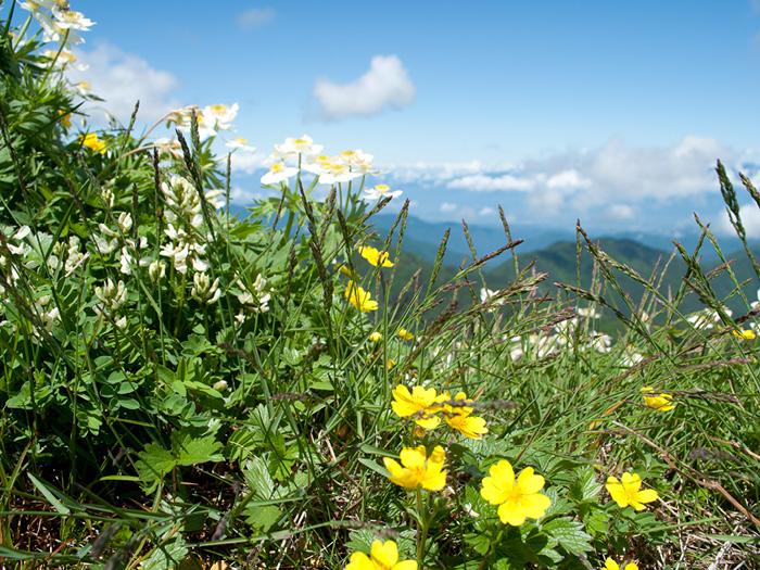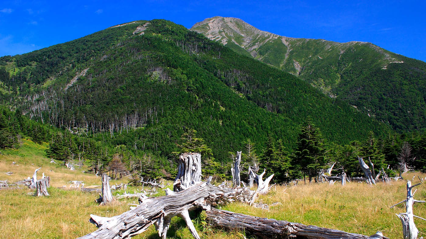
Mt. Hijiri-dake stands at a prefecture borderline between the northern Shizuoka prefecture and the southeast Nagano prefecture, locating in the most southern point of the Southern Japan Alps at an elevation of 3,000 m. A mountain, locating at the most southern point in Japan, at an elevation higher than 3,000 m is Mt. Fuji-yama. The feminine shape of the mountain stands with grace. Due to the difficult access to the area, untouched nature still remains there. Unlike the Northern Japan Alps, this area seems to be still growing. The forest is covered with deep green and spreads widely. There are many forests in the area, which resemble European forests.
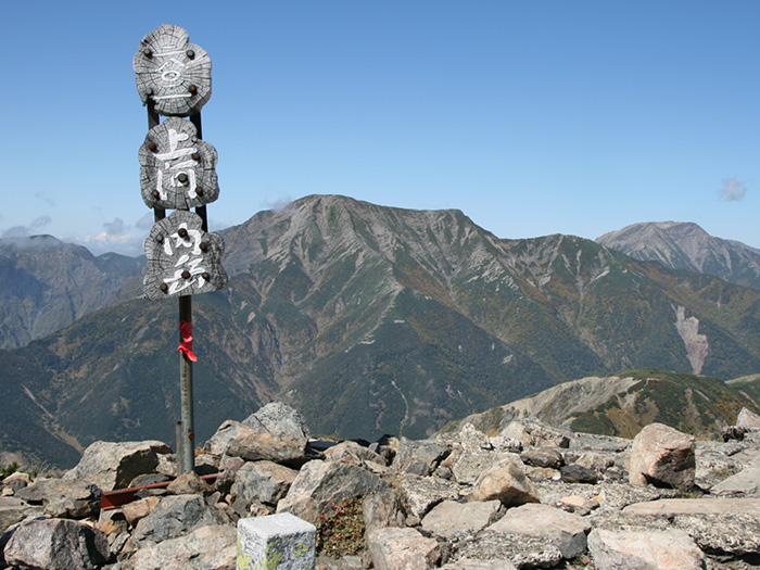
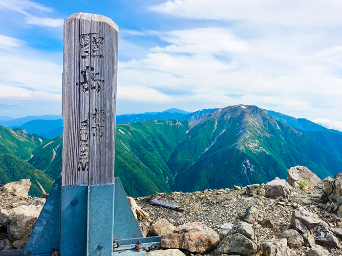
Mt. Hijiri-dake: Elevation 3,013 m
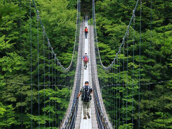
The quickest route to Mt. Hijiri-dake is a course from Iroudo via the Seiko koya Mountain hut (closed), Koke-daira and the Hijiri-daira koya Mountain hut. Many hikers enjoy this route. However, compared with the northern mountains in the Southern Japan Alps, the trail will not get too crowded even during the busiest hiking season. Seiko koya Mountain hut used to be accessible by cars or taxi, however, now, cars or taxis can travel only as far as the Shibasawa-gate for now.
The difficult access of the trailhead has made fewer people hike by this route these days.
Three routes to Mt. Hijiri-dake are introduced here.
①Hata-nagi Daiichi Dam ~ Mt. Chausu-dake Trailhead ~ Mt. Chausu-dake ~ Mt. Hijiri-dake round trip
③Shiba-sawa Gate ~ Tayori-ga-shima ~ Hijiri-daira-koya Mountain hut ~ Mt. Hijiri-dake round trip
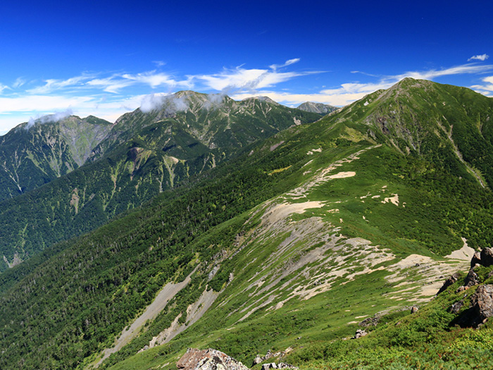
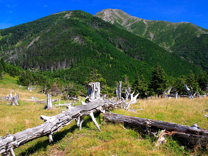
By any routes, the beauty of the Southern Japan Alps can be admired.
Trailhead vicinity weather
Weekly weather forecast zone:Chubu region, Shizuoka prefecture
| DAY | WEATHER | LOWEST | HIGHEST |
|---|---|---|---|
| 7/20 | 24℃ | 31℃ | |
| 7/21 | 26℃ | 33℃ | |
| 7/22 | 26℃ | 33℃ | |
| 7/23 | 26℃ | 33℃ | |
| 7/24 | 25℃ | 33℃ | |
| 7/25 | 25℃ | 32℃ |
This is a publication of the calculated figures for weather predictions and is not the weather forecast. There are instances where there will be big differences in the values stated for the mountains, in accord with the topography as well as sunlight, etc. so please take care.
72 hours weather information:Sawarajima Lodge, 1301-4 Tashiro, Aoi Ku, Shizuoka City, Shizuoka Prefecture
| Date and time |
7/19 8:00 |
7/19 9:00 |
7/19 10:00 |
7/19 11:00 |
7/19 12:00 |
7/19 13:00 |
7/19 14:00 |
7/19 15:00 |
7/19 16:00 |
7/19 17:00 |
7/19 18:00 |
7/19 19:00 |
7/19 20:00 |
7/19 21:00 |
7/19 22:00 |
7/19 23:00 |
7/20 0:00 |
7/20 1:00 |
7/20 2:00 |
7/20 3:00 |
7/20 4:00 |
7/20 5:00 |
7/20 6:00 |
7/20 7:00 |
7/20 8:00 |
7/20 9:00 |
7/20 10:00 |
7/20 11:00 |
7/20 12:00 |
7/20 13:00 |
7/20 14:00 |
7/20 15:00 |
7/20 16:00 |
7/20 17:00 |
7/20 18:00 |
7/20 19:00 |
7/20 20:00 |
7/20 21:00 |
7/20 22:00 |
7/20 23:00 |
7/21 0:00 |
7/21 1:00 |
7/21 2:00 |
7/21 3:00 |
7/21 4:00 |
7/21 5:00 |
7/21 6:00 |
7/21 7:00 |
7/21 8:00 |
7/21 9:00 |
7/21 10:00 |
7/21 11:00 |
7/21 12:00 |
7/21 13:00 |
7/21 14:00 |
7/21 15:00 |
7/21 16:00 |
7/21 17:00 |
7/21 18:00 |
7/21 19:00 |
7/21 20:00 |
7/21 21:00 |
7/21 22:00 |
7/21 23:00 |
7/22 0:00 |
|---|---|---|---|---|---|---|---|---|---|---|---|---|---|---|---|---|---|---|---|---|---|---|---|---|---|---|---|---|---|---|---|---|---|---|---|---|---|---|---|---|---|---|---|---|---|---|---|---|---|---|---|---|---|---|---|---|---|---|---|---|---|---|---|---|---|
| Weather | |||||||||||||||||||||||||||||||||||||||||||||||||||||||||||||||||
| Temperature | 14℃ | 16℃ | 17℃ | 18℃ | 18℃ | 19℃ | 19℃ | 19℃ | 19℃ | 19℃ | 18℃ | 17℃ | 16℃ | 15℃ | 15℃ | 14℃ | 14℃ | 14℃ | 14℃ | 13℃ | 13℃ | 12℃ | 13℃ | 14℃ | 16℃ | 18℃ | 19℃ | 19℃ | 20℃ | 20℃ | 19℃ | 19℃ | 19℃ | 19℃ | 18℃ | 18℃ | 17℃ | 16℃ | 15℃ | 15℃ | 15℃ | 16℃ | 15℃ | 14℃ | 14℃ | 14℃ | 14℃ | 15℃ | 17℃ | 19℃ | 19℃ | 20℃ | 19℃ | 18℃ | 18℃ | 18℃ | 18℃ | 18℃ | 18℃ | 18℃ | 17℃ | 17℃ | 16℃ | 16℃ | 16℃ |
| Precipitation | 0mm/h | 0mm/h | 0mm/h | 0mm/h | 0mm/h | 0mm/h | 0mm/h | 0mm/h | 0mm/h | 0mm/h | 0mm/h | 0mm/h | 0mm/h | 0mm/h | 0mm/h | ※ 16時間以降は表示されません | |||||||||||||||||||||||||||||||||||||||||||||||||
| Wind direction |
north-northwest 1m/s |
north-northwest 1m/s |
north-northwest 1m/s |
north-northwest 2m/s |
north-northwest 2m/s |
north-northwest 2m/s |
north-northwest 2m/s |
north-northwest 2m/s |
north-northwest 1m/s |
north-northwest 1m/s |
north-northwest 1m/s |
north-northwest 1m/s |
north-northwest 1m/s |
north-northwest 1m/s |
north-northwest 1m/s |
north-northwest 1m/s |
north-northwest 1m/s |
north-northwest 1m/s |
north-northwest 1m/s |
north-northwest 1m/s |
north-northwest 1m/s |
north-northwest 1m/s |
north-northwest 1m/s |
north-northwest 1m/s |
0m/s |
north-northwest 1m/s |
north-northwest 1m/s |
north-northwest 1m/s |
north-northwest 1m/s |
north-northwest 1m/s |
north-northwest 1m/s |
north-northwest 1m/s |
north-northwest 1m/s |
north-northwest 1m/s |
north-northwest 1m/s |
north-northwest 1m/s |
north-northwest 1m/s |
north-northwest 1m/s |
north-northwest 1m/s |
north-northwest 1m/s |
north-northwest 1m/s |
0m/s |
north-northwest 1m/s |
north-northwest 1m/s |
north-northwest 2m/s |
north-northwest 1m/s |
north-northwest 1m/s |
north-northwest 1m/s |
north-northwest 1m/s |
0m/s |
north-northwest 1m/s |
north-northwest 1m/s |
north-northwest 1m/s |
north-northwest 1m/s |
0m/s |
north-northwest 1m/s |
0m/s |
north-northwest 1m/s |
north-northwest 1m/s |
north-northwest 1m/s |
north-northwest 2m/s |
north-northwest 1m/s |
north-northwest 1m/s |
north-northwest 1m/s |
north-northwest 1m/s |
※The weather information will be information on 5km square including the relevant point.
※天気予報マークは一次細分区域から表示しています
View of Mt. Hijiri-dake