Iroudo Route
③Shiba-sawa gate ~ Iroudo ~ Nishi-sawa-watari ~ Azami-batake ~ Hijiri-daira-koya Mountain hut ~ Mt. Hijiri-dake ~ Azami-batake ~ Nishi-sawa-watari ~ Siba-sawa gate
Technical level: C
Physical strength level: 8
Difficulty level: ⛰️⛰️⛰️⛰️
The quickest route to Mt. Hijiri-dake
Enjoy a one night two days hiking schedule.
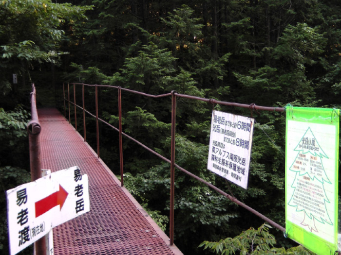
Access to Iroudo from Shibasawa
●Hiking Data
Schedule: One night two days
Walking hours: 17 hours 50 minutes
(Up: 10 hours 35 minutes/Down: 7 hours 15 minutes)
Walking distance: 30 km
Difference in elevation: 3,335 m
Shiba-sawa gate
Elevation 710m
↓ 1hour 30 minutes
Iroudo

Elevation 880m
↓ 1 hour 15 minutes
Nishi-sawa-watari
Elevation 1,100m
↓ 4hours 30 minutes
Azami-batake
Elevation 2,400m
↓ 25 minutes
Hijiri-daira-koya Mountain hut
Elevation 2,265m
↓ 2hours 55 minutes
Mt. Hijiri-dake
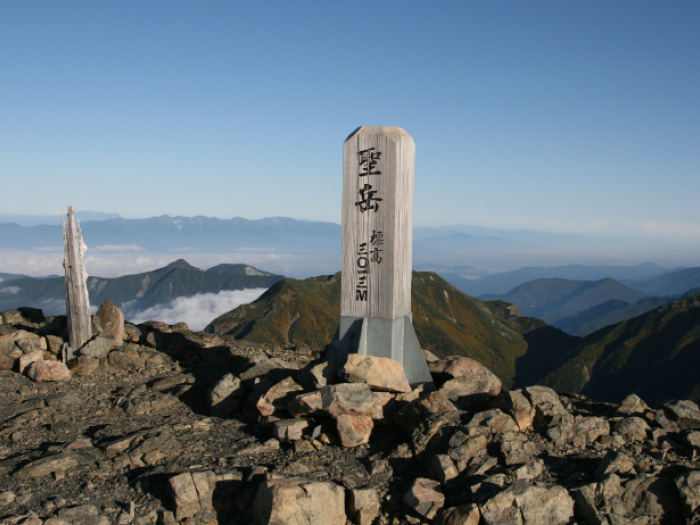
Elevation 3,013m
↓ 1hour 30 minutes
Azami-batake
Elevation 2,400m
↓ 3 hours
Nishi-sawa-watari
Elevation 1,100m
↓ 2 hours 45 minutes
Shiba-sawa gate
Elevation 710m
Route Guide
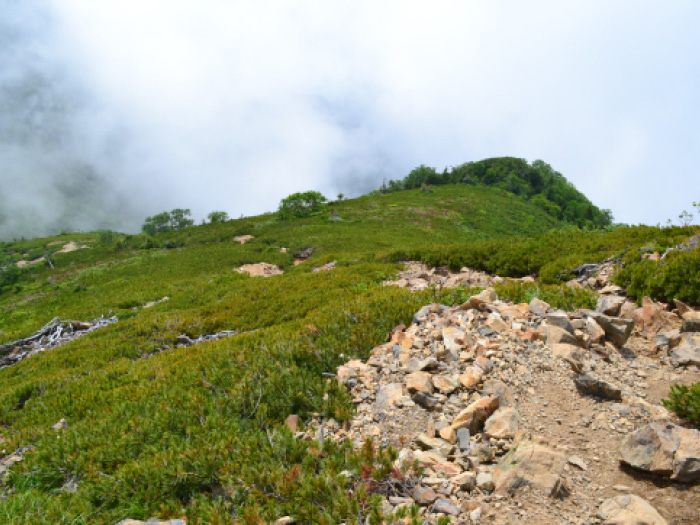
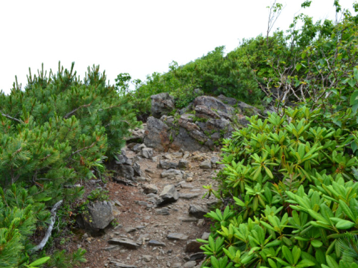
Start walking on the logging road from Shiba-sawa gate. It is a long slope trail. At Iroudo, a descending trail from Mt. Iroudo-dake joins the trail from your right side. Proceed straight on the trail while looking at the descending trail. Tayori-ga-shima hiroba is reached soon. Seiko koya Mountain hut at the place is closed. Proceed on the logging road and walk through a small tunnel. The logging road used to have rails laid to carry out trees. The trail goes along contour lines on the slope. Nisi-sawa-watari is reached after crossing two bridges. Cross Nishi-sawa by a small bridge. When the river water is high, use a palanquin called Wired Rope Way. After crossing Nishi-sawa, the trail becomes steep ridgeline. It is a graveled trail but fairly stable. As you proceed, the trail becomes more stable but steep with no open views. Azami-batake is reached by the time you become bored with walking the trail with no views. Some hikers leave their backpacks to take a round trip to Mt. Hijiri-dake. It’s recommended to check in at Hijiri-daira koya Mountain hut.
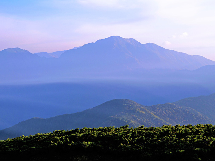
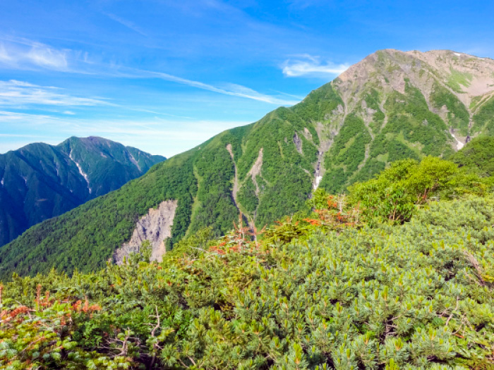
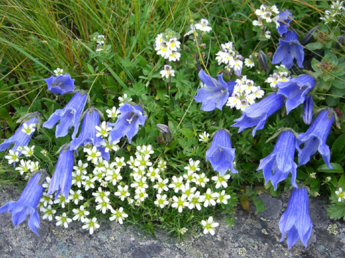
Start early on the next day. Return to Azami-batake and head out to Mt. Hijiri-dake.The trail will be covered by gravel and Pinus Pumila after passing low Betula Ermani forest. The view becomes clearer and the dynamic shapes of Mt. Kamikouchi-dake and Mt. Chausu-dake come into your sight. From Mt. Kojiri-dake, Mt. Hijiridake will be in front of you. Descend on the trail and start climbing up on the main part of Mt. Hijiri-dake. Stellaria Nipponica, Stellaria ruscifolia, and Gentiana Algida are in bloom along the trail. Ascend in a zigzag pattern.
Rest while standing when you become out of breath. The summit of Mt. Hijiri-dake is broad in its west to east topography. Mt. Akaishi-dake, Mt. Shiomi-dake, and Mt. Senjyou-dake can be seen. On your left side, the Northern Japan Alps and the Central Japan Alps can also be seen. Enjoy the view and lunch at the summit. Descend the same trail used for ascending to Shiba-sawa gate. Descend at a steady pace.