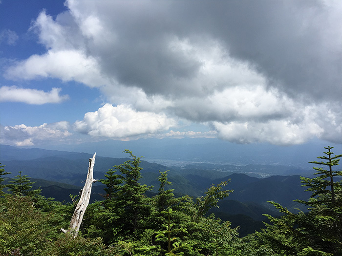
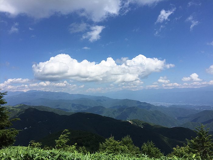
This mountain is located at the most southern point of the Central Alps. It sits on the border between Nagano and Gifu prefectures and looks down on the city of Nakatsugawa. When looking from Noubi-heiya, the mountain looks like a big hair comb. It is the highest peak in the Minou area. Its name comes from the history that the ena, or afterbirth, was committed to this mountain when Emperor Tensho was born. It is also called Mt. Funafuse-yama from its similar appearance to a funa, when the boat is placed upside down, “fuse.” From Shinshu side, it is also called Mt. Nokuma-yama. The elevation is 2,191 m. The summit is flat, skinny and long. It has been known as a site for mountain worship from long time ago. Katsuragi-sya, Kumano-sya, Jinmei-sya, Tsurugi-sya, and Rokusetsu-sya have been placed in the mountain. Trees of this mountain had to be used as a sacred trees or timbers for Isetaibyo-O-nusa. To these days, local people have loved this mountain.
Mt. Ena-san: Elevation 2,191 m
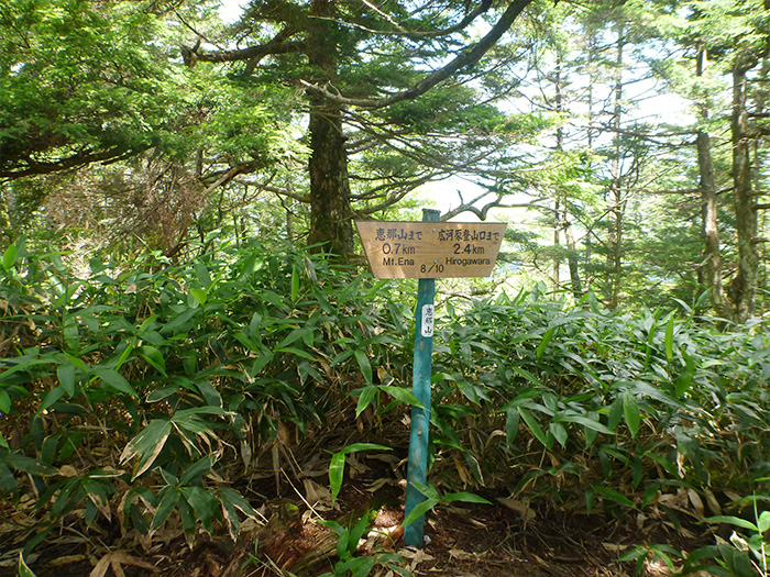
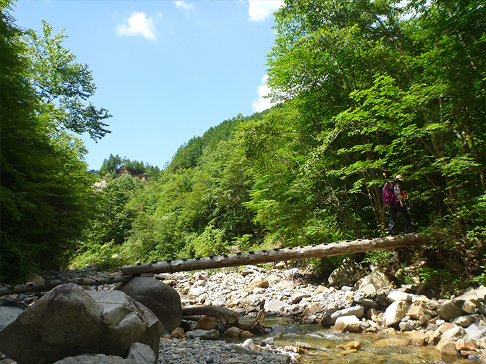
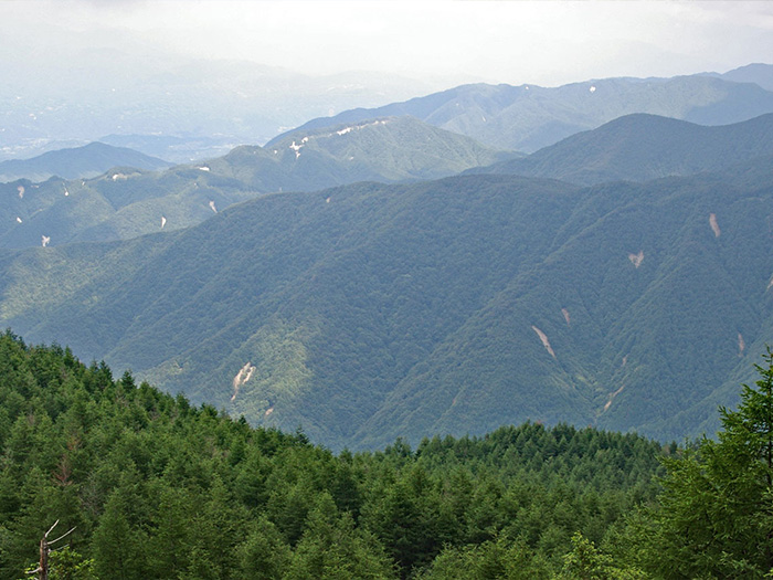
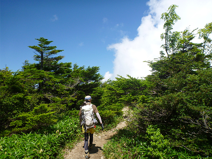
This mountain is categorized as the first triangulation mountain, however, the view from the summit is covered by spruce and kome-tsuga and not widely open. The North and South Alps and Mt. Fuji-yama can be spotted from the back of Sancho-koya Mountain hut, located at the summit. There are many coniferous forests such as cypress or fir these days, however, there used to be cypres or fir in the Edo era. Walter Weston climbed the summit on May 11th, 1893 (Meiji 26) and that made this mountain known globally. On May 11th every year, the Weston festival has been held by Nakatsugawa city sightseeing association to celebrate his achievement. There are three courses, one from Hirogawara to a ridgeline, one from Misaka pass to the prefecture borderline between Nagano and Gifu, and the other from Kuroi-sawa via the logging road. One from Hirogawara and another from Kuroi-sawa will be introduced here. It is recommended that you visit this mountain in your own car because public transportation takes a long time to get there. The starting point for both routes is the parking lot at the bottom of the mountain.
Trailhead vicinity weather
Weekly weather forecast zone:Gifu Prefecture Mino
| DAY | WEATHER | LOWEST | HIGHEST |
|---|---|---|---|
| 7/16 | 24℃ | 33℃ | |
| 7/17 | 25℃ | 32℃ | |
| 7/18 | 23℃ | 35℃ | |
| 7/19 | 22℃ | 35℃ | |
| 7/20 | 23℃ | 35℃ | |
| 7/21 | 23℃ | 35℃ |
This is a publication of the calculated figures for weather predictions and is not the weather forecast. There are instances where there will be big differences in the values stated for the mountains, in accord with the topography as well as sunlight, etc. so please take care.
72 hours weather information:Nakatsugawa, Nakatsugawa City, Gifu Prefecture, Japan Kuroisawa Ascent Yamaguchi
| Date and time |
7/15 7:00 |
7/15 8:00 |
7/15 9:00 |
7/15 10:00 |
7/15 11:00 |
7/15 12:00 |
7/15 13:00 |
7/15 14:00 |
7/15 15:00 |
7/15 16:00 |
7/15 17:00 |
7/15 18:00 |
7/15 19:00 |
7/15 20:00 |
7/15 21:00 |
7/15 22:00 |
7/15 23:00 |
7/16 0:00 |
7/16 1:00 |
7/16 2:00 |
7/16 3:00 |
7/16 4:00 |
7/16 5:00 |
7/16 6:00 |
7/16 7:00 |
7/16 8:00 |
7/16 9:00 |
7/16 10:00 |
7/16 11:00 |
7/16 12:00 |
7/16 13:00 |
7/16 14:00 |
7/16 15:00 |
7/16 16:00 |
7/16 17:00 |
7/16 18:00 |
7/16 19:00 |
7/16 20:00 |
7/16 21:00 |
7/16 22:00 |
7/16 23:00 |
7/17 0:00 |
7/17 1:00 |
7/17 2:00 |
7/17 3:00 |
7/17 4:00 |
7/17 5:00 |
7/17 6:00 |
7/17 7:00 |
7/17 8:00 |
7/17 9:00 |
7/17 10:00 |
7/17 11:00 |
7/17 12:00 |
7/17 13:00 |
7/17 14:00 |
7/17 15:00 |
7/17 16:00 |
7/17 17:00 |
7/17 18:00 |
7/17 19:00 |
7/17 20:00 |
7/17 21:00 |
7/17 22:00 |
7/17 23:00 |
7/18 0:00 |
|---|---|---|---|---|---|---|---|---|---|---|---|---|---|---|---|---|---|---|---|---|---|---|---|---|---|---|---|---|---|---|---|---|---|---|---|---|---|---|---|---|---|---|---|---|---|---|---|---|---|---|---|---|---|---|---|---|---|---|---|---|---|---|---|---|---|---|
| Weather | ||||||||||||||||||||||||||||||||||||||||||||||||||||||||||||||||||
| Temperature | 19℃ | 19℃ | 20℃ | 20℃ | 20℃ | 20℃ | 20℃ | 21℃ | 21℃ | 21℃ | 21℃ | 21℃ | 19℃ | 19℃ | 18℃ | 18℃ | 18℃ | 18℃ | 18℃ | 18℃ | 18℃ | 18℃ | 18℃ | 18℃ | 19℃ | 19℃ | 19℃ | 20℃ | 20℃ | 21℃ | 21℃ | 21℃ | 20℃ | 20℃ | 20℃ | 19℃ | 19℃ | 19℃ | 19℃ | 19℃ | 19℃ | 19℃ | 19℃ | 19℃ | 19℃ | 19℃ | 19℃ | 18℃ | 18℃ | 18℃ | 18℃ | 18℃ | 19℃ | 19℃ | 19℃ | 19℃ | 18℃ | 18℃ | 18℃ | 18℃ | 18℃ | 18℃ | 18℃ | 18℃ | 17℃ | 17℃ |
| Precipitation | 15mm/h | 11mm/h | 4mm/h | 7mm/h | 0mm/h | 0.4mm/h | 0mm/h | 0mm/h | 0mm/h | 0mm/h | 0mm/h | 0mm/h | 0mm/h | 0mm/h | 0mm/h | ※ 16時間以降は表示されません | ||||||||||||||||||||||||||||||||||||||||||||||||||
| Wind direction |
southeast 3m/s |
southeast 3m/s |
southeast 3m/s |
southeast 1m/s |
southeast 2m/s |
southeast 2m/s |
southeast 2m/s |
southeast 2m/s |
southeast 2m/s |
southeast 2m/s |
southeast 2m/s |
southeast 2m/s |
southeast 2m/s |
southeast 2m/s |
southeast 2m/s |
southeast 2m/s |
southeast 2m/s |
southeast 2m/s |
southeast 2m/s |
southeast 2m/s |
southeast 2m/s |
southeast 2m/s |
southeast 2m/s |
southeast 2m/s |
southeast 2m/s |
southeast 2m/s |
southeast 2m/s |
southeast 2m/s |
southeast 2m/s |
southeast 2m/s |
southeast 2m/s |
southeast 2m/s |
southeast 2m/s |
southeast 2m/s |
southeast 2m/s |
southeast 2m/s |
southeast 2m/s |
southeast 2m/s |
southeast 2m/s |
southeast 2m/s |
southeast 2m/s |
southeast 1m/s |
southeast 1m/s |
southeast 2m/s |
southeast 2m/s |
southeast 2m/s |
southeast 2m/s |
southeast 2m/s |
southeast 2m/s |
southeast 2m/s |
southeast 2m/s |
southeast 2m/s |
southeast 2m/s |
southeast 2m/s |
southeast 2m/s |
southeast 2m/s |
southeast 2m/s |
southeast 2m/s |
southeast 2m/s |
southeast 2m/s |
southeast 2m/s |
southeast 2m/s |
southeast 2m/s |
southeast 2m/s |
southeast 2m/s |
southeast 2m/s |
※The weather information will be information on 5km square including the relevant point.
※天気予報マークは一次細分区域から表示しています
View of Mt. Ena-san