Minekoshi Route
①Minekoshi-rindo-gate ~ Hirogawara trailhead ~ Elevation 1,710 m point ~ Elevation 2,071 m point ~ Mt. Ena-san ~ Elevation 2,071 m point ~ Hirogawara trailhead ~ Minekoshi-rindo-gate
Technical level: B
Physical strength level: 3
Difficulty level: ⛰️⛰️
Let’s hike to the summit of Mt. Ena-san via a basic route
Access to Hirogawara (Mt. Ena-san)
●Hiking Data
Schedule: One day
Walking hours: 7 hours 15 minutes
(Up: 4 hours 20 minutes/Down: 2 hours 55 minutes)
Walking distance: 11.3 km
Difference in elevation: 1,176 m
Minekoshi-rindo-gate

Elevation 1,135m
↓ 40 minutes
Hirogawara trailhead
Elevation 1,250m
↓ 1hour 40 minutes
Elevation 1,710 m point
Elevation 1,710m
↓ 1hour 20 minutes
Elevation 2,071 m point
Elevation 2,071m
↓ 40 minutes
Mt. Ena-san
Elevation 2,191m
↓ 30 minutes
Elevation 2,071 m point
Elevation 2,191m
↓ 1hour 50 minutes
Hirogawara trailhead
Elevation 1,250m
↓ 35 minutes
Minekoshi-rindo-gate
Elevation 1,135m
Route Guide
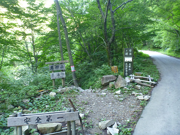
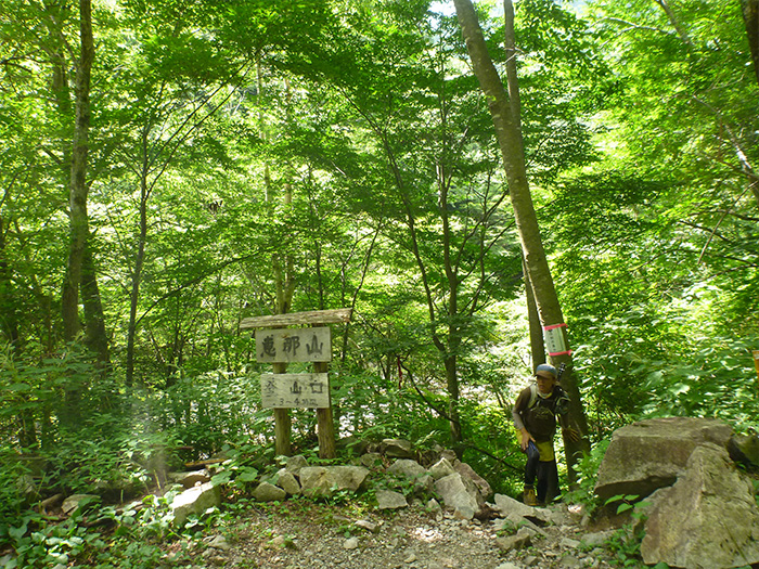
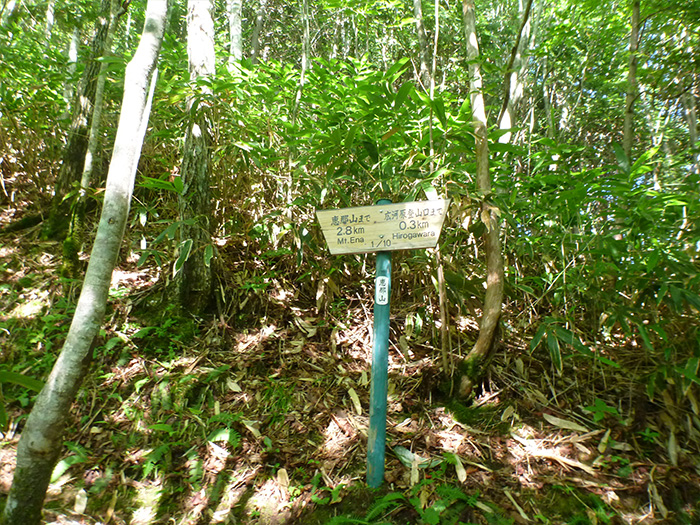
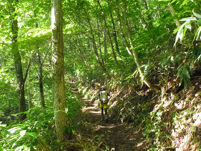
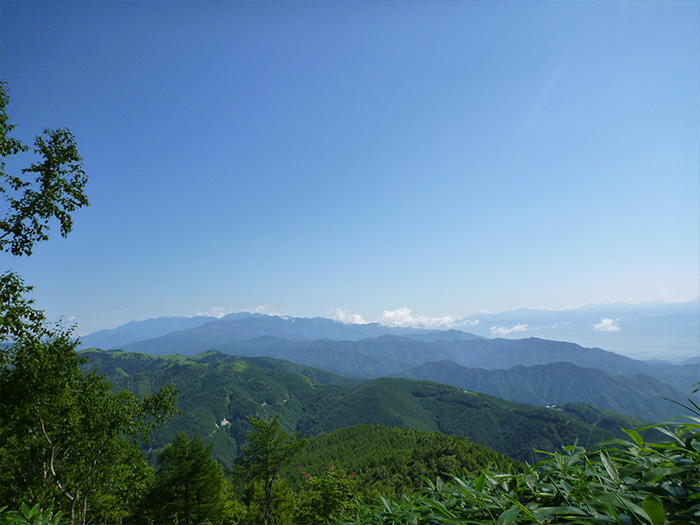
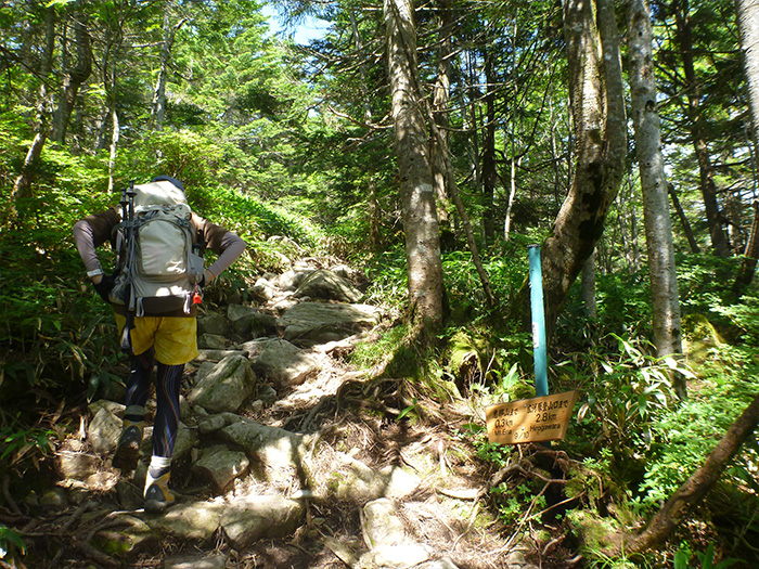
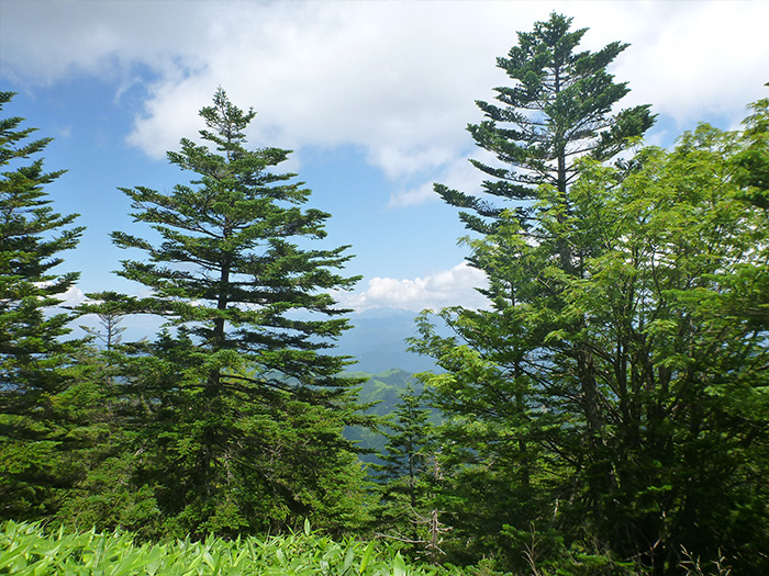
Many hikers approach the summit via this route. At the end of the Minekoshi route, there is a parking lot and toilets by the gate. Please do warm-up exercise before you start. A post box is located at the gate so make sure that you submit a hiking registration. From the gate, start walking on the logging road. Use the 40 minute hike to prepare your body. Walk at a steady pace while enjoying the therapeutic walk in the forest. Hirogawara will be reached by the time your body warms up. The trail becomes very steep from this point but the trail itself is well maintained. Walk at a steady pace and avoid over-exhaustion. The trail is covered by larches. Even with an even pace, you can tell that you are gaining elevation very quickly. From point to point, the view become wider and the South Alps and the big shape of Mt. Utsuki-dake can be spotted. Those points are good places to take a break. Pass the 1,716 m elevation point. The trail becomes less steep from this point. However, it still takes more than one hour to the summit, so maintain a steady pace. Mt. Ena-san becomes shinier in the fall foliage season than in the early spring. You can tell that as the elevation grows higher, the view beneath your feet becomes wider.
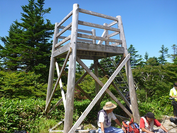
After passing the 2,071 m elevation point, the ridgeline takes a wide turn to the right. The trail merges into the ridgeline of the summit. The trail becomes less steep and the summit of Mt. Ena-san is reached. Shorter trees such as Azaleas are spotted around the summit. A lookout tower has been set up, however, the view is not that great. Mt. Ena-san is categorized as the first triangulation mountain, however, the highest point is set ahead of the summit. If you visit during weekdays, you may be able to enjoy the quiet all by yourself. Descend the same trail used for ascending. The downhill is very steep so caution must be employed to avoid falling.