Narada Route
①Narada ~ Daimonzawa trailhead ~ pass ~ Daimonzawa-koya Mountain hut ~ Daimonzawa descending point ~ Mt. Noutori-dake ~ Noutori-koya Mountain hut ~ Mt. Aino-dake ~ Mt. Noutori-dake ~ Daimonzawa descending point ~ Narada
Technical level: C
Physical strength level: 8
Difficulty level: ⛰️⛰️⛰️⛰️
After ascending through a forest zone with no open view, hike on an open ridgeline.
●Hiking Data
Schedule: two nights and three days
Walking hours: 21 hours 35 minutes
(Up: 11 hours 55 minutes/Down: 9 hours 40 minutes)
Walking distance: 27.0 km
Difference in elevation: 3,496 m
Narada bus stop
Elevation 830m
↓ 1 hour 5 minutes
Daimonzawa trailhead
Elevation 1,050m
↓ 1 hour 50 minutes
Pass
Elevation 1,500m
↓ 1 hour 15 minutes
Daimonzawa-koya Mountain hut

Elevation 1,710m
↓ 3 hours 35 minutes
Daimonzawa descending point
Elevation 2,828m
↓ 1hour
Mt. Notori-dake
Elevation 3,025m
↓ 1hour 40 minutes
Notori-koya Mountain hut
Elevation 2,813m
↓ 1hour 30 minutes
Mt. Aino-dake
Elevation 3,190m
↓ 3 hours
Mt. Notori-dake
Elevation 3,025m
↓ 40 minutes
Daimonzawa descending point
Elevation 2,828m
↓ 6 hours
Narada bus stop
Elevation 830m

Route Guide
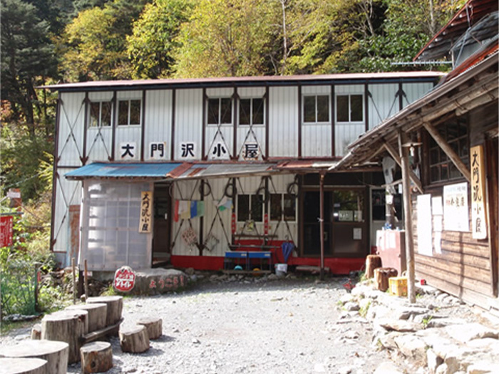
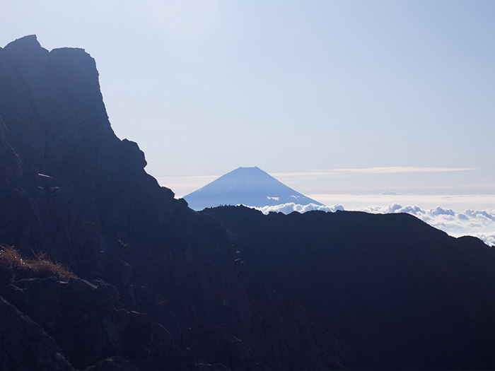
From Narada bus stop walk 30 minutes on a logging road. From Narada Daiichi power plant, proceed on the logging road along the branch of the Hayakawa river. It is a boring road but maintain a steady pace. Pass a resting point where a post box is located and Daimonzawa trailhead is reached. From this point, the load becomes a mountain trail. Cross three hanging bridges. After passing a sluice gate of the Hayakawa hydroelectric power plant, cross the river, following inked signs. After crossing the river a few times, the trail enters into a forest zone. Use caution when crossing unstable bridges and cross the river. The pass is reached after a while. Cross a simple bridge made of steel pipes and another small rustic bridge. You have arrived at the Daimonzawa koya Mountain hut. It is recommended that you end your hike today here and stay for the night. Mt. Fuji-yama can be seen from the front of the hut.
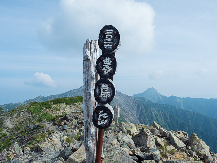
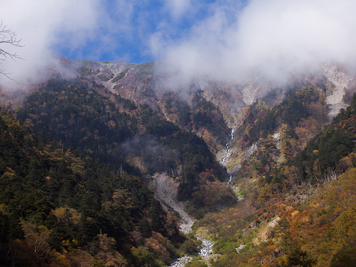
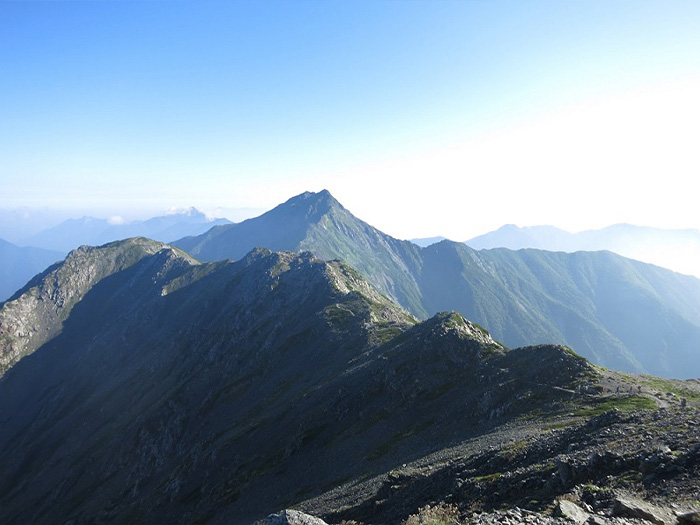
On day 2, climb to Mt Aino-dake and stay at Noutori koya Mountain hut. The number of walking hours is about 8 hours and 10 minutes. Depart from the hut before sunrise. Make sure that you check in to the Noutori koya Mountain hut around 3 pm. Replenish your water supply at Daimonzawa koya Mountain hut, which is the last place to refill water bottles. Ascend through a coniferous tree forest. Caution must be employed to avoid slipping when crossing the stream for a few times. The trail reaches the upper corner of a scree slope, where the Daimonzawa stream can be seen. Proceed on the trail. The view becomes opens up when entering a Pinus Pumila zone. The Daimonzawa descending point is reached when the graveled trail comes into a zigzag pattern. The point is located in the saddle, where a big steel road sign stands. This Guidance mark may be useful especially in fog when descending. After the descending point, the trail becomes less steep, however, an uphill still continues. The trail merges into a ridgeline so the view becomes open and wide. Proceed on the ridgeline with few ups and downs. The peak that you are aiming for can be spotted in the upper right corner of your sight. When looking back, Mt. Kogouchi-dake can be seen. After passing two small peaks, Mt. Notori-dake is reached. The view of Mt. Shiomi-dake and Mt. Aino-dake is impressive. The Hou Three mountains can be seen up close.
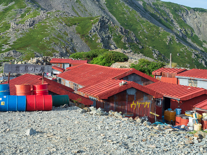
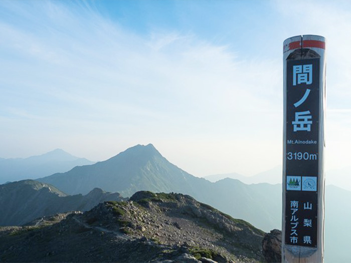
Head to Mt. Nishi-noutori-dake, which is 25 m higher that Mt. Notori-dake. After a short uphill, descend in a zigzag pattern to Noutori-koya Mountain hut. It is recommended that you stay at the hut for the night. Please visit Mt. Aino-dake before the end of the day. Climb the main ridgeline. Follow the inked signs. Pass the road to Mikuni-daira on the left. When getting closer to Mt. Aino-dake, the view towards Mt. Kita-dake becomes wider. The summit of Mt. Aino-dake is wide and a good place to take a break. However, you may get lost easily when it is foggy. Caution must be employed. Mt. Kita-dake can be seen in front of you. Hikers walking on the ridgeline can be spotted as well. Descend the same trail used for ascending to Notori koya Mountain hut. Start early on the following day. Descend the same trail used for ascending to Narada. Do not miss a sign of the Daimonzawa descending point at the junction when descending towards the Narada area from the ridgeline.