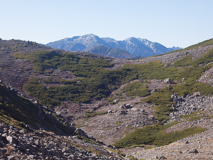
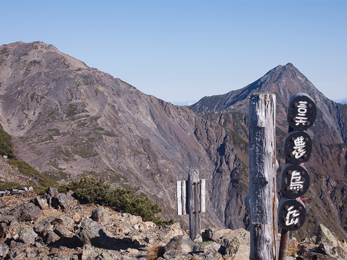
It is located in the west of Yamanashi prefecture and belongs to the Shirane mountains of the Southern Japan Alps. With Mt. Oku-hotaka-dake in the North Japan Alps, it ranks the third highest in Japan. Its large shape stands out among the big mountains in the Southern Alps. It is located facing Mt. Kita-dake, second highest in Japan. A part of the mountain functions as a borderline between Shizuoka prefecture. A ridgeline from Mt. Kita-dake runs towards Mt. Noutori-dake in the south and the sub ridgeline runs to the west to Mt. Mitsumine-dake and leads to Mt. Shiomi-dake. The summit of Mt. Aino-dake is wide so caution must be employed to avoid getting lost, especially when it is foggy. It is said that an area around the summit had fallen off at one point and the elevation of the summit used to be dozens of meters higher.
Mt. Aino-dake: Elevation 3,189 m
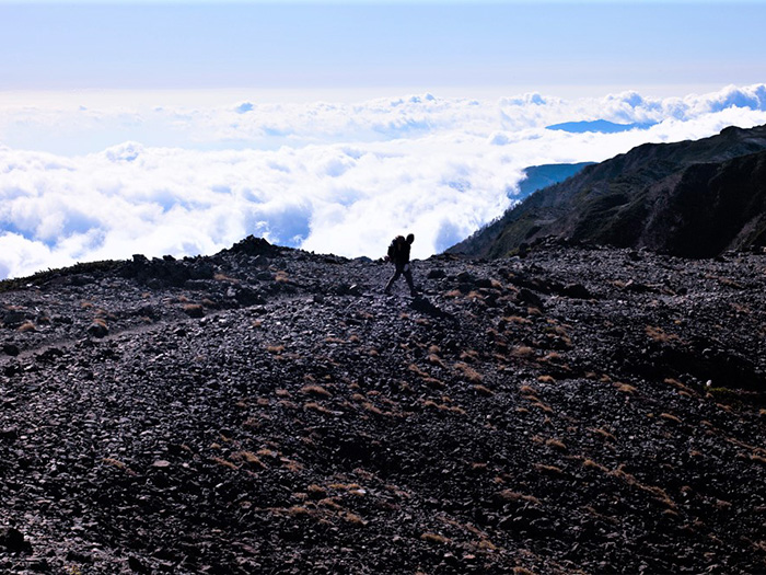
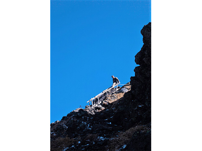
There is no straight route to climb Mt. Aino-dake. Therefore many hikers visit the mountain when they hike from Mt. Kita-dake or Mt. Senjyo-dake to another in the South Japan Alps. For the Shirane three mountains route, it starts from Hirogawara to Mt. Kita-dake ~ Mt. Aino-dake ~ Mt. Noutori-dake or starts from Narada to Mt. Noutori-dake ~ Mt. Aino-dake ~ Mt. Kita-dake. (For a course guide of Mt. Kita-dake ~ Mt. Aino-dake ~ Mt. Noutori-dake, please visit the page of Mt. Kita-dake). Also there are other courses such as one from Mt. Shiomi-dake to Mt. Kita-arakawa-dake ~ Mitsumine ~ Mt. Aino-dake or another from Mt. Senjo-dake to Mt. Ina-arakura-dake ~ Mt. Mitsumine-dake ~ Mt. Aino-dake. Many hikers visit the area even in heavy winter season with snow. In that case, most of them chose to hike on Ikeyama Tsuri o’ne. Some approach from Onashi o’ne or Koubo-koya-o’ne. Regardless of the route, it is essential that one attaches to the summit in a well-organized group. The Narada ~ Mt. Noutori-dake ~ Mt. Aino-dake route will be introduced here. For a route from Mt. Aino-dake ~ Mt. Kita-dake, please visit the page of Mt. Kita-dake.
Trailhead vicinity weather
Weekly weather forecast zone:Western Yamanashi Prefecture
| DAY | WEATHER | LOWEST | HIGHEST |
|---|---|---|---|
| 7/7 | 25℃ | 34℃ | |
| 7/8 | 26℃ | 33℃ | |
| 7/9 | 25℃ | 34℃ | |
| 7/10 | 25℃ | 35℃ | |
| 7/11 | 25℃ | 35℃ | |
| 7/12 | 24℃ | 34℃ |
This is a publication of the calculated figures for weather predictions and is not the weather forecast. There are instances where there will be big differences in the values stated for the mountains, in accord with the topography as well as sunlight, etc. so please take care.
72 hours weather information:YamanashiNan Alps City Ashiyasu Ashikura Hirokawara bus stop
| Date and time |
7/6 7:00 |
7/6 8:00 |
7/6 9:00 |
7/6 10:00 |
7/6 11:00 |
7/6 12:00 |
7/6 13:00 |
7/6 14:00 |
7/6 15:00 |
7/6 16:00 |
7/6 17:00 |
7/6 18:00 |
7/6 19:00 |
7/6 20:00 |
7/6 21:00 |
7/6 22:00 |
7/6 23:00 |
7/7 0:00 |
7/7 1:00 |
7/7 2:00 |
7/7 3:00 |
7/7 4:00 |
7/7 5:00 |
7/7 6:00 |
7/7 7:00 |
7/7 8:00 |
7/7 9:00 |
7/7 10:00 |
7/7 11:00 |
7/7 12:00 |
7/7 13:00 |
7/7 14:00 |
7/7 15:00 |
7/7 16:00 |
7/7 17:00 |
7/7 18:00 |
7/7 19:00 |
7/7 20:00 |
7/7 21:00 |
7/7 22:00 |
7/7 23:00 |
7/8 0:00 |
7/8 1:00 |
7/8 2:00 |
7/8 3:00 |
7/8 4:00 |
7/8 5:00 |
7/8 6:00 |
7/8 7:00 |
7/8 8:00 |
7/8 9:00 |
7/8 10:00 |
7/8 11:00 |
7/8 12:00 |
7/8 13:00 |
7/8 14:00 |
7/8 15:00 |
7/8 16:00 |
7/8 17:00 |
7/8 18:00 |
7/8 19:00 |
7/8 20:00 |
7/8 21:00 |
7/8 22:00 |
7/8 23:00 |
7/9 0:00 |
|---|---|---|---|---|---|---|---|---|---|---|---|---|---|---|---|---|---|---|---|---|---|---|---|---|---|---|---|---|---|---|---|---|---|---|---|---|---|---|---|---|---|---|---|---|---|---|---|---|---|---|---|---|---|---|---|---|---|---|---|---|---|---|---|---|---|---|
| Weather | ||||||||||||||||||||||||||||||||||||||||||||||||||||||||||||||||||
| Temperature | 16℃ | 17℃ | 18℃ | 19℃ | 20℃ | 21℃ | 21℃ | 22℃ | 22℃ | 22℃ | 21℃ | 20℃ | 19℃ | 18℃ | 17℃ | 17℃ | 16℃ | 16℃ | 15℃ | 15℃ | 16℃ | 15℃ | 15℃ | 15℃ | 15℃ | 17℃ | 18℃ | 19℃ | 20℃ | 21℃ | 22℃ | 22℃ | 21℃ | 21℃ | 20℃ | 19℃ | 19℃ | 18℃ | 18℃ | 17℃ | 17℃ | 17℃ | 17℃ | 17℃ | 16℃ | 16℃ | 16℃ | 16℃ | 17℃ | 18℃ | 19℃ | 19℃ | 19℃ | 19℃ | 19℃ | 19℃ | 19℃ | 18℃ | 18℃ | 18℃ | 17℃ | 17℃ | 16℃ | 16℃ | 16℃ | 16℃ |
| Precipitation | 0mm/h | 0mm/h | 0mm/h | 0mm/h | 0mm/h | 0mm/h | 0mm/h | 0mm/h | 0mm/h | 0mm/h | 0mm/h | 0mm/h | 0mm/h | 0mm/h | 0mm/h | ※ 16時間以降は表示されません | ||||||||||||||||||||||||||||||||||||||||||||||||||
| Wind direction |
west-southwest 3m/s |
west-southwest 2m/s |
west-southwest 2m/s |
west-southwest 2m/s |
west-southwest 1m/s |
west-southwest 1m/s |
west-southwest 2m/s |
west-southwest 2m/s |
west-southwest 2m/s |
west-southwest 2m/s |
west-southwest 2m/s |
west-southwest 2m/s |
west-southwest 1m/s |
west-southwest 1m/s |
west-southwest 1m/s |
west-southwest 1m/s |
west-southwest 1m/s |
west-southwest 1m/s |
west-southwest 1m/s |
west-southwest 1m/s |
west-southwest 1m/s |
west-southwest 1m/s |
west-southwest 1m/s |
west-southwest 1m/s |
west-southwest 1m/s |
west-southwest 1m/s |
west-southwest 1m/s |
west-southwest 1m/s |
west-southwest 2m/s |
west-southwest 2m/s |
west-southwest 2m/s |
west-southwest 2m/s |
west-southwest 2m/s |
west-southwest 1m/s |
west-southwest 1m/s |
west-southwest 1m/s |
west-southwest 2m/s |
west-southwest 1m/s |
west-southwest 1m/s |
west-southwest 1m/s |
west-southwest 1m/s |
west-southwest 1m/s |
west-southwest 1m/s |
west-southwest 1m/s |
west-southwest 1m/s |
west-southwest 1m/s |
west-southwest 1m/s |
west-southwest 1m/s |
west-southwest 1m/s |
0m/s |
west-southwest 1m/s |
west-southwest 1m/s |
west-southwest 2m/s |
west-southwest 2m/s |
west-southwest 1m/s |
west-southwest 1m/s |
west-southwest 1m/s |
west-southwest 2m/s |
west-southwest 1m/s |
west-southwest 1m/s |
west-southwest 1m/s |
west-southwest 1m/s |
west-southwest 1m/s |
west-southwest 1m/s |
west-southwest 1m/s |
west-southwest 1m/s |
※The weather information will be information on 5km square including the relevant point.
※天気予報マークは一次細分区域から表示しています
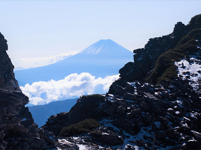
View of Mt. Aino-dake