The Shionomichi (literally meaning “Salt Trail” in English) Trail is a 120 km long road that stretches from Itoigawa, a city located on the coast of the Japan Sea in Niigata Prefecture, to Matsumoto, a city in central Nagano Prefecture.
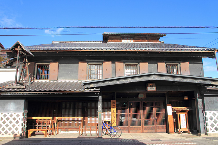
This long trail that passes through eight different cities, towns, and villages, is dotted with numerous legends and famous places. Feel the history, allow the natural scenery to soothe your soul, take a dip in an Onsen, and savor the local specialties. You can experience the various and assorted pleasures offered throughout the four seasons. In particular, the Otari Village area, which still retains the atmosphere of days gone by, has been preserved for many long years by local researchers and the members of the Shionomichi Preservation Association. The Shionomichi Trail is characterized by the fact that its 120 km length is divided into three distinct areas: the mountainous area (from Itoigawa to Otari), the satoyama area (from Hakuba to Omachi/Ikeda), and the urban area (from Azumino to Matsumoto). The trail has changed over time. Please walk each area of the trail in a manner suited to the area. One thing to be particularly aware of in the mountainous area is that bears are seen from time to time, so please wear a bear bell and take care to walk in the standard manner. Also, although the trail is at a low altitude, the Oami mountain pass near the prefectural border has a snow cover from December through the end of May.
Two-day, one night or day trip walking course: Because the Shionomichi Trail runs along the JR Oito train line, you can set a course that starts and ends at stations along the train line. (*Use JR even though this is a local line with few trains throughout the day.) The entire distance of 120 km is divided into 11 different course itineraries of 10 – 15 km and each course itinerary starts and ends at a station on the JR Oito Line, so you can arrange a course to suit your physical capabilities, group activities, or mode of transportation. With this in mind, there are 11 different day trip course itineraries. Two-day, one night courses can be planned using combinations of the 11 course itineraries.


<Guide>
Japan Trekking Association
Mr. Saburo Yoshida

The northern portion of the route (between Itoigawa – Omachi) can be walked between May, after the snow melts, until November. The sightseeing facilities and public restrooms in the mountainous area are closed in the winter from December when snow starts falling. The southern portion of the route (Omachi – Matsumoto) can be walked year-round. However, as urbanization of the route progresses, even guides get lost trying to follow the ancient Shionomichi Trail. Today, there are tours conducted by knowledgeable guides available for the entire length of the trail.
The entire length of the Shionomichi Trail is 120 km, and we have divided this up into 11 sections with each section starting and finishing at a station along the Oito train line, which runs parallel to the trail. Please use this as a base plan along with official maps as a reference when you plan your journey. It is normal for roads to change with the times, and especially for the southern portion of the route, we recommend leaving behind any strong desire to follow the exact path of the ancient trail and try walking the “Ikeda-machi Northern Alps Scenic Road,” a new, attractive trail built in the Azumino Plain that offers panoramic views of the Northern Alps, or the Jikka-segi recommended course of the Azumino Yamabiko Cycling Course (walking permitted), which is an 18 km trail stretching from the former town of Akashina in Matsumoto all the way to Hotaka.
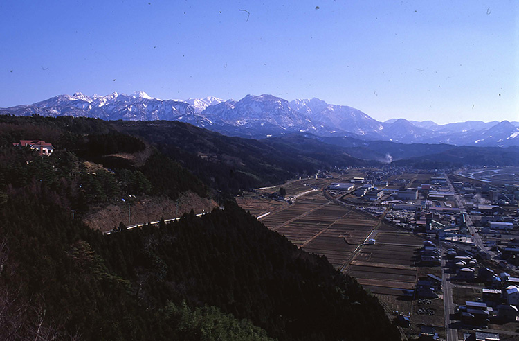
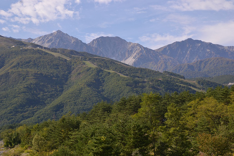
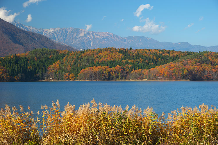
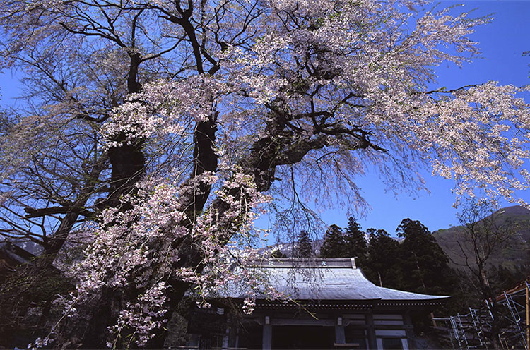
Highlights: The Northern Alps in spring and autumn (the entire Shionomichi Trail is situated within the foothills of the Northern Alps), Nishina Three Lakes (three lakes in the Omachi area along the Shionomichi Trail, from north to south, Lake Aoki, Lake Nakatsuna, and Lake Kisaki. Each have their own unique aspects while sharing the beauty of the Northern Alps as their backdrops)
Notes of caution while walking the trail: The Shionomichi Trail is characterized by the fact that its 120 km length is divided into three distinct areas: the mountainous area (from Itoigawa to Otari), the satoyama area (from Hakuba to Omachi/Ikeda), and the urban area (from Azumino to Matsumoto). In the mountainous area, you must be aware that bears are seen from time to time, so please wear a bear bell or other ringing device and take care to walk in the standard manner. *If you suddenly start running or veer off the road, your chances of encountering a bear increase which can be life threatening. Another point to note is that even though the altitude is low, this is a heavy snowfall area, so from December until the end of May, this is a snow-covered area, especially around the Oami mountain pass. Hikers unaccustomed to snow should pay attention to the time of year. There is no danger of falling rocks, but right after the snow melts in particular, the trail is in poor condition. There are routes with trees that have fallen from the snowfall and loose rocks covering the paths beside mountain streams, so please take care to walk while ensuring the proper footing.
Trailhead vicinity weather
Weekly weather forecast zone:Northern Nagano Prefecture
| DAY | WEATHER | LOWEST | HIGHEST |
|---|---|---|---|
| 7/14 | 23℃ | 32℃ | |
| 7/15 | 24℃ | 32℃ | |
| 7/16 | 24℃ | 33℃ | |
| 7/17 | 24℃ | 33℃ | |
| 7/18 | 23℃ | 35℃ | |
| 7/19 | 23℃ | 35℃ |
This is a publication of the calculated figures for weather predictions and is not the weather forecast. There are instances where there will be big differences in the values stated for the mountains, in accord with the topography as well as sunlight, etc. so please take care.
72 hours weather information:Nakatsuchi, Otari Village, Kitaazumi District, Nagano Prefecture
| Date and time |
7/13 17:00 |
7/13 18:00 |
7/13 19:00 |
7/13 20:00 |
7/13 21:00 |
7/13 22:00 |
7/13 23:00 |
7/14 0:00 |
7/14 1:00 |
7/14 2:00 |
7/14 3:00 |
7/14 4:00 |
7/14 5:00 |
7/14 6:00 |
7/14 7:00 |
7/14 8:00 |
7/14 9:00 |
7/14 10:00 |
7/14 11:00 |
7/14 12:00 |
7/14 13:00 |
7/14 14:00 |
7/14 15:00 |
7/14 16:00 |
7/14 17:00 |
7/14 18:00 |
7/14 19:00 |
7/14 20:00 |
7/14 21:00 |
7/14 22:00 |
7/14 23:00 |
7/15 0:00 |
7/15 1:00 |
7/15 2:00 |
7/15 3:00 |
7/15 4:00 |
7/15 5:00 |
7/15 6:00 |
7/15 7:00 |
7/15 8:00 |
7/15 9:00 |
7/15 10:00 |
7/15 11:00 |
7/15 12:00 |
7/15 13:00 |
7/15 14:00 |
7/15 15:00 |
7/15 16:00 |
7/15 17:00 |
7/15 18:00 |
7/15 19:00 |
7/15 20:00 |
7/15 21:00 |
7/15 22:00 |
7/15 23:00 |
7/16 0:00 |
|---|---|---|---|---|---|---|---|---|---|---|---|---|---|---|---|---|---|---|---|---|---|---|---|---|---|---|---|---|---|---|---|---|---|---|---|---|---|---|---|---|---|---|---|---|---|---|---|---|---|---|---|---|---|---|---|---|
| Weather | ||||||||||||||||||||||||||||||||||||||||||||||||||||||||
| Temperature | 22℃ | 22℃ | 21℃ | 20℃ | 20℃ | 19℃ | 19℃ | 19℃ | 18℃ | 18℃ | 18℃ | 18℃ | 17℃ | 17℃ | 18℃ | 18℃ | 19℃ | 21℃ | 22℃ | 22℃ | 22℃ | 22℃ | 23℃ | 23℃ | 23℃ | 22℃ | 21℃ | 21℃ | 20℃ | 20℃ | 19℃ | 19℃ | 18℃ | 18℃ | 19℃ | 19℃ | 18℃ | 18℃ | 18℃ | 18℃ | 18℃ | 19℃ | 20℃ | 21℃ | 22℃ | 21℃ | 22℃ | 22℃ | 22℃ | 22℃ | 20℃ | 19℃ | 19℃ | 19℃ | 18℃ | 18℃ |
| Precipitation | 0mm/h | 0mm/h | 0mm/h | 0mm/h | 0mm/h | 0mm/h | 0mm/h | 0mm/h | 0mm/h | 0mm/h | 0mm/h | 0mm/h | 0mm/h | 0mm/h | 0mm/h | ※ 16時間以降は表示されません | ||||||||||||||||||||||||||||||||||||||||
| Wind direction |
south-southeast 1m/s |
south-southeast 1m/s |
south-southeast 1m/s |
south-southeast 1m/s |
south-southeast 2m/s |
south-southeast 2m/s |
south-southeast 3m/s |
south-southeast 3m/s |
south-southeast 3m/s |
south-southeast 3m/s |
south-southeast 3m/s |
south-southeast 3m/s |
south-southeast 3m/s |
south-southeast 3m/s |
south-southeast 4m/s |
south-southeast 4m/s |
south-southeast 5m/s |
south-southeast 4m/s |
south-southeast 4m/s |
south-southeast 4m/s |
south-southeast 3m/s |
south-southeast 3m/s |
south-southeast 3m/s |
south-southeast 3m/s |
south-southeast 2m/s |
south-southeast 2m/s |
south-southeast 2m/s |
south-southeast 2m/s |
south-southeast 3m/s |
south-southeast 3m/s |
south-southeast 4m/s |
south-southeast 5m/s |
south-southeast 4m/s |
south-southeast 4m/s |
south-southeast 4m/s |
south-southeast 4m/s |
south-southeast 3m/s |
south-southeast 4m/s |
south-southeast 4m/s |
south-southeast 4m/s |
south-southeast 3m/s |
south-southeast 3m/s |
south-southeast 4m/s |
south-southeast 4m/s |
south-southeast 3m/s |
south-southeast 3m/s |
south-southeast 3m/s |
south-southeast 3m/s |
south-southeast 3m/s |
south-southeast 3m/s |
south-southeast 3m/s |
south-southeast 3m/s |
south-southeast 3m/s |
south-southeast 3m/s |
south-southeast 3m/s |
south-southeast 3m/s |
※The weather information will be information on 5km square including the relevant point.
※天気予報マークは一次細分区域から表示しています
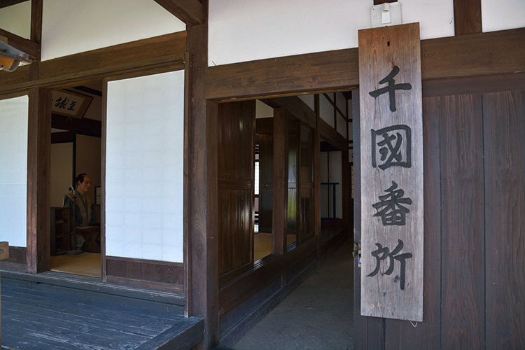
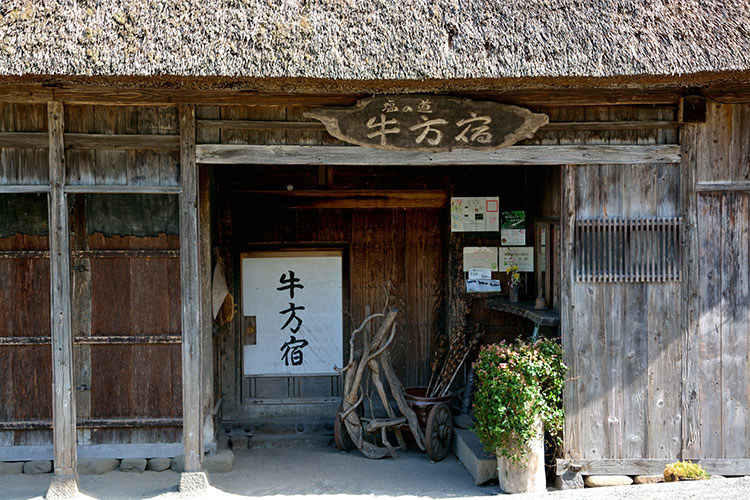
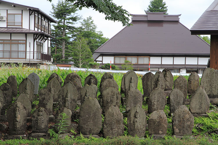
Scenery on the trail