Nishi-kama o’ne Route
Shin-hotaka Onsen ~ Koike-shindou Trailhead ~ Yumiori Junction ~ Sugoroku-goya Mountain hut ~ Mt. Sugoroku-dake ~ Senjo-nokkoshi ~ Mt. Yari-gatake ~ Yokoo ~ Kamikochi
Technical level: C
Physical strength level: 9
Difficulty level: ⛰️⛰️⛰️⛰️
This trail leads to Mt. Yari-gatake from Mt. Sugoroku-dake, standing close to the center of the Northern Japan Alps.
●Hiking Data
Schedule: Three nights four days
Walking hours: 23 hours 50 minutes
(Up: 15 hours 20 minutes/Down 8 hours 30 minutes)
Walking distance: 41.3 ㎞
Difference in elevation:3,366 m
Shin-hotaka Onsen

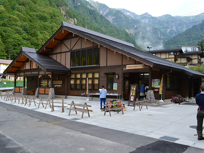
Elevation 1,090m
↓ 1 hours 40 minutesutes
Koike-shindo Trailhead
Elevation 1,590m
↓ 4 hours 30 minutes
Yumiori Junction
Elevation 2,588m
↓ 1 hour 10 minutes
Sugoroku-goya Mountain hut
Elevation 2,600m
↓ 1 hour 10 minutes
Mt. Sugoroku-dake
Elevation 2,860m
↓ 55 minutes
Sugoroku-goya Mountain hut
Elevation 2,600m
↓ 2 hours 25 minutes
Samata-nokkoshi
Elevation 2,670m
↓ 3 hours 30 minutes
Mt. Yari-gatake
Elevation 3,179m
↓ 5 hours 20 minutes
Yokoo
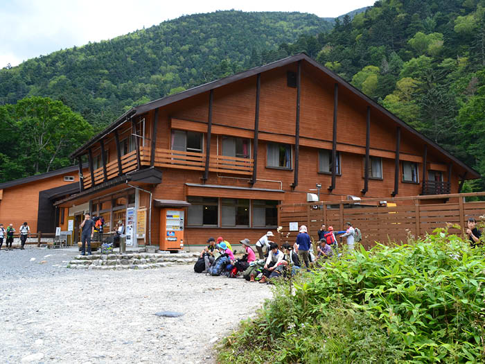
Elevation 1,620m
↓ 3 hours 10 minutes
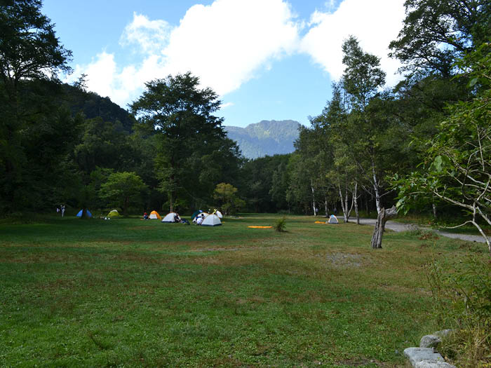
Kamikochi
Elevation 1,505m


Route Guide
From the bus stop at Shin-hotaka Onsen, cross Kamata River and continue to walk past some hotels. Pass a parking zone then cross Kamata River Hidarimata, followed by a logging road. It will be a monotonous walk for a while. Pass Kasa-shindou Trailhead on your left then you will reach Wasabi-daira koya Mountain hut. Take a first break here. It takes about 20 minutes from the hut to Koike-shindou Trailhead.
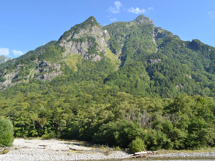
The trail separates from Samata rindou logging road and begins to climb along the stream. The view of Mt. Yari-gatake and Hotaka Mountains can be seen when approaching Chichibu-sawa-deai. Water can be replenished from anywhere in Chichibu-sawa stream. From Itadori-gahara, the slope becomes steep. Take a sharp turn at Shishido-gahara and continue to walk through Kuma-no-odoriba. Kagami-daira will be reached. Mt. Yari-gatake and Hodaka mountains are reflected in the water surface. Kadami-daira sanso Mountain hut is located just ahead of the pond.
A meadow spreads out in front of the hut. The trail becomes steeper till you reach Yumiori Junction.
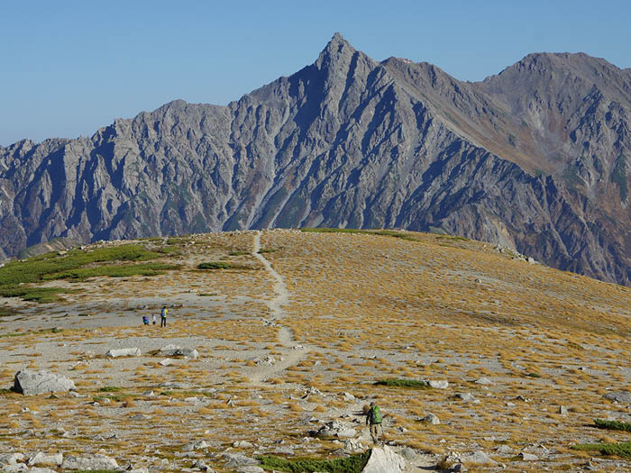
Continue the trail and pass a white-brown plateau. After a few ups and downs, Kuroyuri bench is reached. A saddle, where Sugoroku koya Mountain hut is located, can be reached by following the dried up stream from the bench. To reach Mt. Sugoroku-dake, it is recommended to take a round trip on the ridgeline route from Maki-michi junction. The view from Mt. Sugoroku-dake is fantastic, especially the view of Mt. Yari-gatake and Hotaka mountains. Enjoy the view and return to Sugoroku-koya Mountain hut then head out to Mt. Yari-gatake.
From Sugoroku-koya Mountain hut, start hiking up to Mt. Momisawa-dake. This trail is very steep so hike at a steady pace. Mt. Momisawa-dake is reached when the steep slope becomes flatter. The sharp summit of Mt. Yari-gatake can be seen clearly from the top. Hike down the slope on Yumada side to reach Hida side, where a field of flowers spread.
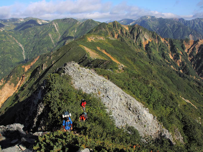
The trail become steep from Ganreki saddle. Follow the ridgeline, where beautiful alpine plants can be found. After you reach Iou-nokkoshi, continue to the plateau on Senjo-sawa side of the branch stream of Yumata River. This place is like a Japanese garden where big stones scatter though Pinus pumila. The shores of Senjo-sawa can be seen just below your feet.
Cross the saddle to Hida side, where a rocky slope begins. Use chains for your safety.
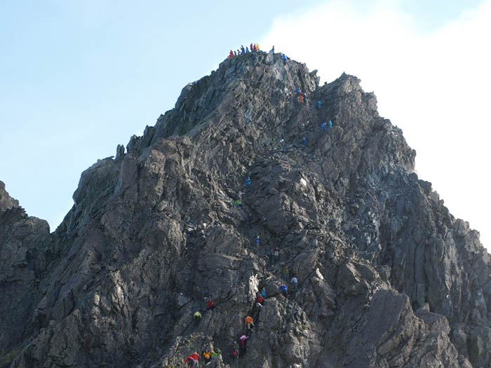
At a signpost to Mt. Yari-gatake, go on a slope on Senjo-sawa side. Senjo-nokkoshi is reached where the slope ends at the ridgeline. Follow a slightly unstable ridgeline to Yari-gatake sanso Mountain hut. The summit of Mt. Yari-gatake is approached from here using chains and ladders through a rocky zone. To descend, hike down from Yarisawa to Yokoo then walk back to Kamikochi.