Hinokio-dake Traverse Route
②Senjo-jiki ~ Mt. Kiso-koma-gatake ~ Mt. Houken-dake ~ Mt. Hinokio-dake ~ Kisodono-sanso Mountain hut ~ Mt. Utsugi-dake ~ Komaishi ~ Mt. Ike-yama ~ Suganodai bus stop
Technical level: C
Physical strength level: 6
Difficulty level: ⛰️⛰️⛰️
A golden route of the Central Alps from Mt. Kiso-koma-gatake to Mt. Utsugi-dake
Access to Senjo-jiki
Access to Komagane Kogen Ikeyama-rindo
●Hiking Data
Schedule: two nights and three days
Walking hours: 18 hours 5 minutes
Walking distance: 19.1 km
Difference in elevation: 1,584 m
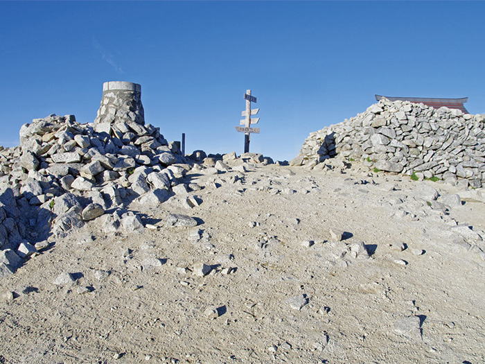
Senjo-jiki
Elevation 2,612m
↓ 2 hours
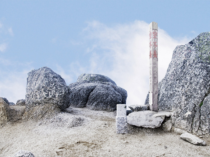
Mt. Kiso-koma-gatake

Elevation 2,956m
↓ 1 hour 10 minutes
Mt. Houken-dake
Elevation 2,931m
↓ 4 hours 10 minutes
Mt. Hinokio-dake
Elevation 2,728m
↓ 3 hours 40 minutes
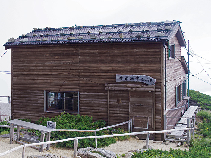
Kisodono-sanso Mountain hut
Elevation 2,490m
↓ 1 hour 30 minutes
Mt. Utsugi-dake
Elevation 2,864m
↓ 20 minutes
Komaishi
Elevation 2,655m
↓ 3 hours 25 minutes
Mt. Ike-yama
Elevation 1,774m
↓ 1 hour 50 minutes
Suganodai bus stop
Elevation 850m

Route Guide
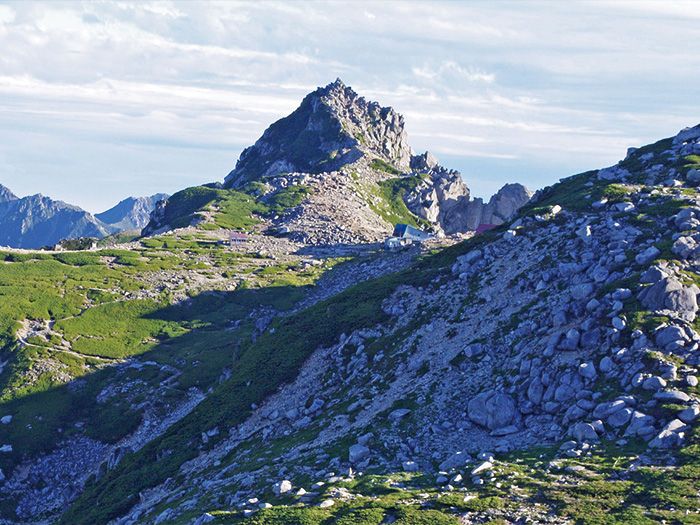
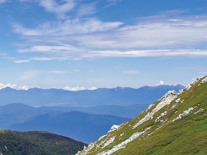
Mt. Houken-dake and Mt. Utsuki-dake are two big rocky peaks in the Central Alps, known for their shapes of Alpine-like mountains. Please hike the ridgeline, which connects these two mountains. The Southern Japan Alps can be seen on your left and Mt. Ontake and mountains in the Kiso area can be seen on your right while hiking.
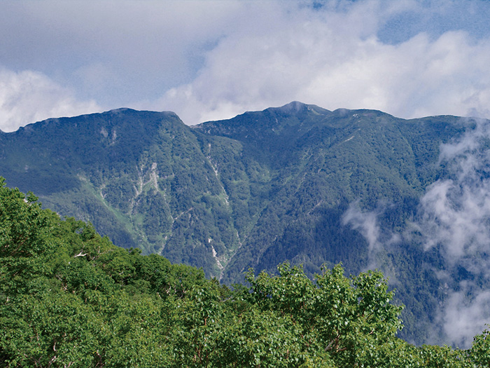
Use Koma-gatake ropeway to Senjo-jiki. Start hiking from there to Mt. Kiso-koma-gatake. Climb up Haccho-zaka and hike to Mt. Naka-dake via the Houken-sanso Mountain hut and Tengu-sanso Mountain hut. It will take about 30 minutes to reach Mt. Kiso-koma-ga-take. Mt. Ontake and Mt. Norikura-dake can be viewed at the summit. Return to Houken-sanso Mountain hut. It is recommended that you stay at Houken-sanso Mountain hut or Tengu-sanso Mountain hut for the first night.
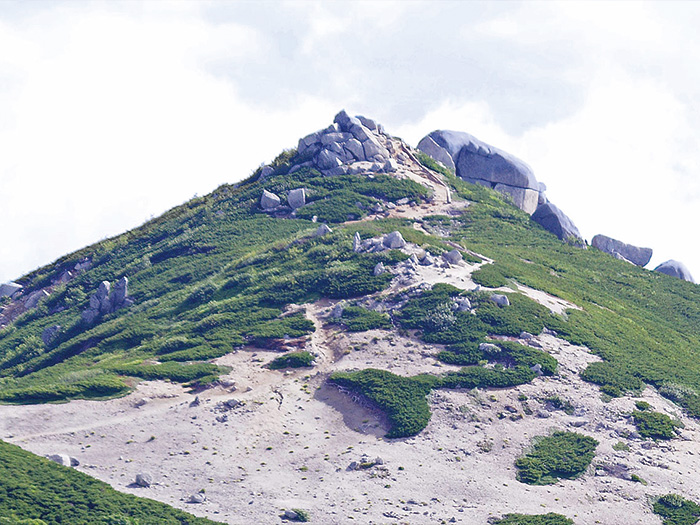
Start early on the next day. From the front of Houken-sanso Mountain hut, climb up the rocky slope with the use of a chain. It should not be a challenging climb if one has experience using chains. The summit of Mt. Houken-dake is narrow. Take turns taking pictures at the summit. From Mt. Houken-dake, proceed to Shimada-musume. From there, descend down and ascend again to Nigori-sawa-O-mine. From O-mine to Mt. Hinokio-dake, there are zones requiring the use of chains and some bushes along the trail so caution must be employed. An emergency shelter is located on the ridgeline east of Mt. Hinokio-dake. The trail includes some ups and downs from Mt. Hinokio-dake to Mt. Kumasawa-dake. Big rocks stand at the summit of Mt. Kumasawa-dake. From here,the trail continues on a gradual slope to Mt. Higashi-kawa-dake. Kisodono-sanso Mountain hut is reached in about 20 minutes. It is recommended that you stay at the hut for the second night.
The third day starts with a steep slope from Kisodono-sanso Mountain hut. The summit of Mt. Utsugi-dake is reached after passing the trail covered by big rocks and Pinus Pumila. Enjoy a great view where nothing blocks your sight. Please then descend. After passing Komaho hutte, head towards the Komaishi area. After passing a big rock, Komaishi, the trail intersects with a trail from Ustugi-daira. The trail goes through a forest zone. After passing Yona-sawa-no-kashira, the trail runs on the right side of the ridgeline. Carefully pass Sho-jigoku and Dai-jigoku with the use of chains and ladders on the ridgeline. Ike-yama-koya Mountain hut is passed when the trail becomes covered by deciduous trees. The end of the logging road is reached shortly after passing Takauchi-jo. Follow the sign through the ski hill and head to Suganodai bus stop.