Komagane Kogen Route
①Suganodai bus center ~ The end of a logging road ~ Ikeyama koya Mountain hut ~ Yonasawa-no-kashira ~ Komaishi ~ Mt. Utsughi-dake ~ Ikeyama koya Mountain hut ~ Suganodai bus center
Technical level: C
Physical strength level: 6
Difficulty level: ⛰️⛰️⛰️
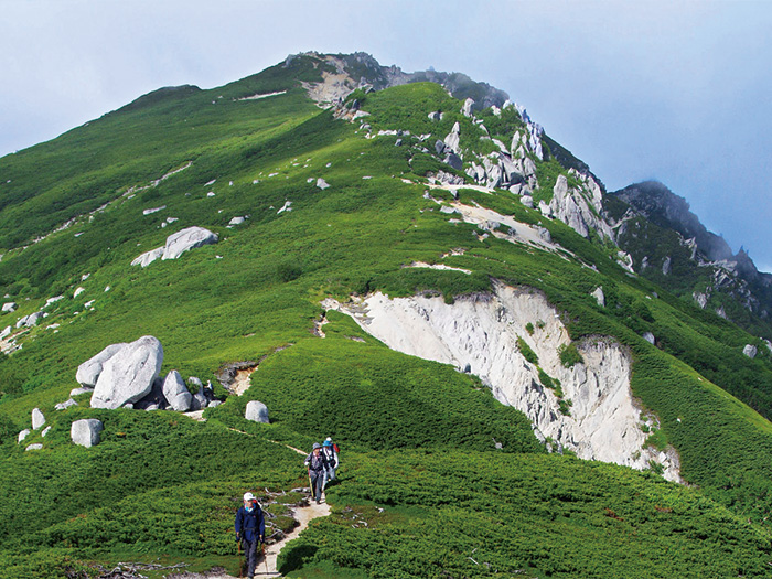
The most popular course to hike Mt. Utsugi-dake
This is a good one-night-two-days route for beginners
Access to Komagane Kogen
●Hiking data
Schedule: One night two days
Walking hours: 13 hours 10 minutes
(Up: 8 hours 10 minutes/Down: 5 hours)
Walking distance: 15.3 km
Difference in elevation: 1,670 m
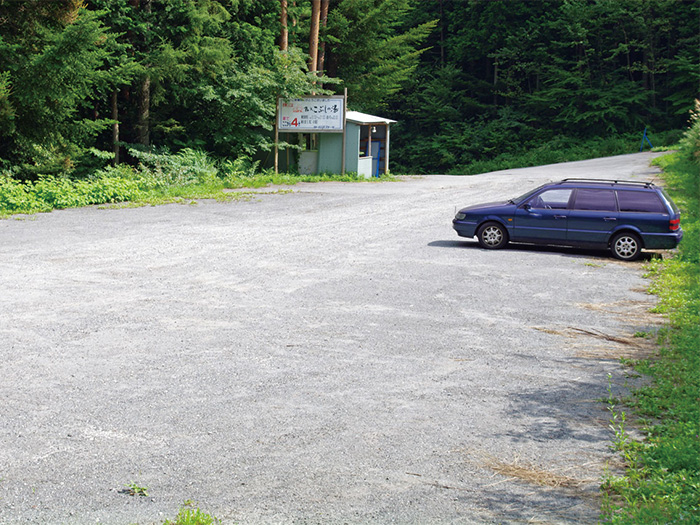
Suganodai bus center
Elevation 850m
↓ 1hour 30 minutes
The end of a logging road


Elevation 1,370m
↓ 1hour 35 minutes
Ikeyama koya Mountain hut
Elevation 1,750m
↓ 2hours 30 minutes
Yonasawa-no-kashira
Elevation 2,282m
↓ 2hours
Komaishi
Elevation 2,655m
↓ 35 minutes
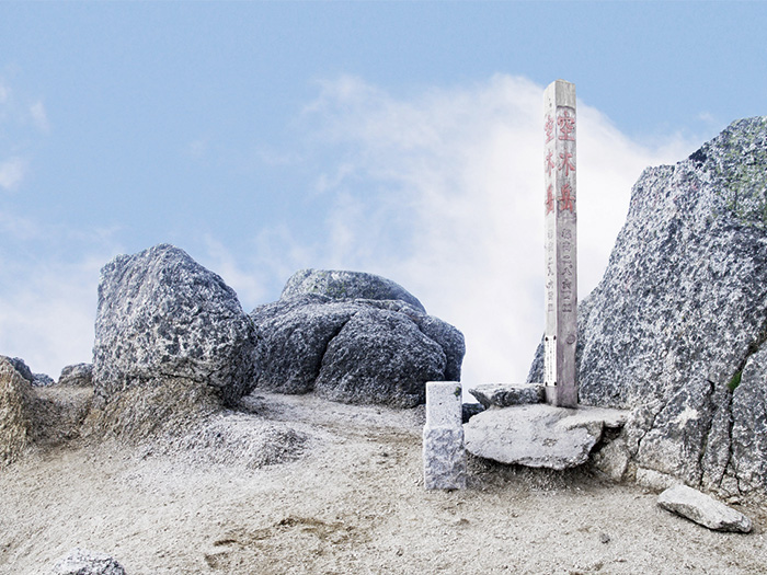
Mt. Utsughi-dake
Elevation 2,864m
↓ 3hours 15 minutes
Ikeyama koya Mountain hut
Elevation 1,750m
↓ 1hour 45 minutes
Suganodai bus center
Elevation 850m

Route Guide
The variance in elevation between Suganodai bus center and the summit of Mt. Utsugi-dake is about 2,000 m. This route is set as a beginner course, however, it takes about 8 hours for ascending. You should plan on starting early in the morning. It is recommended that you stay nearby a trailhead for the previous night to avoid over exhaustion on hiking day.
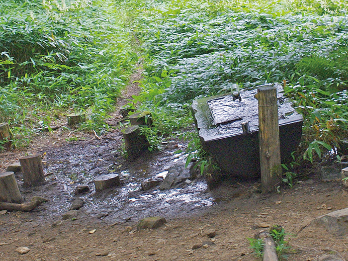
Head out to Komakane plateau Ski Resort from Suganodai bus center. Proceed to the trail via the ski slope. Cross a logging road on 2 occasions. When you meet the logging road for the third time, that will be the end of the logging road. Take the promenade on the slope. The promenade becomes a trail, leading to Mt. Ike-yama. Mt. Ike-yama is reached at the end of the uphill after passing Takauchi place, which is covered by Japanese oaks. Ikeyama-koya Mountain hut, an emergency shelter, is reached about 15 minutes from the summit of Mt. Ike-yama at an elevation of 1,774 m. Replenish your water supply here. There is a bench in the shape of an animal in the water supply area. After passing Masenagi, the trail enters Dai-jigoku. Steps are mounted on the narrow ridgeline. The steps wind from left to right but it is not a dangerous zone to pass. Then the trail comes to Sho-jigoku, where chains and ladders are mounted on the steep slope. Pay attention to your feet. After passing here, the trail leads to a ridgeline, named Mayoi o’ne. Even though the name of the ridgeline is “Mayoi”, which can mean “getting lost” in Japanese, it is unlikely that one would get lost on this ridgeline. The slope is so steep however, that caution must be employed.
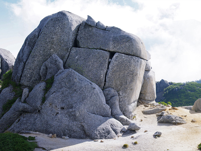
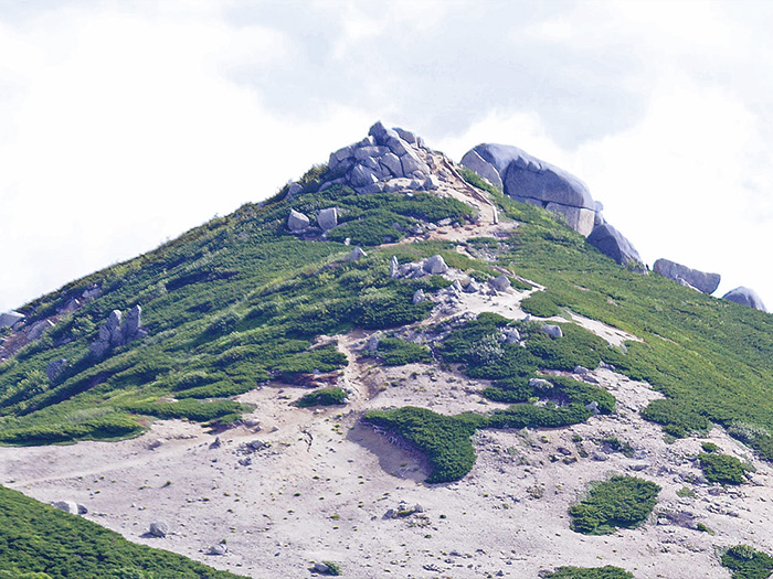
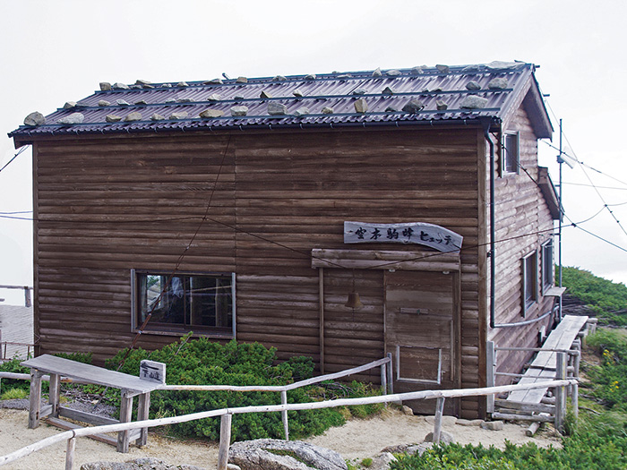
When the trail comes to a small open space, the trail starts ascending the north slope. Be careful not to slip. Pay attention to the roots of trees as well. Take a right trail at the junction where the trail towards Utsugi-daira emergency hut meets. After passing this point, the tree line is close. The summit of Mt. Utsugi-dake and Komaho hutte comes in sight. The big rock Komaishi appears in your direction. Proceed behind the rock. Komaho hutte will be reached as the elevation becomes higher while hiking. Check in at the hut first then head to the summit.
On the next day, climb the mountain in the early morning and enjoy the view of the Central Japan Alps at sunrise. Descend the same trail used for ascending.