Hayatsuki o’ne Route
②Banba-jima ~ Matsuodaira ~ Mt. Tsurugi-Hayatsuki-koya Mountain hut ~ Mt. Tsurugi-dake ~ Mt. Tsurugi-Hayatsuki-koya Mountain hut ~ Matsuodaira ~ Banba-jima
Technical level: E
Physical strength level: 6
Difficulty level: ⛰️⛰️⛰️⛰️
It is the classic route for climbing in winter season, however, the slope is steep and variance in elevation is 2,250 m.
●Hiking Data
Schedule: One night two days or two nights three days
Walking hours: 15 hours 40 minutes
(Up: 9 hours 20 minutes/Down: 6 hours 20 minutes)
Walking distance: 16.2 km
Difference in elevation: 2,332 m
Banba-jima


Elevation 740m
↓ 4hours 40 minutes
Emergency Shelter remaining
Elevation 1,960m
↓ 1hour 10 minutes
Tsurugi-dake-hayatsuki-o’ne-koya Mountain hut
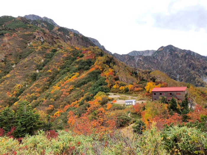
Elevation 2,224m
↓ 3hours 30 minutes
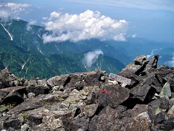
Mt. Tsurugi-dake
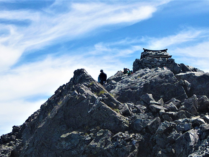
Elevation 2,999m
↓ 2hours 30 minutes
Tsurugi-dake-hayatsuki-o’ne-koya Mountain hut
Elevation 2,224m
↓ 45 minutes
Emergency Shelter remaining
Elevation 1,960m
↓ 3 hours 5 minutes
Banba-jima
Elevation 740m


Route Guide
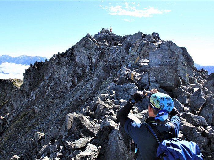
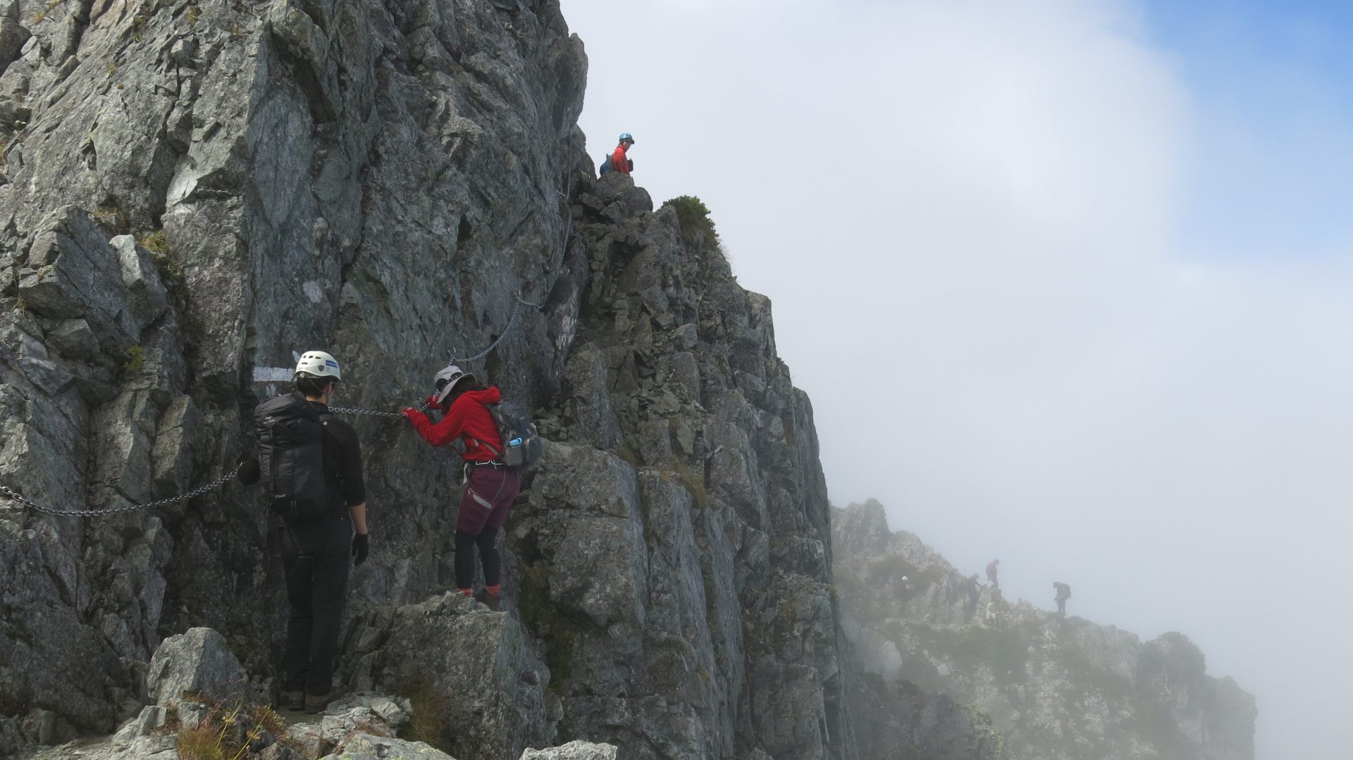
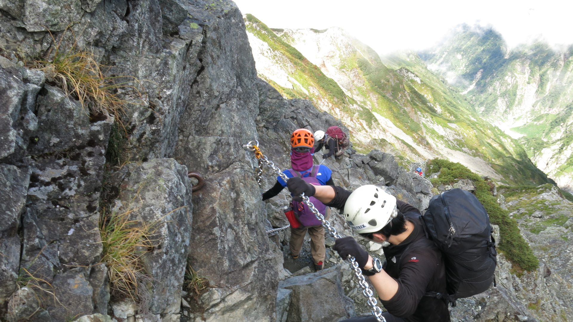
This mountain is ranked in the highest in difficulty for general mountain climbers. Bessan o’ne route, course 1, includes a series of ladders and chains and Hayatsuki o’ne route, course 2, includes steep slopes, which make this route hard and exhausting. It does include some areas, requiring use of chains; the hard ups and downs on this course do require proper preparation. At the trailhead of Banba-jima, there is a stone monument, with the words “Challenge and longing” engraved, implying the difficulty of this route. Stay calm and hike at your breath tempo.
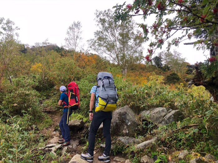
After passing Banba-jima sou Mountain hut, start on Hayatsuki o’ne. From the beginning, the trail is very steep. It becomes flat for once at Matsuo-daira, however, it enters into a forest zone and gets back to being a steep slope soon. Climb up with the use of wooden ladders or roots of trees, which makes it look like you are crawling rather than hiking. The view becomes wider above 1,500 m elevation.
Above 1,800 m in altitude, the big shape of Mt. Akatani-yama comes into sight. Rest while standing. After passing 2,000 m, a chitou, a swamp in high altitude appears. That view reminds you of Oze when you just look at the swamp. After passing 2,200 m in altitude, Tsurugi-dake-hayatsuki-o’ne-koya Mountain hut is reached. This is the only mountain hut on Hayatsuki o’ne. It is recommended that you stay at the hut for the night and start early the next day. There are more hikers who approach from Besan o’ne than Hayatsuki o’ne, therefore, the summit may become full in morning.
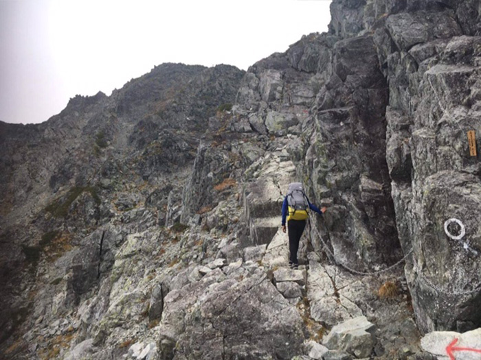
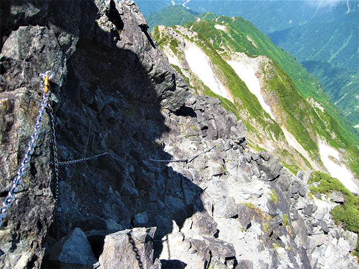
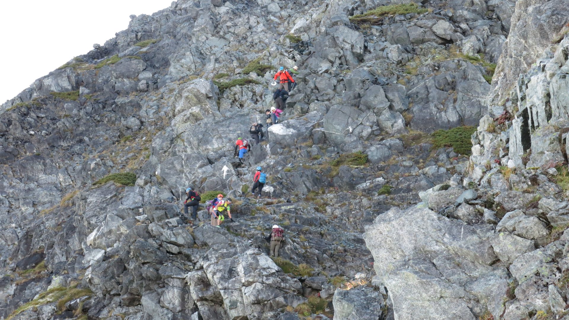
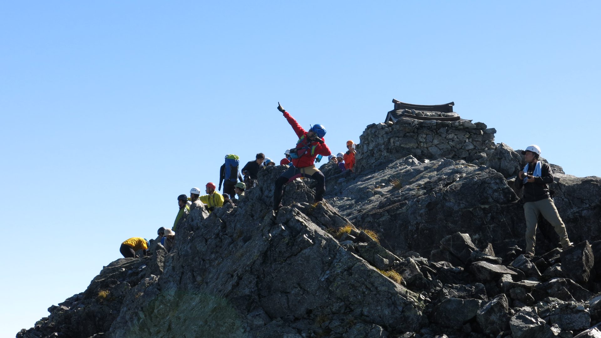
From the mountain hut, ascend through a coniferous forest. The trail comes to a narrow ridgeline and some parts require you to step over some rocks. A while after passing 2,600 m in elevation, the trail comes to a scree slope. This is a slippery slope, where the cliff beneath your feet can only be spotted here and there. It may become a fatal incident if you slip. Caution must be employed. Proceed as you crawl over rocks. After passing an open space where a road sign of 2,800 m elevation stands, Shishi-gashira is reached. After this spot, you will arrive at the most difficult part, Kani-no-hasami. Proceed with a chain in your hand and step over a bolt mounted to the rock cliff. Once the trail reaches the ridgeline, climb another rocky zone from a scree slope with the guide of a long chain. After passing the junction of Bessan o’ne, the summit of Mt. Tsurugi-dake is reached. A small Tsurugi-dake shrine is setup at the summit. The Northern Japan Alps, Ushiro-tate-yama mountains, and Toyama bay can be seen. You may descend the trail used for ascending or descend Bessan o’ne, introduced as a part of Course 1.