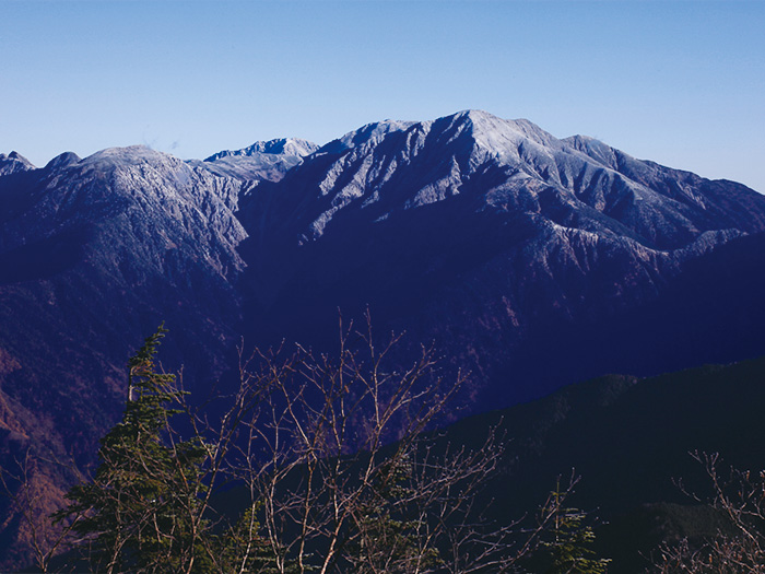
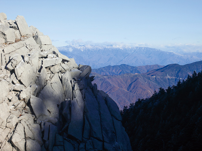
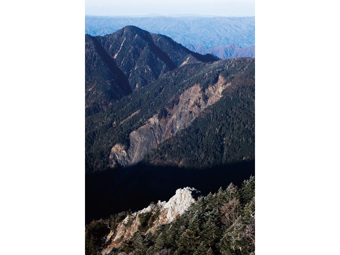
It is a mountain with an elevation of 2,591 m, locating on a main ridgeline of the South Japan Alps. The summit locates around To’yama-gawa-Iroudo-sawa and the source of the Sumata river. The entire mountain is covered by Pinus Pumila, co-habiting with conifer trees and deciduous trees. It is said that Mt. Tekari-dake is the southern limit of Pinus Pumila. A trail near by the summit is a wooden trail if you approach from the Iroudo area. However after Mt. Tekari-dake, the forest is so deep that it is hard to find the route. There are some footsteps, showing that hikers search for the right path. If you climb Mt. Kuro-nagi or Mt. Ikeguchi-dake, caution must be employed. Mt. Tekari-dake sits in the deepest part of in the South Japan Alps. The gentle shape of the mountain covered by black trees is plain, however, it can be said that this mountain still is authentic South Japan Alps. Due to its romantic name and an image of the “distant mountain”, hikers like this mountain. The mountain sits at the southern most point in Japan among those mountains higher than 2,500 m. It is also the most southern area for Ptarmigan habitation. Because the summit is the only area just above the tree line, this mountain is also the most southern point in Japan for Pinus Pumila and alpine plants.
Mt. Tekari-dake: Elevation 2,591 m
The name of Mt. Tekari-dake comes from the reflection of light off the rocky peak of limestones on the east side of the summit. The peak is called Tekari-iwa. The mountain is also called Mt. Misumi-dake. The ridgeline is fairly flat and grassy. There are alpine plants along the ridgeline. There are not many hikers due to the poor access to the deepest part of the South Japan Alps. Mt. Tekari-dake is quiet, compared to Mt. Hijiri-dake, where many hikers visit. One would wish for better access to this mountain. However, due to poor access, the natural resources in the area have been preserved. It may be valuable to spend some time in such an environment, away from normal daily life.
Trailhead vicinity weather
Weekly weather forecast zone:Chubu region, Shizuoka prefecture
| DAY | WEATHER | LOWEST | HIGHEST |
|---|---|---|---|
| 7/28 | 26℃ | 35℃ | |
| 7/29 | 26℃ | 36℃ | |
| 7/30 | 26℃ | 36℃ | |
| 7/31 | 27℃ | 36℃ | |
| 8/1 | 26℃ | 34℃ | |
| 8/2 | 26℃ | 34℃ |
This is a publication of the calculated figures for weather predictions and is not the weather forecast. There are instances where there will be big differences in the values stated for the mountains, in accord with the topography as well as sunlight, etc. so please take care.
72 hours weather information:Shibasawa Gate, Minami-Shinano-Kizawa, Iida City, Nagano Prefecture
| Date and time |
7/27 9:00 |
7/27 10:00 |
7/27 11:00 |
7/27 12:00 |
7/27 13:00 |
7/27 14:00 |
7/27 15:00 |
7/27 16:00 |
7/27 17:00 |
7/27 18:00 |
7/27 19:00 |
7/27 20:00 |
7/27 21:00 |
7/27 22:00 |
7/27 23:00 |
7/28 0:00 |
7/28 1:00 |
7/28 2:00 |
7/28 3:00 |
7/28 4:00 |
7/28 5:00 |
7/28 6:00 |
7/28 7:00 |
7/28 8:00 |
7/28 9:00 |
7/28 10:00 |
7/28 11:00 |
7/28 12:00 |
7/28 13:00 |
7/28 14:00 |
7/28 15:00 |
7/28 16:00 |
7/28 17:00 |
7/28 18:00 |
7/28 19:00 |
7/28 20:00 |
7/28 21:00 |
7/28 22:00 |
7/28 23:00 |
7/29 0:00 |
7/29 1:00 |
7/29 2:00 |
7/29 3:00 |
7/29 4:00 |
7/29 5:00 |
7/29 6:00 |
7/29 7:00 |
7/29 8:00 |
7/29 9:00 |
7/29 10:00 |
7/29 11:00 |
7/29 12:00 |
7/29 13:00 |
7/29 14:00 |
7/29 15:00 |
7/29 16:00 |
7/29 17:00 |
7/29 18:00 |
7/29 19:00 |
7/29 20:00 |
7/29 21:00 |
7/29 22:00 |
7/29 23:00 |
7/30 0:00 |
|---|---|---|---|---|---|---|---|---|---|---|---|---|---|---|---|---|---|---|---|---|---|---|---|---|---|---|---|---|---|---|---|---|---|---|---|---|---|---|---|---|---|---|---|---|---|---|---|---|---|---|---|---|---|---|---|---|---|---|---|---|---|---|---|---|
| Weather | ||||||||||||||||||||||||||||||||||||||||||||||||||||||||||||||||
| Temperature | 24℃ | 25℃ | 26℃ | 27℃ | 27℃ | 28℃ | 28℃ | 27℃ | 27℃ | 26℃ | 25℃ | 25℃ | 24℃ | 24℃ | 23℃ | 23℃ | 23℃ | 23℃ | 23℃ | 23℃ | 23℃ | 23℃ | 23℃ | 24℃ | 25℃ | 26℃ | 27℃ | 28℃ | 28℃ | 28℃ | 30℃ | 30℃ | 29℃ | 28℃ | 26℃ | 24℃ | 23℃ | 23℃ | 22℃ | 22℃ | 21℃ | 21℃ | 21℃ | 21℃ | 20℃ | 20℃ | 21℃ | 23℃ | 26℃ | 28℃ | 30℃ | 31℃ | 31℃ | 32℃ | 31℃ | 31℃ | 30℃ | 28℃ | 27℃ | 24℃ | 23℃ | 22℃ | 21℃ | 21℃ |
| Precipitation | 0mm/h | 0mm/h | 0mm/h | 0mm/h | 0mm/h | 0mm/h | 0mm/h | 0mm/h | 0mm/h | 0mm/h | 0mm/h | 0mm/h | 0mm/h | 0mm/h | 0mm/h | ※ 16時間以降は表示されません | ||||||||||||||||||||||||||||||||||||||||||||||||
| Wind direction |
north 1m/s |
north 1m/s |
north 2m/s |
north 2m/s |
north 2m/s |
north 2m/s |
north 2m/s |
north 2m/s |
north 1m/s |
north 1m/s |
north 1m/s |
0m/s |
0m/s |
north 1m/s |
north 1m/s |
north 1m/s |
north 1m/s |
north 1m/s |
north 1m/s |
north 1m/s |
north 1m/s |
north 1m/s |
north 1m/s |
north 2m/s |
north 2m/s |
north 2m/s |
north 2m/s |
north 3m/s |
north 3m/s |
north 2m/s |
north 2m/s |
north 2m/s |
north 2m/s |
north 1m/s |
north 1m/s |
0m/s |
north 1m/s |
north 1m/s |
north 1m/s |
north 1m/s |
north 1m/s |
north 1m/s |
north 1m/s |
north 1m/s |
north 1m/s |
north 1m/s |
north 1m/s |
north 1m/s |
north 1m/s |
north 2m/s |
north 2m/s |
north 2m/s |
north 3m/s |
north 3m/s |
north 3m/s |
north 3m/s |
north 3m/s |
north 2m/s |
north 2m/s |
north 1m/s |
north 1m/s |
north 1m/s |
north 1m/s |
north 1m/s |
※The weather information will be information on 5km square including the relevant point.
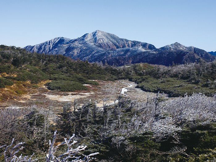
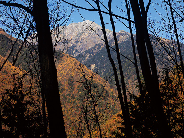
View of Mt. Tekari-dake