Ichi-nokoshi Route
Murodo ~ Ichi-nokoshi ~ Mt. O'yama ~ Mt. O-naji ~ Mt. O'yama ~ Ichi-nokkoshi ~ Murodo
Technical level: B
Physical strength level: 2
Difficulty level: ⛰️
One day trip route recommended for beginners
A popular course where hikers can enjoy the spectacular view of and get a glimpse of the essence of Tateyama Mountains in a relatively shorter walking time.
●Hiking Data
Schedule: A day trip
Walking Hours: 4hours10minutes
(Up: 2hours 20 min、Down: 1hour50minutes)
Walking Distance: 3.1km
Difference in elevation: 646 m
Murodo

Elevation 2,420m
↓ 10 min
Mt. Tateyama-Murodo-sanso Mountain hut
Elevation 2,450m
↓ 50 min
Ichi-nokoshi
Elevation 2,705m
↓ 1hour
Mt. O'yama
Elevation 2,991m
↓ 20 min
Mt. O-naji-yama
Elevation 3,015m
↓ 20 min
Mt. O'yama
Elevation 2,991m
↓ 40 min
Ichi-nokoshi
Elevation 2,705m
↓ 40 min
Mt. Tateyama-Murodo-sanso Mountain hut
Elevation 2,450m
↓ 10 min
Murodo
Elevation 2,420m
Route Guide
The elevation of Murodo is 2420m.
From Murodo, the trail climbs up for 2 hours and 20 minutes to Mt. O-naji-yama, with an elevation of 3,015m.
As a standard of Japanese hiking, a hike of a 300m elevation over the course of an hour is considered to be easy. The variance in elevation from Murodo to Mt.O-naji-yama is 600m. Except for the steep path from Ichi-nokoshi to Mt. O'yama, this trail suits well for beginners. However, the hike will include walking on a ridgeline of 3,000M. Proper hiking shoes and mountain rain gear should be prepared.
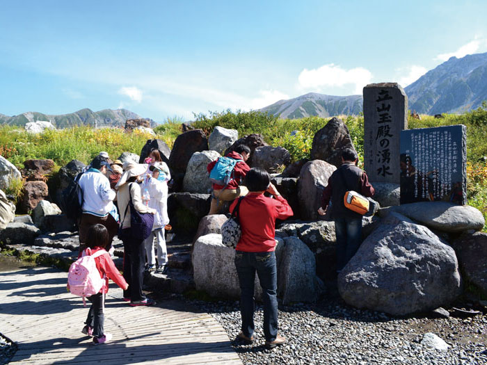
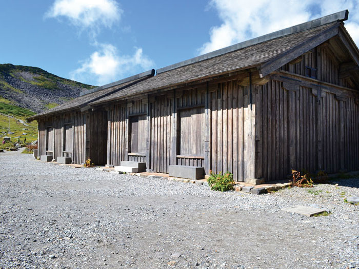
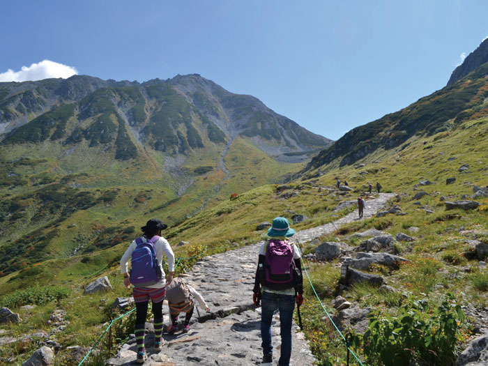
Just outside the Murodo terminal on the Tateyama-Kurobe Alpine route, there is a "Tateyama-tamadono" place to replenish the water supply. Start on the trail towards Mikuriga Pond then take the right-hand promenade. Mt. O'yama is seen at the upper left corner of the frontal view. Shortly you will pass Tateyama-Murodou sansou trail. The oldest mountain lodge in Japan is displayed here. It is worth a visit here if you have extra time. The path changes into a stoned pavement. Once the trail begins to climb up, you will notice some benches along the path. Occasionally cute ptarmigan families are witnessed in this area. Be careful not to scare them.
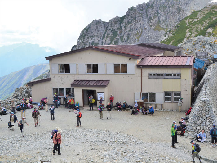
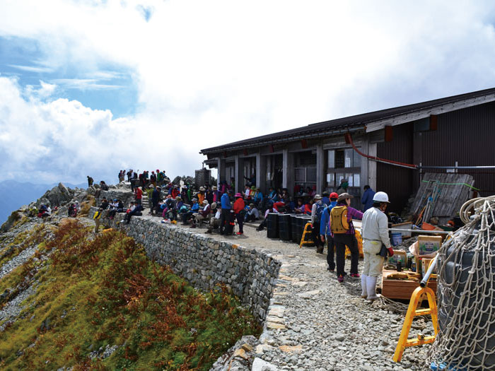
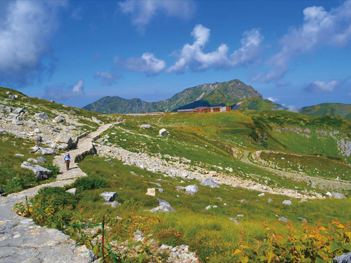
After the wide turn to the right, a trail leads to the Ichi-nokoshi sanso Mountain hut. There is an open space in front of the lodge. A restroom is available at the lodge. Mt. Yari-gatake can be viewed from here.
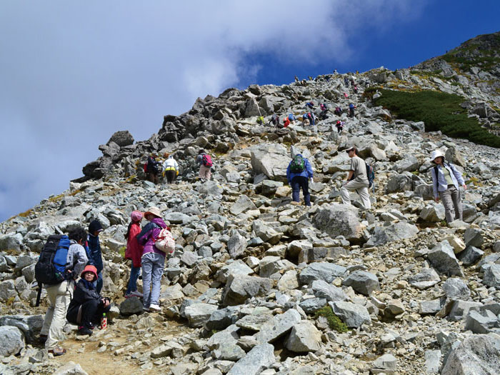
After a short break, continue onto the path, which will be facing a steep slope. The slope is a mixture of rocks and gravel but is a beaten path that many people have hiked on so this trail should not be too dangerous as long as you stay on it. With a gain in altitude, Ichi-nokoshi sanso Mountain hut will appear in sight. You might take a short break when you reach the plateau. The Mt. O'yama shrine office can be seen above your head. After your break, ascend the rocky steep slope and you will come upon the shrine office in a short time.
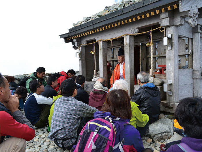
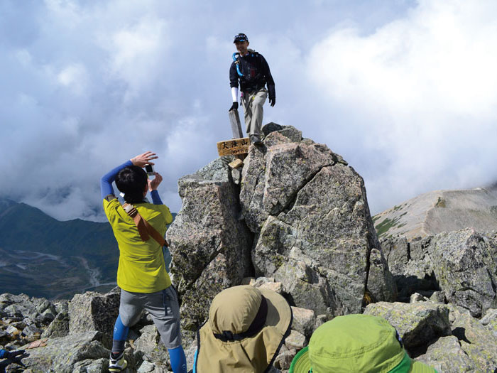
The elevation of Mt. O'yama is 2,991m, however the highest point is Mt. O'yama shrine, standing at the summit with an elevation of 3,003m. A prayer fee is required to enter the shine. Prayers from priests, amulets, bells and sacred wines are available. It could be a precious experience at the summit of 3,003m.
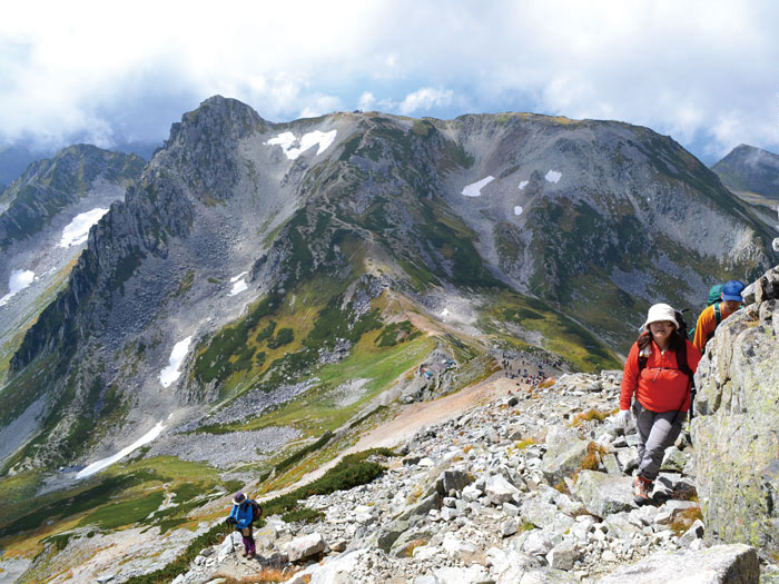
Most hikers take the trail back from Mt. O'yama-jinja Shrine. It is actually a short hike to the highest point of the Tateyama Mountains from the shrine so if the weather permits, it is recommended that you continue on the trail. The trail does not have hazardous points. A graveled ridge line descends shortly and ascends back. The path goes slightly off the ridge line and heads west, which makes Murodo and Mt. Oku-dainichi-dake come better into view.
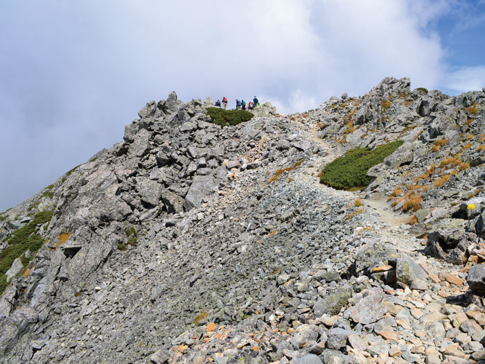
As a building appears in your direction, the mountain to the right of the building is Mt. O-naji-yama. The trail reaches the summit after a short hike. Only one person can stand on the summit. The building below your feet is the O-nanji rest spot. Enjoy the spectacular view then descend the trail back to Murodo.