Koike Shindo – Takase Dam Route
③Shin-hotaka Onsen ~ Yumiori junction ~ Mt. Sugoroku-dake ~ Mt. Washiba-dake ~ Mt. Suisho-dake ~ Mt. Noguchi-goro-dake ~ Takase dam
Technical level: C
Physical strength level: 8
Difficulty level: ⛰️⛰️⛰️⛰️
Hike through Koike-shindo and get on the dynamic ridgeline.
●Hiking Data
Schedule: Two nights and three days
Walking hours: 19 hours 20 minutes
(Up: 10 hours 50 minutes/Down: 8 hours 30 minutes)
Walking Distance: 37.1 km
Difference in elevation: 3,735 m
Shin-hotaka Onsen

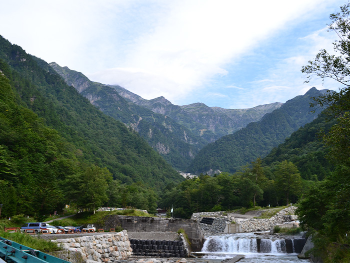
Elevation 1,090m
↓ 6 hours 10 minutes
Yumiori junction
Elevation 2,560m
↓ 2 hours 20 minutes
Mt. Sugoroku-dake
Elevation 2,860m
↓ 3 hours 20 minutes
Mt. Washiba-dake
Elevation 2,924m
↓ 2 hours 30 minutes
Mt. Suisho-dake
Elevation 2,986m
↓ 3 hours 10 minutes
Mt. Noguchi-goro-dake

Elevation 2,924m
↓ 6 hours 10 minutes
Takase dam
Elevation 1,270m

Route Guide
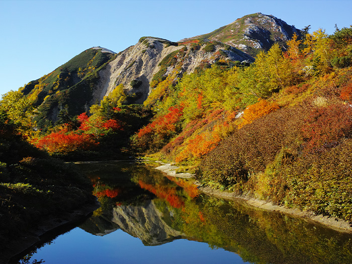
From Shin-hotaka Onsen, walk on the logging road along the left bank of the Kamata River. After passing the gate, the trail enters a restricted area for cars. Pass the junction to Mt. Kasa-gatake on the left and proceed straight. After passing Wasabi-daira-koya Mountain hut, the trail enters into Koike-shindo. It is a well-maintained road. Shishido-gahara is reached after an uphill from Chichibu-sawa-deai. The trail traverses from this point. The trail enters Kagami-daira, where Kagami-daira-koya Mountain hut is located. It is recommended that you stay at the hut for the night. Please start early on the next day.
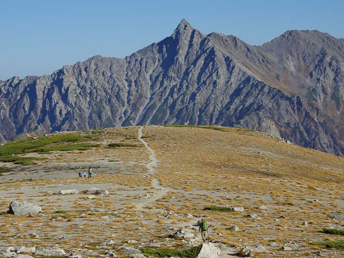
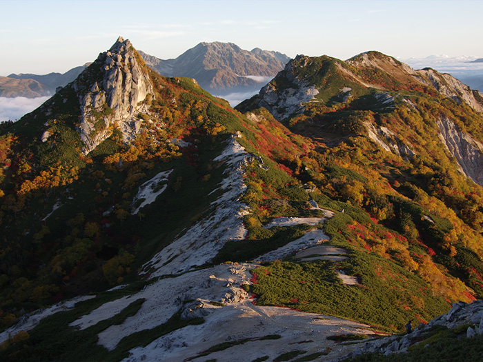
From Kagami-daira-sanso Mountain hut, Yumiori junction is reached in about 1 hour. If you go left and follow the ridgeline, Mt. Kasa-gatake will be reached. Please proceed straight ahead for a while, towards Sugoroku-koya Mountain hut. The snow remains along the trail till late summer, however, the flower fields are beautiful during this season. Sugoroku-koya Mountain hut is reached after descending a short downhill which is just off the ridgeline slightly. After a short break, please hike to Mt. Sugoroku-dake. From the junction of Maki-michi, ascend the trail along the ridgeline. The trail is so wide that it should be easy to hike on. From the summit, the ridgeline of Mt. Yari-gatake and the Hotaka mountains can be seen clearly. After passing the summit and following the ridgeline, Mt. Mitsumata-renge-dake is reached. Mt. Washiba-dake and Mt. Suisho-dake, which are the source of the Kurobe river, can be seen. On the left side in your direction, the views of Kumono-daira and Mt. Yakushi-dake are spread. After enjoying the view, descend towards Mitsumata-sanso Mountain hut, which can be seen on the lower right corner. It is recommended that you stay the night at this hut.
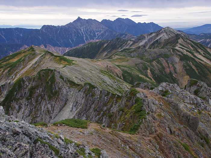
On the next day, start hiking on the ridgeline, which begins in the front of the hut and heads out to the ridgeline of Mt. Washiba-dake. It is a steep slope that will take about an hour to climb. The view of Mt. Yari-gatake and the Omote-ginza course should cheer you up. Mt. Washiba-dake is located on the prefectural border of Toyama and Nagano. It is located in the middle of the Northern Japan Alps, which makes will require you to take a few days to reach the mountain, no matter where you start. The name of the mountain comes from its shape, which appears like a that “washi,” an eagle spreading its wings. After enjoying the view, descend to Warimo-kita junction. There are some areas guided by some ropes but it is safe to pass these areas if you remain on the trail. From Warimo-kita junction, head towards Suisho-koya Mountain hut. From this spot, walk on the ridgeline and make a round trip to the summit of Mt. Suisho-dake. There are some steep uphills, where ladders are mounted near the summit. Enjoy the 360 degree view. Afterwards, return to Suisho-koya Mountain hut. From here, take the Ura-ginza traverse course.
The ridgeline from Suisho-koya Mountain hut to Mt. Noguchi-goro-dake is fairly graduated and must be easy to walk on. The view along the trail is beautiful and that should make it an enjoyable hike on sunny days. Alpine plants can be spotted along the way. After passing Mt. Masago-dake, the trail becomes an uphill towards Mt. Noguchi-goro-dake. There is a trail that goes around the summit. However, it is recommended that you visit the summit. Noguchi-goro-koya Mountain hut is located at the end of a short downhill from the summit. The last night of this course will be spent at this hut.
For the last day, most parts of the trail are all downhills. You must be exhausted by this point after the four day hike. Descend at a steady pace. It takes about 6 hours to Takase dam. From Eboshi-koya Mountain hut, the view must be great. It takes about an hour for the round trip to Mt. Eboshi-dake, which can be seen when looking back from the hut. If you are not over exhausted yet and still have some time, it is recommended that you visit the summit. Bunatate o’ne from Eboshi-koya Mountain hut is very steep. Caution must be employed to avoid falling. When the trail gets closer to Takase river, Takase dam is reached shortly.