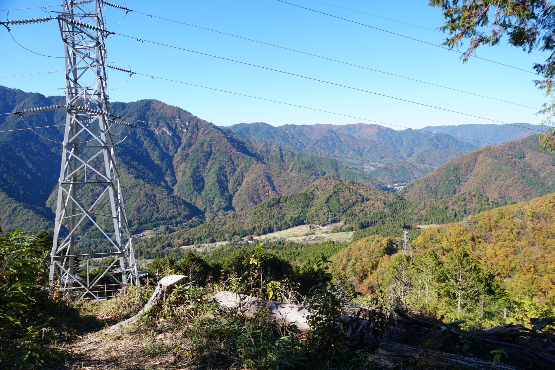
The Kiso road, which Toson Shimazaki ( a famous author of Meiji era) described in his novel about his birthplace, is a mountainous area with only mountains. The mountains that cover the Kiso road from the east are known as the Kiso Mountain Range, or the Central Alps, and the mountain that stands at the entrance to Nakasendo (Edo-period Edo-Kyoto highway), on the west side of the southern end of the range, is Nagiso-dake.
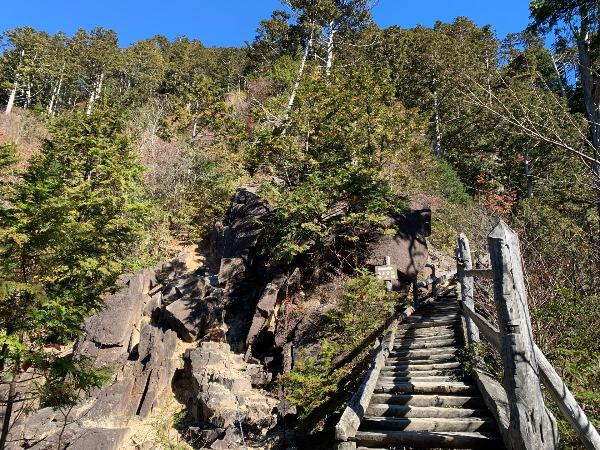
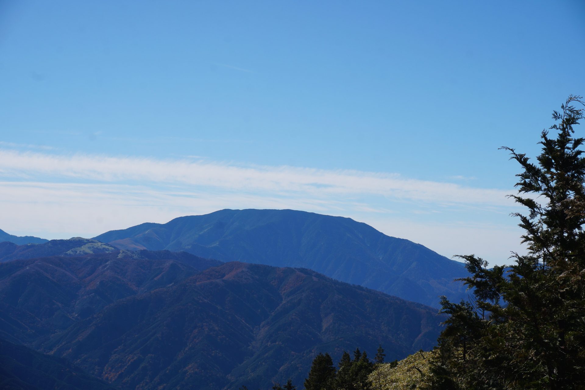
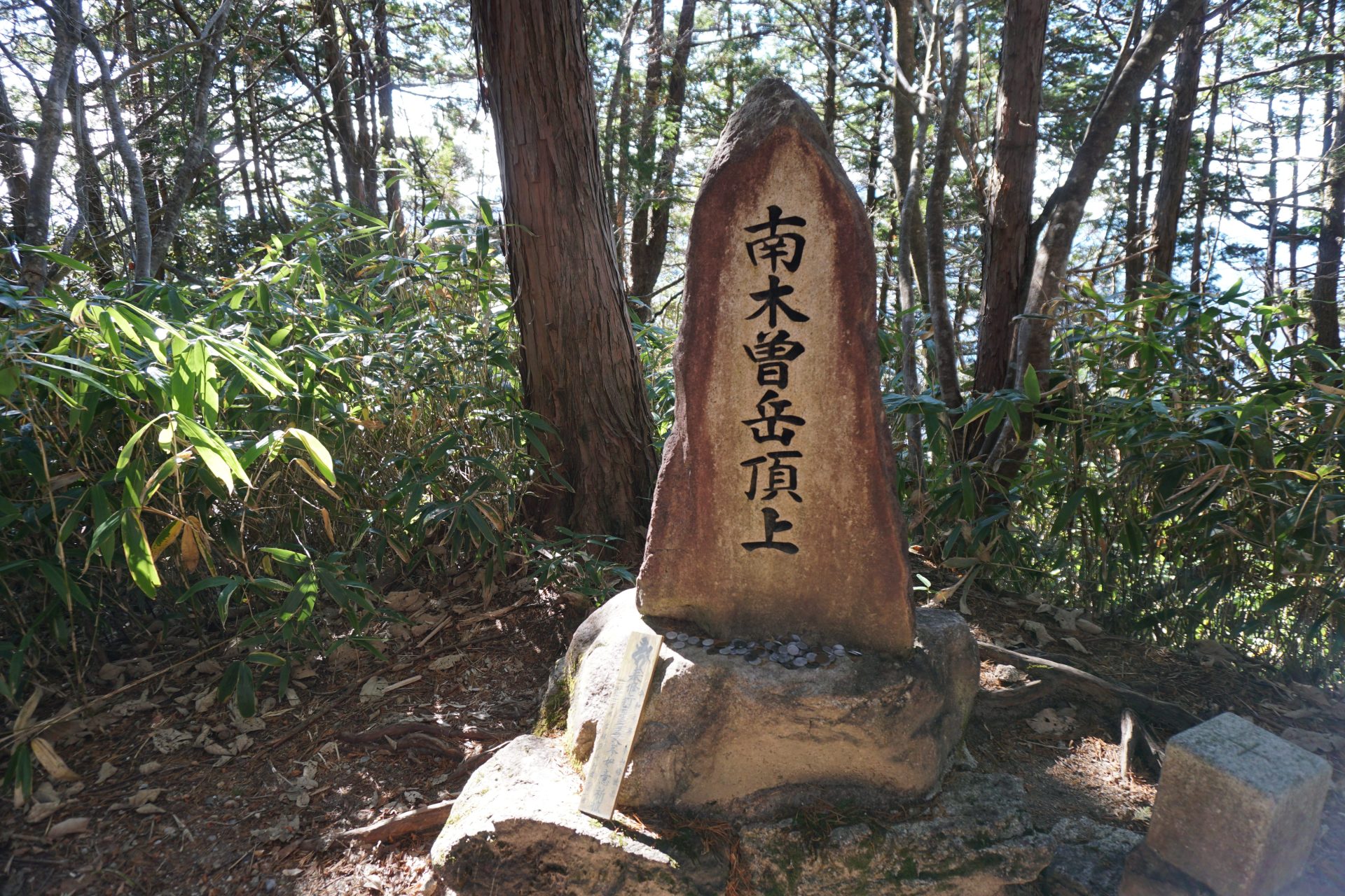
Although this mountain is less than 1,700 m in height, it is a mountain with steep granite rocky terrain and was once the site of severe mountain ascetic practices. Nowadays, the chain sections are hardly noticeable, as some places can be bypassed, but there are still steep climbs and descents followed by wooden ladders and stairs, and the mountain is also used as a training climb for more rugged Alpine mountaineering, and so on. The summit with the triangular point is covered with trees and visibility is limited, but there are lookout points from which you can enjoy the view of the Southern Alps and Mt. Ena-san to the east and south, the Hotaka mountains to the west, and the 3,000-meter peaks of Ontake and Norikura-mountains to the north, and the Central Alps to the north.
It is one of the 300 Famous Mountains and is also a beautiful mountain where akayashio (red bellflower) blooms in early summer. It is also known locally as Crying mountain because it rains a lot, or as Mt. Kintoki-yama (Kintoki is the legendary Samurai general ) . Since it is relatively close to the Osaka/Nagoya area and the climbing time is compact, many visitors come here on a day trip.
Nagiso dake:height 1,679m
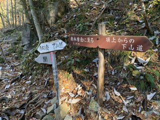
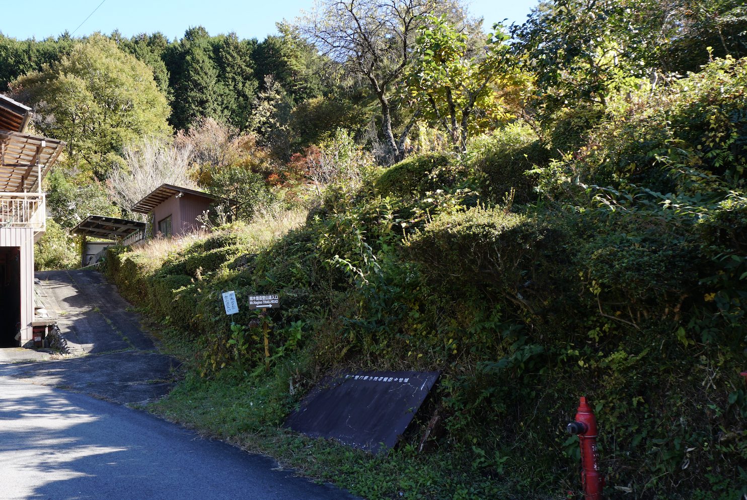
There are two routes: the Ran Route, which goes up from the Ogose bus stop on Route 256 on the south side of the mountain and enters the mountain from the upper part of the Araragi Campsite; and the Uehara route, which starts from JR Chuo Line Nagiso Station and climbs up the west ridge from a place called Uehara. Most visitors by car seem to use the Araragi route, which is shorter.
The Araragi route is divided into an uphill route that heads left before a steep climb begins, and a downhill route that circles around and comes down from the right side.
On the other hand, the Uenohara route is not used by many people and does not offer any particular view, but it is a good way to walk quietly through the forest zone where the trees called “Kiso 5 famous trees” are abundantly found, unique to this area. Please note that there are places along the route where you may have difficulty walking due to thick bamboo thickets, and you may almost lose the route.
Trailhead vicinity weather
Weekly weather forecast zone:Southern Nagano Prefecture
| DAY | WEATHER | LOWEST | HIGHEST |
|---|---|---|---|
| 7/13 | 22℃ | 33℃ | |
| 7/14 | 23℃ | 32℃ | |
| 7/15 | 23℃ | 31℃ | |
| 7/16 | 23℃ | 32℃ | |
| 7/17 | 24℃ | 32℃ | |
| 7/18 | 23℃ | 34℃ |
This is a publication of the calculated figures for weather predictions and is not the weather forecast. There are instances where there will be big differences in the values stated for the mountains, in accord with the topography as well as sunlight, etc. so please take care.
72 hours weather information:Kuroisawa trailhead, Nakatsugawa, Nakatsugawa, Gifu Prefecture
| Date and time |
7/12 16:00 |
7/12 17:00 |
7/12 18:00 |
7/12 19:00 |
7/12 20:00 |
7/12 21:00 |
7/12 22:00 |
7/12 23:00 |
7/13 0:00 |
7/13 1:00 |
7/13 2:00 |
7/13 3:00 |
7/13 4:00 |
7/13 5:00 |
7/13 6:00 |
7/13 7:00 |
7/13 8:00 |
7/13 9:00 |
7/13 10:00 |
7/13 11:00 |
7/13 12:00 |
7/13 13:00 |
7/13 14:00 |
7/13 15:00 |
7/13 16:00 |
7/13 17:00 |
7/13 18:00 |
7/13 19:00 |
7/13 20:00 |
7/13 21:00 |
7/13 22:00 |
7/13 23:00 |
7/14 0:00 |
7/14 1:00 |
7/14 2:00 |
7/14 3:00 |
7/14 4:00 |
7/14 5:00 |
7/14 6:00 |
7/14 7:00 |
7/14 8:00 |
7/14 9:00 |
7/14 10:00 |
7/14 11:00 |
7/14 12:00 |
7/14 13:00 |
7/14 14:00 |
7/14 15:00 |
7/14 16:00 |
7/14 17:00 |
7/14 18:00 |
7/14 19:00 |
7/14 20:00 |
7/14 21:00 |
7/14 22:00 |
7/14 23:00 |
7/15 0:00 |
|---|---|---|---|---|---|---|---|---|---|---|---|---|---|---|---|---|---|---|---|---|---|---|---|---|---|---|---|---|---|---|---|---|---|---|---|---|---|---|---|---|---|---|---|---|---|---|---|---|---|---|---|---|---|---|---|---|---|
| Weather | |||||||||||||||||||||||||||||||||||||||||||||||||||||||||
| Temperature | 23℃ | 22℃ | 21℃ | 20℃ | 19℃ | 18℃ | 18℃ | 18℃ | 17℃ | 17℃ | 17℃ | 17℃ | 16℃ | 16℃ | 16℃ | 17℃ | 19℃ | 20℃ | 21℃ | 22℃ | 23℃ | 23℃ | 24℃ | 24℃ | 24℃ | 23℃ | 21℃ | 20℃ | 20℃ | 19℃ | 19℃ | 18℃ | 18℃ | 18℃ | 18℃ | 17℃ | 18℃ | 18℃ | 18℃ | 18℃ | 20℃ | 21℃ | 22℃ | 23℃ | 23℃ | 23℃ | 23℃ | 23℃ | 22℃ | 22℃ | 20℃ | 20℃ | 19℃ | 19℃ | 18℃ | 18℃ | 18℃ |
| Precipitation | 0mm/h | 0mm/h | 0mm/h | 0mm/h | 0mm/h | 0mm/h | 0mm/h | 0mm/h | 0mm/h | 0mm/h | 0mm/h | 0mm/h | 0mm/h | 0mm/h | 0mm/h | ※ 16時間以降は表示されません | |||||||||||||||||||||||||||||||||||||||||
| Wind direction |
southeast 2m/s |
southeast 2m/s |
southeast 2m/s |
southeast 1m/s |
southeast 1m/s |
southeast 1m/s |
0m/s |
0m/s |
southeast 1m/s |
southeast 1m/s |
southeast 1m/s |
southeast 1m/s |
southeast 1m/s |
southeast 1m/s |
southeast 1m/s |
southeast 1m/s |
southeast 1m/s |
southeast 1m/s |
0m/s |
0m/s |
0m/s |
0m/s |
southeast 1m/s |
southeast 1m/s |
southeast 1m/s |
southeast 1m/s |
southeast 1m/s |
southeast 1m/s |
southeast 1m/s |
southeast 1m/s |
southeast 1m/s |
southeast 1m/s |
southeast 1m/s |
southeast 1m/s |
southeast 2m/s |
southeast 1m/s |
southeast 1m/s |
southeast 1m/s |
southeast 1m/s |
0m/s |
southeast 1m/s |
southeast 1m/s |
southeast 1m/s |
southeast 2m/s |
southeast 2m/s |
southeast 1m/s |
southeast 1m/s |
southeast 1m/s |
southeast 1m/s |
southeast 1m/s |
southeast 2m/s |
southeast 2m/s |
southeast 1m/s |
southeast 1m/s |
southeast 2m/s |
southeast 2m/s |
southeast 3m/s |
※The weather information will be information on 5km square including the relevant point.
※天気予報マークは一次細分区域から表示しています
View of Mt. Nagiso dake