Gyoja-koya Route
①Minoto-guchi ~ Minoto ~ Gyoja koya Mountain hut ~ Mt. Aka-dake ~ Gyoja koya Mountain hut ~ Minoto ~ Minoto-guchi
Technical Level: C
Physical strength Level: 4
Difficulty level: ⛰️⛰️
A course recommended for Mt Minami-yatsu-gatake beginners
From Gyoja koya mountain hut, take a round trip to the main peak of Mt. Yatsu-gatake via Bunzaburo o’ne.
This includes ups and downs on rocky zones and requires physical endurance.
●Hiking data:
Schedule: one night two days
Walking hours: 9 hours 10 minutes
(Up: 5 hours 20 minutes/Down: 3 hours 50 minutes)
Walking distance: 15.9 km
Difference in elevation: 1,502 m
Minoto- guchi

Elevation 1,490m
↓ 1 hour
Minoto
Elevation 1,760m
↓ 2 hours 30 minutes
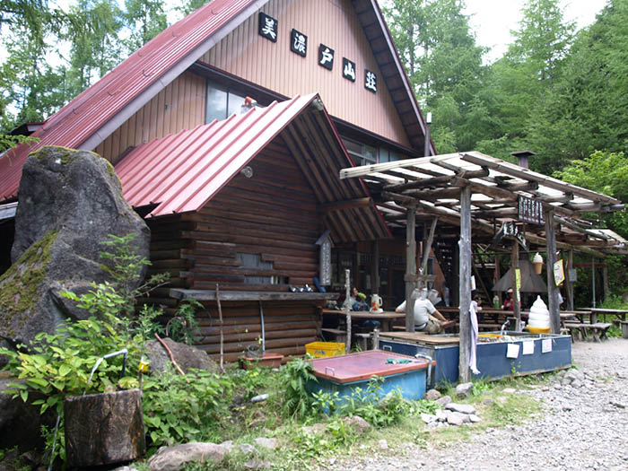
Gyoja koya Mountain hut
Elevation 2,350m
↓ 1 hour 50 minutes
Mt. Aka-dake
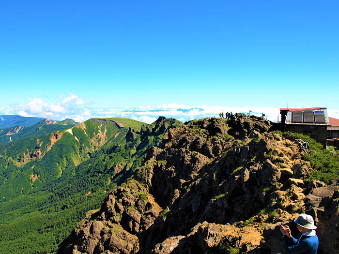
Elevation 2,899m
↓ 1 hour 10 minutes
Gyoja koya Mountain hut
Elevation 2,350m
↓ 1 hour 40 minutes
Minoto
Elevation 1,760m
↓ 50 minutes
Minoto-guchi
Elevation 1,490m
Route Guide
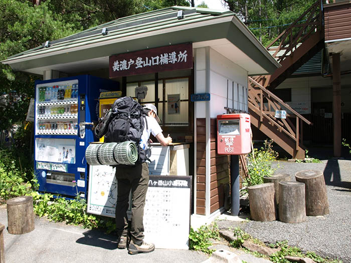
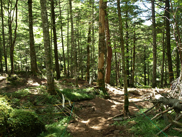
Get off a bus at Minoto-guchi then start walking on the logging road on your left. It will include some ups and downs with no open view and you might get bored with walking. There might be some cars passing to Minoto. There is a parking lot for a fee at the huts at Minoto. There are three huts at Minoto. In front of Minoto sanso Mountain hut, the trail separates to Kitazawa course for Akadake-kousen and Minamizasa course for Gyoja koya Mountain hut. Let’s proceed on the Minamisawa course.
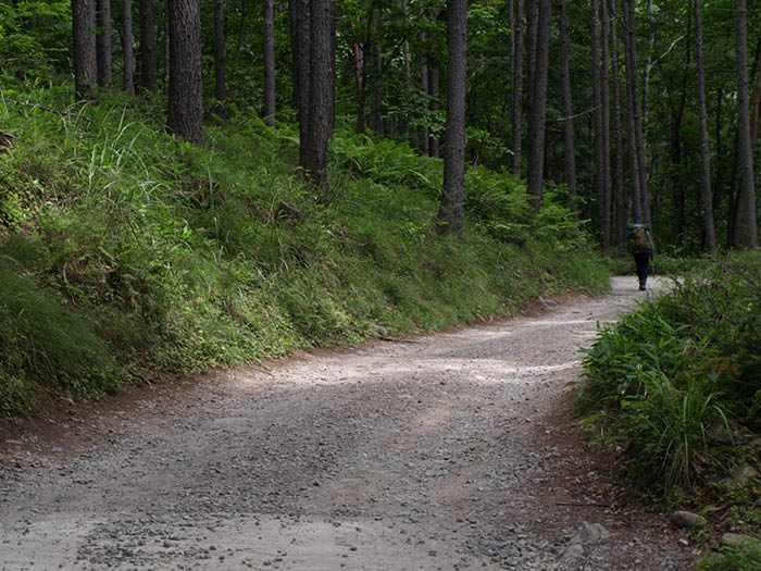
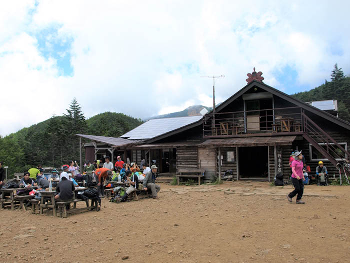
Take the stairs down and cross a few log bridges. The trail is covered by a dark forest even during daytime. In about 30 minutes, Mt. Aka-dake can be spotted through the trees, however, the trail goes back to deep forest again with no view. A ridgeline from Mt. Aka-dake and Mt. Iou-dake appears in your direction. Follow the path to the right, then Gyoja koya Mountain hut is reached. The rocky ridgeline of Mt. Aka-dake can be seen above the hut.
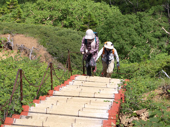
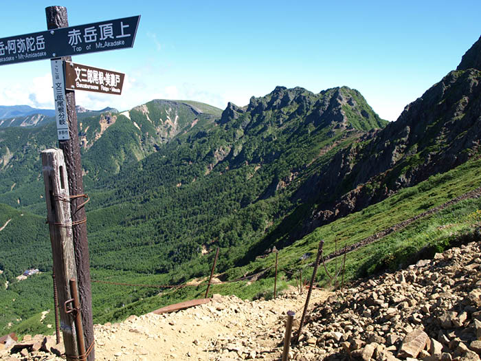
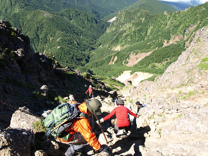
Take a short break then proceed through the camping site at Gyoja koya Mountain hut. The trail leads to a ridgeline. There are six long stairs in sequence. They are made of steel and stable but the height might scare you. After finishing those stairs, the trail leads to a scree slope, where use of chains is necessary to climb up the rocky zone. Turn left at the junction where the ridgeline from Mt. Amida-nyorai-dake meets. The summit of Mt. Aka-dake is reached after a short but steep rocky hill.
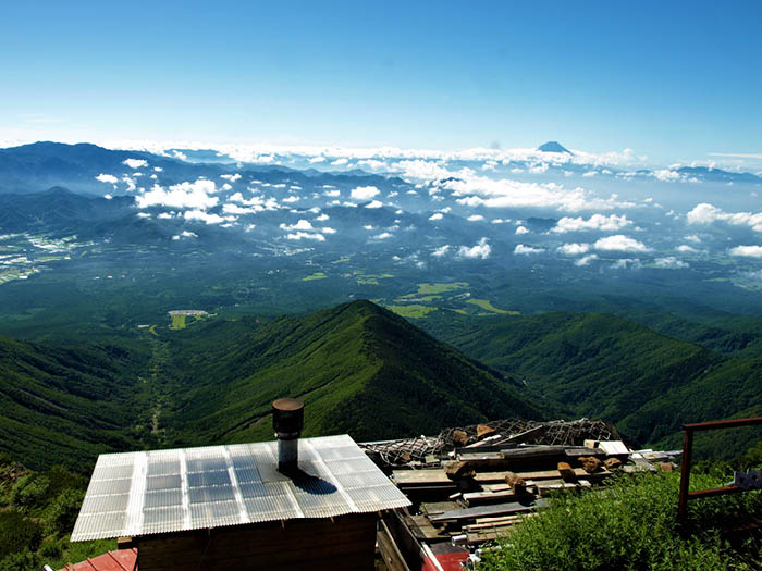
The summit is divided into north and south. You will reach the south peak by this route. A mountain sign and a small Aka-dake shrine are located at the summit. Mountains in central Japan can be seen. From the front of the hut, a ridgeline of Yatsu-gatake Mountains can be spotted. If you look closely, you might be able to see hikers on the ridgeline afar. Aka-dake-tenbou-sou Mountain hut, a popular hut for ridgeline walkers can be seen below your feet. After enjoying the view from the north and the south peak, descend the same route used for ascending. The trail is steep up until Gyoja koya Mountain hut. Caution needs to be employed.