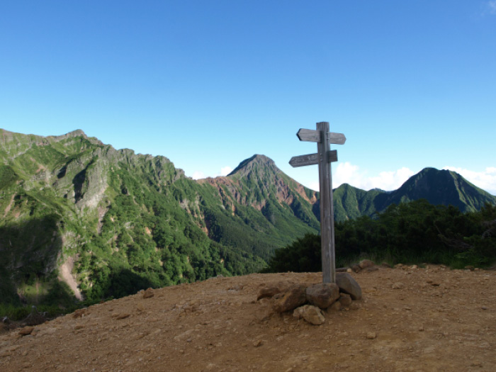
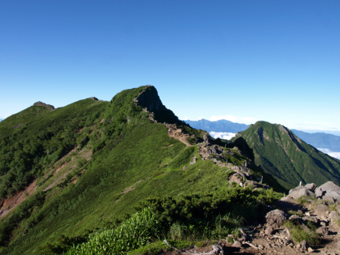
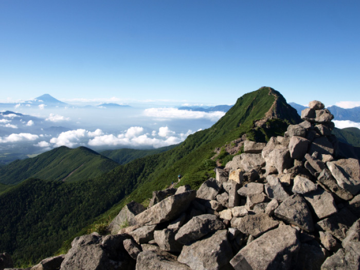
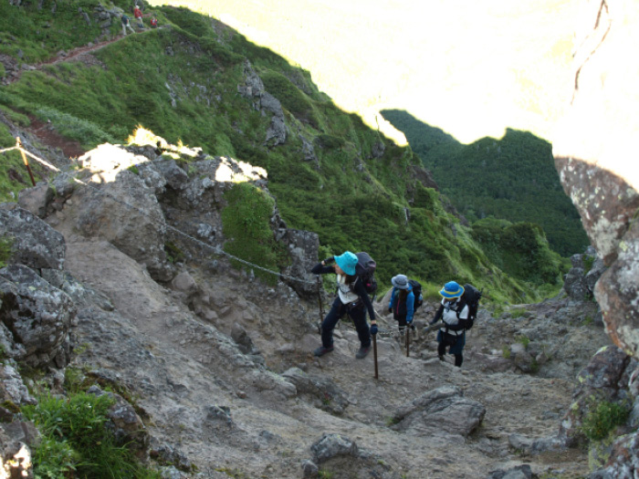
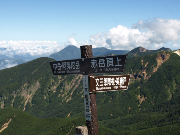
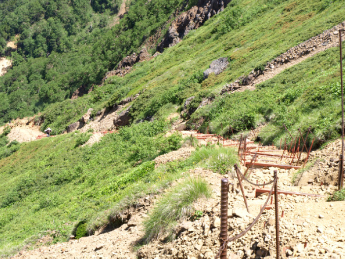
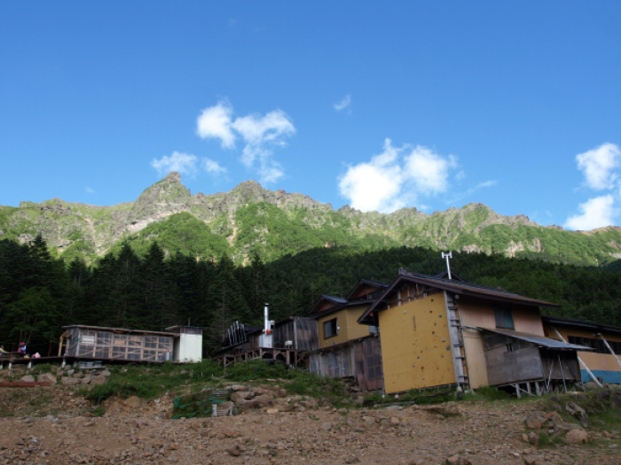
Yatsu-gatake Mountains is the name for a large group of dormant volcanoes, locating in the central east of Nagano prefecture and the north of Yamanashi prefecture. It is said that the name comes from the fact that eight peaks can be spotted from the base of the mountains. The main peak is Mt. Aaka-dake. Many hikers visit the mountain, enjoying the great view throughout the year. The name “Aka” is after the reddish brown color of the mountain, rusted over the ages. Yatsu-gatake Mountains is divided at Natsuzawa pass to Kita-yatsu-gatake (Northern Yatsu-gatake) and Minami yatsu-gatake (Southern Yatsu-gatake). The main peak Mt. Aka-dake sits in Minami-yatsu-gatake Mountains, a powerful and rocky mountain area. On the other hand, Kita-yatsu-gatake Mountains has forests, ponds, and mosses and hikers consider this area soft and tender.
Yatsu-gatake Mountains (Mt. Aka-dake)
:Elevation 2,899m
There are some options to reach the summit of Mt. Aka-dake. It is accessible from all directions. The most popular route is the course from Minoto to Jizou o’ne via Gyoja koya Mountain hut, or to Bunzaburou o’ne via the hut. If you are a fast hiker, it can be a one day hike. The route from Minoto-guchi to Okoya o’ne is another popular course, as well as Somazoe o’ne on the east slope, Kenzakai o’ne and Shinkyoji o’ne.
A route from Mt. Gongen-dake, locating in the south of Mt. Aka-dake, has challenging ups and downs but some prefer this route. If you approach from Mt. Kita-yatsu-gatake, hike the main ridgeline via Mt. Iou-dake from Natsuzawa pass.
Trailhead vicinity weather
Weekly weather forecast zone:Central Nagano Prefecture
| DAY | WEATHER | LOWEST | HIGHEST |
|---|---|---|---|
| 7/20 | 23℃ | 35℃ | |
| 7/21 | 23℃ | 34℃ | |
| 7/22 | 23℃ | 34℃ | |
| 7/23 | 23℃ | 33℃ | |
| 7/24 | 22℃ | 33℃ | |
| 7/25 | 22℃ | 33℃ |
This is a publication of the calculated figures for weather predictions and is not the weather forecast. There are instances where there will be big differences in the values stated for the mountains, in accord with the topography as well as sunlight, etc. so please take care.
72 hours weather information:11400 Tamagawa, Chino City, Nagano Prefecture, 850 Minoto Trailhead Aid Station
| Date and time |
7/19 9:00 |
7/19 10:00 |
7/19 11:00 |
7/19 12:00 |
7/19 13:00 |
7/19 14:00 |
7/19 15:00 |
7/19 16:00 |
7/19 17:00 |
7/19 18:00 |
7/19 19:00 |
7/19 20:00 |
7/19 21:00 |
7/19 22:00 |
7/19 23:00 |
7/20 0:00 |
7/20 1:00 |
7/20 2:00 |
7/20 3:00 |
7/20 4:00 |
7/20 5:00 |
7/20 6:00 |
7/20 7:00 |
7/20 8:00 |
7/20 9:00 |
7/20 10:00 |
7/20 11:00 |
7/20 12:00 |
7/20 13:00 |
7/20 14:00 |
7/20 15:00 |
7/20 16:00 |
7/20 17:00 |
7/20 18:00 |
7/20 19:00 |
7/20 20:00 |
7/20 21:00 |
7/20 22:00 |
7/20 23:00 |
7/21 0:00 |
7/21 1:00 |
7/21 2:00 |
7/21 3:00 |
7/21 4:00 |
7/21 5:00 |
7/21 6:00 |
7/21 7:00 |
7/21 8:00 |
7/21 9:00 |
7/21 10:00 |
7/21 11:00 |
7/21 12:00 |
7/21 13:00 |
7/21 14:00 |
7/21 15:00 |
7/21 16:00 |
7/21 17:00 |
7/21 18:00 |
7/21 19:00 |
7/21 20:00 |
7/21 21:00 |
7/21 22:00 |
7/21 23:00 |
7/22 0:00 |
|---|---|---|---|---|---|---|---|---|---|---|---|---|---|---|---|---|---|---|---|---|---|---|---|---|---|---|---|---|---|---|---|---|---|---|---|---|---|---|---|---|---|---|---|---|---|---|---|---|---|---|---|---|---|---|---|---|---|---|---|---|---|---|---|---|
| Weather | ||||||||||||||||||||||||||||||||||||||||||||||||||||||||||||||||
| Temperature | 17℃ | 18℃ | 19℃ | 20℃ | 20℃ | 21℃ | 21℃ | 21℃ | 21℃ | 20℃ | 19℃ | 18℃ | 17℃ | 17℃ | 17℃ | 16℃ | 16℃ | 15℃ | 15℃ | 15℃ | 15℃ | 15℃ | 16℃ | 17℃ | 19℃ | 20℃ | 20℃ | 21℃ | 22℃ | 23℃ | 23℃ | 22℃ | 22℃ | 21℃ | 20℃ | 19℃ | 18℃ | 18℃ | 17℃ | 17℃ | 17℃ | 16℃ | 16℃ | 16℃ | 16℃ | 16℃ | 17℃ | 19℃ | 20℃ | 21℃ | 21℃ | 21℃ | 22℃ | 22℃ | 22℃ | 21℃ | 20℃ | 20℃ | 19℃ | 19℃ | 18℃ | 18℃ | 18℃ | 17℃ |
| Precipitation | 0mm/h | 0mm/h | 0mm/h | 0mm/h | 0mm/h | 0mm/h | 0mm/h | 0mm/h | 0mm/h | 0mm/h | 0mm/h | 0mm/h | 0mm/h | 0mm/h | 0mm/h | ※ 16時間以降は表示されません | ||||||||||||||||||||||||||||||||||||||||||||||||
| Wind direction |
east 2m/s |
east 2m/s |
east 2m/s |
east 2m/s |
east 2m/s |
east 2m/s |
east 2m/s |
east 2m/s |
east 2m/s |
east 1m/s |
east 1m/s |
east 1m/s |
east 1m/s |
east 1m/s |
0m/s |
0m/s |
0m/s |
east 1m/s |
east 1m/s |
east 1m/s |
east 1m/s |
east 1m/s |
east 1m/s |
0m/s |
east 1m/s |
east 1m/s |
east 2m/s |
east 2m/s |
east 2m/s |
east 2m/s |
east 2m/s |
east 1m/s |
east 1m/s |
east 1m/s |
east 1m/s |
0m/s |
0m/s |
0m/s |
0m/s |
east 1m/s |
east 1m/s |
east 1m/s |
east 1m/s |
east 1m/s |
east 1m/s |
east 1m/s |
east 1m/s |
0m/s |
0m/s |
east 1m/s |
east 1m/s |
east 1m/s |
east 1m/s |
east 1m/s |
east 1m/s |
0m/s |
east 1m/s |
east 1m/s |
east 1m/s |
east 1m/s |
east 1m/s |
east 1m/s |
east 1m/s |
east 2m/s |
※The weather information will be information on 5km square including the relevant point.
※天気予報マークは一次細分区域から表示しています
Route Information
A-Basic course sorted by trailheads
From Minoto
-
Gyoja-koya Route
①Minoto-guchi ~ Minoto ~ Gyoja-koya Mountain hut ~ Mt. Aka-dake ~ Gyoja koya Mountain hut ~ Minoto ~ Minoto-guchi (Difficulty level: ⛰️⛰️) -
Minami-yatsu-gatake Traverse Route
②Minoto-guchi ~ Minoto ~ Akadake-kosen ~ Mt. Iou-dake ~ Mt. Yoko-dake ~ Mt. Aka-dake ~ Gyoja koya Mountain hut ~ Minoto ~ Minoto-guchi (Difficulty level: ⛰️⛰️)
