Torikura Route
①Torikura trailhead ~ Sanpuku pass ~ Mt. Hontani-yama ~ Shiomi koya Mountain hut ~ Mt. Shiomi-dake east peak ~ Shiomi koya Mountain hut ~ Mt. Hontani-yama ~ Sanpuku pass ~ Torikura trailhead
Technical level: D
Physical strength level: 7
Difficulty level: ⛰️⛰️⛰️⛰️
A satisfying course that starts from a coniferous forest to flower fields and a rocky ridgeline.
●Hiking Data
Schedule: One night two days
Walking hours: 14 hours
Walking distance: 24.3 km
Difference in elevation: 2,770 m
Torikura trailhead


Elevation 1,790m
↓ 3 hours
Sanpuku pass

Elevation 2,580m
↓ 1hour 20 minutes
Mt. Hontani-yama
Elevation 2,658m
↓ 2 hours
Shiomi koya Mountain hut

Elevation 2,766m
↓ 1hour 20 minutes
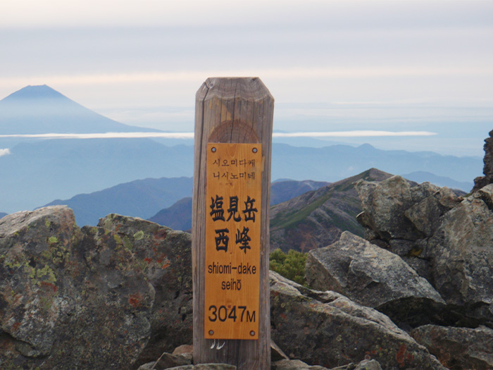
Mt. Shiomi-dake east peak
Elevation 3,052m
↓ 50 minutes
Shiomi koya Mountain hut
Elevation 2,766m
↓ 2 hours
Mt. Hontani-yama
Elevation 2,658m
↓ 1hour 15 minutes
Sanpuku pass
Elevation 2,580m
↓ 2hours 15 minutes
Torikura trailhead
Elevation 1,790m
Route Guide
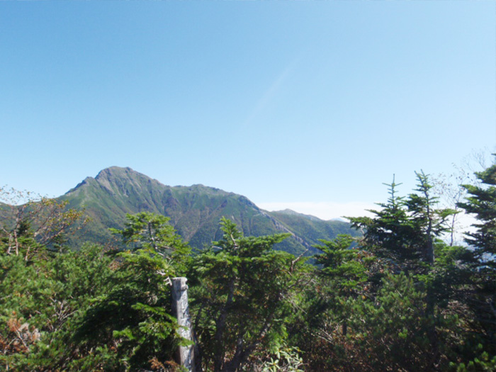
Start hiking through forest from the trailhead. After a while, Mt. Kamikochi-dake at an elevation of 2,802 m can be seen on the right. Pass the saddle among Mt. Toyoguchi-yama and traverse through a beautiful coniferous forest. When the trail becomes narrower, plank roads appear here and there. Walk with caution. Pass the junction of Shokawa route, which is closed currently. Mt. Senjyo-gatake comes into sight. Sanpuku pass is reached shortly. Sanpuku pass koya Mountain hut is located here. It would be about a 3 hour walk by then so take a break here. Make sure that you have a snack while resting. There may be some alpine plants in bloom along the trail towards Mt. Eboshi-dake. It may be a good idea to walk around for a while as a break. However, make sure that you do not burn your energy out. From Sanpuku pass, it still takes about 3 hours 20 minutes to Shiomi koya Mountain hut in which you are scheduled to stay for the night.
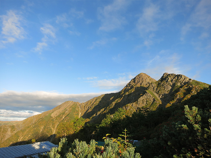
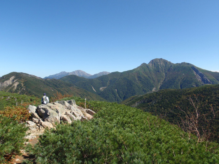
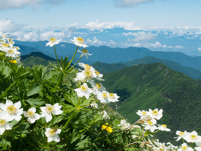
From Sanpuku pass, head out to Mt. Sanpuku-yama, which has a great view. The summit is reached shortly. F,rom there, descend through bushes along the ridgeline. After passing the saddle at 2,498 m, a flower field spreads out. It is a ridgeline walk with a great view of the Central Japan Alps. Mt. Hontani-yama is reached in about 35 minutes from the saddle. The narrow summit is surrounded by Pinus pumila but has a great view of Mt. Shiomi-dake. Mt. Kamikochi-dake appears in sight. It looks more powerful as the elevation becomes higher. Stop and take your time to enjoy the view. After passing a deep coniferous forest, the source of Gonemon stream is reached. The elevation around the area is higher than 2,500 m. If you have symptoms of altitude sickness, take a break. If symptoms do not get better, it is recommended that you descend the mountain. After passing the tree line, Mt. Shiomi-dake is reached. It is recommended that you stay for the night. You need to make a reservation to stay at Shiomi-koya Mountain hut.
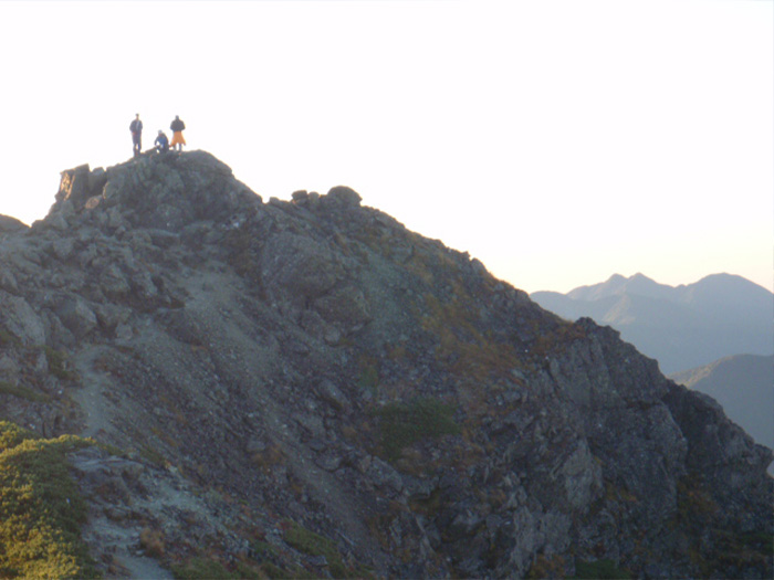
On the second day, you need to descend to the trailhead so make sure that you start early in the morning. You will be ascending through the rocky ridgeline so put trekking poles away into your backpack. After a while, the trail becomes very steep. Use your arms and legs to ascend. More focus is required to ascend to Mt. Tengu-dake. Traverse the rocky zone and descend to the saddle of Mt. Shiomi-dake. Ascend the rocky zone again. There are some graveled parts so caution must be employed. When the trail begins to ascend in a zigzag pattern, the west peak is close. The triangulation point is set at the west peak; however, the highest point is the east peak. From the east peak, the view of Mt. Koumori-dake in the southwest direction is impressive. From the east peak, descend the same trail used for ascending to Torikura trailhead.