Ontake mountains Otaki-guchi Route
④Tanohara trailhead 〜 Yohaijo 〜 O-e Gongen 〜 8th station 〜 9th station 〜 Otaki summit 〜 Kenga-mine 〜 Tanohara trailhead
Technical level: B
Physical fitness level: 2
Difficulty: ★
At the end of July 2023, Kenganbō from the Otaki-guchi route will open for the first time in nine years.
Let’s climb it as a memorial to the dead.
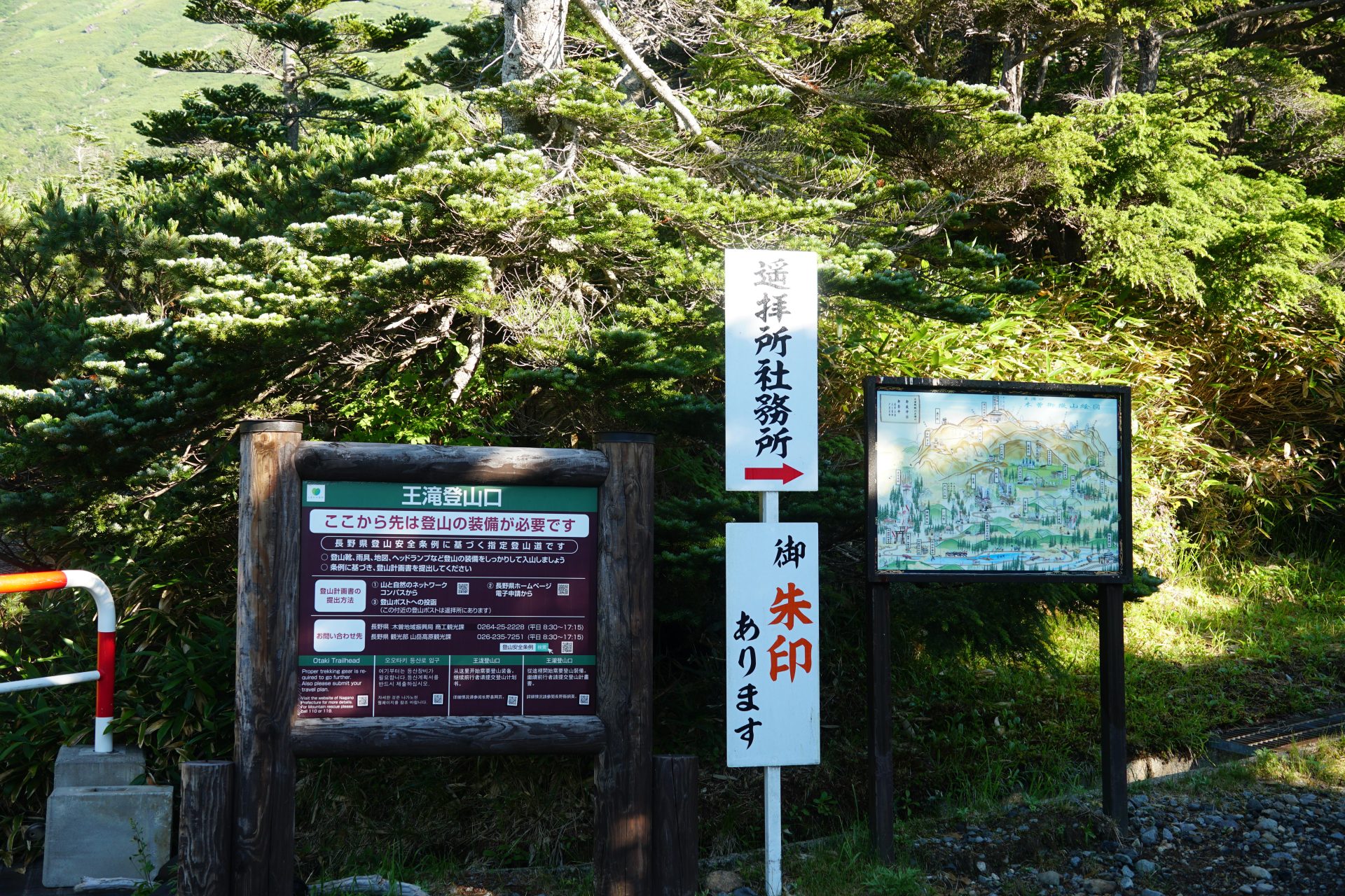
There is no drinking water available on the route, so please be prepared,
※Please be sure to bring a helmet and wear it from the 8th station.
●Climbing data
Schedule: Day trip or overnight
Walking time: 5 hours 35 minutes (ascent: 3 hours 10 minutes, descent: 2 hours 25 minutes)
Walking distance: approx. 3.5 km
Ascent cumulative elevation gain: +882m -19m
Tanohara trailhead

Elevation 2,191m
↓ 10 minutes
Mitake Haruka Haisho
Elevation 2,229m
↓ 15 minutes
Oe Gongen
Elevation 2,318m
↓ 50 minutes
Eighth station evacuation hut
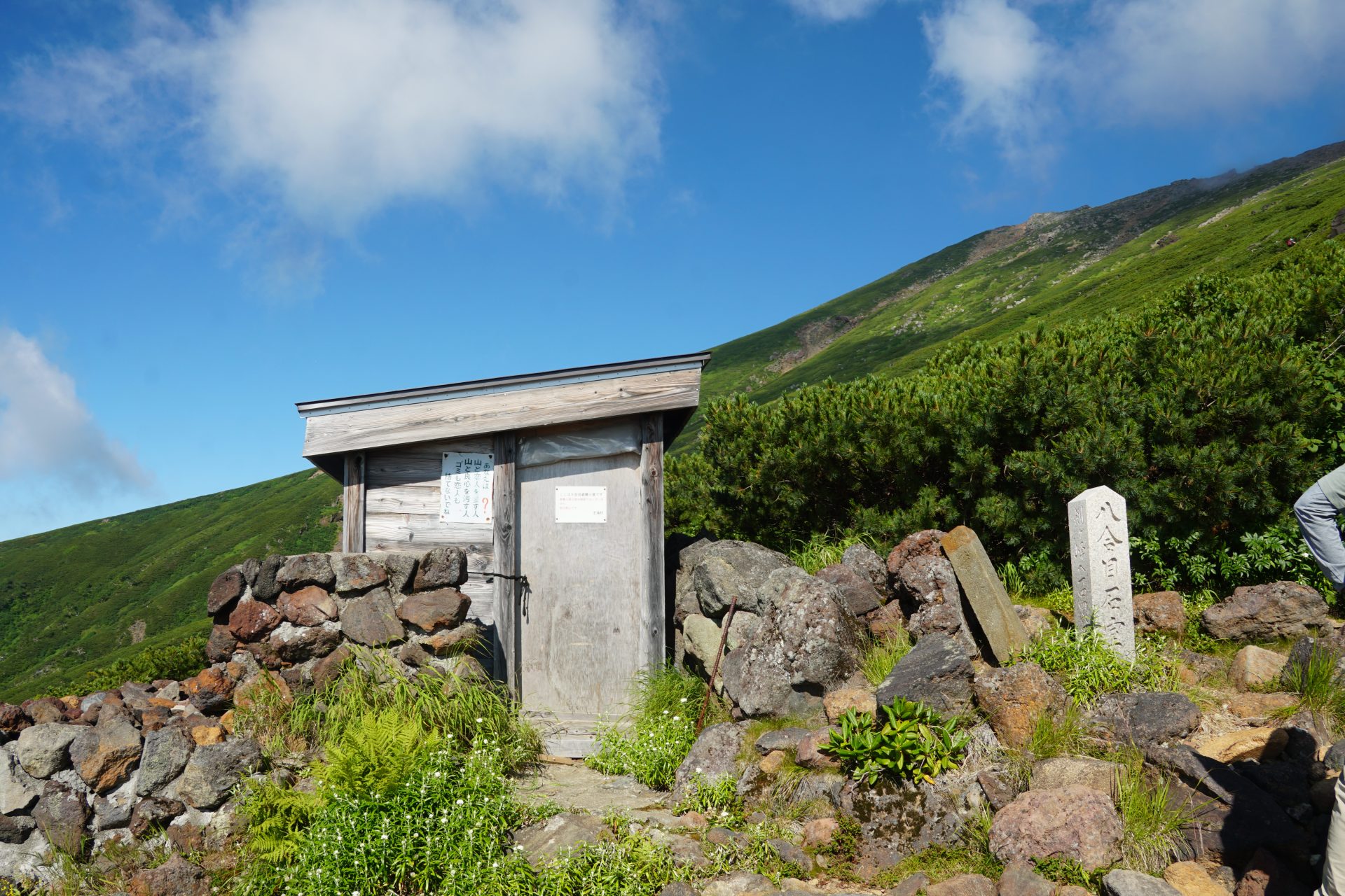
Elevation 2,550m
↓ 50 minutes
Ninth station evacuation hut
Elevation 2,806m
↓ 40 minutes
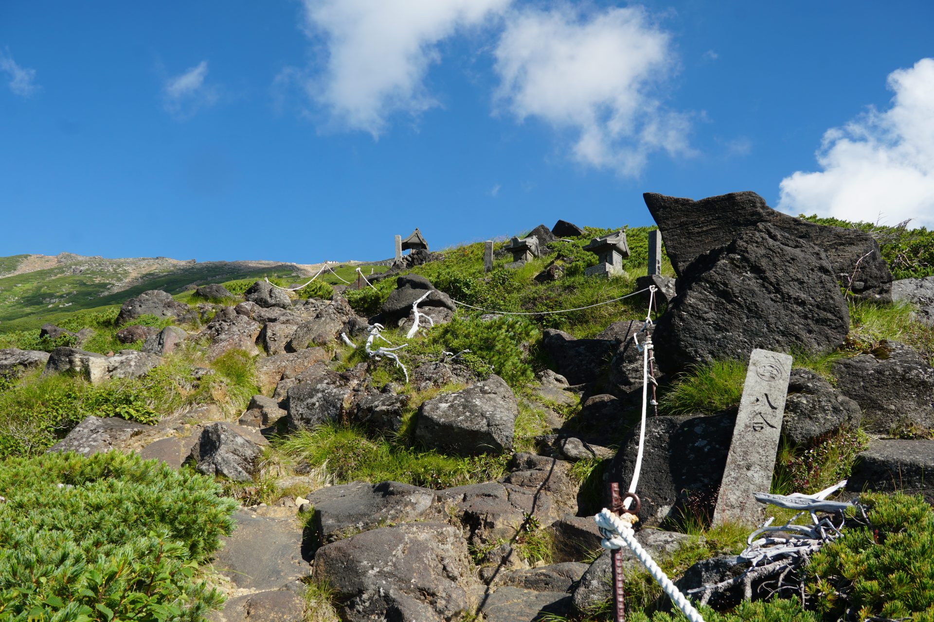
Otakiguchi Summit Okusha
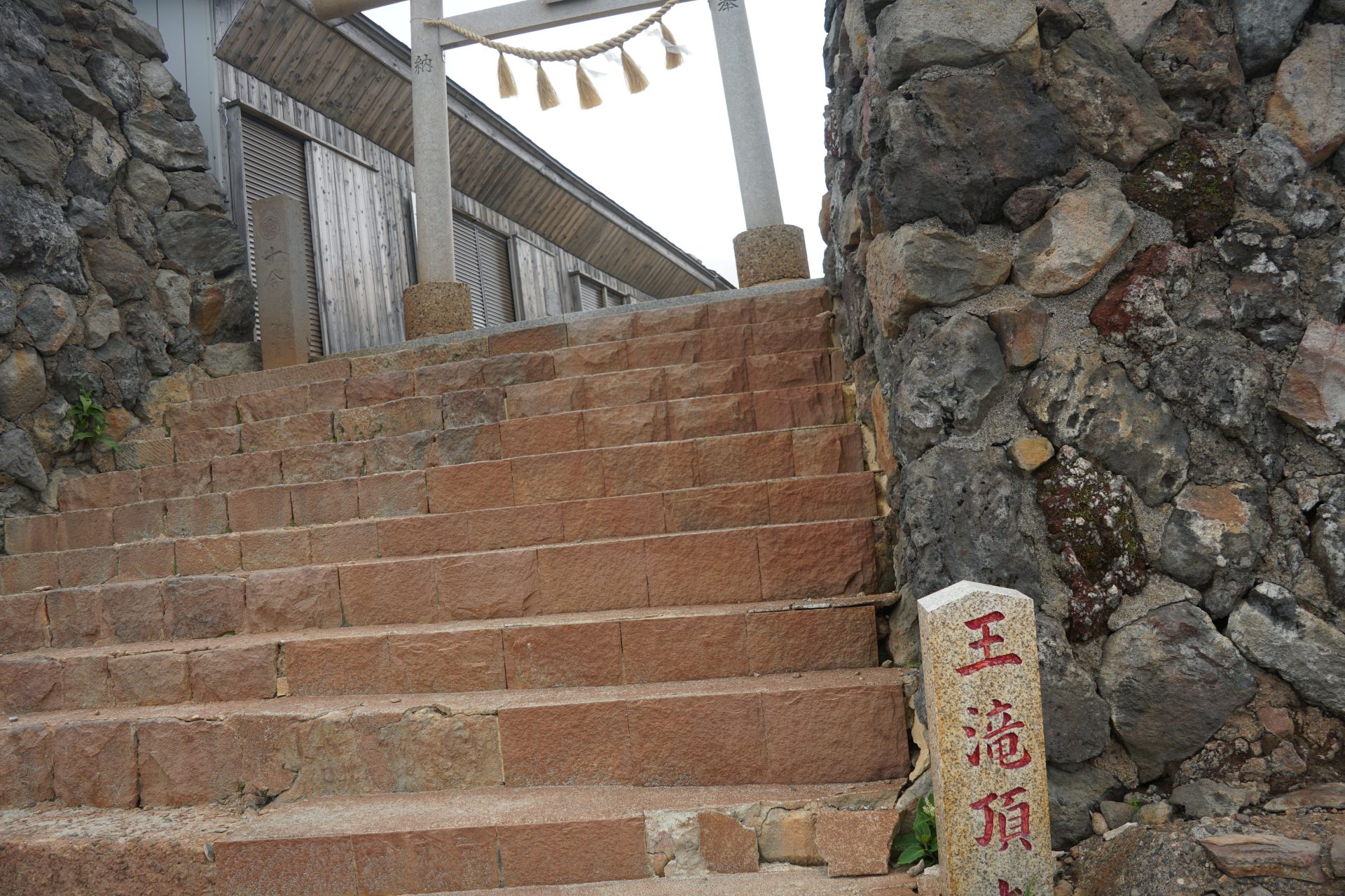
Elevation 2,933m
↓ 25 minutes
Kengamine
Elevation 3,067m
↓ 20 minutes
Otakiguchi Summit Okusha
Elevation 2,933m
↓ 35 minutes
Ninth station evacuation hut
Elevation 2,806m
↓ 35 minutes
Eighth station evacuation hut
Elevation 2,550m
↓ 55 minutes
Tanohara trailhead
Elevation 2,191m
Route Guide
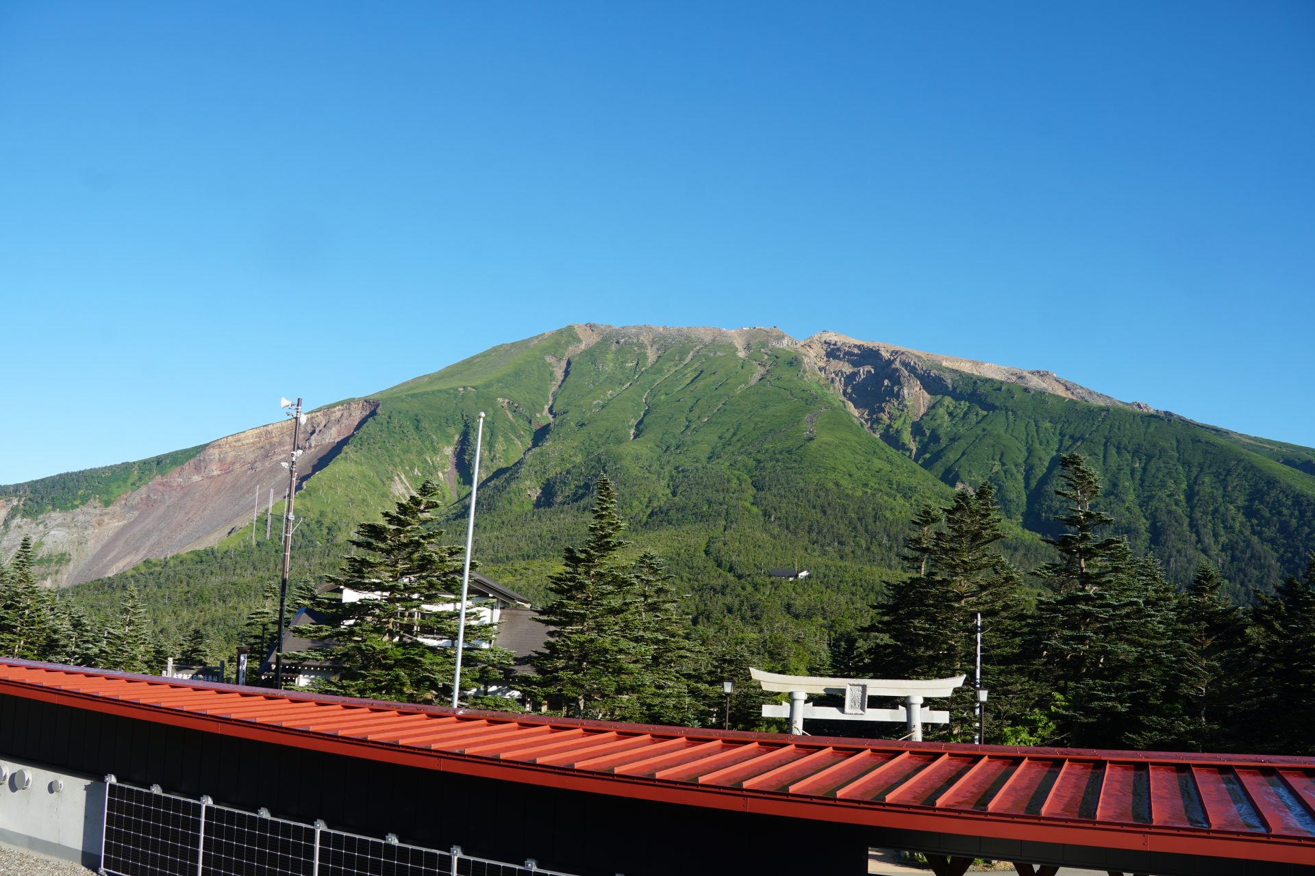
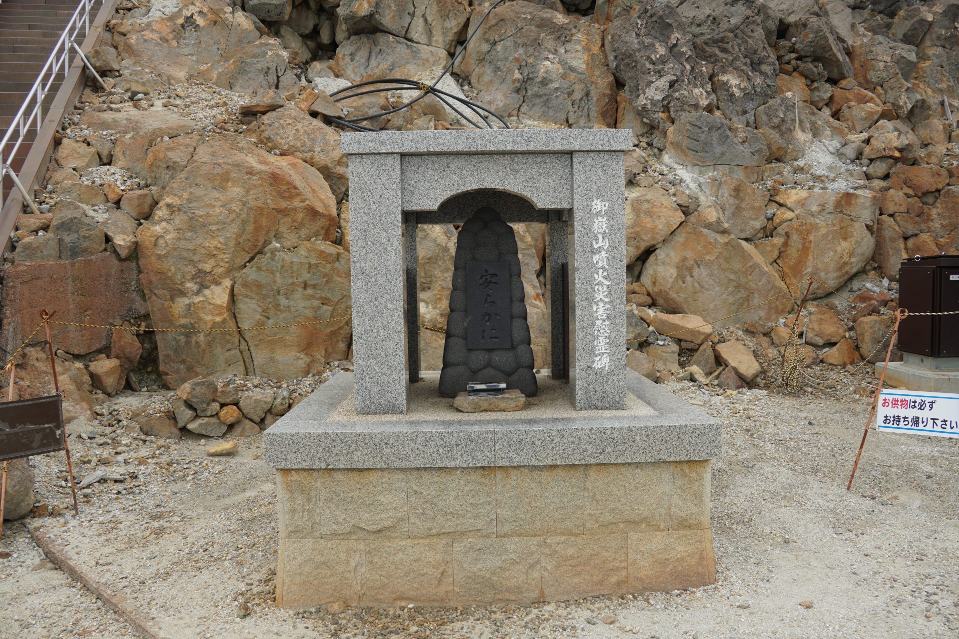
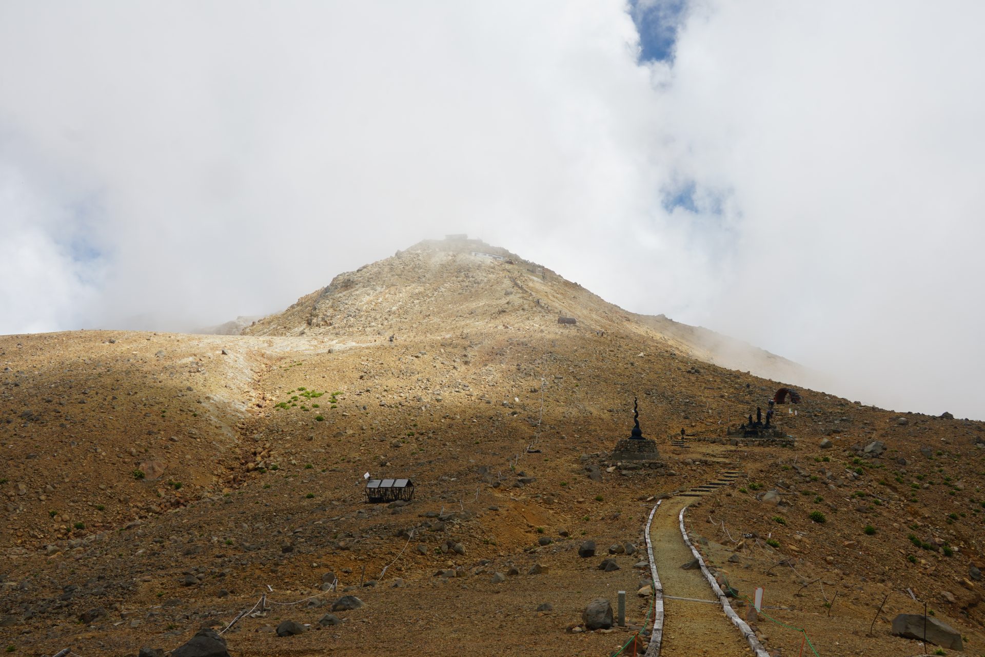
The Ontake mountains, the shortest route from the Tanohara trailhead to the top of the peak, the Otaki summit, and the Kenga-mine via Haccho-darumi. However, as you know, the route has been closed since the eruption in September 2014, and of the 54 victims of the eruption, 80% were killed along the route, and some are still missing. As people who love the mountain, let us climb the mountain with a sense of consolation.
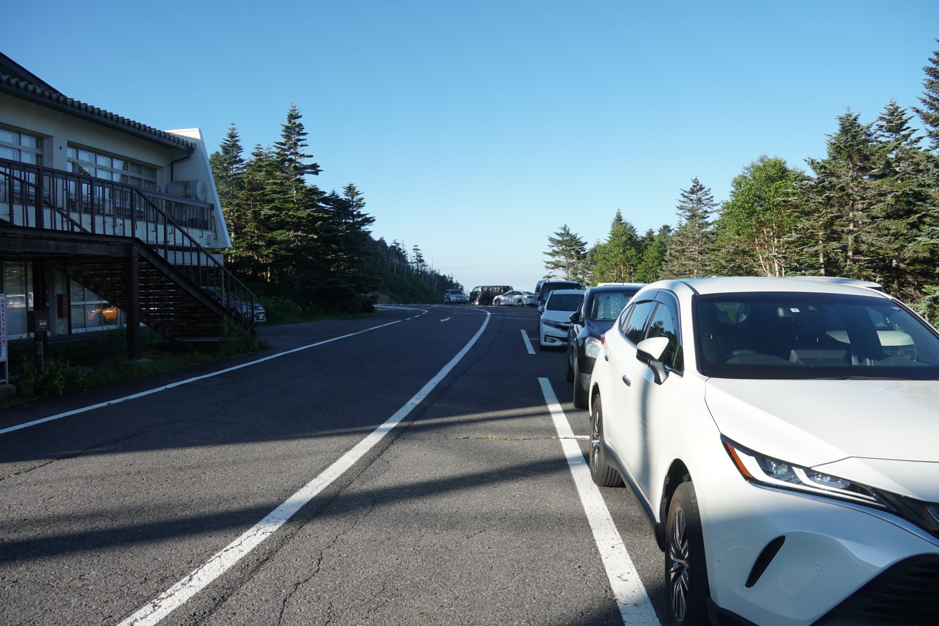
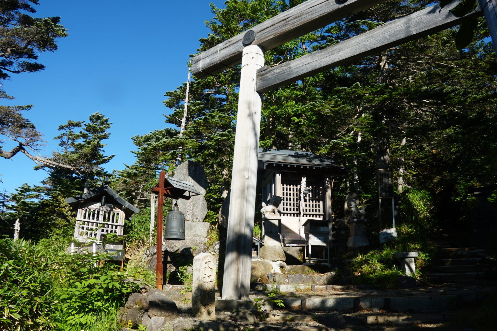
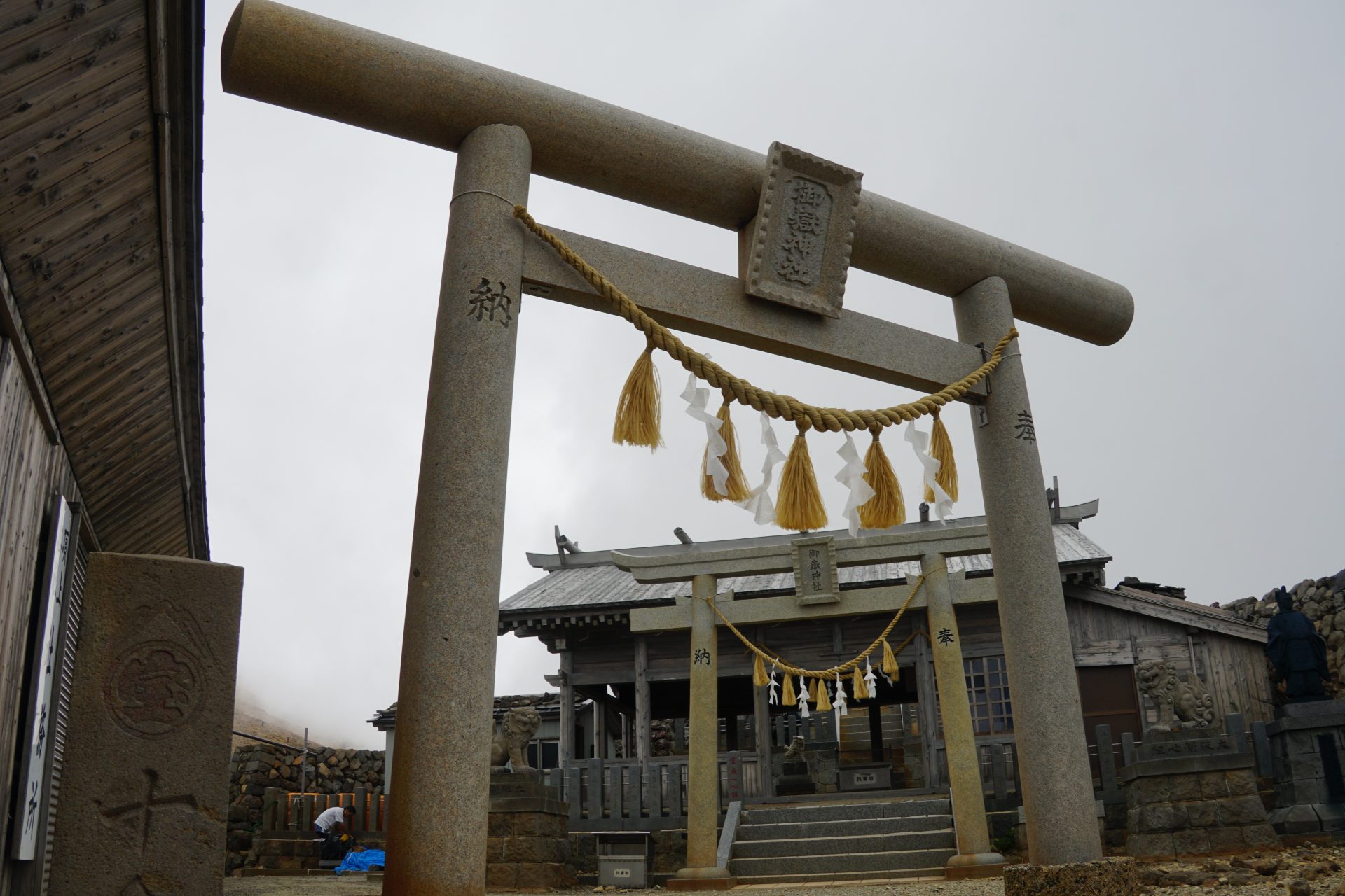
If you have time, stop by the Ontake Shrine Satomiya in Otaki Village to pray for safety before heading to the trailhead. On the way, you will see many stone pillars called "Reijhin Monument," which are said to be the places where believers of the Ontake faith return to Ontake after their death.
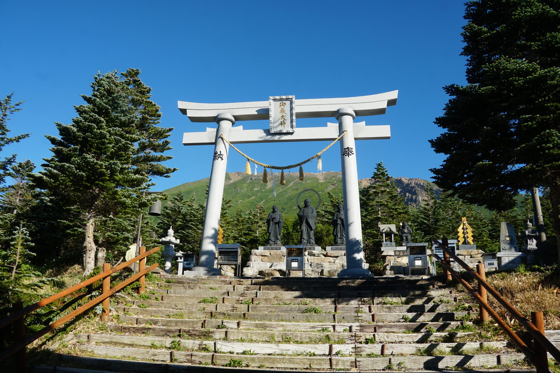
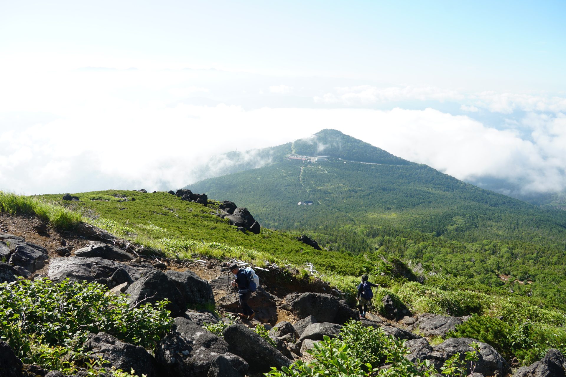
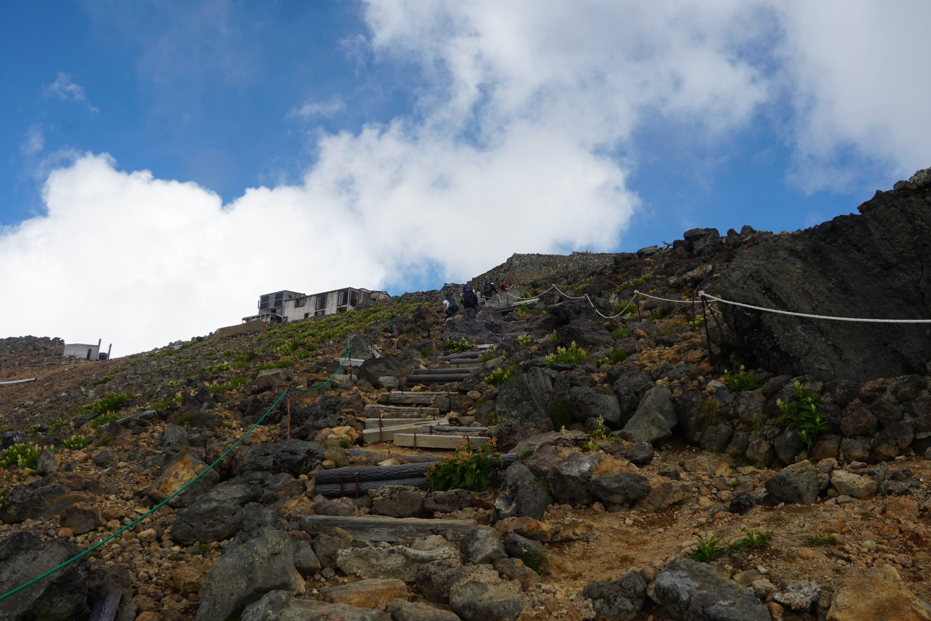
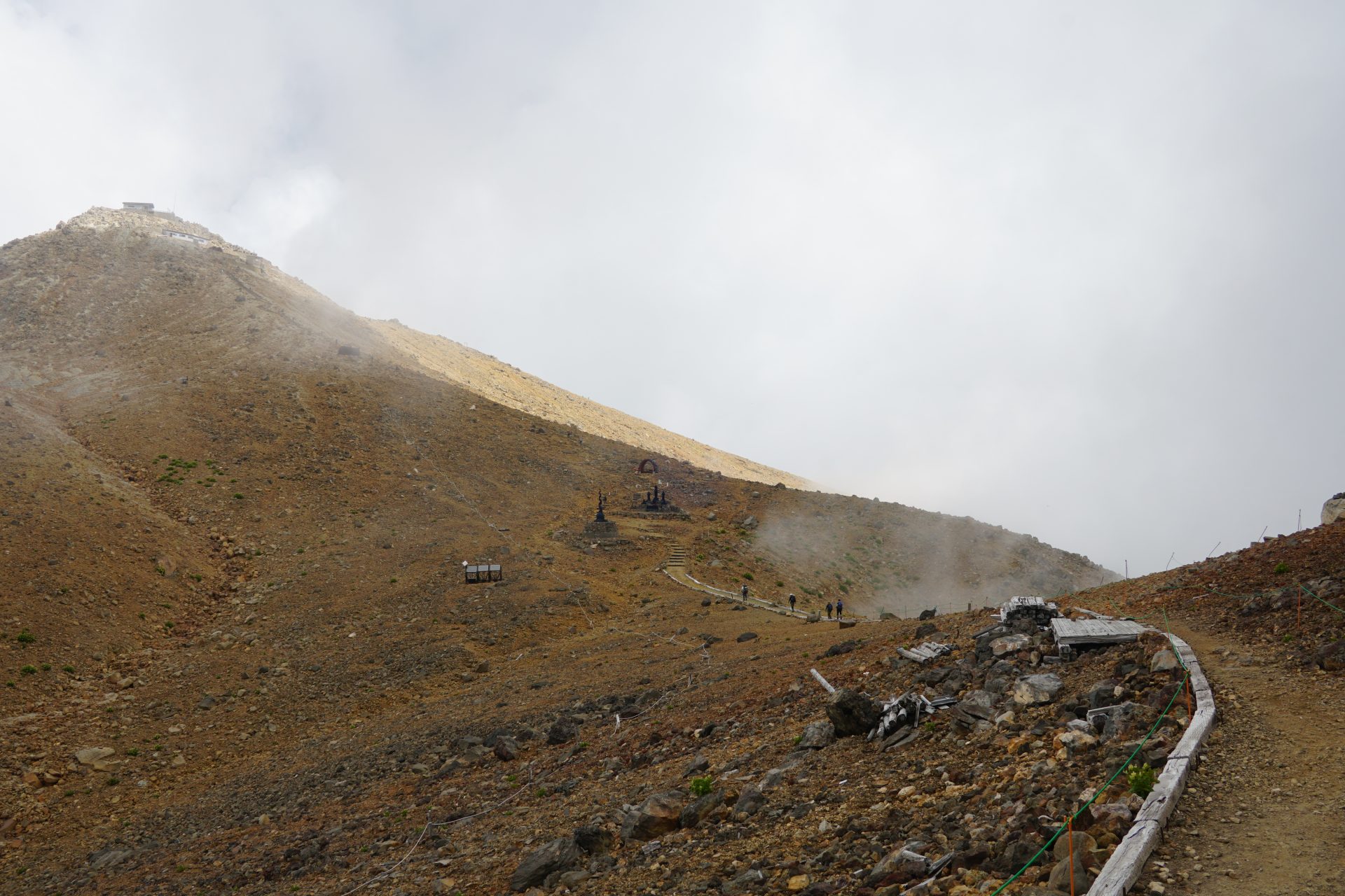
After 15 minutes' walk, you will see the Ontake Shrine Yohaijyo on your right hand side. Pray to the Ontake mountains, which can be seen behind the altar, and pray for the safety of the ascent. After that, the actual climbing starts from the torii of Oe Gongen. Torii gates, shrines, and statues of gods and Buddha that can be seen everywhere along the way will tell you the original purpose for which this trail was built. After about an hour's walk from the shrine, you will reach the 8th station refuge hut. Looking up, you can see people piled up on the route and buildings on the ninth station and the summit of Otaki, it is a view similar to that of climbing Mt. Fuji-san.
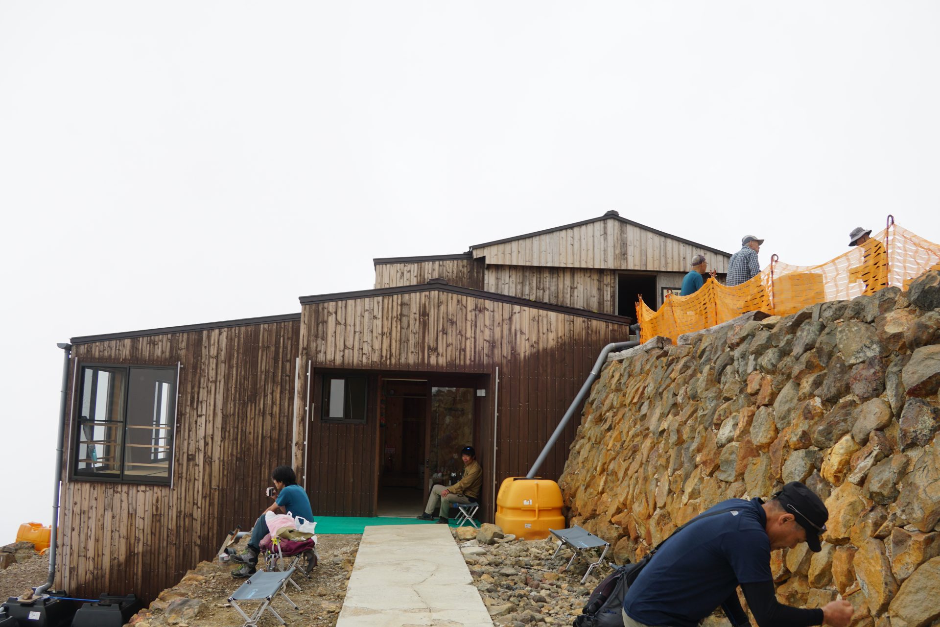
From this point on, you will need to wear a helmet. The route enters the crux of the climb, a crucial point where it becomes steep. The elevation is steadily increasing. After taking in water and catching your breath, you will reach the 9th station in less than an hour. After another 40 minutes of persistent climbing, we reached the summit of Otaki. We have been able to climb up to this point before. This is the Ontake-jinja Summit Okusha Shrine. There are no mountain huts on the route of the Otaki entrance, and no drinking water is sold. The water stations on the route may be dry, so please be prepared to drink plenty of water before climbing. Be sure to bring a helmet and wear it from the eighth station.
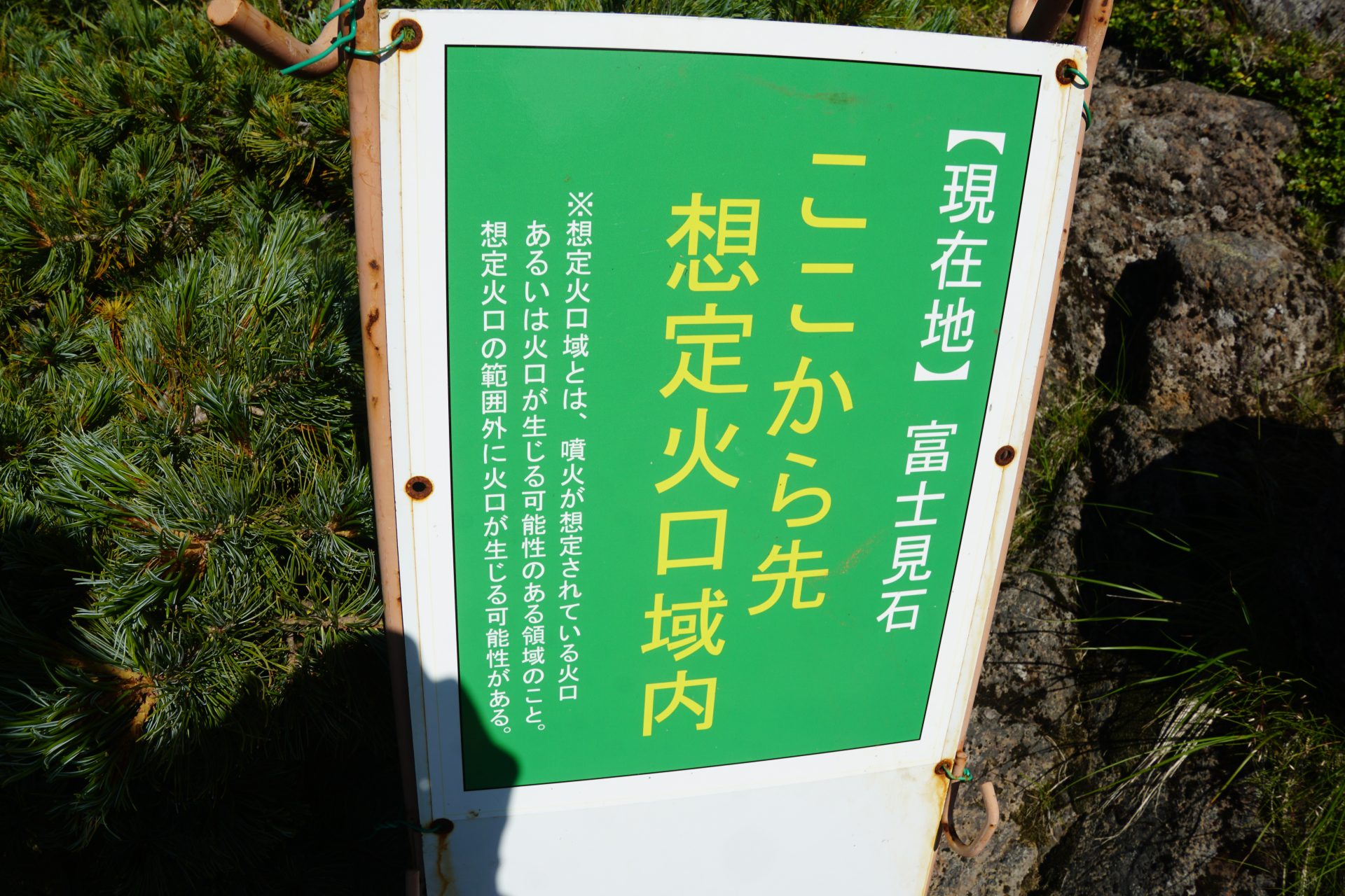
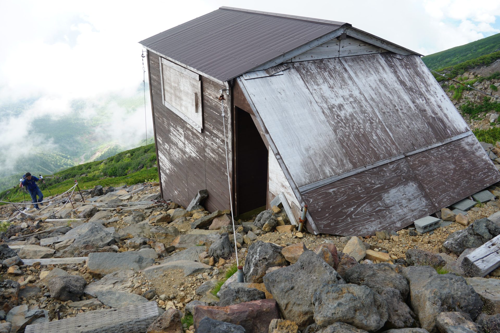
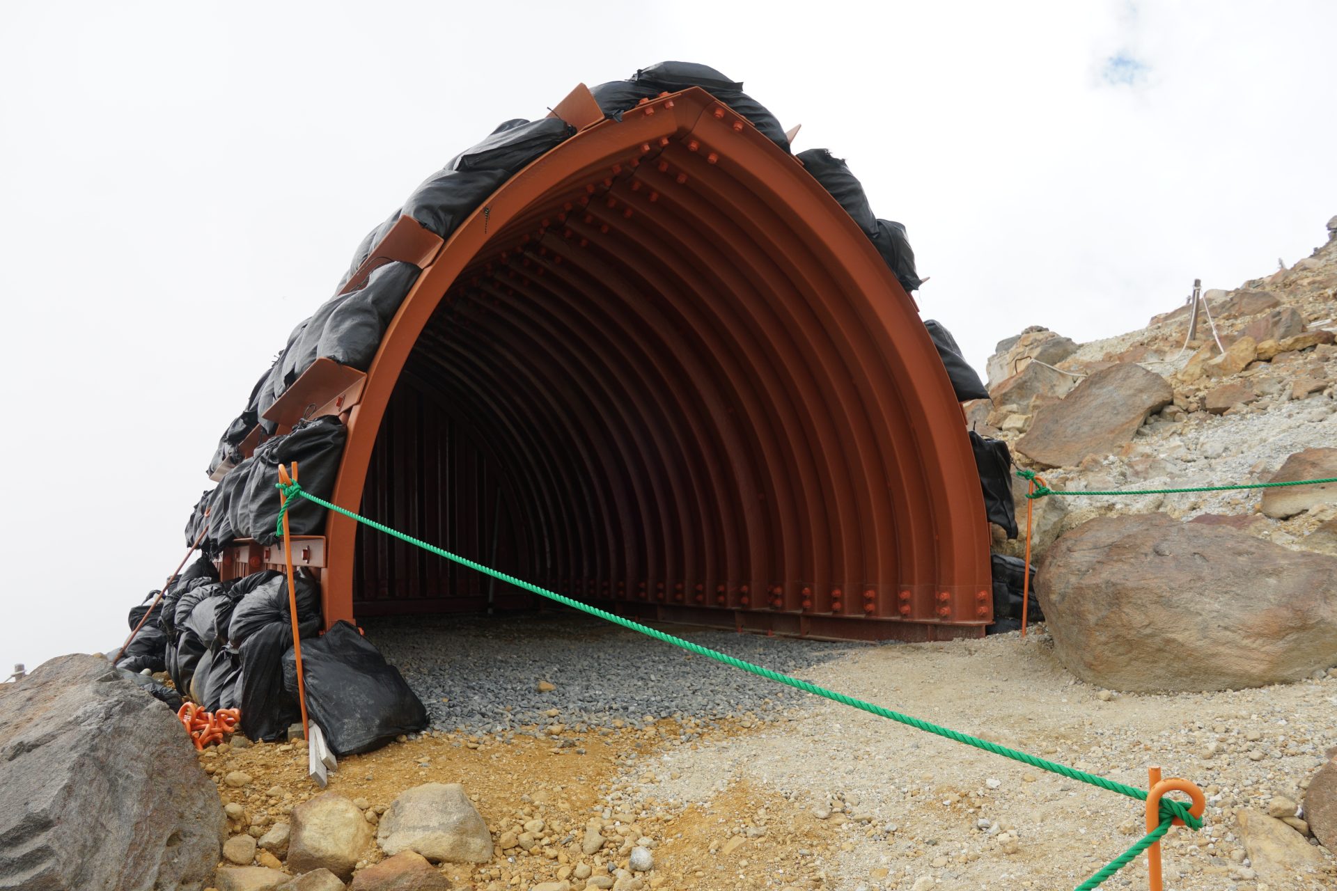
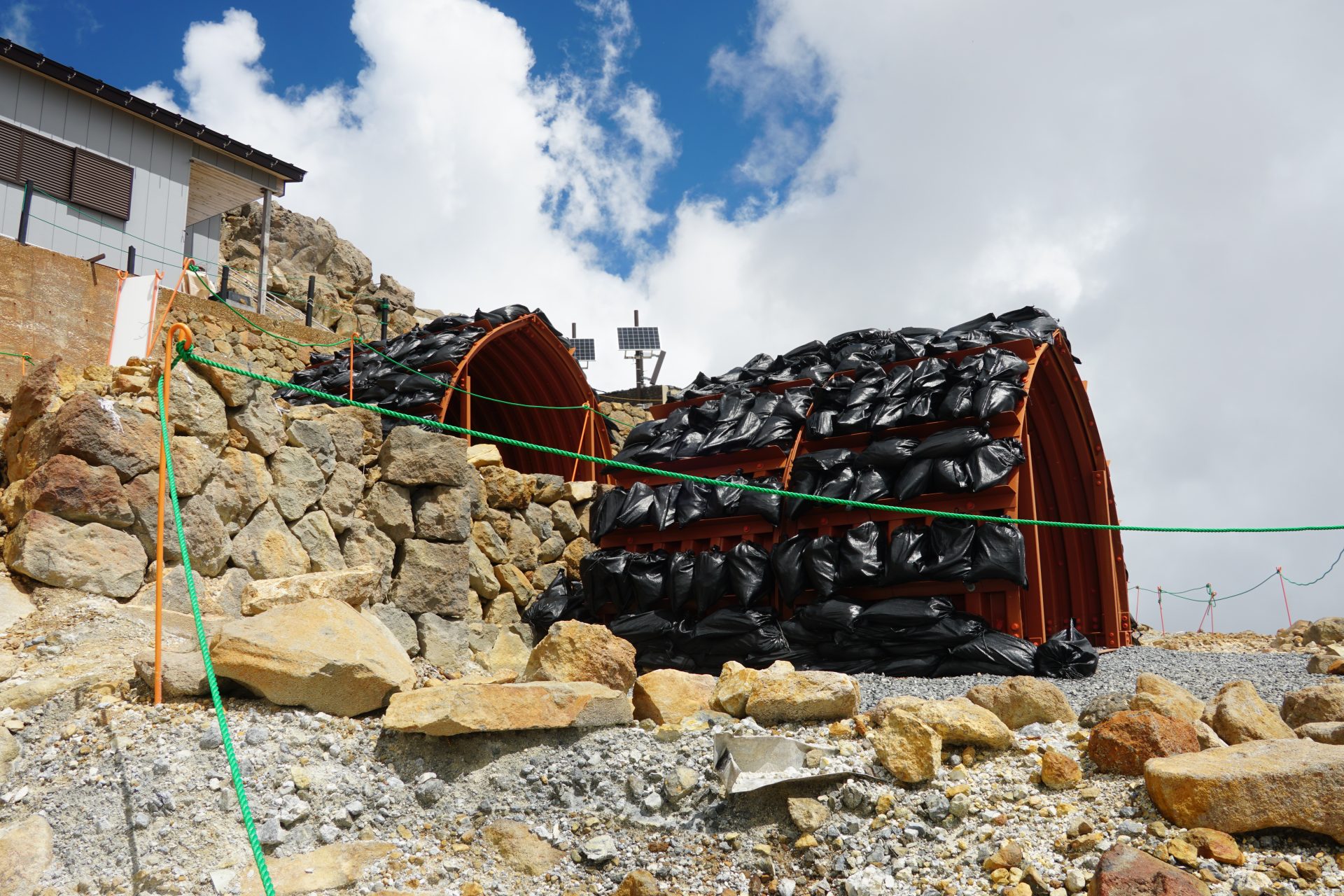
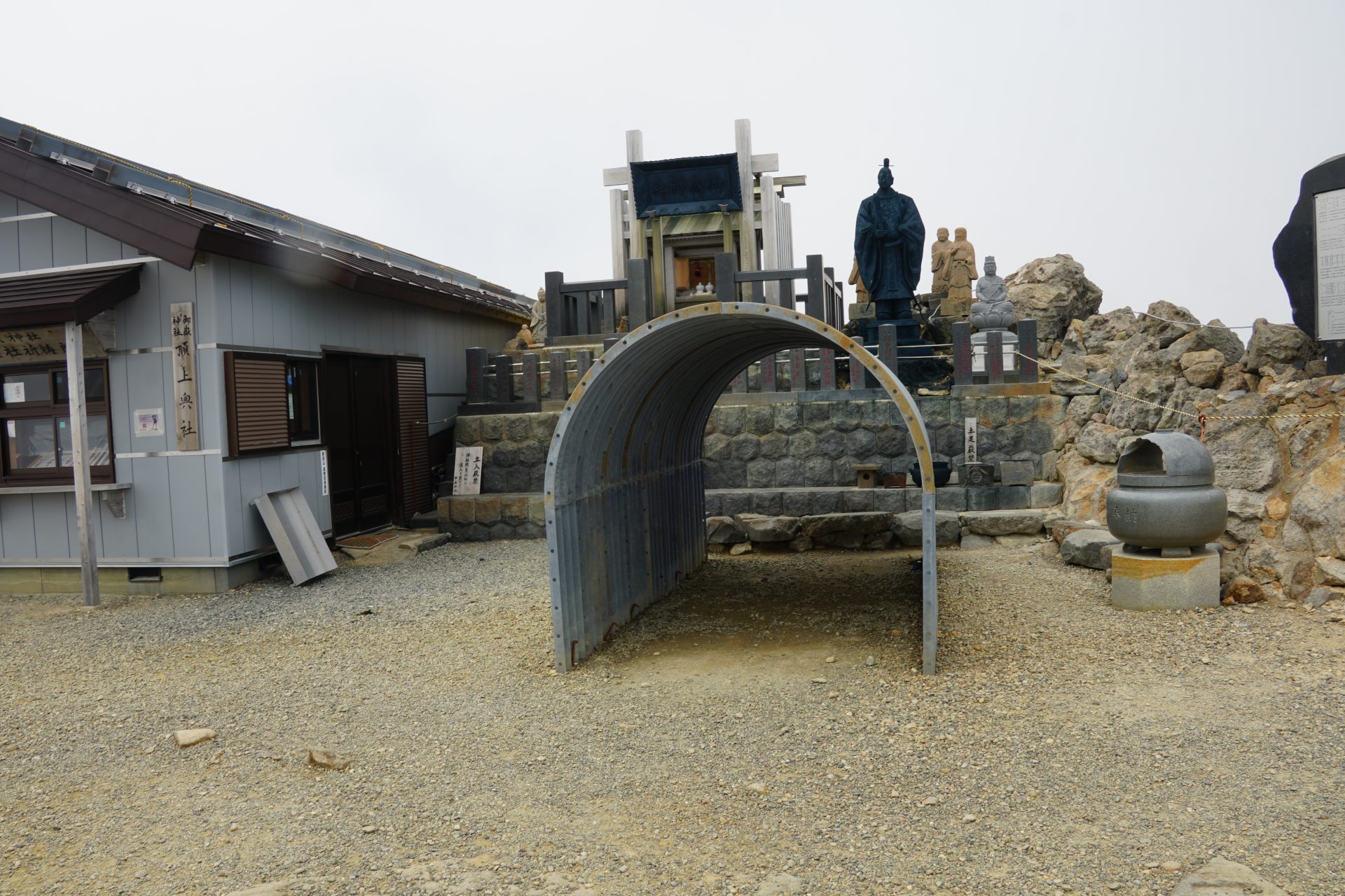
This is where the Haccho-darmi volcano erupted and many people were killed. Depending on the direction of the wind, you can smell the sulfur, reminding you that although the path is now passable, this is still a stone's throw from the volcano's crater. Shelters were set up at two locations in the middle of the rugged volcanic terrain. Natural disasters are truly unpredictable, and this is safety equipment just in case, but when thinking of those who lost their lives in them, my greatest wish must be that this equipment will never be used.
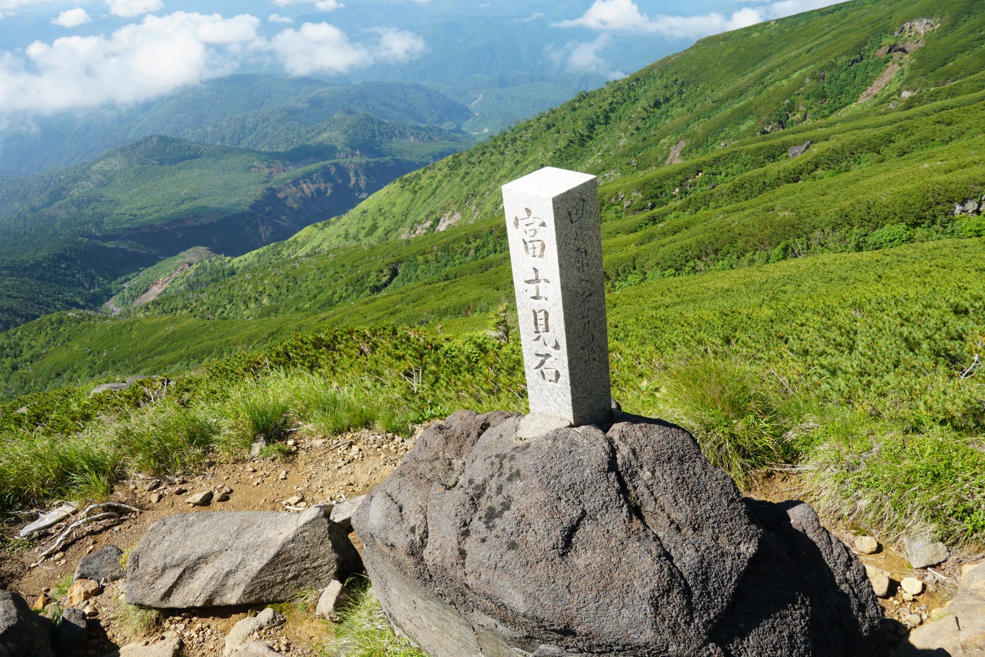
In less than 30 minutes, we reached the summit of Ken-gamine. From here, you can enjoy a spectacular view of the Central Alps, the Northern Alps, and the Southern Alps, as well as the Nino-ike Pond and the Sai-no-Kawara River below. On the way back down the same route, there are two lodging facilities at Nino-ike Pond, and other lodges at Kurosawa-guchi and Kosaka-guchi, so it is recommended to stay overnight to see the sunrise.