Tatami-daira Route
①Tatami-daira ~ Kenzakai-hiroba ~ Katano-koya Mountain hut ~ Mt. Ken-gamine/ Highest Peak of Norikura mountains~ Katano-koya Mountain hut ~ O'hana-batake junction ~ Tatami-daira
Technical level: B
Physical strength level: 2
Difficulty level: ⛰️
A route recommended for beginners, the quickest route to the summit of Ken-gamine.
●Hiking Data
Schedule: One day
Walking hours: 2 hours 50 minutes
(Up: 1 hours 35 minutes/Down: 1 hour 15 minutes)
Walking distance: 5.1 km
Difference in elevation: 418 m
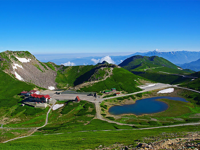
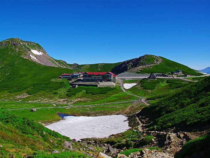
Tatami-daira

Elevation 2,700m
↓ 10 minutes
Kenzakai-hiroba
Elevation 2,710m
↓ 35 minutes
Katano-koya Mountain hut

Elevation 2,800m
↓ 50 minutes
Mt. Ken-gamine/ Highest Peak of Norikura Mountains
Elevation 3,025m
↓ 40 minutes
Katano-koya Mountain hut
Elevation 2,800m
↓ 15 minutes
O'hana-batake junction
Elevation 2,730m
↓ 20 minutes
Tatami-daira
Elevation 2,700m

Route Guide
It can be said that Mr. Norikura-dake is a part of Mt. Yari-gatake and the Hotaka mountains. You will be amazed by the view from the summit at an elevation of 3,025 m. From Tatami-daira, hike on a trail by the side of Tsuruga-ike. It takes about 1 hour and 35 minutes to the summit. Enjoy walking while admiring alpine plants in bloom along the trail. The beaten trail comes to a pavement. This is Kenzakai-hiroba, which is known for Dicentra in bloom. Take a sharp turn to the right. It is a comfortable trail to walk on. Elevation will be gained gradually. Mt Fujimi-dake can be spotted in the upper left corner of your sight. The summit can be reached directly from Kenzaka-hiroba. If you would like to visit, climb straight up to the summit instead of visiting the flower field when descending. From the saddle, it takes about 25 minutes to Kenzakai-hiroba.
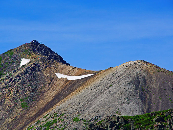
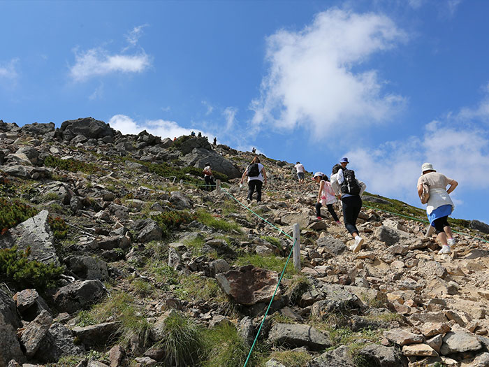
When proceeding on the wide and comfortable trail, another trail to Mt. Masyari-ten-dake appears from the right. A weather station is placed at the summit. If time allows, you may visit the summit. It takes about 25 minutes from the junction. A snowy valley comes into sight at the left beneath the trail. Snow remains until late summer so some enjoy skiing then. The Katano-koya Mountain hut is located just ahead of this point. You may take a break in the backyard of the hut. Many hikers can be spotted climbing on the slope straight ahead. After a short break, please head out.
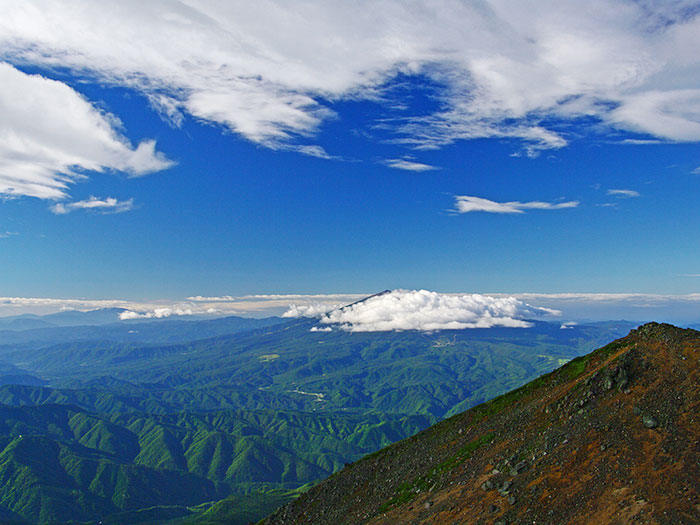
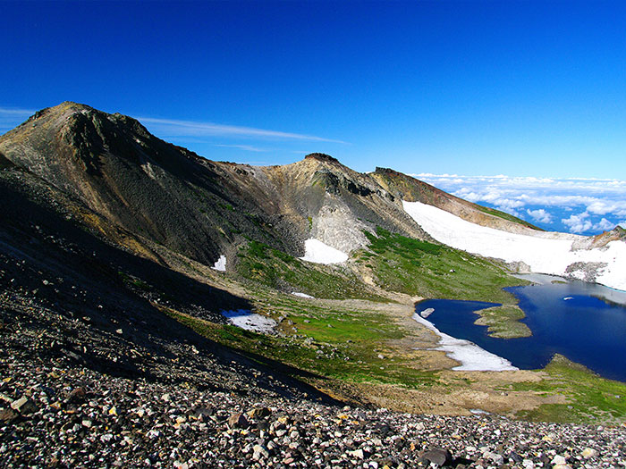
You might want to ask staff at the hut if the weather seems to be changing. They would give you good advice from their expertise and experience. The trail becomes rocky with small and large rocks. The trail is covered by Pinus Pumila. Walk at a steady pace with shorter strides. After passing here, the trail becomes graveled. The summit of Mt. Kodama-dake is reached after passing the zone where alpine plants such as Stellaria nipponica are in bloom. Gongen-ike pond can be spotted in the lower right corner. A sign for the Chojo-koya Mountain hut is reached in about five minutes. Chojo-koya Mountain hut is open only in a store capacity. It does not provide a place to stay for the night. The summit of Ken-gamine is reached after a short uphill from here. A shrine of Asahi-gongen-sha stands at the summit. The view is 360 degrees. Mt. Ontake-san stands right in front of you.
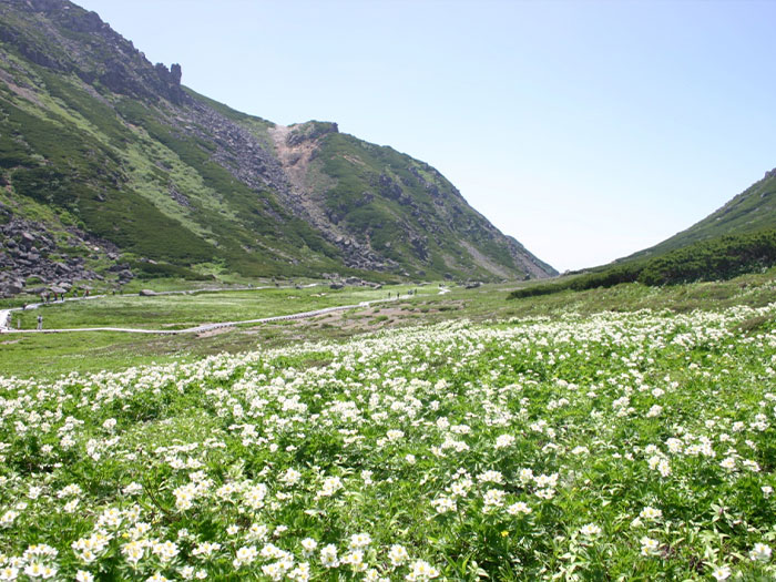
Descend the same trail used for ascending with caution till the junction with the Mt. Fujimi-dake ridgeline. Proceed to the left from the junction. This is a route to a flower field that spreads out below Tatami-daira. It is a flower field where a boardwalk is placed and is easy to walk on. Many tourists visit here. Iwa-kagami, Kobai-keiso, and Arens are in bloom. Tatami-daira is reached at the top of the stairs to a restaurant. Enjoy the view of the mountains till the time the bus departs.