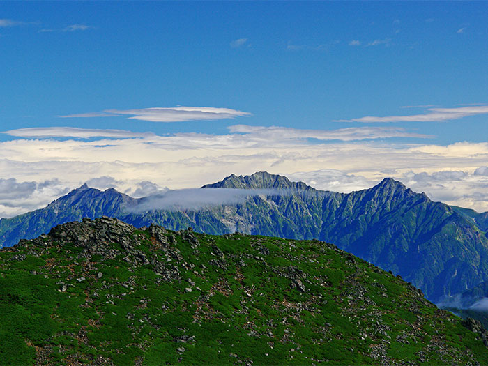
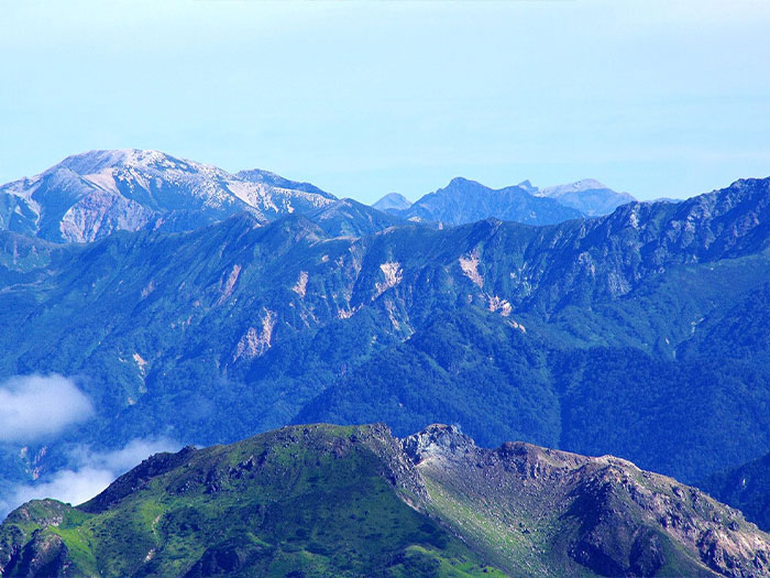
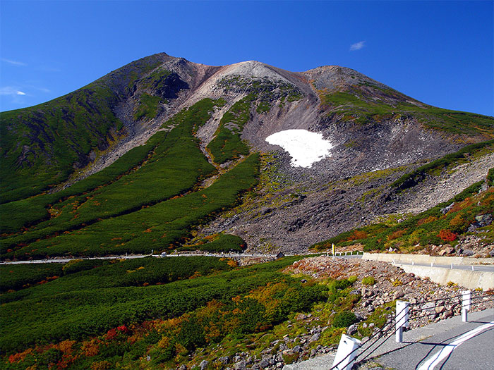
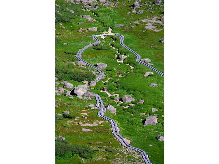
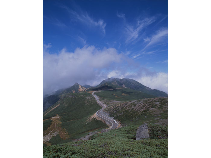
Norikura Mountains are located between Gifu and Nagano prefectures and are a large group of volcanoes. This mountains belongs to the Norikura volcanic belt and are a popular mountain like Ontake mountains. It used to be called Mt. Abou-yama or Mt. Kurai-yama. The name of Norikura is named after its shape, which looks like as if the saddle is placed on the back of horse from the Hida side. The main peak is Ken-gamine at an elevation of 3,025 m. There are 22 peaks in the area. It is an entry level mountain due to its easy access to the summit of 3,000 m. It is well known as a great lookout of the North and South Japan Alps, Mt. Haku-san, and Mt. Fuji-yama. It is also popular as a jewel box of alpine plants. Summer skiing can be enjoyed in a large snowy valley below Katano-koya Mountain hut. At the bottom of the mountains, the Norikura plateau spreads out.
Norikura Mountains: Elevation 3,025 m (Highest Peak Kenga-mine)
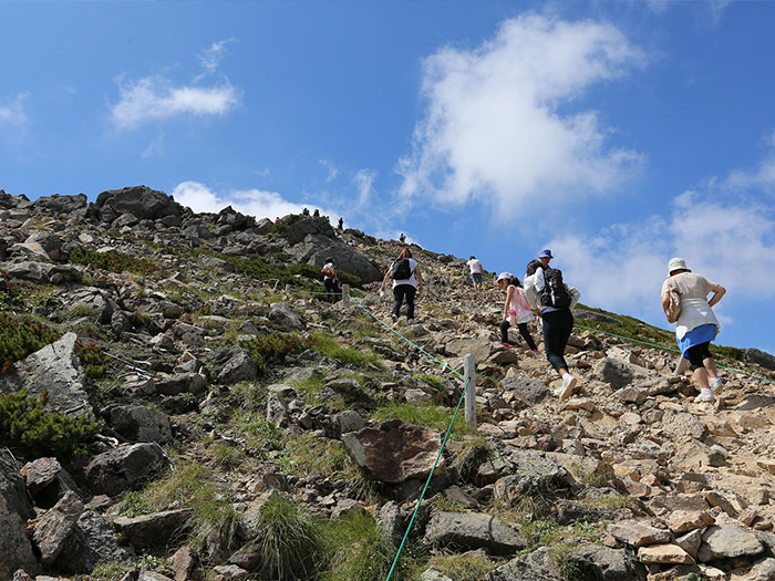
It is an easy hike to the peak, high above an elevation of 3,000 m, however, caution must be employed for altitude sickness. The starting point of the Norikura tatami-daira route, which is the quickest route to the summit, is at an elevation of 2,700 m. You may get altitude sickness anytime from the height. It is important to take time to adjust to the height even though the trip may be a day hike. Sometimes you might become sick around an elevation of 2,000 m. If you have a headache or feel sick already when you reach Tatami-daira, you need to give up hiking on that day. Even though you are symptom free, you should rest at Tatami-daira for at least an hour. You may take a break or look for souvenirs here. You also can walk around the flower fields, which spread out below Tatami-daira. If you do not feel sick and feel energized about an hour later, then you are ready for hiking. If you start feeling sick while hiking, you should descend immediately. There is no cure for altitude sickness. Once you start feeling sick, descending and lowering the altitude is the only way to get over the sickness.
Trailhead vicinity weather
Weekly weather forecast zone:Nagano Prefecture, Chubu Region
| DAY | WEATHER | LOWEST | HIGHEST |
|---|---|---|---|
| 7/20 | 23℃ | 35℃ | |
| 7/21 | 23℃ | 34℃ | |
| 7/22 | 23℃ | 34℃ | |
| 7/23 | 23℃ | 33℃ | |
| 7/24 | 22℃ | 33℃ | |
| 7/25 | 22℃ | 33℃ |
This is a publication of the calculated figures for weather predictions and is not the weather forecast. There are instances where there will be big differences in the values stated for the mountains, in accord with the topography as well as sunlight, etc. so please take care.
72 hours weather information:Shuttle bus information desk at the summit of Mt. Norikura, Azumi Suzuran, Matsumoto City, Nagano Prefecture
| Date and time |
7/19 9:00 |
7/19 10:00 |
7/19 11:00 |
7/19 12:00 |
7/19 13:00 |
7/19 14:00 |
7/19 15:00 |
7/19 16:00 |
7/19 17:00 |
7/19 18:00 |
7/19 19:00 |
7/19 20:00 |
7/19 21:00 |
7/19 22:00 |
7/19 23:00 |
7/20 0:00 |
7/20 1:00 |
7/20 2:00 |
7/20 3:00 |
7/20 4:00 |
7/20 5:00 |
7/20 6:00 |
7/20 7:00 |
7/20 8:00 |
7/20 9:00 |
7/20 10:00 |
7/20 11:00 |
7/20 12:00 |
7/20 13:00 |
7/20 14:00 |
7/20 15:00 |
7/20 16:00 |
7/20 17:00 |
7/20 18:00 |
7/20 19:00 |
7/20 20:00 |
7/20 21:00 |
7/20 22:00 |
7/20 23:00 |
7/21 0:00 |
7/21 1:00 |
7/21 2:00 |
7/21 3:00 |
7/21 4:00 |
7/21 5:00 |
7/21 6:00 |
7/21 7:00 |
7/21 8:00 |
7/21 9:00 |
7/21 10:00 |
7/21 11:00 |
7/21 12:00 |
7/21 13:00 |
7/21 14:00 |
7/21 15:00 |
7/21 16:00 |
7/21 17:00 |
7/21 18:00 |
7/21 19:00 |
7/21 20:00 |
7/21 21:00 |
7/21 22:00 |
7/21 23:00 |
7/22 0:00 |
|---|---|---|---|---|---|---|---|---|---|---|---|---|---|---|---|---|---|---|---|---|---|---|---|---|---|---|---|---|---|---|---|---|---|---|---|---|---|---|---|---|---|---|---|---|---|---|---|---|---|---|---|---|---|---|---|---|---|---|---|---|---|---|---|---|
| Weather | ||||||||||||||||||||||||||||||||||||||||||||||||||||||||||||||||
| Temperature | 17℃ | 18℃ | 20℃ | 21℃ | 21℃ | 22℃ | 22℃ | 21℃ | 21℃ | 20℃ | 19℃ | 18℃ | 17℃ | 16℃ | 16℃ | 15℃ | 15℃ | 15℃ | 15℃ | 14℃ | 14℃ | 14℃ | 15℃ | 17℃ | 19℃ | 20℃ | 22℃ | 22℃ | 23℃ | 22℃ | 22℃ | 22℃ | 22℃ | 21℃ | 20℃ | 19℃ | 18℃ | 17℃ | 17℃ | 16℃ | 16℃ | 16℃ | 16℃ | 16℃ | 16℃ | 16℃ | 17℃ | 18℃ | 20℃ | 21℃ | 21℃ | 22℃ | 22℃ | 21℃ | 20℃ | 20℃ | 20℃ | 20℃ | 19℃ | 18℃ | 18℃ | 18℃ | 18℃ | 17℃ |
| Precipitation | 0mm/h | 0mm/h | 0mm/h | 0mm/h | 0mm/h | 0mm/h | 0mm/h | 0mm/h | 0mm/h | 0mm/h | 0mm/h | 0mm/h | 0mm/h | 0mm/h | 0mm/h | ※ 16時間以降は表示されません | ||||||||||||||||||||||||||||||||||||||||||||||||
| Wind direction |
west-northwest 2m/s |
west-northwest 2m/s |
west-northwest 2m/s |
west-northwest 2m/s |
west-northwest 2m/s |
west-northwest 2m/s |
west-northwest 2m/s |
west-northwest 2m/s |
west-northwest 1m/s |
west-northwest 1m/s |
west-northwest 1m/s |
west-northwest 1m/s |
west-northwest 1m/s |
west-northwest 1m/s |
west-northwest 1m/s |
west-northwest 1m/s |
west-northwest 1m/s |
west-northwest 1m/s |
west-northwest 1m/s |
west-northwest 1m/s |
west-northwest 1m/s |
west-northwest 1m/s |
west-northwest 1m/s |
0m/s |
west-northwest 1m/s |
west-northwest 1m/s |
west-northwest 1m/s |
west-northwest 1m/s |
west-northwest 2m/s |
west-northwest 2m/s |
west-northwest 1m/s |
west-northwest 1m/s |
west-northwest 1m/s |
west-northwest 1m/s |
west-northwest 1m/s |
west-northwest 1m/s |
west-northwest 1m/s |
west-northwest 1m/s |
west-northwest 1m/s |
west-northwest 1m/s |
west-northwest 1m/s |
west-northwest 1m/s |
west-northwest 1m/s |
west-northwest 1m/s |
west-northwest 1m/s |
west-northwest 1m/s |
west-northwest 1m/s |
0m/s |
west-northwest 1m/s |
west-northwest 1m/s |
west-northwest 1m/s |
west-northwest 1m/s |
0m/s |
west-northwest 1m/s |
west-northwest 1m/s |
west-northwest 1m/s |
west-northwest 1m/s |
west-northwest 1m/s |
west-northwest 1m/s |
west-northwest 1m/s |
0m/s |
west-northwest 1m/s |
west-northwest 1m/s |
west-northwest 1m/s |
※The weather information will be information on 5km square including the relevant point.
※天気予報マークは一次細分区域から表示しています
View of Norikura mountains