Kosumo-Minamikoma Circuit Route
Inagawa Rindo – Inagawa Dam- 4th Station Junction – Kosumo-goya mountain hut – Mt. Kosumo-yama – Sengairei – Mt. Minamikoma-gatake – Kitazawa One – 4th Station Junction – Inagawa Rindo
Technical level: C
Physical strength level: 6
Difficulty level: ⛰️⛰️⛰️
This is the most popular route today, a circuitous route from Kosumo-yama Shindo from the Inagawa Dam on the Kiso side.
Please note that there are no huts or water stations on the ridge line.
●Hiking Data
Schedule: 1 night 2 days
Walking hours: 16 hours
(Inagawa Forest Road-Koshi Hyakuya: 6 hours 10 minutes, Koshi Hyakuya-Minami Komagatake: 4 hours 20 minutes Minami Komagatake-Inagawa Forest Road: 6: 10)
Walking distance 18.3 km
Difference in elevation: 2,800 m
Inagawa Rindo

Elevation 952m
↓ 40 minutes
Inagawa Dam Trailhead

Elevation 1,081m
↓ 1 hour
Inagawa Dam- 4th Station Junction
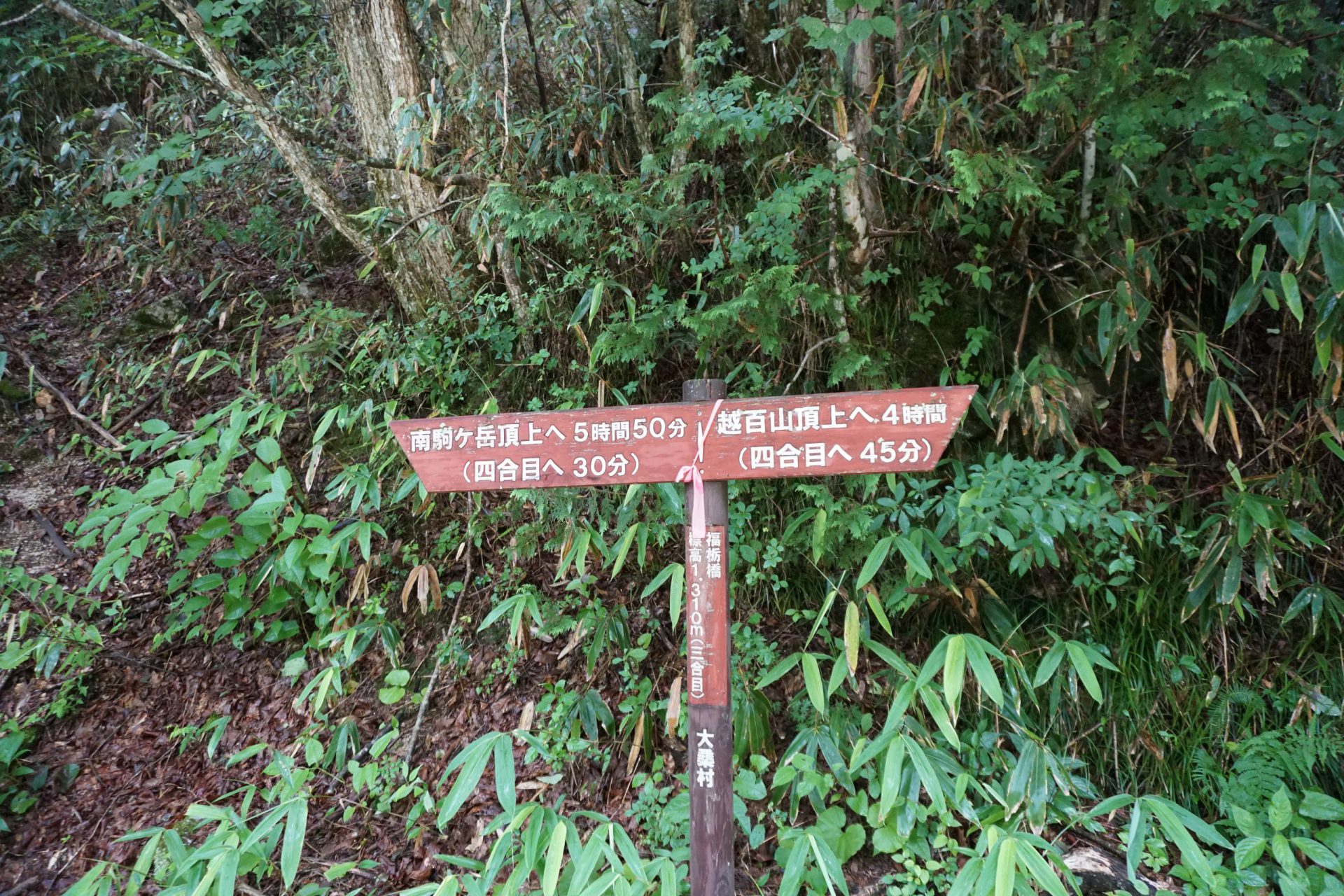
Elevation 1,310m
↓ 1 hour
Kol (water place) below
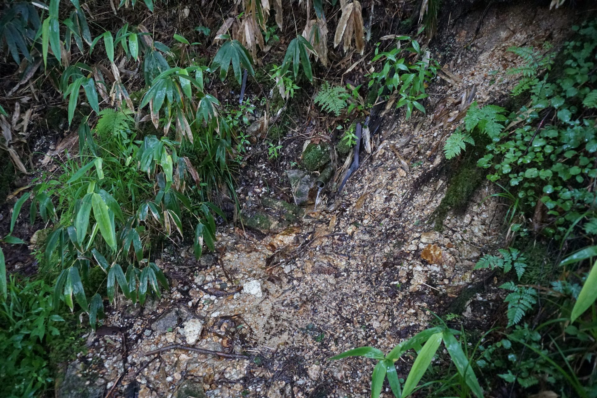
Elevation 1,623m
↓ 30 minutes
Top col
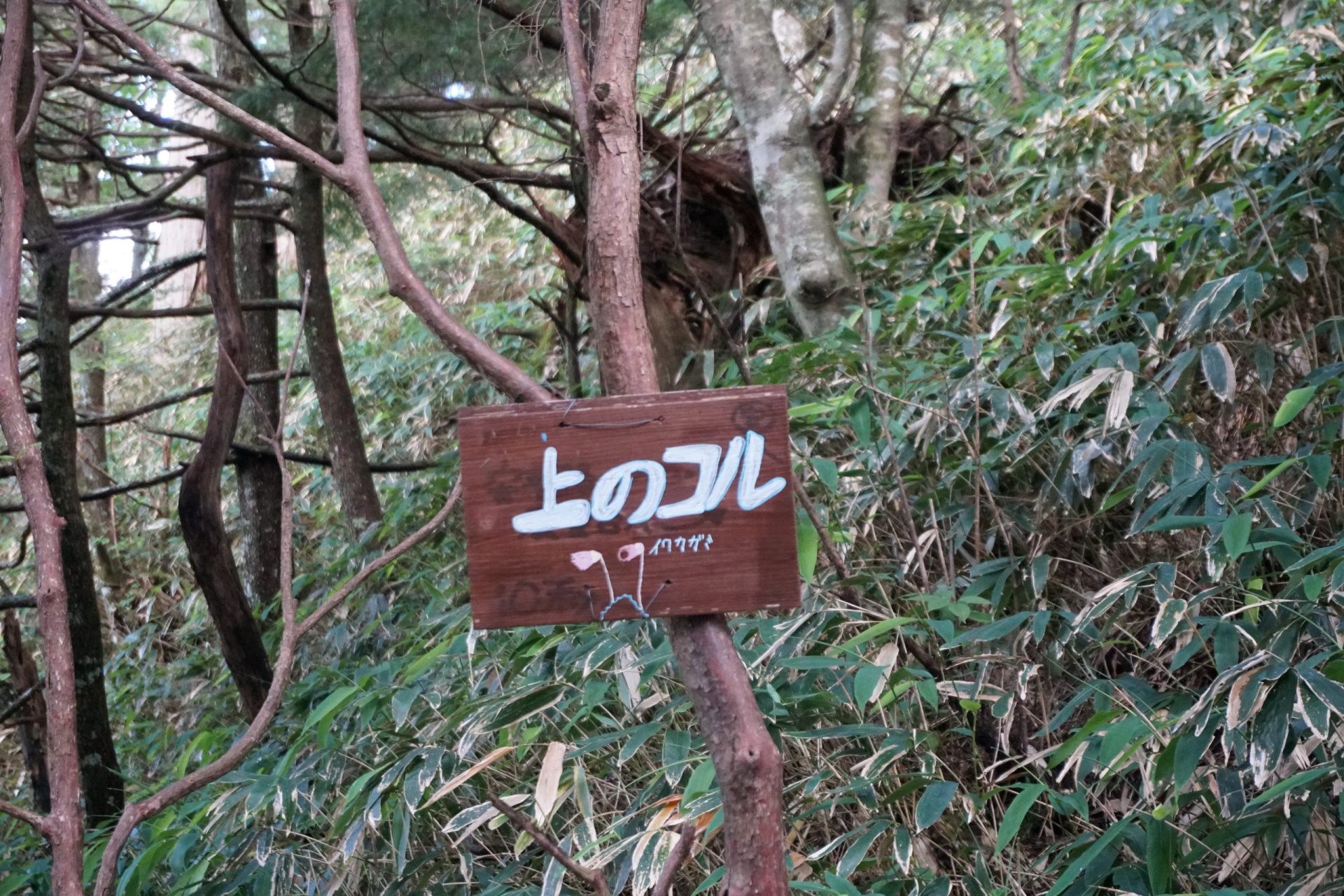
Elevation 1,721m
↓ 1 hour 40 minutes
Water branch
Elevation 2,175m
↓ 1 hour 20 minutes
Kosumo-goya mountain hut
Elevation 2,342m
↓ 1 hour
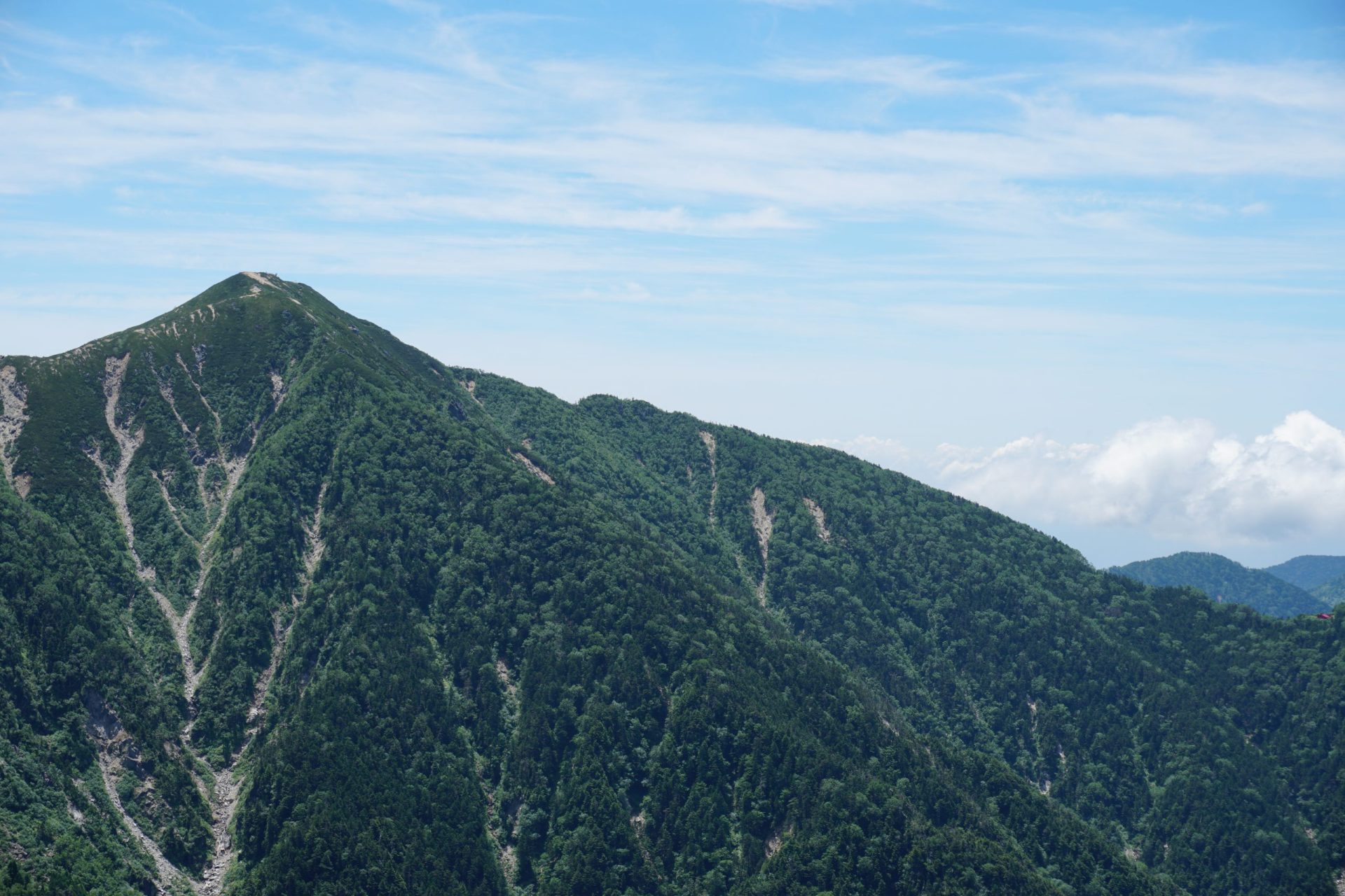
Mt. Kosumo-yama

Elevation 2,613.6m
↓ 1 hour 30 minutes
Sengairei

Elevation 2,734m
↓ 1 hour 50 minutes
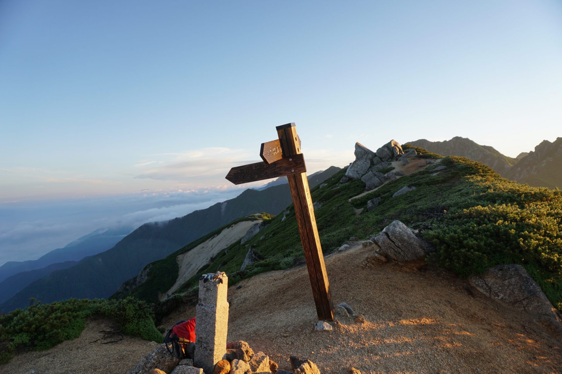
Mt. Minamikoma-gatake
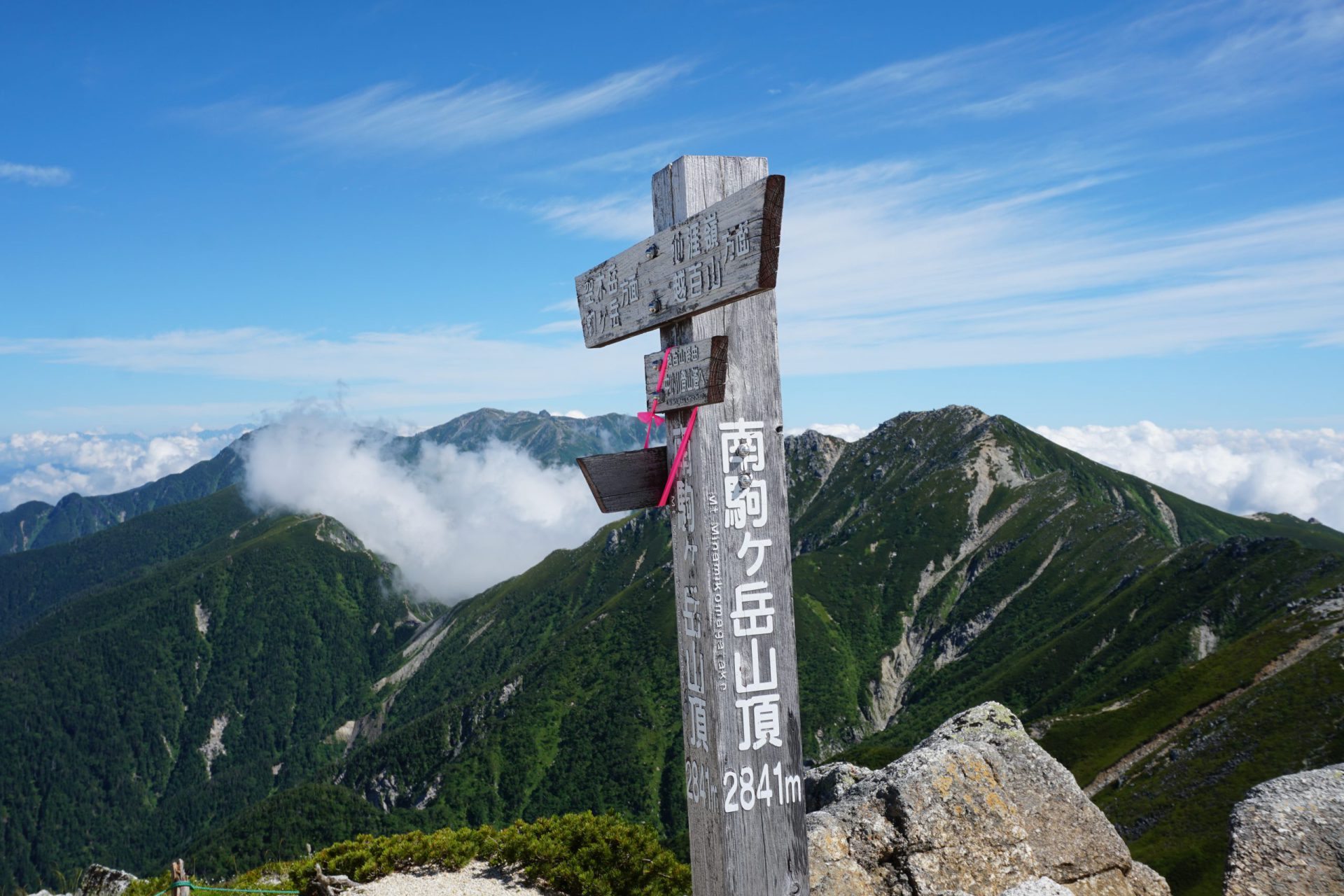
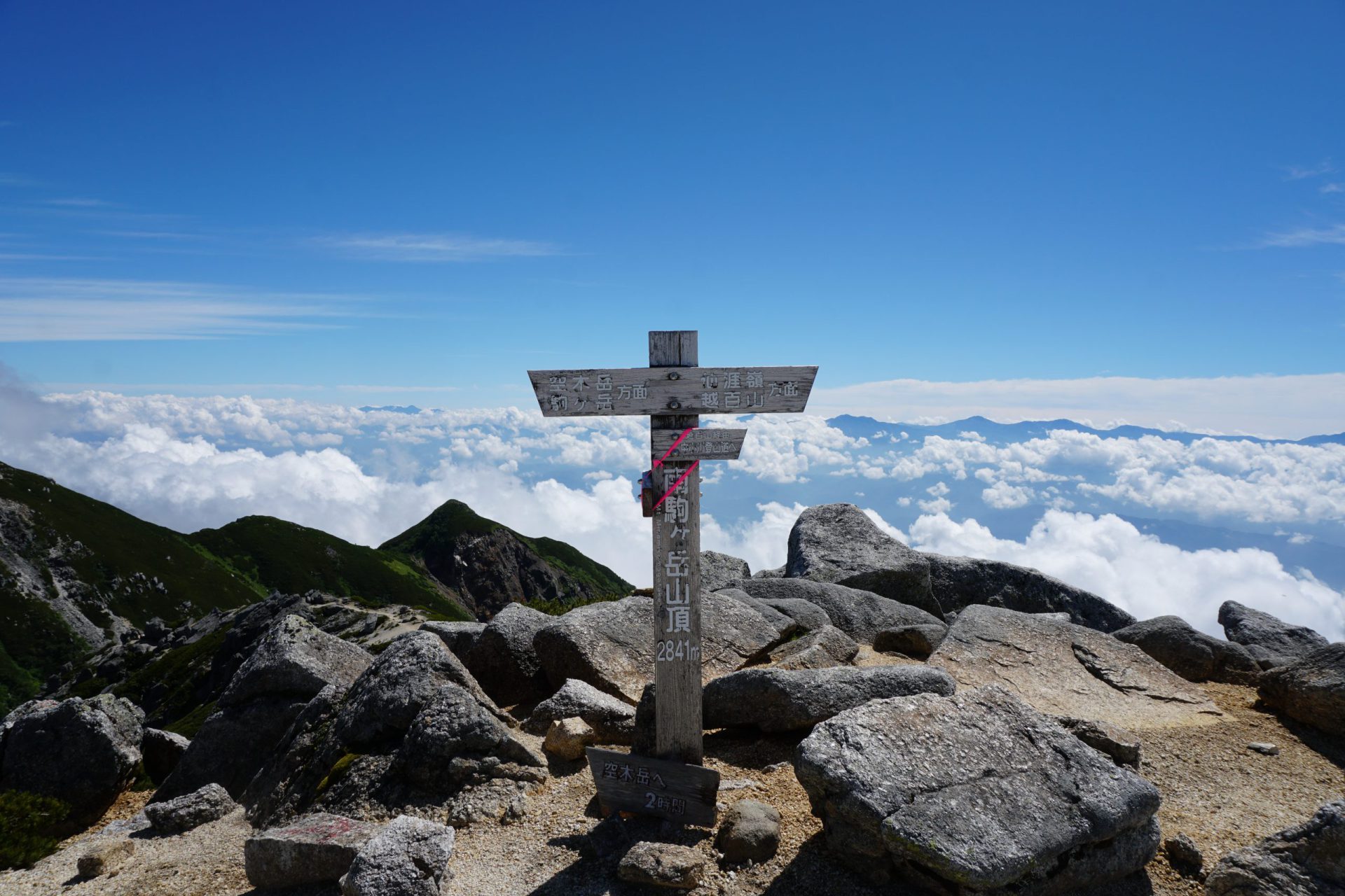
Elevation 2,841m
↓ 1 hour 45 minutes
2,411m
Elevation 2,411m
↓ 2 hours 30 minutes
4th station this morning river
Elevation 1,430m
↓ 30 minutes
Fukutochibashi branch
Elevation 1,310m
↓ 1 hour 15 minutes
Inagawa Rindo
Elevation 952m
Route Guide
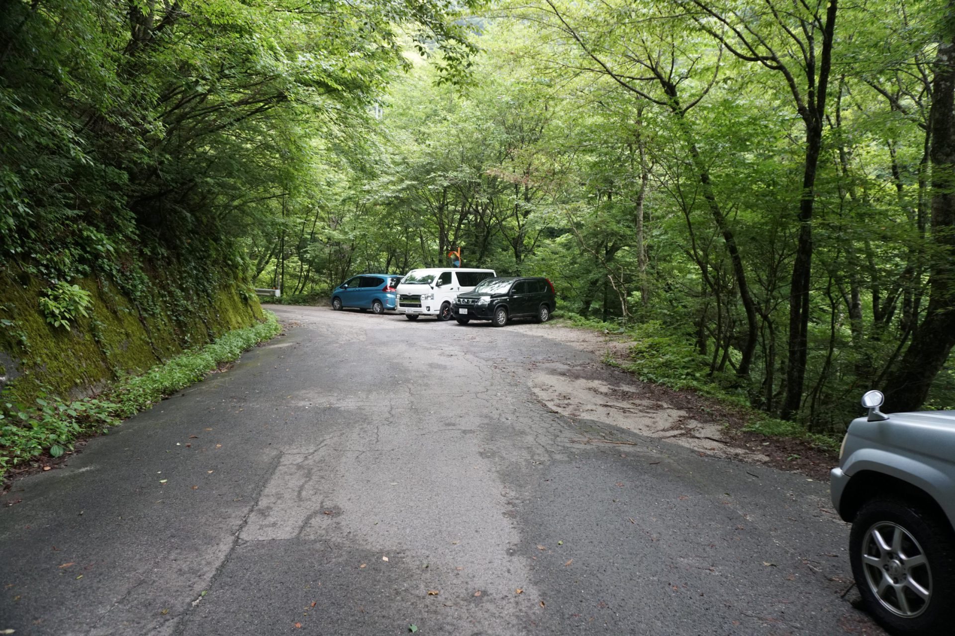
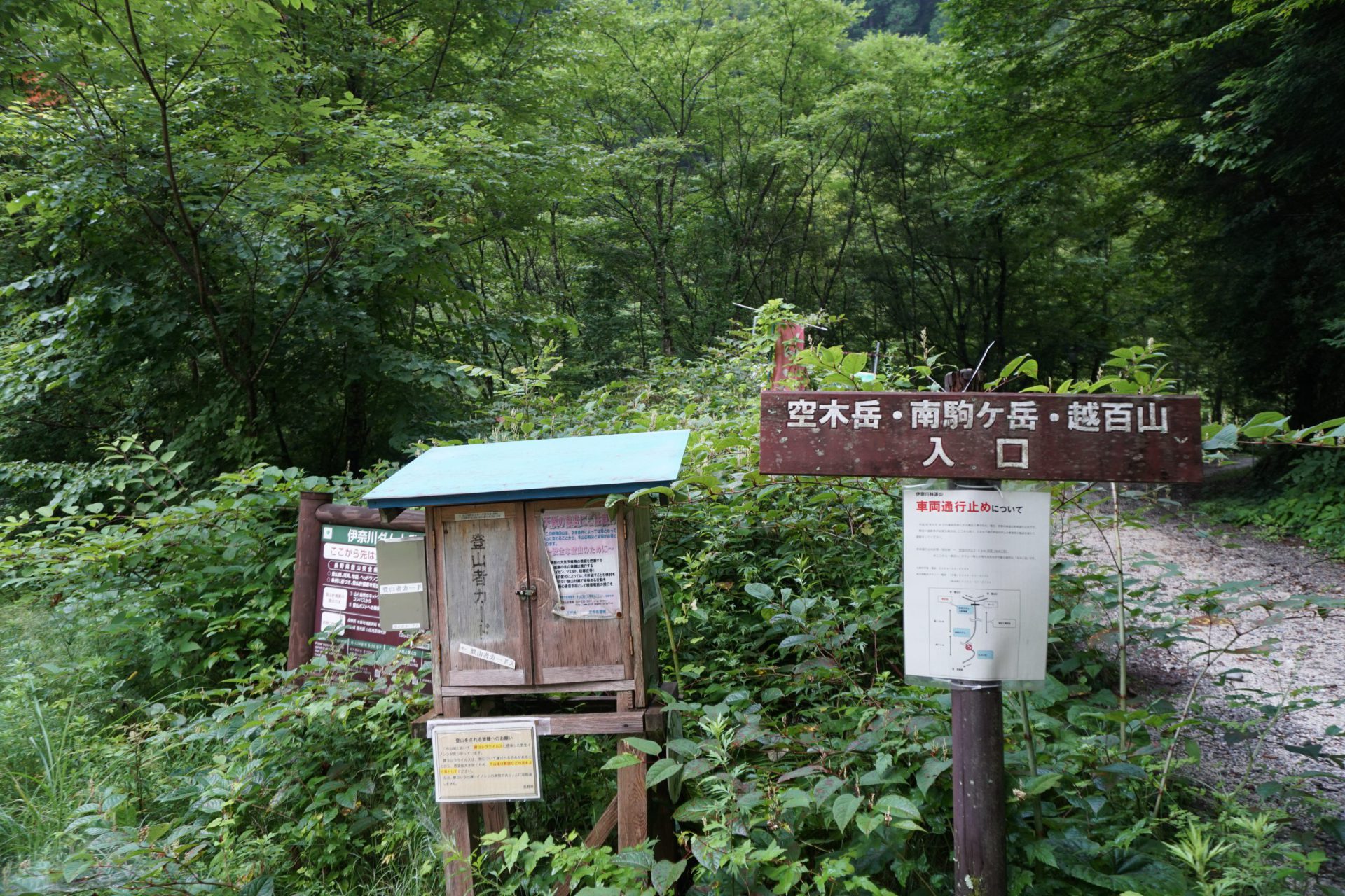
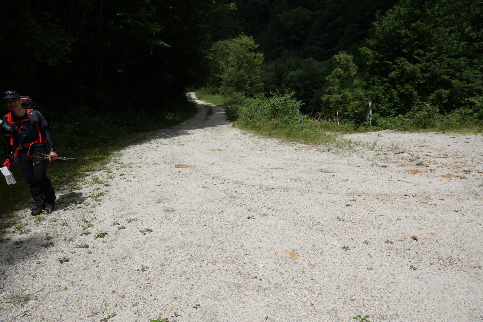
In 2018, due to heavy rains, the Inagawa Dam trailhead collapsed making it inaccessible at the moment, so you will have to walk an extra 30-40 minutes before the trailhead. Take the forest road that continues from Route 19 to the Inagawa Dam, and after continuing for about 20 minutes, you will find an area where several cars can be parked on the right side of the forest road. Please be sure to park your car in a way that will not obstruct the construction vehicles coming in and out here. Submit your climbing registration form in the box located in front of the parking area or submit it online before your climb. It is a climber’s duty to submit a climbing registration form.
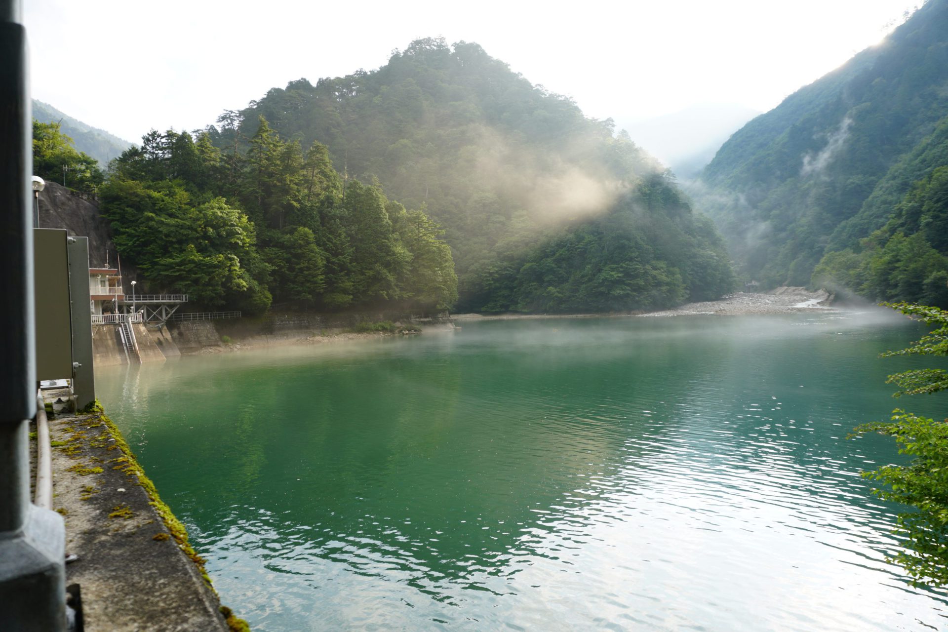
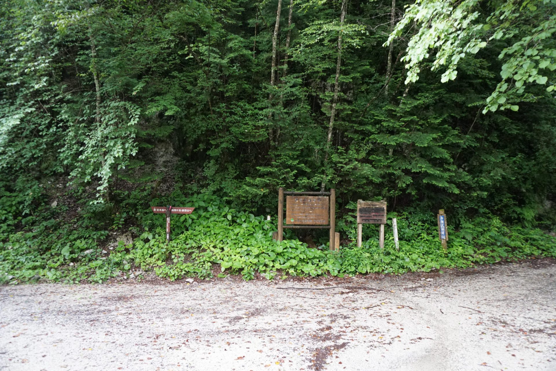
A short distance from the parking area, there is a river with a bridge. Regular vehicles cannot go past the bridge. Those who come by taxi must also get out here. Cross the bridge, go through the tunnel, and you will come out in front of Inagawa Dam. The damage to the forest road in front of the dam is obvious and you will understand immediately why car access is restricted. Continue walking for about 20-30 minutes and you will arrive at the original trailhead. Once you cross Kesa-sawa bridge, follow the trail path on the left that takes you along the Ina River and you will be headed toward the Mt. Utsugi-dake Kiso route. The route to Mt. Kosumo-yama and Mt. Minamikoma-gatake follows the forest road along the Kesa-sawa River on the right for about another hour. Crossing the Fukutochi Bridge, the route on the left goes to Mt. Minamikoma-gatake’s Kitazawa ridge, and on the right is the Kosumo-yama Shindo, which continues on to the Mt. Kosumo-yama Tomi ridge. We are going to take the route on the right and officially begin our climb.
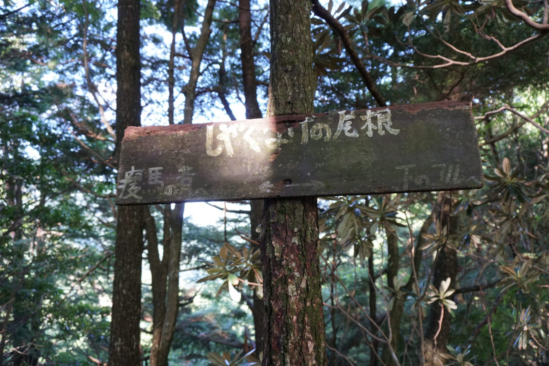
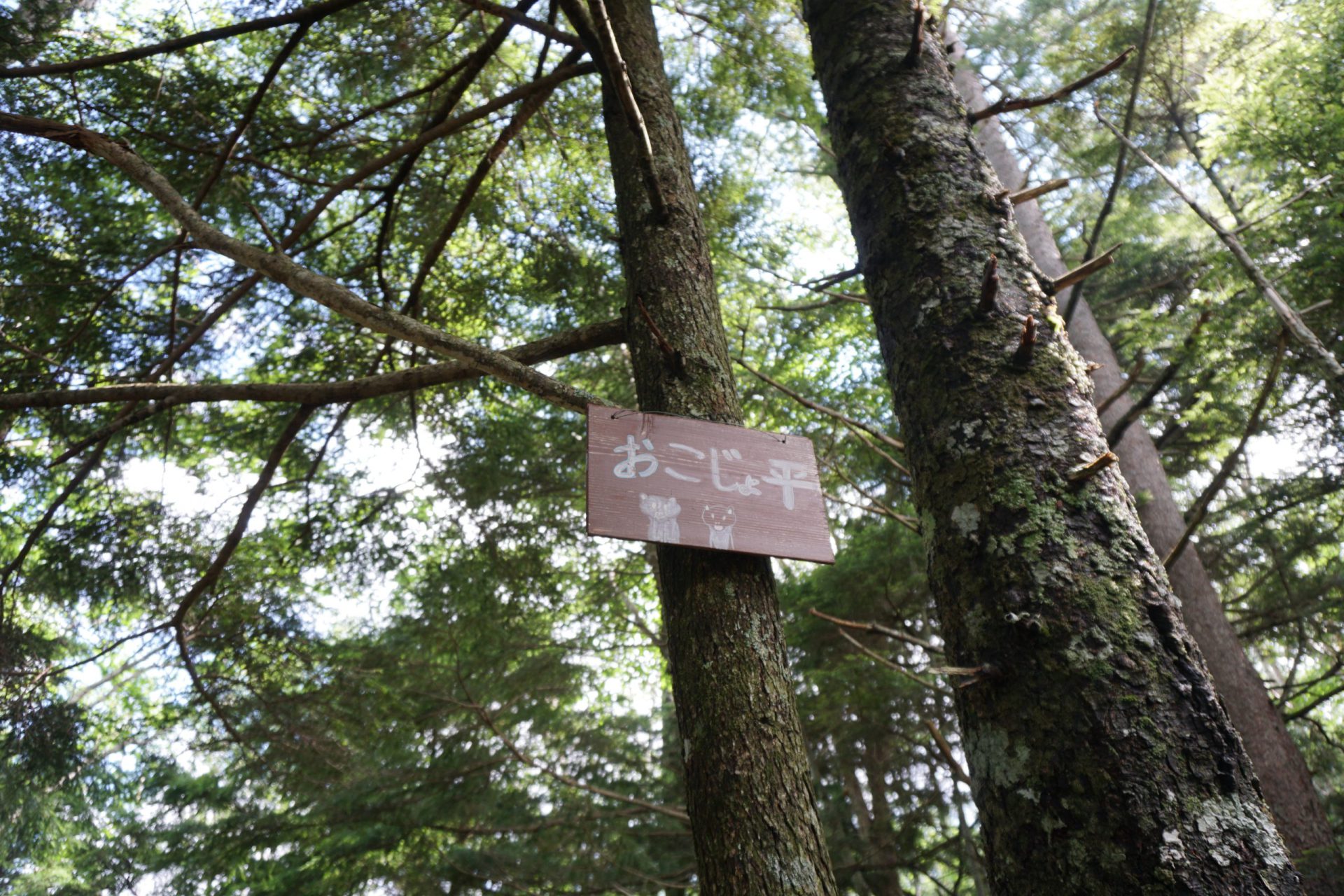
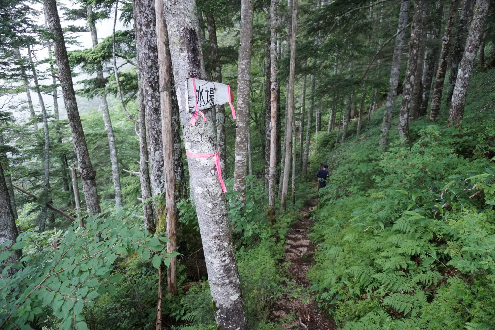
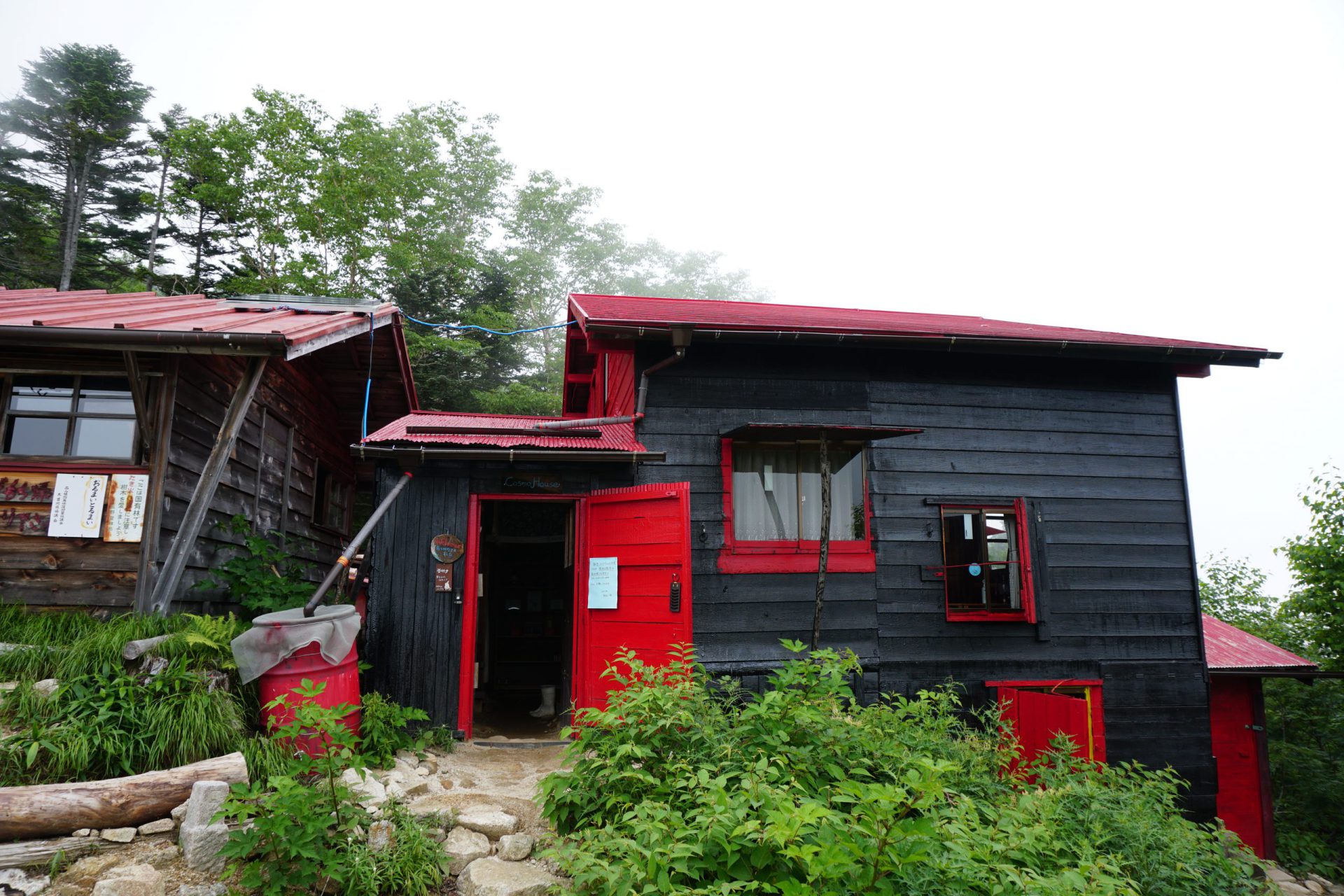
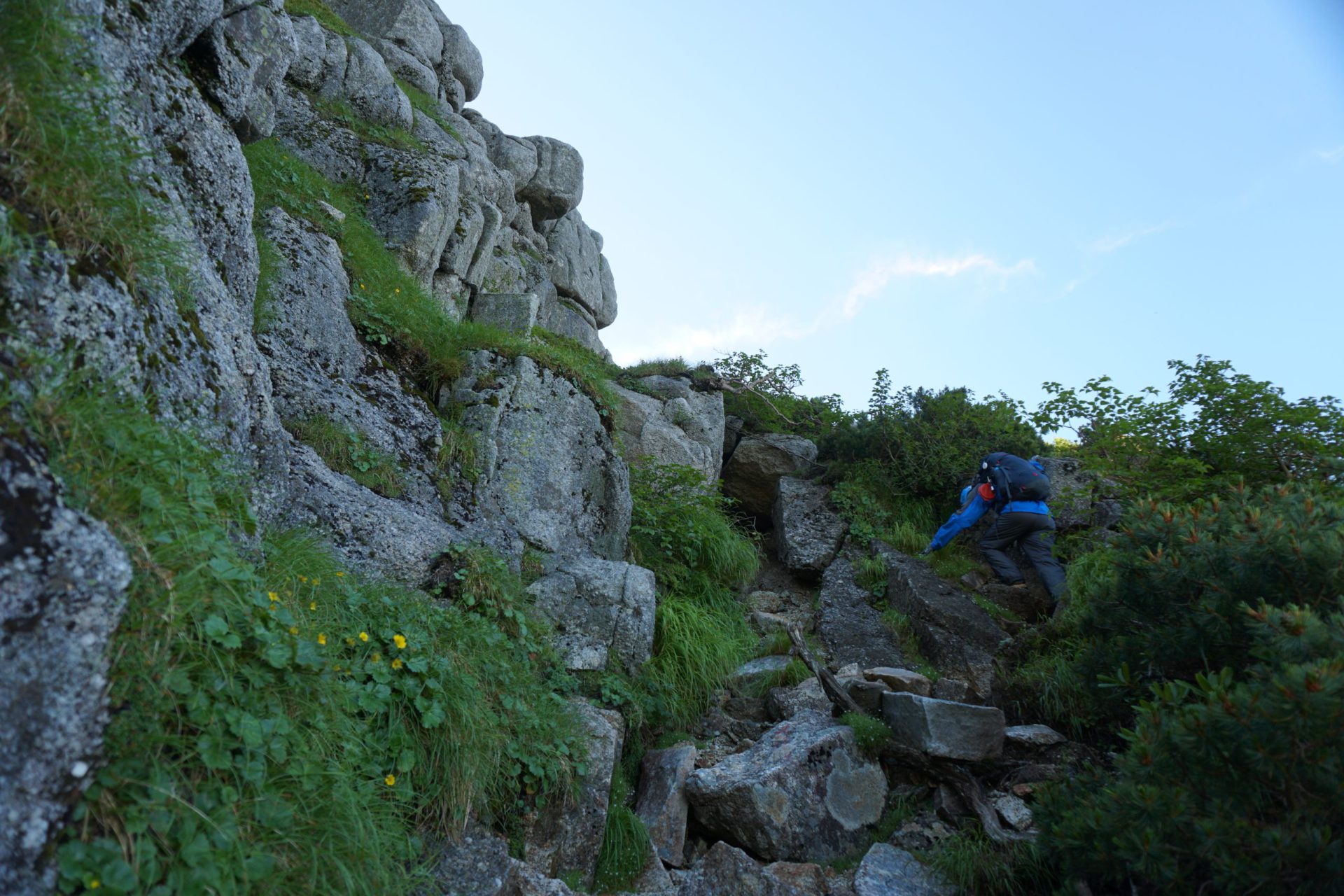
After walking up a steep climb for a while, you will arrive at the lower saddle where you can replenish your water. From here you will walk along a relatively gentle ridgeline for about 30 minutes until you arrive at the upper saddle. Traveling on a little further, you will find yourself proceeding along the gentle Okojo-daira path. Continuing for a little over an hour from here, you should arrive at what is said to be a lookout point for Mt. Ontake, but there are no signs to confirm its location. The water point above is just ahead. The Kosumo-goya mountain hut does not supply water to those who are not staying at the hut, so if you will not be spending the night there, make sure to gather a sufficient water supply here. After the water point comes an extremely steep climb. This is the most difficult portion of the journey. Kosumo-goya mountain hut stands past the ridge’s peak and at a slightly lower elevation. It should generally take about six hours to get here from the parking area.
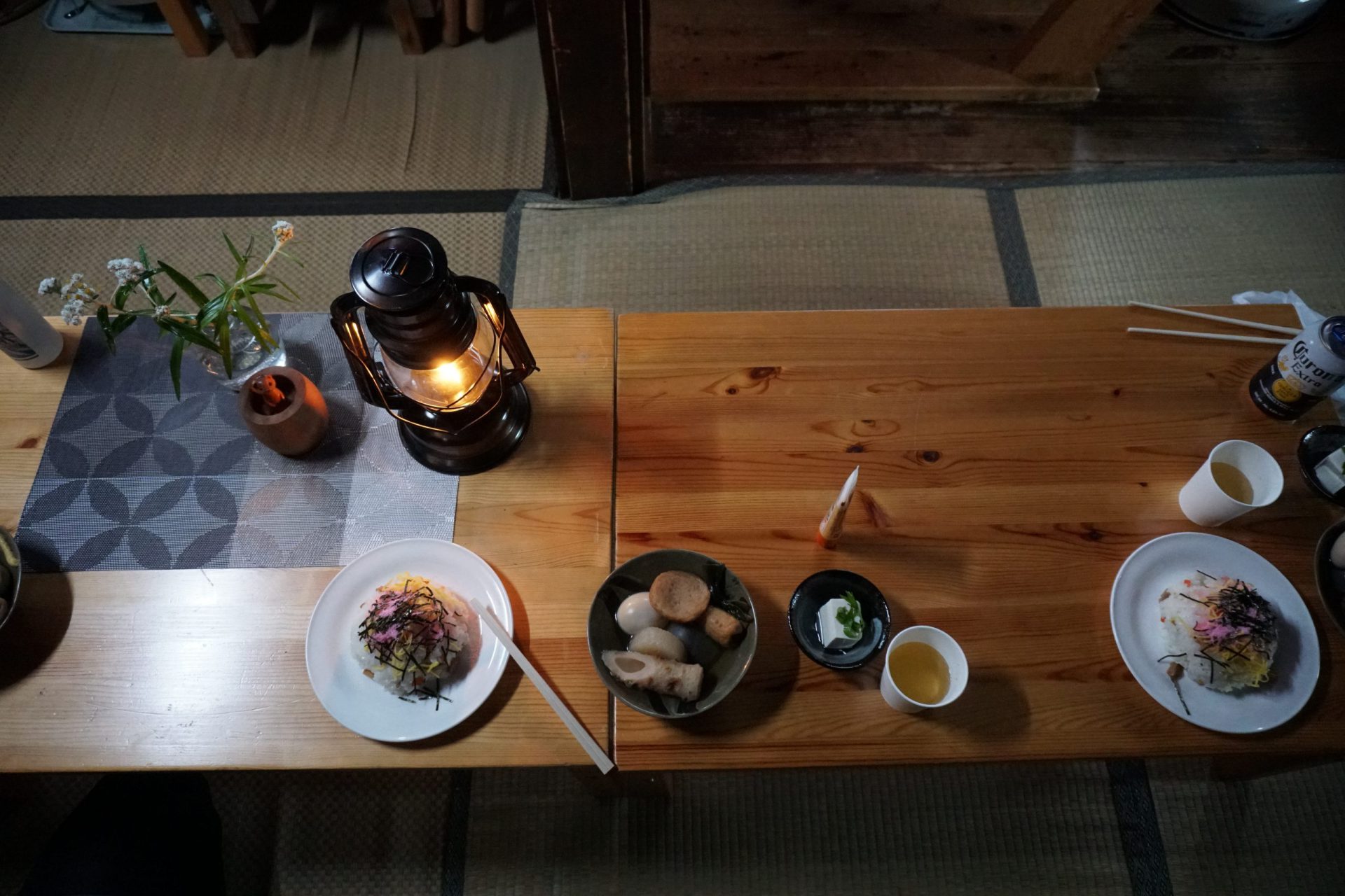
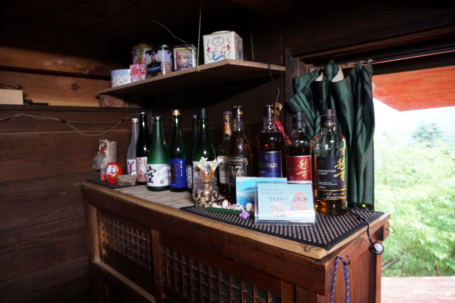
At the time Kyuya Fukada, who wrote “One Hundred Mountains of Japan,” traversed the Central Alps, Kosumo-goya was situated in a location where the Ina Valley was visible, but it is currently located just before Mt. Kosumo-yama and looks out onto Mt. Kosumo-yama to the front and Mt. Minamikoma-gatake to the left. As an inhabited hut, it offers warm meals and a place to stay. It is a very valuable base for those traversing the mountain for the support it offers mountaineers.
From here we follow the mountain trail on a slight traverse to Mt. Kosumo-yama, and in about an hour we should reach one of Japan’s 300 most famous peaks, Mt. Kosumo-yama. Once you arrive here, you get a spectacular view of the Southern Alps across the Ina Valley, and the entirety of the Ontake Mountains from the foothills to its peaks, which could not be seen from the forest roads.
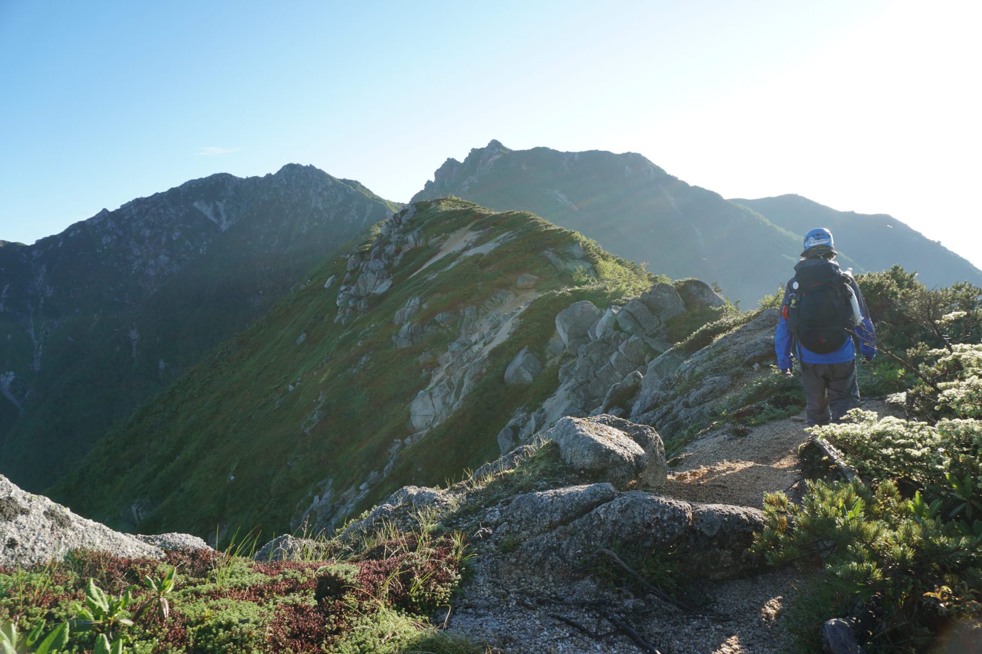
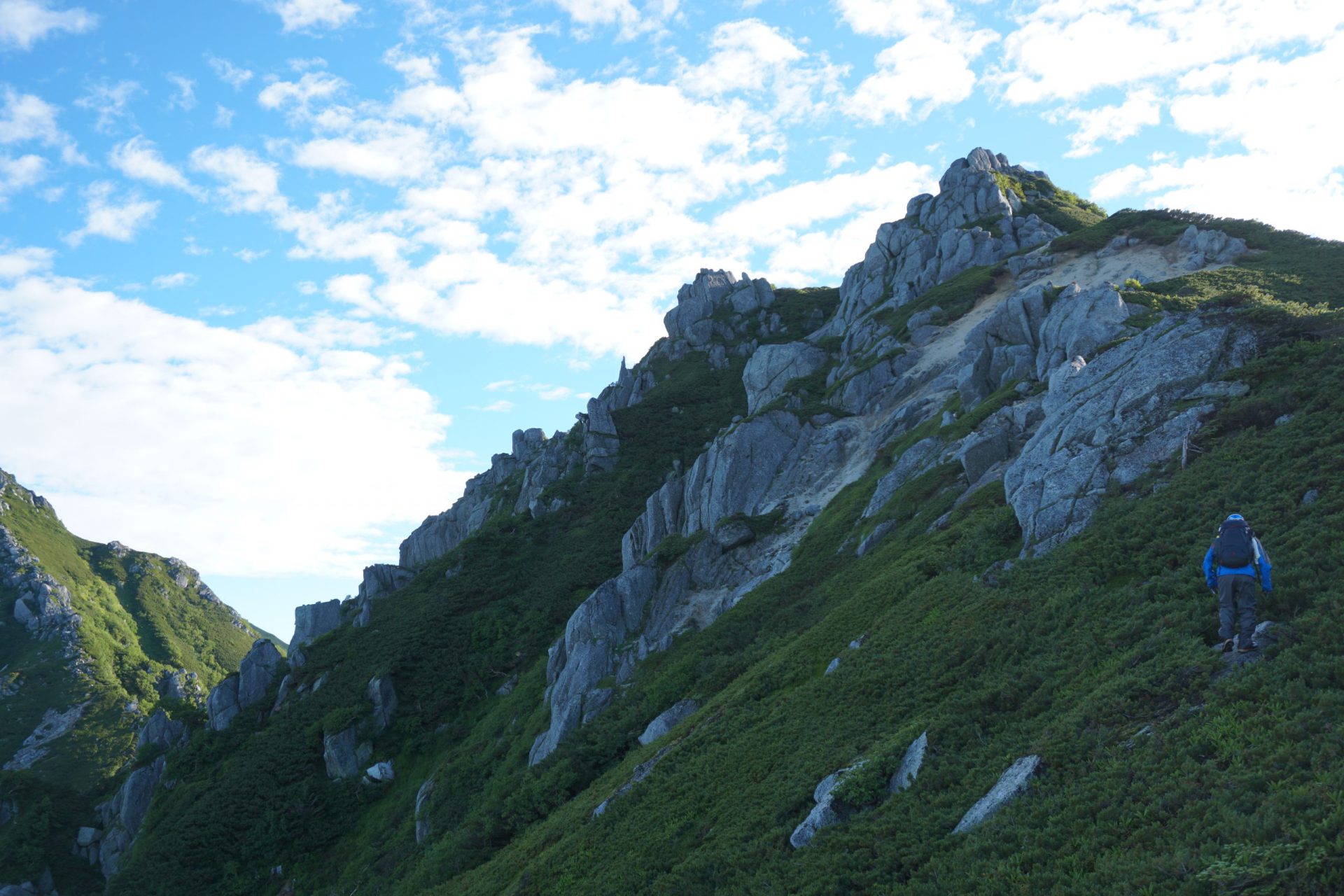
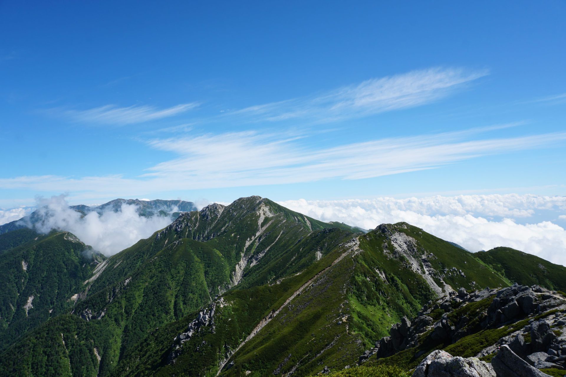
The highlight of this route is yet to come. Here is where we begin our walk along the main ridge of the Central Alps. The mountain trail covered in creeping pine stands at an elevation of 2500 meters in the alpine range, which means sightings of rock ptarmigan are not uncommon at this elevation. Situated between the Ina and Kiso Valleys, this is often called “Tenku no Alps Kaido” or “Alps Highway in the Sky.”
As you get closer to Sengairei, the path weaves through giant granite boulders that Kyuya Fukada described as “rai-rai” or “massive piles of rocks.” The descent from Sengairei requires more caution than normal to avoid falling.
We descend for a time and continue past several peaks. There are few mountaineers here and the route markers are either inconspicuous or too old to be recognized, so please proceed carefully. Just when you think you have finally reached the summit, there is still more to come. The magnificent peak of Mt. Minamikoma-gatake spreads before us just before the final climb. Please keep in mind that from Sengairei, it is nearly a full two-hour climb. When we finally arrive at Mt. Minamikoma-gatake, one of Japan’s 200 famous peaks, we will be at an elevation of 2,841 meters.
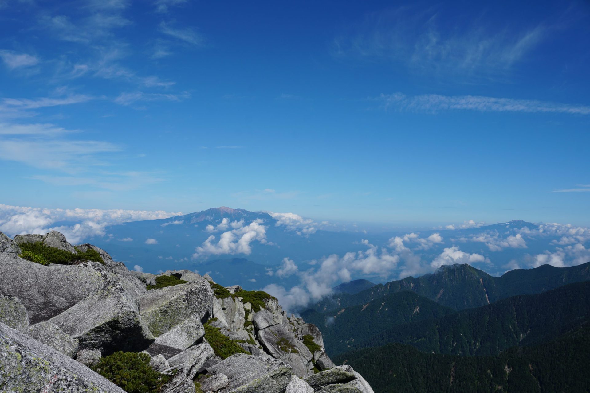
It is the third highest peak of the Central Alps at an elevation even higher than the 2,814-meter elevation of Mt. Goryu-dake and the 2,840-meter elevation of Kurobe-goro-dake, two of Japan’s 100 most famous mountains in the Northern Alps. To the north you can see Mt. Kisokoma-gatake, Mt. Utsugi-dake, and the main ridge of the Central Alps, left of that you can see the Norikura and Hotaka Mountain ranges in the southern portion of the Northern Alps, and across the Kiso Valley, you can see the resplendent figure of Mt. Ontake. Looking to the south you can see almost all of the Southern Alps from Mt. Anbeiji-yama to Mt. Ena-san and the top of Mt. Fuji.
We will make our descent from Mt. Minamikoma-gatake’s Kitazawa-one ridge. To start, we have to weave between a series of giant rocks and boulders, which will be a tough test of our stamina. After we pass the rocks, we will proceed through a route that is like wading through a thicket of creeping pine. As there are not that many climbers on this route to begin with, the creeping pine may be so overgrown that it covers the trail. When we finally reach the 2,413-meter peak, we are at the end of the trail that offers glimpses of Mt. Kosumo-yama and Sengairei. From here on, we continue down a plain forest trail, though the bamboo thicket you have to wade through midway will stand out. There are a few places where the route is difficult to follow on the open forest trail, so make sure to follow the pink tape as your guideposts. Persevering down the mountain, you will eventually hear the sound of a stream, and you will eventually arrive at Kesa-sawa River. This is Minamikoma-gatake’s 4th Station at an elevation of 1,430 meters, and if you continue further along the river for another 30 minutes, you will arrive at the junction where Kosumo-yama Shindo and Fukutochi Bridge meet. From here, continue leisurely down the forest trail for about an hour and 15 minutes until you return to the parking area.