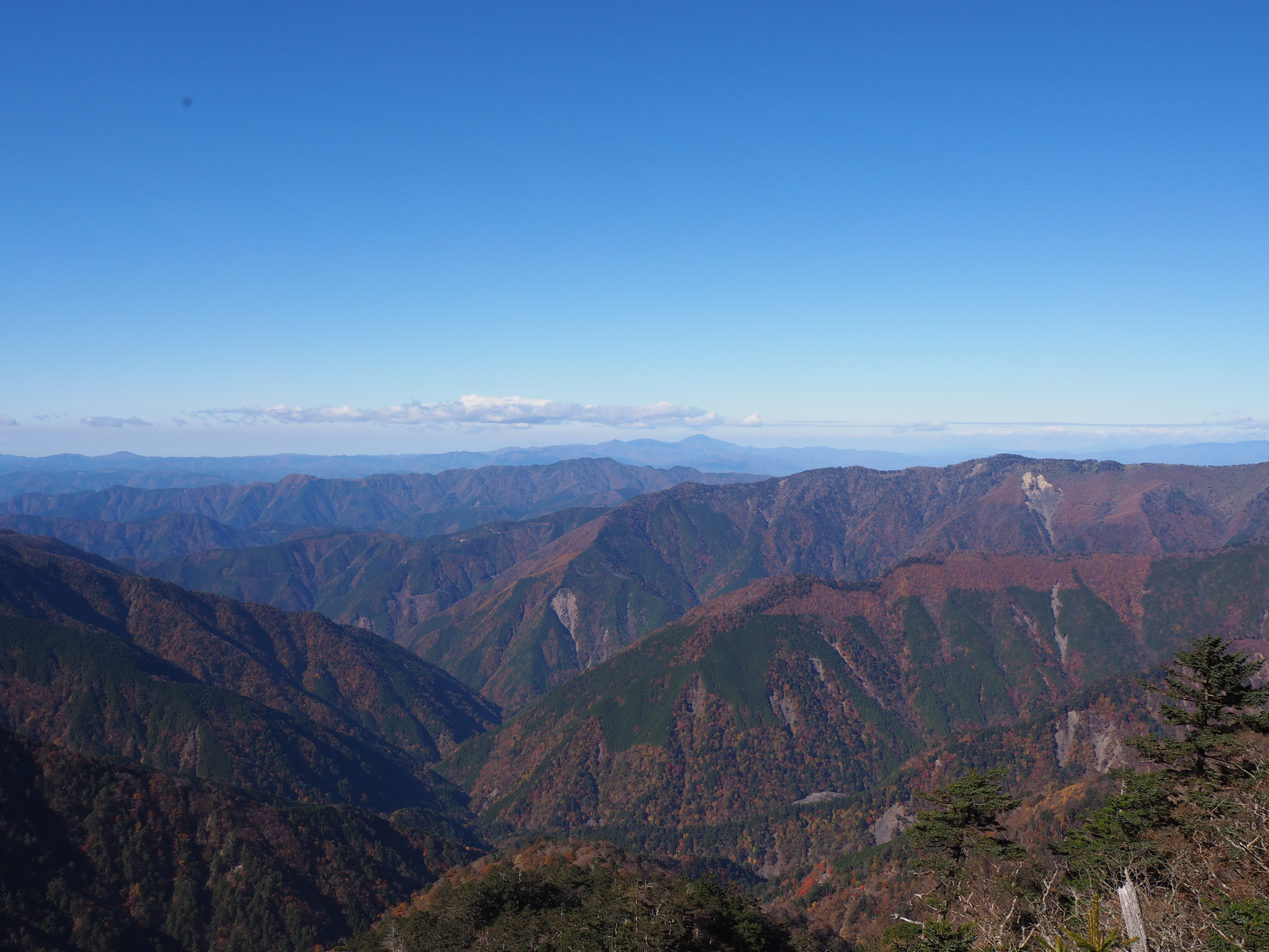
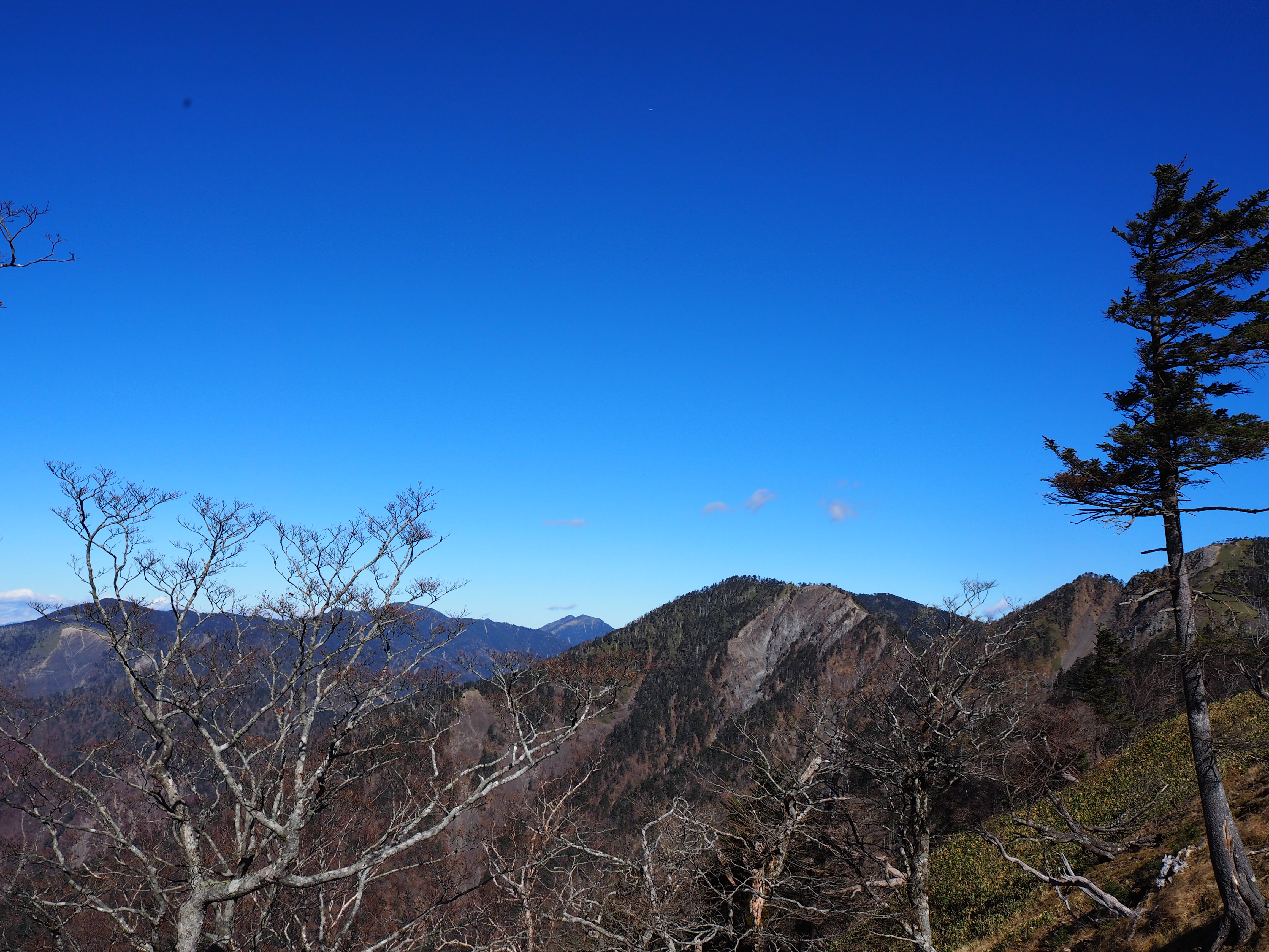
Mt. Kyo-gatake is located at the northern tip of the Central Alps and is one Japan’s 200 most famous mountains. Its name is derived from the word “sutra” as the characters that make up its name suggest. It is said the high priest, Jikaku Daishi of Hieizan Enryakuji Temple, who established Chusenji Temple at the foot of the mountain, was told in a dream to carve a statue of the eleven-headed Kannon bodhisattva and offer it to Shinano Daijin Gozan, as the mountain was called at the time. He wrote sutras, called “kyo,” on the remaining wood from the statue and offered them together. Since then, Daijin Gozan has been called “Mt. Kyo-gatake.” The Central Alps appear to be divided into north and south (geologically speaking, there is a big difference) by the Gonbee Kaido highway (Gonbee-Toge Pass), which links Kiso and Ina and sits on the southern end of Mt. Kyo-gatake, and there are those who do not include Mt. Kyo-gatake as part of the Central Alps. This mountain is also on the central divide in terms of water systems. The west, the Narai River flows into the Sai River, which flows in the Shinano River before flowing into the Japan Sea, and to the east, the Tenryu River flows into the Pacific Ocean.
Kyogatake:Altitude2296.4m Climbing
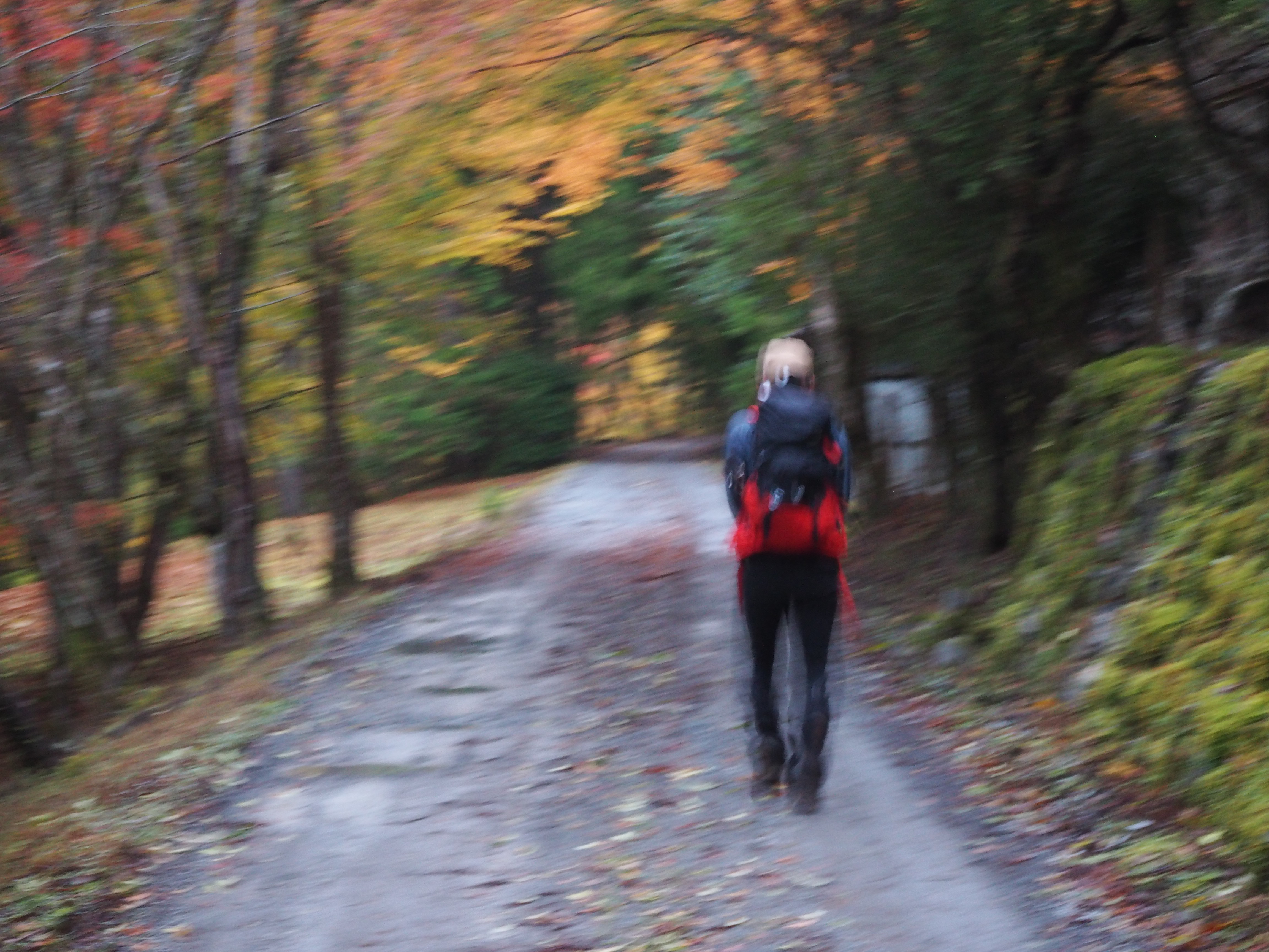
Traditionally, Mt. Kyo-gatake could be approached from two different trailheads; one that starts at Chusenji Temple, which is also the origin of the mountain, and the other begins at Oizumidokoro Dam. However, due to the tireless efforts of the “Mt. Kyo-gatake wo Aisuru-kai” (which translates to “Mt. Kyo-gatake Supporters Association”), a new route from the Gonbee-Toge Pass opened. The route on the Chusenji Temple side is a straight climb while the route from the Gonbee-Toge Pass offers a lot of ups and downs. Each route offers its own unique mountain climbing enjoyment, and there is relatively little snow in the winter, which allows you to get a taste of mountain climbing in each of the four seasons. There are no mountain huts are identifiable water points along the way, so you will not be able to replenish your water. When climbing in summer, please make sure you are well prepared for your climb.
Trailhead vicinity weather
Weekly weather forecast zone:Southern Nagano Prefecture
| DAY | WEATHER | LOWEST | HIGHEST |
|---|---|---|---|
| 7/14 | 23℃ | 32℃ | |
| 7/15 | 24℃ | 32℃ | |
| 7/16 | 24℃ | 33℃ | |
| 7/17 | 24℃ | 33℃ | |
| 7/18 | 23℃ | 35℃ | |
| 7/19 | 23℃ | 35℃ |
This is a publication of the calculated figures for weather predictions and is not the weather forecast. There are instances where there will be big differences in the values stated for the mountains, in accord with the topography as well as sunlight, etc. so please take care.
72 hours weather information:Near Gonbee-Toge, Minamiminowa-mura, Kamiina-gun, Nagano Prefecture
| Date and time |
7/13 17:00 |
7/13 18:00 |
7/13 19:00 |
7/13 20:00 |
7/13 21:00 |
7/13 22:00 |
7/13 23:00 |
7/14 0:00 |
7/14 1:00 |
7/14 2:00 |
7/14 3:00 |
7/14 4:00 |
7/14 5:00 |
7/14 6:00 |
7/14 7:00 |
7/14 8:00 |
7/14 9:00 |
7/14 10:00 |
7/14 11:00 |
7/14 12:00 |
7/14 13:00 |
7/14 14:00 |
7/14 15:00 |
7/14 16:00 |
7/14 17:00 |
7/14 18:00 |
7/14 19:00 |
7/14 20:00 |
7/14 21:00 |
7/14 22:00 |
7/14 23:00 |
7/15 0:00 |
7/15 1:00 |
7/15 2:00 |
7/15 3:00 |
7/15 4:00 |
7/15 5:00 |
7/15 6:00 |
7/15 7:00 |
7/15 8:00 |
7/15 9:00 |
7/15 10:00 |
7/15 11:00 |
7/15 12:00 |
7/15 13:00 |
7/15 14:00 |
7/15 15:00 |
7/15 16:00 |
7/15 17:00 |
7/15 18:00 |
7/15 19:00 |
7/15 20:00 |
7/15 21:00 |
7/15 22:00 |
7/15 23:00 |
7/16 0:00 |
|---|---|---|---|---|---|---|---|---|---|---|---|---|---|---|---|---|---|---|---|---|---|---|---|---|---|---|---|---|---|---|---|---|---|---|---|---|---|---|---|---|---|---|---|---|---|---|---|---|---|---|---|---|---|---|---|---|
| Weather | ||||||||||||||||||||||||||||||||||||||||||||||||||||||||
| Temperature | 25℃ | 24℃ | 22℃ | 21℃ | 20℃ | 19℃ | 18℃ | 18℃ | 18℃ | 17℃ | 17℃ | 16℃ | 15℃ | 15℃ | 16℃ | 18℃ | 19℃ | 21℃ | 22℃ | 23℃ | 24℃ | 24℃ | 24℃ | 23℃ | 23℃ | 21℃ | 21℃ | 20℃ | 20℃ | 19℃ | 19℃ | 19℃ | 19℃ | 19℃ | 18℃ | 18℃ | 18℃ | 18℃ | 18℃ | 18℃ | 19℃ | 19℃ | 19℃ | 21℃ | 21℃ | 21℃ | 22℃ | 22℃ | 21℃ | 21℃ | 20℃ | 18℃ | 18℃ | 17℃ | 17℃ | 17℃ |
| Precipitation | 0mm/h | 0mm/h | 0mm/h | 0mm/h | 0mm/h | 0mm/h | 0mm/h | 0mm/h | 0mm/h | 0mm/h | 0mm/h | 0mm/h | 0mm/h | 0mm/h | 0mm/h | ※ 16時間以降は表示されません | ||||||||||||||||||||||||||||||||||||||||
| Wind direction |
south 1m/s |
south 1m/s |
south 1m/s |
south 1m/s |
0m/s |
0m/s |
south 1m/s |
0m/s |
0m/s |
0m/s |
0m/s |
0m/s |
south 1m/s |
south 1m/s |
south 1m/s |
south 1m/s |
south 1m/s |
south 2m/s |
south 2m/s |
south 2m/s |
south 1m/s |
south 1m/s |
south 1m/s |
south 1m/s |
south 1m/s |
south 1m/s |
south 1m/s |
south 1m/s |
south 2m/s |
south 2m/s |
south 2m/s |
south 2m/s |
south 2m/s |
south 2m/s |
south 1m/s |
south 2m/s |
south 2m/s |
south 2m/s |
south 2m/s |
south 1m/s |
south 1m/s |
south 1m/s |
south 2m/s |
south 2m/s |
south 2m/s |
south 2m/s |
south 2m/s |
south 2m/s |
south 2m/s |
south 2m/s |
south 1m/s |
south 1m/s |
south 1m/s |
south 1m/s |
south 1m/s |
south 2m/s |
※The weather information will be information on 5km square including the relevant point.
※天気予報マークは一次細分区域から表示しています
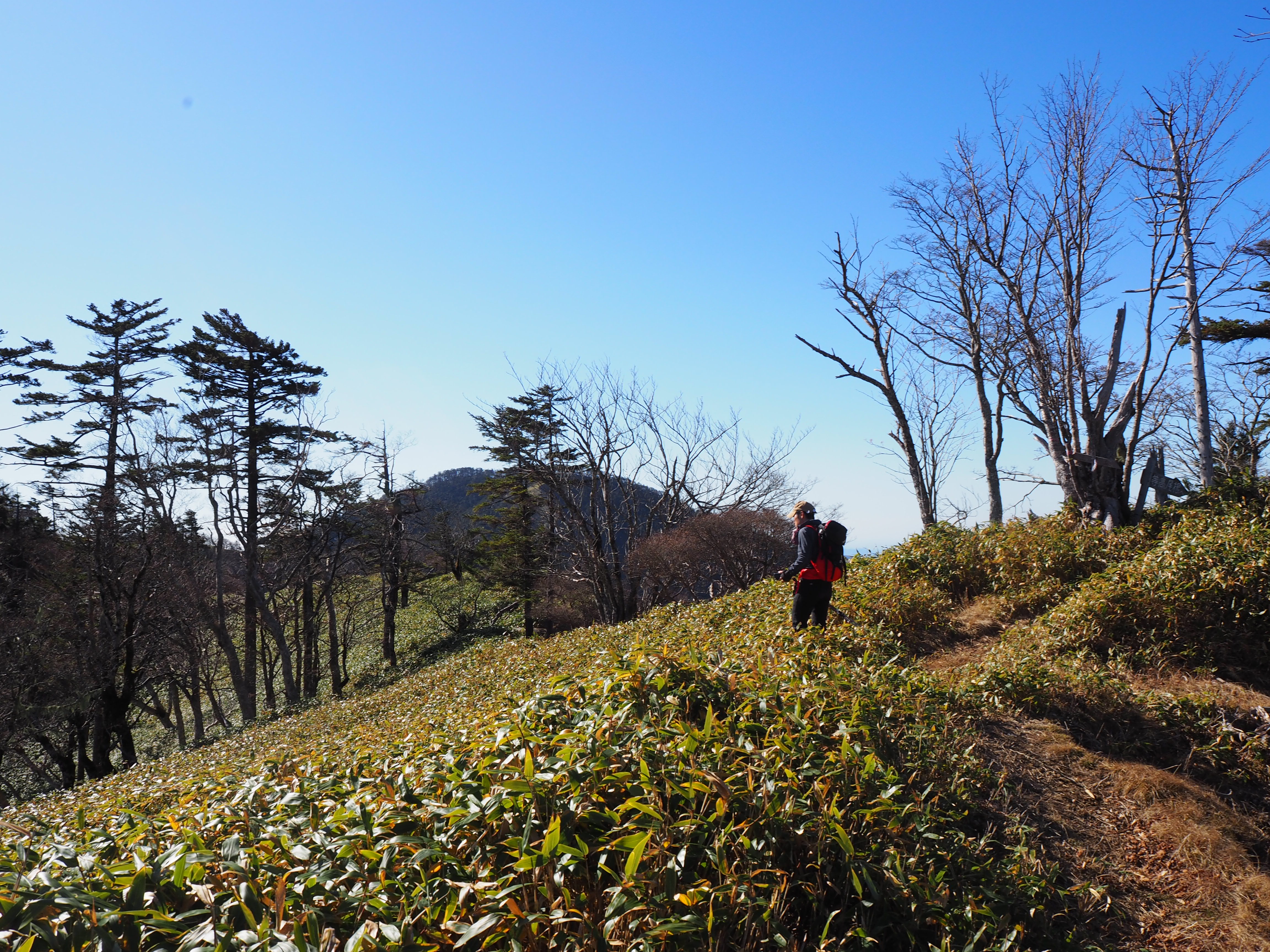
Landscape of Mt. Kyo-gatake