Oritate/Mt.Kitnomata-dake Route
①Oritate- Mt. Tarou-yama ~ Mt. Kitano-mata-dake ~ Mt. Mitsumata-renge-dake ~ Mt. Sugoroku-dake ~ Koike shindo ~ Shin-hotaka Onsen
Technical level: C
Physical strength level: 8
Difficulty level: ⛰️⛰️⛰️⛰️
Start from Oritate where many hikers gather then hike from one mountain to another while enjoying the great views along the trail
●Hiking Data
Schedule: Three nights four days
Walking hours: 22 hours 55 minutes
(Up: 11 hours 30 minutes/Down: 11 hours 25 minutes)
Walking distance: 36.6 km
Difference in elevation: 3,972 m
Oritate


Elevation 1,350m
↓ 6 hours 30 minutes
Mt. Tarou-yama
Elevation 2,373m
↓ 1 hour 55 minutes
Mt. Kitano-mata-dake
Elevation 2,662m
↓ 3 hours 5 iminutes
Mt. Kurobe-goro-dake
Elevation 2,839m
↓ 1hour 50 minutes
Kurobe-goro-koya Mountain hut
Elevation 2,350m
↓ 2 hours 20 minutes
Mt. Mitsumata-renge-dake
Elevation 2,841m
↓ 1 hour 15 minutes
Mt. Sugoroku-dake
Elevation 2,860m
↓ 45 minutes
Sugoroku-goya Mountain hut
Elevation 2,550m
↓ 3 hours 50 minutes
Koike shindo trailhead
Elevation 1,470m
↓ 1 hour 25 minutes
Shin-hotaka Onsen
Elevation 1,090m
Route Guide
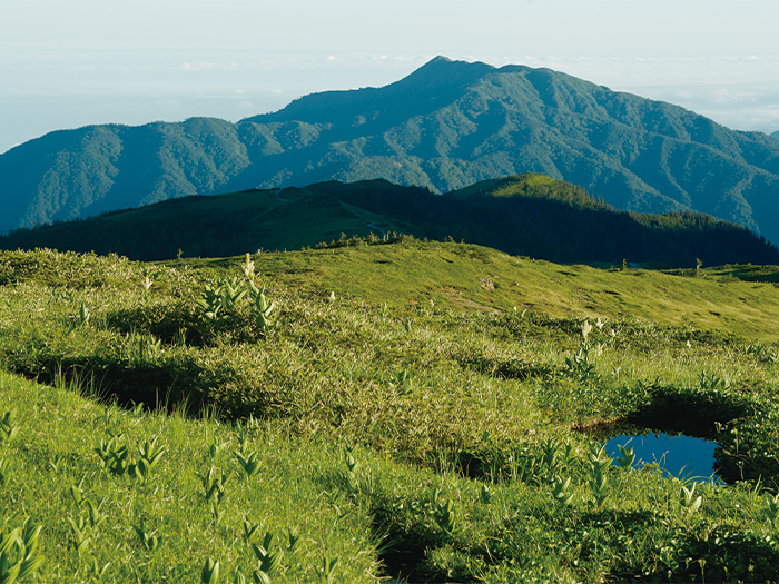
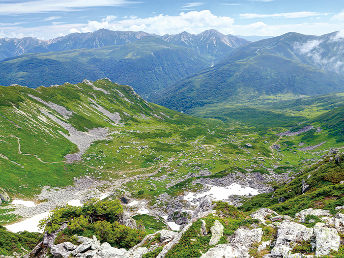
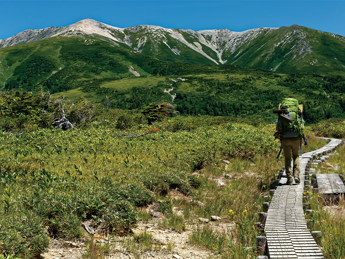
There is a rest area at the trailhead of Oritate. Check the fitting of your backpack and shoes and prepare yourself here before you start. The trailhead starts by a big horse chestnut. On the left side, a memorial monument for the Aichi University students who lost their lives in the mountains. Please pay your respects to them before you start. Ascend through a deep forest zone. Once the triangulation point becomes closer, the height of trees becomes lower. At the triangulation point of an 1,831 m altitude, the view becomes clear. Mt. Yakushi-dake can be seen in your direction. After passing this point, the plateau spreads and the trail merges into a gradual-slope ridgeline. Amida-gahara can be spotted on your left. Mt. Tsurugi-dake can be seen far away. Below your feet, Arens, Narthecium, and Iwashoubu may be in bloom. Mt. Yakushi-dake comes into sight. Taro-koya Mountain hut is reached shortly. It is recommended that you stay here the first night.
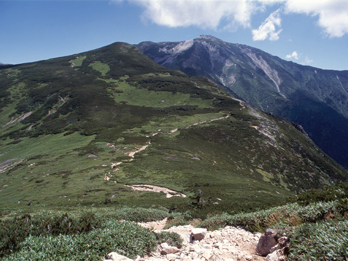
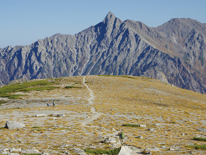
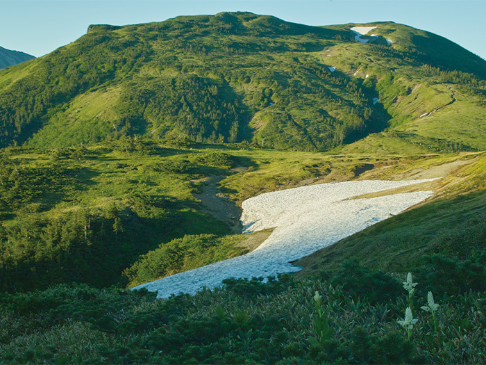
On the next day, hike from Mt. Kurobe-goro-dake to Kurobe-goro koya Mountain hut. The total number of walking hours for the day will be 7. It will be a ridgeline walk with great views. Mt. Taro-yama is reached at the end of the short hill from Taro-koya Mountain hut. After hiking on an unstable trail, the trail starts ascending towards Mt. Kitano-mata-dake. Mt. Kitano-mata-dake is reached after passing the junction of Kamioka-shindo. Arens, Hakusan-ichige, and Geum Japonicum may be in bloom. Mt. Taro-yama at your back can be seen very small. From here to Mt. Kurobe-goro-dake, the trail becomes an uphill all the way. Take a break before you start. Enjoy the beautiful green of the source of the Kurobe-river, which spreads out in the left lower corner of your sight. The trail becomes steeper after passing Nakanomata-nokkoshi. Stay focused. Turn right at the shoulder of Kurobe-gorou and the summit of Mt. Kurobe-goro-dake is reached. The view of Mt. Yari-gatake, the Hotaka Mountains, and Mt. Kasa-gatake spreads out. Descend back to the shoulder and head to Kurobe-goro-koya Mountain hut. The set time is 1 hour 40 minutes. If time allows, enjoy walking around the depression. The hut stands in a meadow. The alpine plants around the hut are beautiful. It is recommended that you spend the second night here while remembering the beautiful view of the source of Kurobe river.
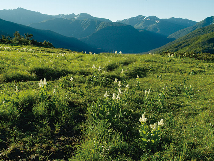
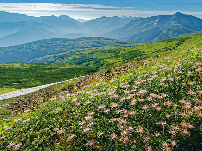
The trail becomes steep when it enters into the forest zone from Kurobe-goro-koya Mountain hut. After a while, the trail becomes a wide ridgeline. It is a gradual slope with beautiful flower fields. From Mt. Mitsumata-renge-dake, descend on the ridgeline to the south. Mt. Sugoroku-dake is reached about 25 minutes from the Nakamichi ridgeline junction. The view of the Hodaka mountains and Mt. Yari-gatake at the summit is fantastic. Follow the wide ridgeline to Sugoroku-goya Mountain hut. It is recommended to check-in early for the third night.
For the fourth day, start from Sugoroku-goya Mountain hut to Yumiori junction. After passing Sugoroku pond, descend a stable trail towards the south. Yumiori junction is reached where a trail to Kagami-daira and another trail to Mt. Yumiori-dake meet. Turn right here. This trail is Koike-shindo. Till Kagami-daira, the trail becomes a steep downhill. Kagami-daira-sanso Mountain hut is reached. Take a short break. The view of the Hodaka Mountains and Mt. Yari-gatake is impressive. Pass Shishidou-gahara and continue to descend. At Koike-shindo trailhead, follow the Samata logging road to Shinhodaka hot spring.