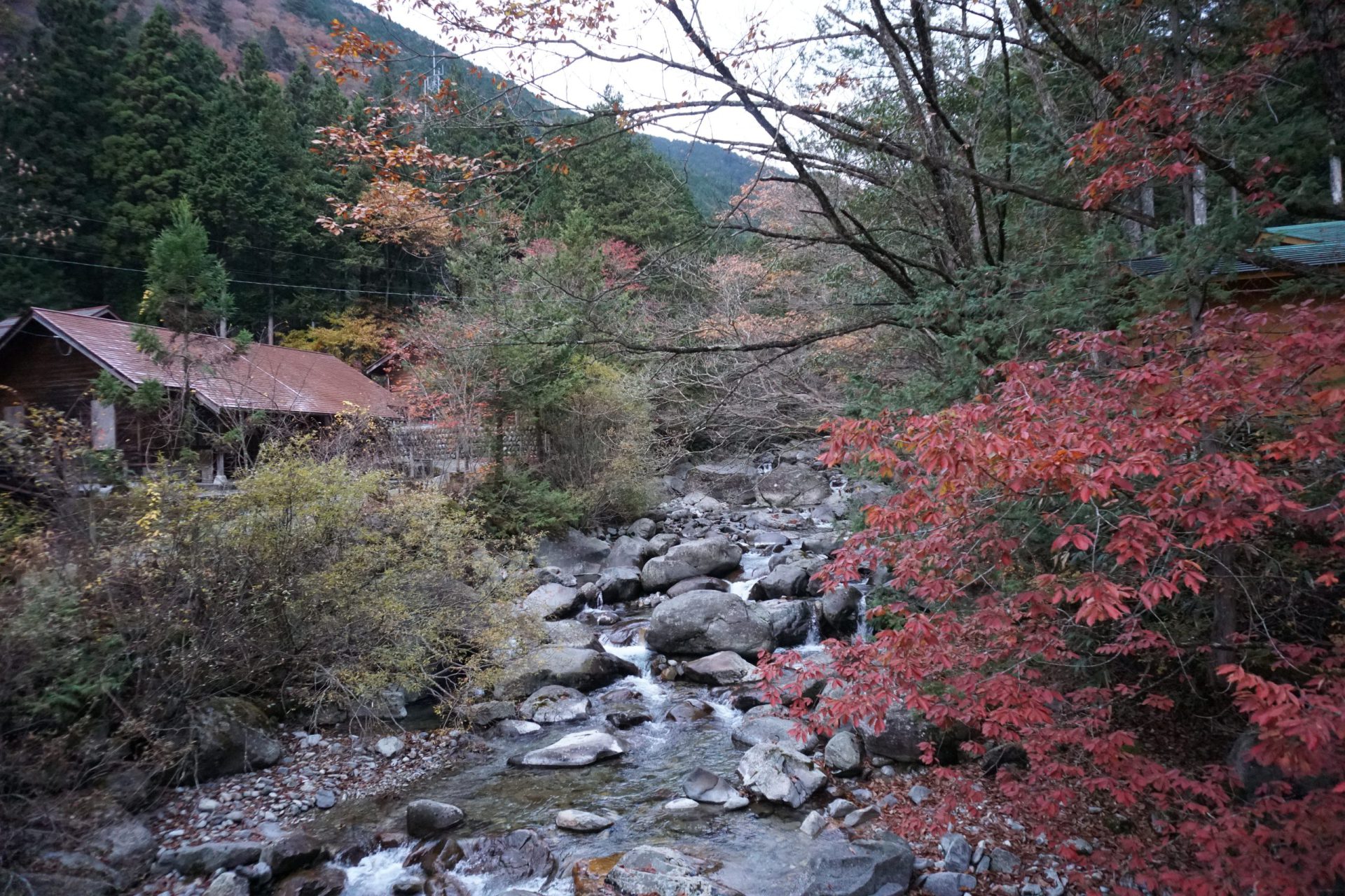
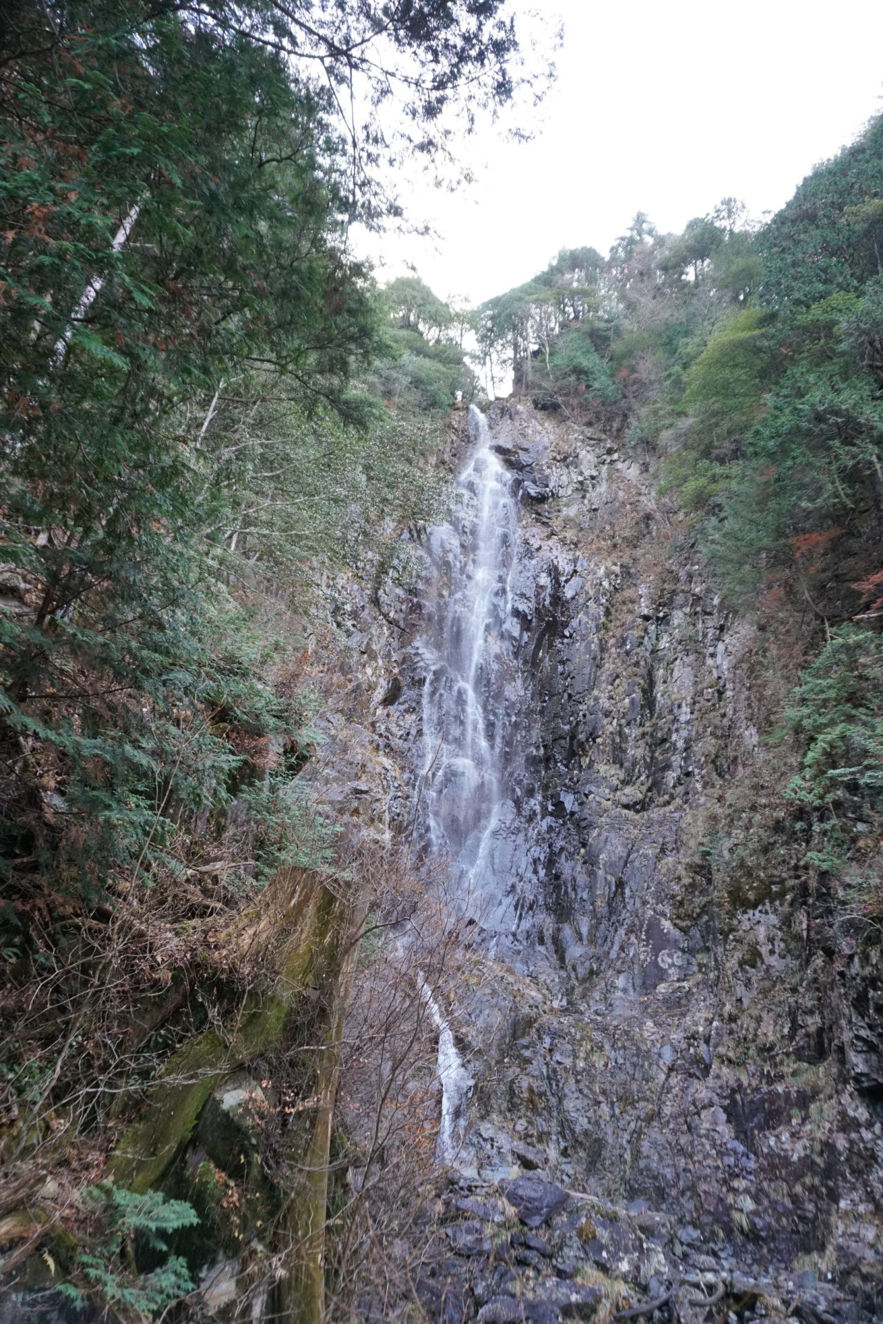
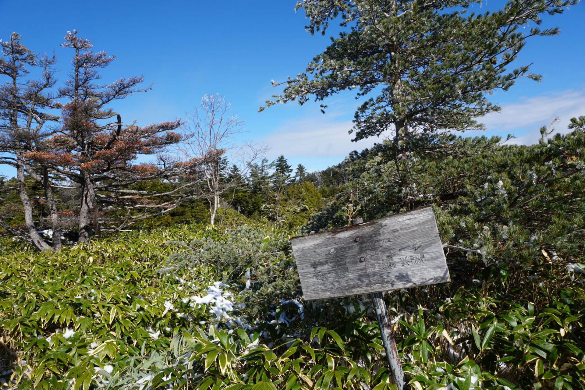
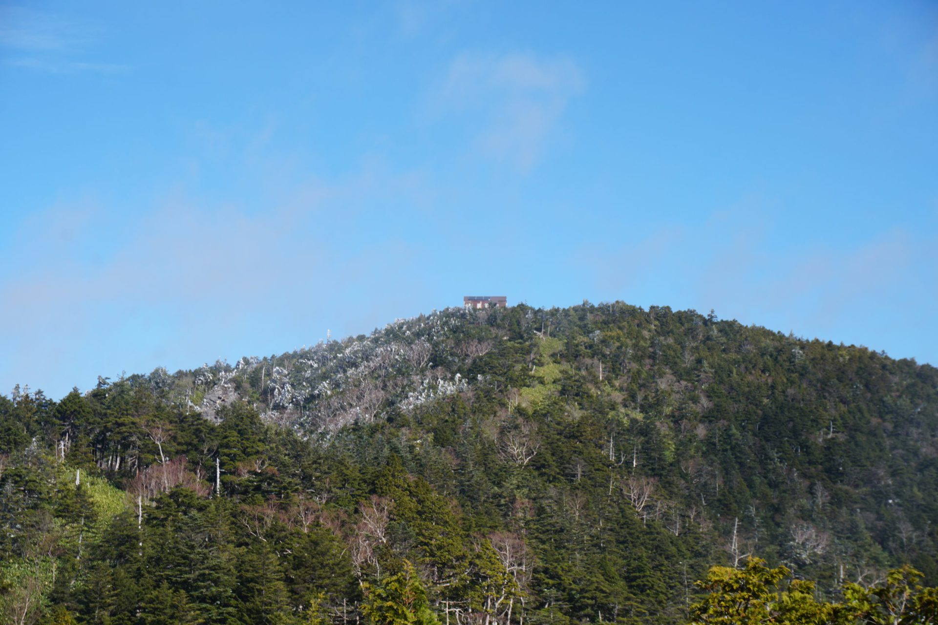
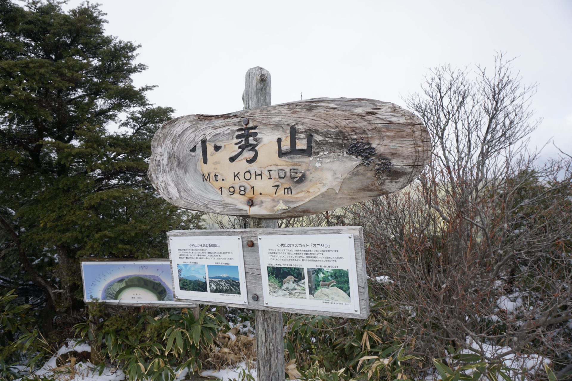
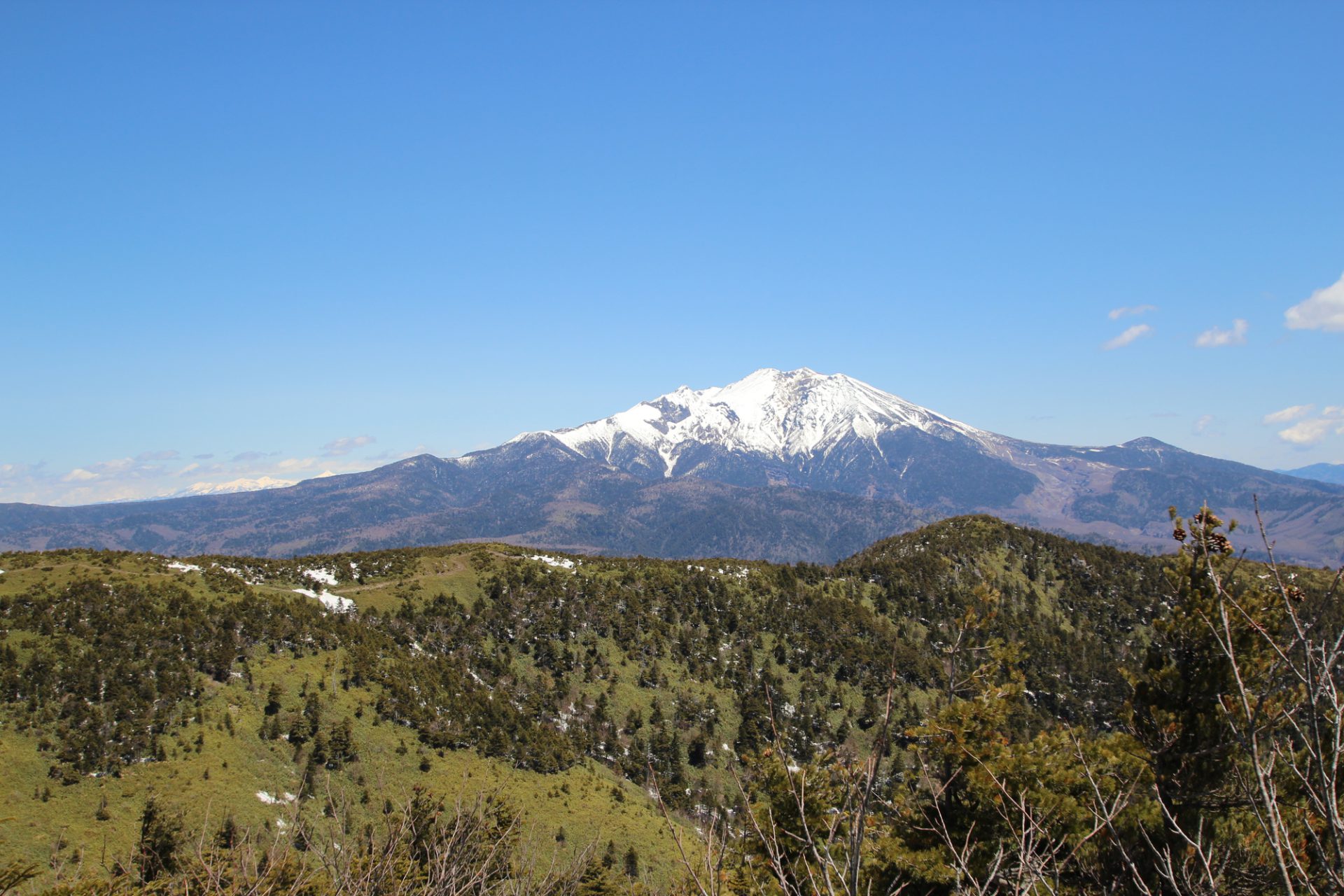
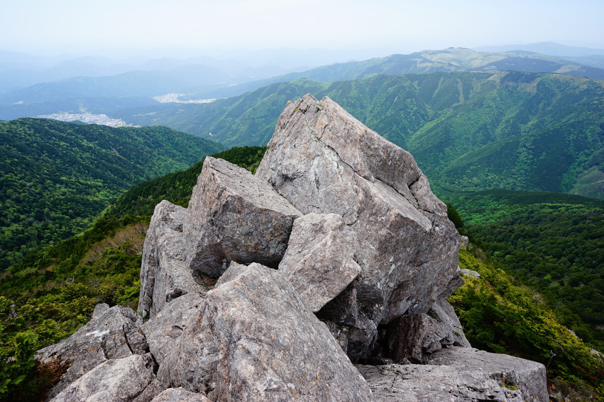
Though Mt. Kohide-yama, one of Japan’s most famous 200 mountains, has an elevation just shy of 2,000 meters at 1,981.9 meters, it is the highest mountain in the Atera mountain range, which straddles the border of Nagano and Gifu prefectures. Many mountaineers love the mountain for its magnificent views of the Ontake range and other mountains. The mountain range and its features, such as Otome Keikoku, one of the trailheads, have been designated part of Gifu Prefecture’s Urakiso Prefectural Nature Park, but it is difficult to see from the foothills on the Gifu side. These mountains are rich in forests cultivated by the Kiso River system, surrounding lush natural scenery. At the summit, there is a lovely shelter constructed by the city of Nakatsugawa. The mountain path features rocky terrain through giant boulders without assistive chains and gentle ridges with beautiful views. Its combination of both difficult and uncomplicated areas makes it a great mountain to climb.
One of Japan’s 200 most famous mountains at an elevation of 1981.9 meters
The main trailhead routes are the Ni-no-tani and San-no-tani routes, which both start at Otome Keikoku gorge in Nakatsugawa, Gifu. The San-no-tani route follows a river upstream for about two kilometers along a forest road from Otome Keikoku. In addition, the Ni-no-tani route has a difficult 7-meter-long rocky area that has to be passed through without any assistive chains making it dangerous to descend from, so generally people ascend via the Ni-no-tani route and descend from the San-no-tani route. A new route starting in Otaki Village in Nagano Prefecture opened that is now the fastest route from trailhead to summit.
Trailhead vicinity weather
Weekly weather forecast zone:Chubu region, Nagano prefecture
| DAY | WEATHER | LOWEST | HIGHEST |
|---|---|---|---|
| 7/20 | 26℃ | 34℃ | |
| 7/21 | 27℃ | 35℃ | |
| 7/22 | 27℃ | 35℃ | |
| 7/23 | 26℃ | 36℃ | |
| 7/24 | 26℃ | 36℃ | |
| 7/25 | 25℃ | 36℃ |
This is a publication of the calculated figures for weather predictions and is not the weather forecast. There are instances where there will be big differences in the values stated for the mountains, in accord with the topography as well as sunlight, etc. so please take care.
72 hours weather information:Otome Valley Trailhead, Nakatsugawa City, Gifu Prefecture
| Date and time |
7/19 8:00 |
7/19 9:00 |
7/19 10:00 |
7/19 11:00 |
7/19 12:00 |
7/19 13:00 |
7/19 14:00 |
7/19 15:00 |
7/19 16:00 |
7/19 17:00 |
7/19 18:00 |
7/19 19:00 |
7/19 20:00 |
7/19 21:00 |
7/19 22:00 |
7/19 23:00 |
7/20 0:00 |
7/20 1:00 |
7/20 2:00 |
7/20 3:00 |
7/20 4:00 |
7/20 5:00 |
7/20 6:00 |
7/20 7:00 |
7/20 8:00 |
7/20 9:00 |
7/20 10:00 |
7/20 11:00 |
7/20 12:00 |
7/20 13:00 |
7/20 14:00 |
7/20 15:00 |
7/20 16:00 |
7/20 17:00 |
7/20 18:00 |
7/20 19:00 |
7/20 20:00 |
7/20 21:00 |
7/20 22:00 |
7/20 23:00 |
7/21 0:00 |
7/21 1:00 |
7/21 2:00 |
7/21 3:00 |
7/21 4:00 |
7/21 5:00 |
7/21 6:00 |
7/21 7:00 |
7/21 8:00 |
7/21 9:00 |
7/21 10:00 |
7/21 11:00 |
7/21 12:00 |
7/21 13:00 |
7/21 14:00 |
7/21 15:00 |
7/21 16:00 |
7/21 17:00 |
7/21 18:00 |
7/21 19:00 |
7/21 20:00 |
7/21 21:00 |
7/21 22:00 |
7/21 23:00 |
7/22 0:00 |
|---|---|---|---|---|---|---|---|---|---|---|---|---|---|---|---|---|---|---|---|---|---|---|---|---|---|---|---|---|---|---|---|---|---|---|---|---|---|---|---|---|---|---|---|---|---|---|---|---|---|---|---|---|---|---|---|---|---|---|---|---|---|---|---|---|---|
| Weather | |||||||||||||||||||||||||||||||||||||||||||||||||||||||||||||||||
| Temperature | 17℃ | 19℃ | 19℃ | 20℃ | 21℃ | 21℃ | 22℃ | 22℃ | 23℃ | 22℃ | 22℃ | 21℃ | 19℃ | 19℃ | 18℃ | 18℃ | 17℃ | 17℃ | 17℃ | 17℃ | 16℃ | 16℃ | 16℃ | 17℃ | 19℃ | 20℃ | 21℃ | 21℃ | 22℃ | 23℃ | 23℃ | 24℃ | 24℃ | 23℃ | 22℃ | 21℃ | 20℃ | 19℃ | 19℃ | 19℃ | 19℃ | 19℃ | 18℃ | 18℃ | 18℃ | 18℃ | 17℃ | 18℃ | 20℃ | 21℃ | 22℃ | 23℃ | 23℃ | 24℃ | 24℃ | 24℃ | 24℃ | 24℃ | 23℃ | 22℃ | 21℃ | 21℃ | 20℃ | 20℃ | 20℃ |
| Precipitation | 0mm/h | 0mm/h | 0mm/h | 0mm/h | 0mm/h | 0mm/h | 0mm/h | 0mm/h | 0mm/h | 0mm/h | 0mm/h | 0mm/h | 0mm/h | 0mm/h | 0mm/h | ※ 16時間以降は表示されません | |||||||||||||||||||||||||||||||||||||||||||||||||
| Wind direction |
west-southwest 1m/s |
west-southwest 2m/s |
west-southwest 2m/s |
west-southwest 2m/s |
west-southwest 2m/s |
west-southwest 2m/s |
west-southwest 2m/s |
west-southwest 2m/s |
west-southwest 2m/s |
west-southwest 1m/s |
west-southwest 1m/s |
west-southwest 1m/s |
west-southwest 1m/s |
west-southwest 1m/s |
west-southwest 1m/s |
west-southwest 1m/s |
west-southwest 1m/s |
0m/s |
west-southwest 1m/s |
west-southwest 1m/s |
west-southwest 1m/s |
west-southwest 1m/s |
west-southwest 1m/s |
west-southwest 1m/s |
west-southwest 1m/s |
west-southwest 1m/s |
west-southwest 1m/s |
west-southwest 2m/s |
west-southwest 2m/s |
west-southwest 2m/s |
west-southwest 2m/s |
west-southwest 2m/s |
west-southwest 1m/s |
west-southwest 1m/s |
west-southwest 1m/s |
west-southwest 1m/s |
west-southwest 1m/s |
west-southwest 1m/s |
west-southwest 1m/s |
west-southwest 1m/s |
west-southwest 1m/s |
west-southwest 1m/s |
0m/s |
west-southwest 1m/s |
west-southwest 1m/s |
west-southwest 1m/s |
west-southwest 1m/s |
west-southwest 1m/s |
0m/s |
west-southwest 1m/s |
west-southwest 1m/s |
west-southwest 1m/s |
west-southwest 2m/s |
west-southwest 2m/s |
west-southwest 2m/s |
west-southwest 1m/s |
west-southwest 1m/s |
west-southwest 1m/s |
west-southwest 1m/s |
west-southwest 1m/s |
west-southwest 1m/s |
0m/s |
west-southwest 1m/s |
0m/s |
west-southwest 1m/s |
※The weather information will be information on 5km square including the relevant point.
※天気予報マークは一次細分区域から表示しています
View of Mt. Kohide-yama