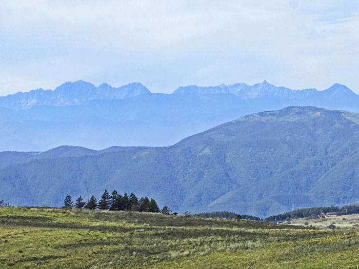
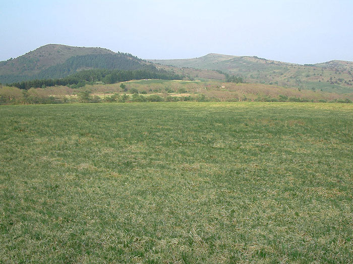
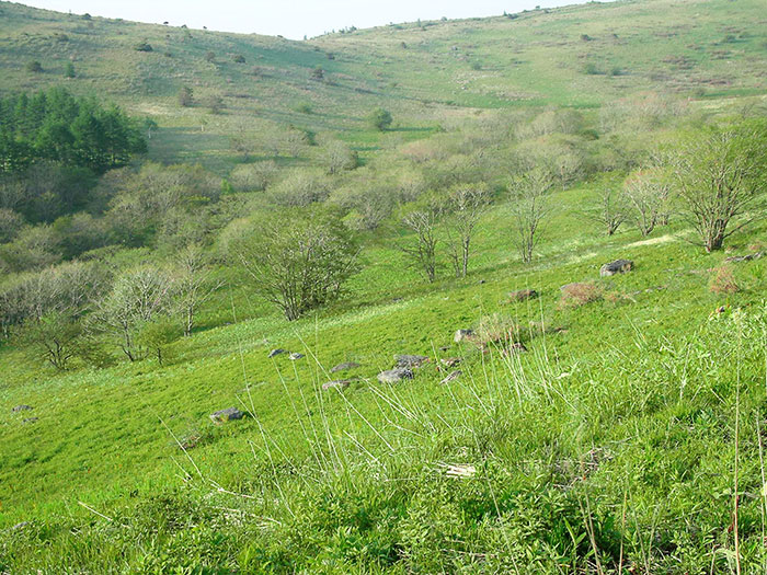
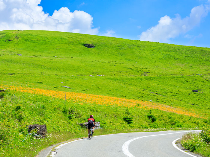
It is a lava plateau that spreads out for about 10+ square kilometers in Yatsu-gatake Chushin Plateau area. Mt. Kuruma-yama locates in the center at an elevation of 1,924 m and green slopes spread around the mountain. Its altitude is not that high however. This area is a treasure box of hygrophytes including subalpine plants. It is said that this area holds very interesting geological features. There are no peaks nor mountains named Kiri-gamine. The highest mountain here is Mt. Kuruma-yama at an elevation of 1,924 m, one of Japan’s one hundred famous mountains. The summit is accessible by a bus. You can drive yourself via Venous line and easily access to the summit on your own. The area is surrounded by gradual slopes of grass and flower fields of high moor. The view is fantastic through four seasons. It is also famous for summer camping and winter skiing.
Kiri-gamine: Elevation 1,924 m (Mt. Kuruma-yama)
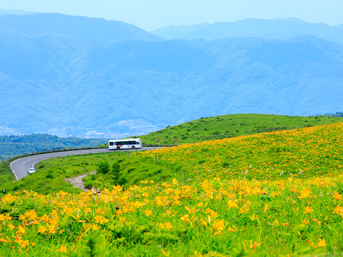
Kiri-gamine can be called a plateau resort, which can be accessed by car in about 4 hours from the city of Tokyo. The name comes after the deep fog that covers the area very often. When the fog clears up, flower fields of Nikko-kisuge may suddenly come into sight. A fantastic view can be enjoyed. Kiri-gamine is also known as the birthplace of gliders in Japan. It is one of the most beautiful plateaus along the Venous line.
Trailhead vicinity weather
Weekly weather forecast zone:Central Nagano Prefecture
| DAY | WEATHER | LOWEST | HIGHEST |
|---|---|---|---|
| 7/4 | 22℃ | 33℃ | |
| 7/5 | 23℃ | 34℃ | |
| 7/6 | 23℃ | 34℃ | |
| 7/7 | 23℃ | 33℃ | |
| 7/8 | 23℃ | 33℃ | |
| 7/9 | 23℃ | 33℃ |
This is a publication of the calculated figures for weather predictions and is not the weather forecast. There are instances where there will be big differences in the values stated for the mountains, in accord with the topography as well as sunlight, etc. so please take care.
72 hours weather information:Kurumayama Shoulder Parking Lot, Oaza-Shiga-Kirigamine, Suwa City, Nagano Prefecture
| Date and time |
7/3 11:00 |
7/3 12:00 |
7/3 13:00 |
7/3 14:00 |
7/3 15:00 |
7/3 16:00 |
7/3 17:00 |
7/3 18:00 |
7/3 19:00 |
7/3 20:00 |
7/3 21:00 |
7/3 22:00 |
7/3 23:00 |
7/4 0:00 |
7/4 1:00 |
7/4 2:00 |
7/4 3:00 |
7/4 4:00 |
7/4 5:00 |
7/4 6:00 |
7/4 7:00 |
7/4 8:00 |
7/4 9:00 |
7/4 10:00 |
7/4 11:00 |
7/4 12:00 |
7/4 13:00 |
7/4 14:00 |
7/4 15:00 |
7/4 16:00 |
7/4 17:00 |
7/4 18:00 |
7/4 19:00 |
7/4 20:00 |
7/4 21:00 |
7/4 22:00 |
7/4 23:00 |
7/5 0:00 |
7/5 1:00 |
7/5 2:00 |
7/5 3:00 |
7/5 4:00 |
7/5 5:00 |
7/5 6:00 |
7/5 7:00 |
7/5 8:00 |
7/5 9:00 |
7/5 10:00 |
7/5 11:00 |
7/5 12:00 |
7/5 13:00 |
7/5 14:00 |
7/5 15:00 |
7/5 16:00 |
7/5 17:00 |
7/5 18:00 |
7/5 19:00 |
7/5 20:00 |
7/5 21:00 |
7/5 22:00 |
7/5 23:00 |
7/6 0:00 |
|---|---|---|---|---|---|---|---|---|---|---|---|---|---|---|---|---|---|---|---|---|---|---|---|---|---|---|---|---|---|---|---|---|---|---|---|---|---|---|---|---|---|---|---|---|---|---|---|---|---|---|---|---|---|---|---|---|---|---|---|---|---|---|
| Weather | ||||||||||||||||||||||||||||||||||||||||||||||||||||||||||||||
| Temperature | 22℃ | 24℃ | 24℃ | 24℃ | 24℃ | 24℃ | 24℃ | 22℃ | 20℃ | 19℃ | 19℃ | 19℃ | 19℃ | 19℃ | 18℃ | 18℃ | 18℃ | 18℃ | 18℃ | 18℃ | 18℃ | 18℃ | 19℃ | 20℃ | 22℃ | 23℃ | 24℃ | 24℃ | 25℃ | 25℃ | 24℃ | 23℃ | 22℃ | 21℃ | 20℃ | 19℃ | 19℃ | 19℃ | 19℃ | 18℃ | 17℃ | 17℃ | 17℃ | 17℃ | 18℃ | 18℃ | 19℃ | 19℃ | 20℃ | 22℃ | 23℃ | 24℃ | 24℃ | 24℃ | 23℃ | 21℃ | 21℃ | 20℃ | 20℃ | 19℃ | 19℃ | 19℃ |
| Precipitation | 0mm/h | 0mm/h | 0mm/h | 0mm/h | 0mm/h | 0mm/h | 0.4mm/h | 6mm/h | 14mm/h | 13mm/h | 3mm/h | 2mm/h | 1mm/h | 1mm/h | 0.4mm/h | ※ 16時間以降は表示されません | ||||||||||||||||||||||||||||||||||||||||||||||
| Wind direction |
south-southeast 1m/s |
south-southeast 1m/s |
south-southeast 1m/s |
0m/s |
south-southeast 1m/s |
south-southeast 1m/s |
south-southeast 1m/s |
south-southeast 1m/s |
south-southeast 2m/s |
south-southeast 2m/s |
south-southeast 2m/s |
south-southeast 2m/s |
south-southeast 2m/s |
south-southeast 2m/s |
south-southeast 2m/s |
south-southeast 1m/s |
south-southeast 1m/s |
south-southeast 1m/s |
south-southeast 1m/s |
south-southeast 1m/s |
south-southeast 1m/s |
south-southeast 2m/s |
south-southeast 1m/s |
south-southeast 2m/s |
south-southeast 2m/s |
south-southeast 2m/s |
south-southeast 2m/s |
south-southeast 2m/s |
south-southeast 2m/s |
south-southeast 2m/s |
south-southeast 2m/s |
south-southeast 1m/s |
south-southeast 1m/s |
0m/s |
south-southeast 1m/s |
south-southeast 1m/s |
south-southeast 1m/s |
south-southeast 2m/s |
south-southeast 2m/s |
south-southeast 2m/s |
south-southeast 1m/s |
south-southeast 1m/s |
south-southeast 1m/s |
south-southeast 1m/s |
south-southeast 1m/s |
south-southeast 2m/s |
south-southeast 2m/s |
south-southeast 1m/s |
south-southeast 1m/s |
south-southeast 1m/s |
south-southeast 1m/s |
south-southeast 1m/s |
south-southeast 1m/s |
south-southeast 1m/s |
south-southeast 1m/s |
south-southeast 1m/s |
south-southeast 1m/s |
south-southeast 1m/s |
0m/s |
0m/s |
south-southeast 1m/s |
south-southeast 1m/s |
※The weather information will be information on 5km square including the relevant point.
※天気予報マークは一次細分区域から表示しています
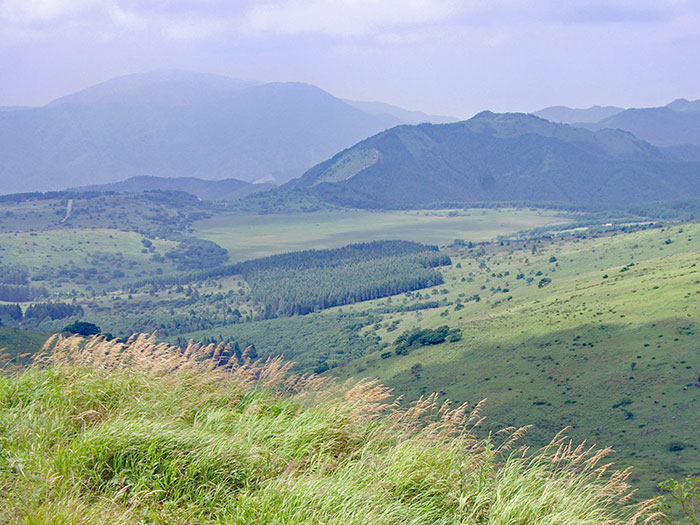
View of Kiriga-mine(Highest peak Mt. Kuruma-yama)