Kasa Shindo Route
① Shinhotaka Onsen ~ Kasa-shindo trailhead ~ The point of 2,742 m ~ Kasa-shindo Junction ~ Mt. Kasa-gatake
Technical level: C
Physical strength level: 6
Difficulty level: ⛰️⛰️⛰️
It is a tough and long route but is also the quickest route to the summit.
●Hiking data
Schedule: two nights and three days
Walking hours: 15 hours 15 minutes
(Up: 8 hours 50 minutes/Down: 6 hours 25 minutes)
Walking Distance: 20.3 km
Difference in elevation: 2,161 m
Shinhotaka Onsen

Elevation 1,090m
↓ 1hour 10 minutes
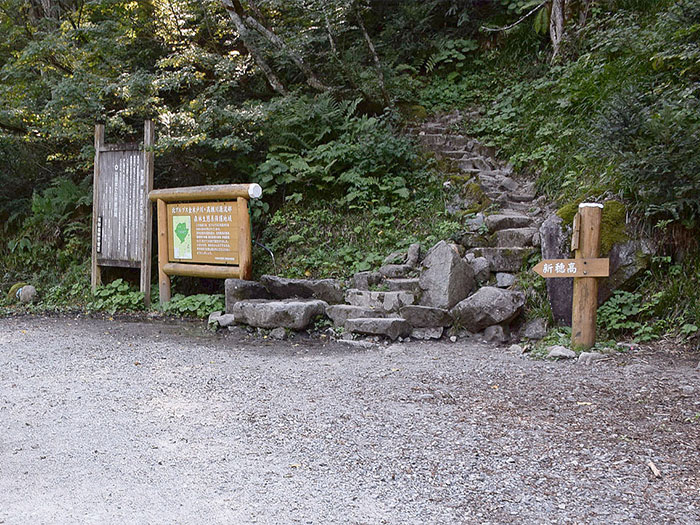
Kasa-shindo trailhead
Elevation 1,360m
↓ 4hours 20 minutes
The point of 2,742 m
Elevation 2,472m
↓ 2hours
Kasa-shindo Junction
Elevation 2,770m
↓ 1hour 20 minutes
Mt. Kasa-gatake


Elevation 2,897m
↓ 1hour 10 minutes
Kasa-shindo Junction
Elevation 2,770m
↓ 4hours 20 minutes
Kasa-shindo trailhead
Elevation 1,360m
↓ 55 minutes
Shinhotaka Onsen
Elevation 1,090m
Route Guide
The hardest part of this route is the steep slope of Kasa-shindo. If time allows, the second route, 2, which is a hike on the ridgeline from Yumiori junction, is recommended.
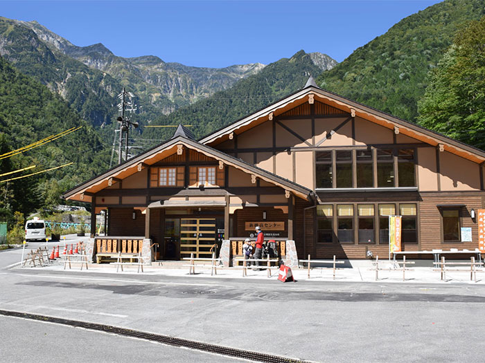
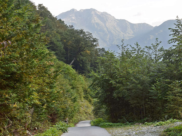
In order to reach the summit as quick as possible, it is recommended that you stay at Shinhotaka Onsen or at the Wasabi-daira-koya Mountain hut for the first night. If you stay at Wasabi-daira-koya Mountain hut, an extra 20 minutes will be added to the total walking hours. From a bus stop at Shinhotaka Onsen, it takes about 1 hour and 10 minutes to the Kasa-shindo trailhead. Follow the logging road, which runs on the left side along the Kamata river. When the logging road traverses the right side of the river, Kasa-shindo trailhead is reached. There is a place to replenish your water supply. Fill up your water bottles here. From the beginning, the trail is a steep slope. As the trail winds up the slope of the mountain, the elevation becomes higher. Walk at a steady pace on the trail covered by beeches and Mongolian oaks. This area will be beautifully colorful in the fall. You may enjoy a cool breeze through the forest in the summer.
There are many elevation signs that give you a clear idea of your current location, however, one may get frustrated that it takes a while to gain elevation. Around an elevation of 1,700 m, the trail comes to a grassy slope. Mt. Yari-gatake and the Hotaka Mountains can be seen from the slope. As the elevation gets higher, Mt. Yake-dake and Mt. Norikura-dake can be seen as well.
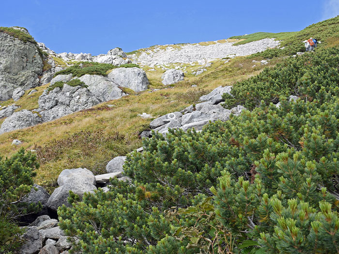
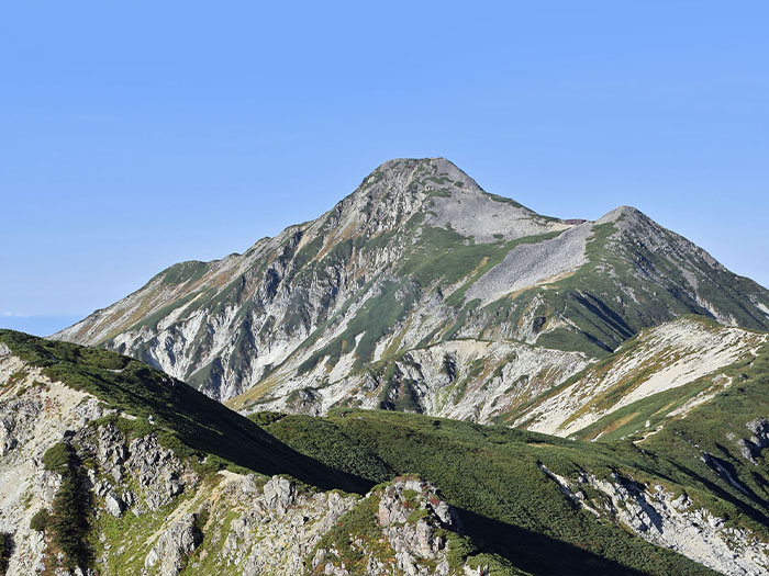
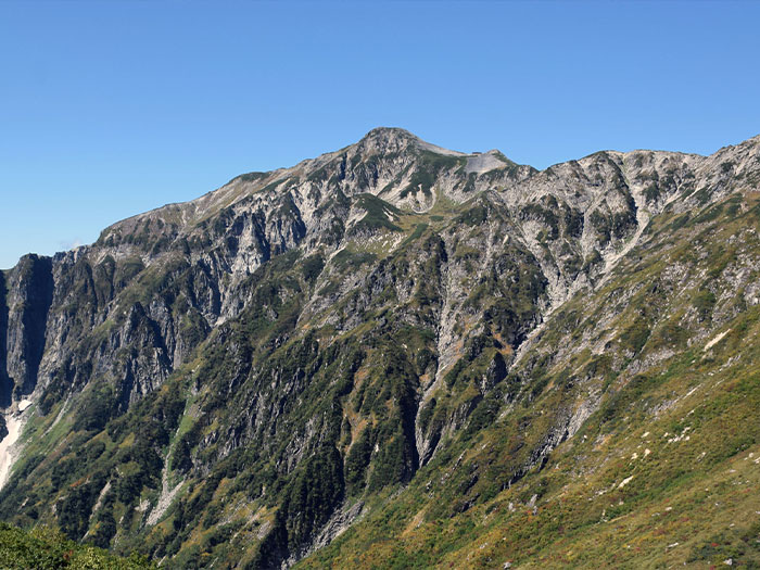
The point of 1,920 m is the middle point to Shakushi-daira. The slope becomes much steeper from here. On your left, the collapsed spot of Iwagoya-zawa can be seen. After passing the forest, the trail becomes a grassy ridgeline. Alpine plants, such as Kirinsou, can be enjoyed. After passing this area, the trail enters sparse forest zones. Rowan trees and Japanese Alders can be spotted. Then the trail climbs up through a Pinus pumila zone. After passing this zone, the slope becomes gradual. Shakushi-daira is reached shortly. Shakushi-daira is an open plateau, where Mt. Kasa-gatake can be seen for the first time on this route. The summit is not at all close but your legs may feel lighter just by spotting the summit. Take a break at the plateau. Proceed through a depression while enjoying the great view. Alpine plants, such as Arens, Hakusan-ichige, or Pedicularis japonica may be in bloom. The slope becomes steeper when the reddish black rock wall comes into sight. Be careful on loose rocks. The trail merges into the main ridgeline.
The view becomes wider on the ridgeline. Hike through some ups and downs and Mt. Nukedo-dake is reached. Proceed while looking down Banryu-daira. Without too much of an effort, Kasa-gatake-sanso Moutain hut is reached. The summit is at the end of the slope where slate shaped rocks are piled up. The slope starts from Kasa-gatake-sanso Mountain hut. The north peak of Mt. Kasaga-take is where thin and flat rocks are piled up. The south peak where the triangulation point is placed is approached from and is a short distance from the north. It is recommended that you stay at Kasa-gatake-sanso Mountain hut. Descend the same trail used for ascending. Be careful not to fall on the steep slope on Kasa-shindo.