Happo-o’ne Route
①Happoike sanso - Happoike – Ougi Sekkei (snow gorge)- Karamatsu-dake Chojo sanso – Karamatsu-dake - Happoike sanso
Technical Level: B
Physical strength: 3
Difficulty: ★★
A course that even beginners can walk without problems
Using the gondola and lifts, the course takes you to Happoike to view the Hakuba mountain range, and then approaches to Mt. Karamatsu-dake. This is a 100% satisfying course for beginners to the Japan Alps, even for first-time hikers to the mountain hut.
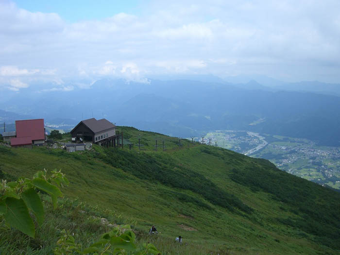
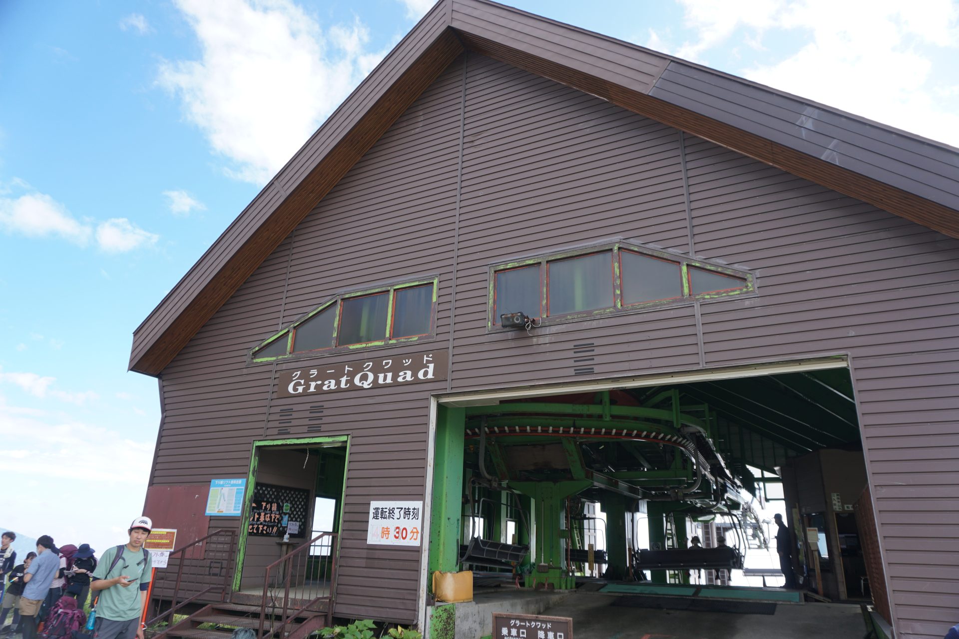
Access to Happo-o’ne &-Happo-ike-sanso Mountain hut
●Hiking Data
Schedule: No day trips or 1 night and 2 days
Walking hours: 7 hours 35 minutes(To Mt. Karamatsu: 4 hours 20 minutes、Downhill: 3 hours 15 minutes
Walking distance: 10.7km
Cumulative elevation difference: 1,059.6m
Happoike sanso

Elevation 1,835m
↓ 1 hour
The confluence point before the second cologne
Elevation 2,000m
↓ 30 minutes
Happoike Pond
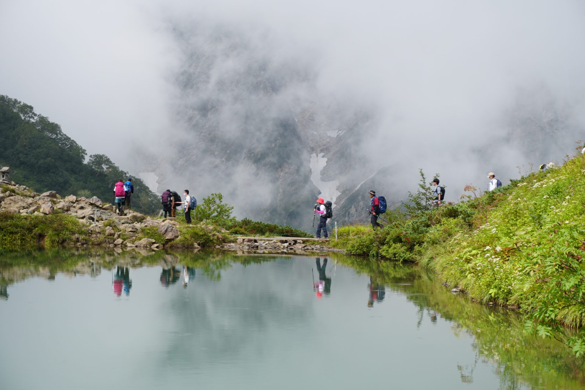
Elevation 2,070m
↓ 1 hour
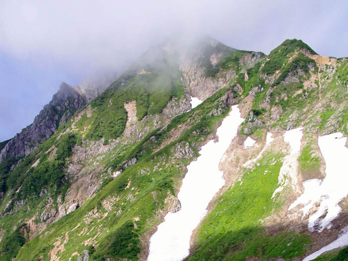
Ougi Snow Gorge
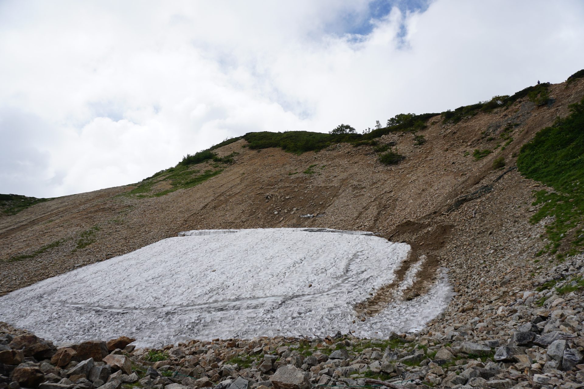
Elevation 2,311m
↓ 1 hour and 30 minutes
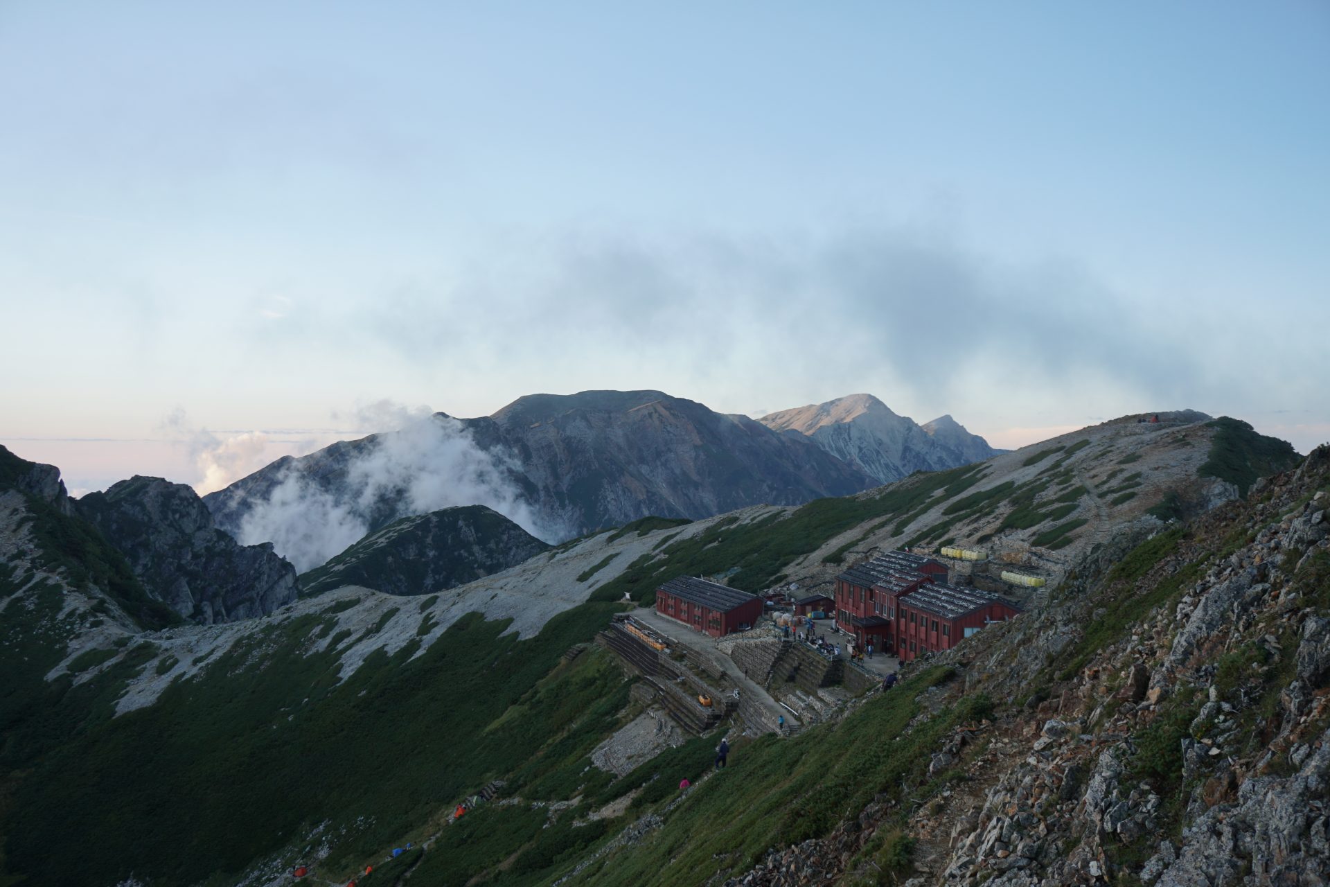
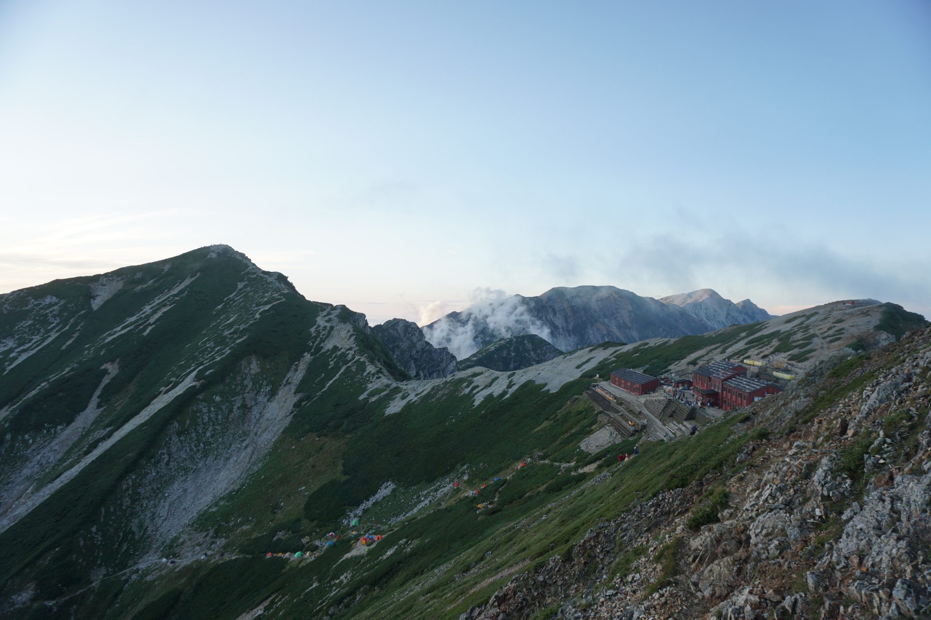
Karamatsu-dake Chojo sanso mountain hut

Elevation 2,490m
↓ 20 minutes
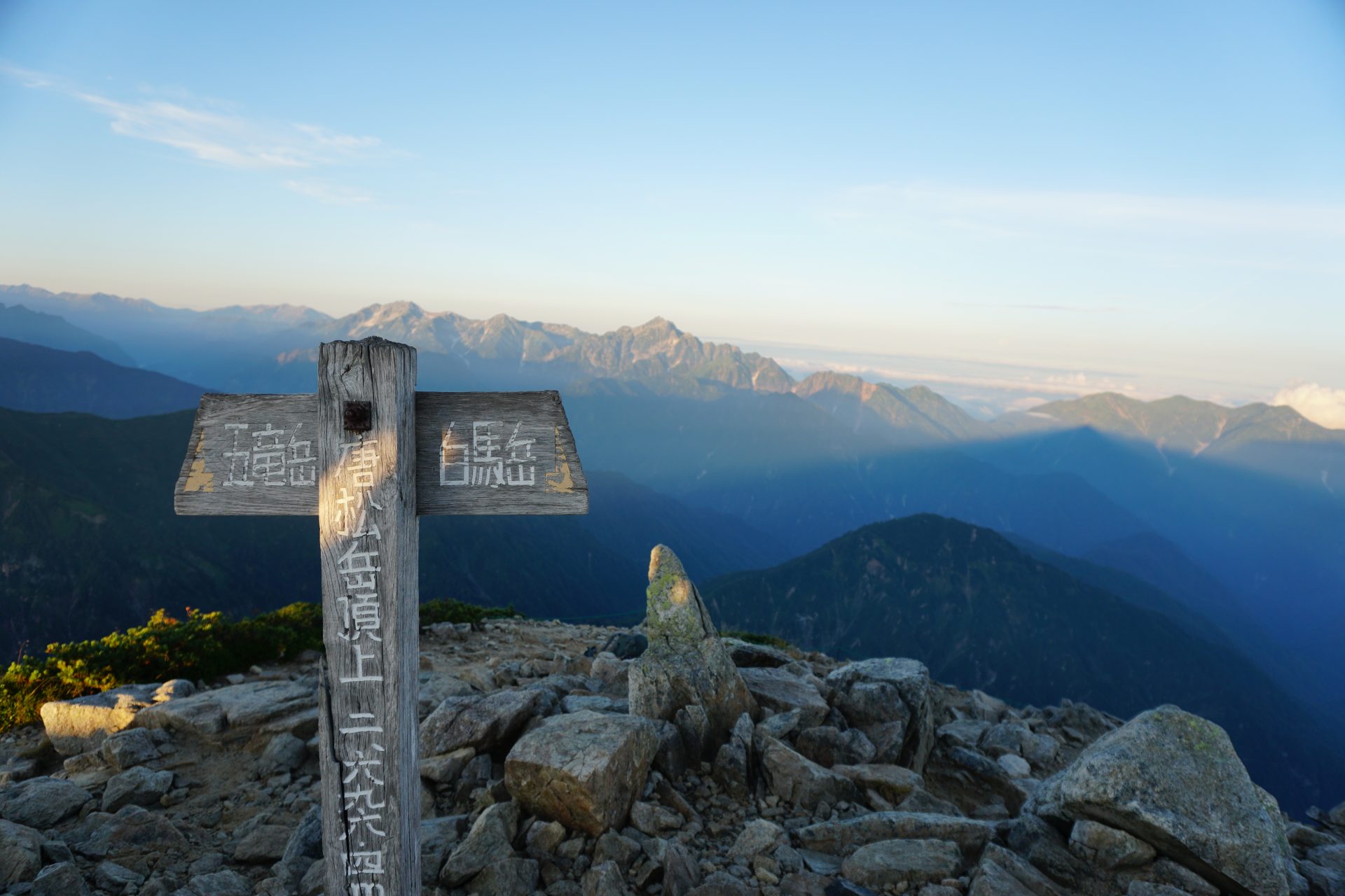
Mt. Karamatsu-dake

Elevation 2,623m
↓ 15 minutes
Karamatsu-dake Chojo sanso mountain hut
Elevation 2,695.9m
↓ 3 hours
Happo-ike pond sanso
Elevation 1,835m

Route Guide
From the Happo Bus Terminal, head for the gondola boarding area, from where you will transfer between the gondola and the lift. The walk will start in front of Happoike Sanso. The trail splits twice before reaching the second cairn, but it does not matter which one you choose. If the weather is fine, you will enjoy a blissful hike with a powerful view of the Ushiro-Tateyama mountain range on both sides.The valley route, with its well-maintained wooden paths, is lined with ponds and alpine flora in full bloom during the season.
Take your first rest at Happoike Pond, which reflects the Hakuba mountain range. If the weather permits, take pictures of the beautiful view of the Hakuba mountain range reflected on the surface of the lake from in front of the pond.
After this, you will gain altitude by walking through a forest of Japanese white birch and Japanese spruce. On the way to the ridge, you will come to a rest point called Ougi Sekkei (snow gorge), which is covered with snow for a long time. We are now almost halfway to the ridge from Happo Pond.
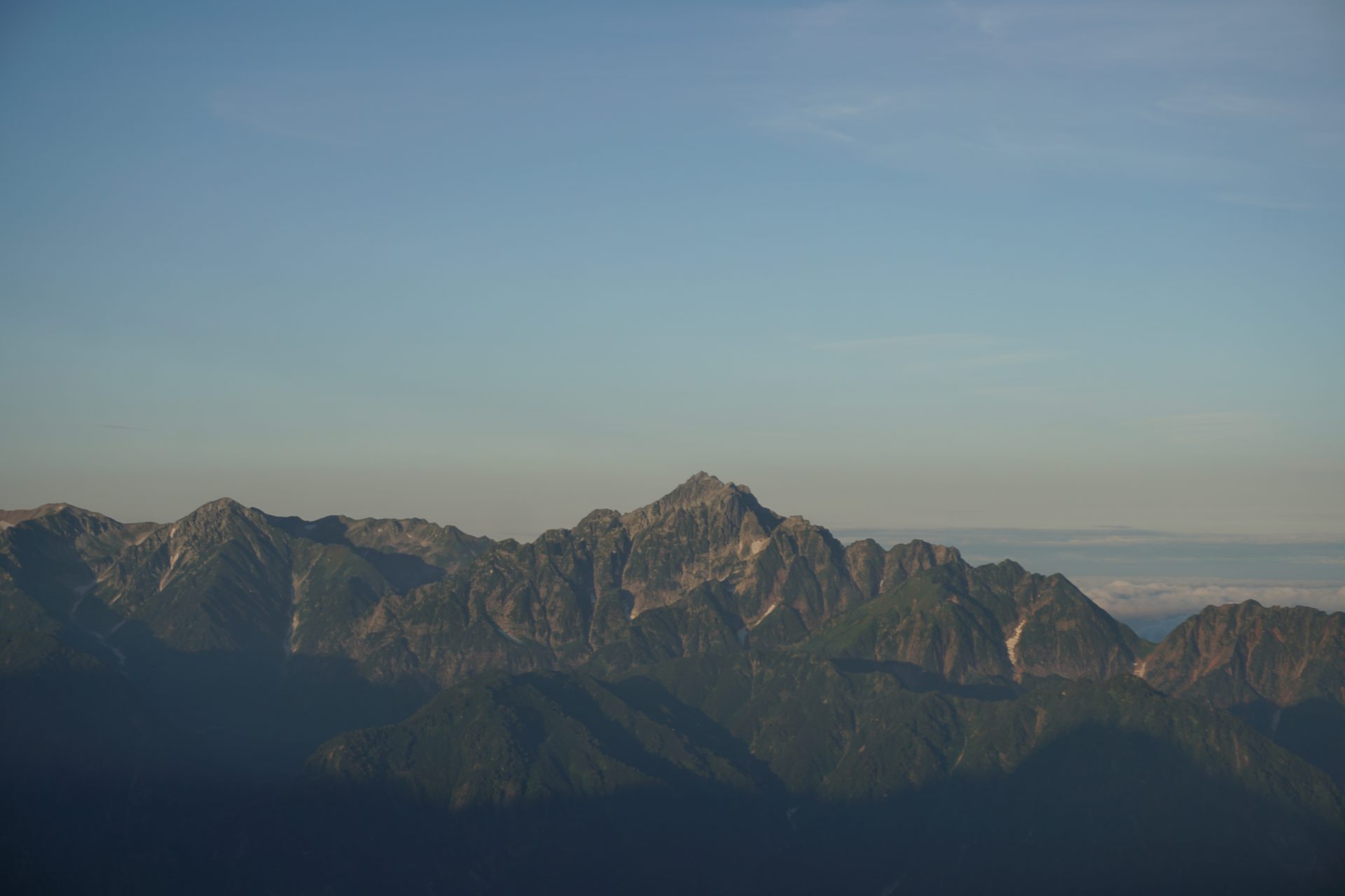
We crossed the forest limit around Maruyama cologne, and the visibility became clearer. The powerful rock face of The Kaerazu-no-ken is approaching before our eyes. After 30 minutes of hard upward climbing, you will soon reach the Karamatsu-dake Chojo sanso mountain hut. The east ridge of the Tsurugi-dake also known as “back Tsurugi-dake” and the Tateyama Mountain range, is right in front of your eyes.
If you are planning to stay at the Karamatsu-dake Chojo sanso mountain hut, you should reach the summit of Karamatsu-dake as soon as possible. If you follow the ridge path faithfully, you will reach the summit in about 20 minutes.
If you have time, you can walk a little to the Goryu side to the difficult spot called Ushikubi-no-atama. You can see the whole view of Mt. Goryu-dake and the mountains in the southern Alps.